
Towns & cities · East of England
Epping Upland
Epping Upland — a civil parish and village in Essex, England.

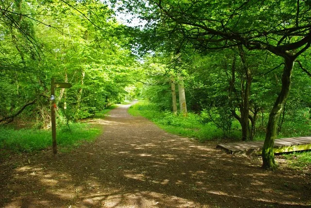
Wikimedia Commons contributors — see linked file page for photographer and licence licence

Plan your visit
- Typical visit
- 3 h–6 h
- Nearest railway station
- Epping · 3.5 km
- Free entry
- Family-friendly
- Dog-friendly
Getting there & planning your visit
Epping Upland is located in Essex with the postcode CM16. The nearest railway station is Epping, which is 3.5 km away. Entry to the area is free.
About
Epping Upland is a town, city, village or settlement in the United Kingdom. Recent population estimates put it at around 790 people. Address: CM16. Wikidata describes it as: "a civil parish and village in Essex, England". Coordinates: 51.7210°, 0.0900°.
Photo gallery
See it from the streetimagery from 2026
Imagery © Mapillary contributors, CC BY-SA 4.0
From the Wikipedia article
Epping Upland, is a village and civil parish in the Epping Forest district of Essex, England. The parish was created in 1896 from the rural part of the older parish of Epping, with All Saints' Church at Epping Upland having been the original parish church of Epping. The parish also includes the village of Epping Green. At the 2021 census the parish had a population of 944. The village is situated on the B181 road, approximately 3 miles (5 km) south of the town of Harlow, and 2 miles (3 km) north-west of the town of Epping and the M11 motorway. Epping Upland parish church is dedicated to All Saints, and the Epping Upland ecclesiastical parish forms part of the Diocese of Chelmsford. The church dates to the 13th century and is Grade II* listed. Until the Dissolution of the Monasteries, All Saints was under the jurisdiction of Waltham Abbey. All Saints' Church was the parish church of Epping, but the settlement around the church remained very small. The main settlements in the parish came to be Epping Green at the northern end of the parish and the town of Epping, sometimes historically called Epping Street, at the southern end of the parish. The parish was subdivided for certain purposes into an Epping Street division covering the town at the southern end of the parish, and an Epping Upland division covering the remainder. In 1831, the Epping Upland division of the parish had a population of 427 within 83 houses. At the time, eighty per cent of Epping Upland's population, and forty per cent of the parish, were employed in agriculture. A chapel of ease existed at Epping town from at least the 14th century, dedicated to St John the Baptist. In 1889, the two churches' roles were reversed, with St John's being redesignated the parish church and All Saints being downgraded to being a chapel of ease. All Saints was restored to being a parish church again in 1912 when Epping Upland became a separate ecclesiastical parish from Epping. In civil terms, the parish of Epping was…
Excerpt from Wikipedia under CC BY-SA 4.0. See the source article linked in Sources below.
- Coordinates
- 51.7210, 0.0900
- County
- Essex
- District
- Epping Forest
- Parish
- Epping Upland
- Postcode
- CM16
- Parliamentary constituency
- Epping Forest
- Population
- 790
- Nearest railway station
- Epping — 3.5 km
Sources
- wikidata: Q966591 (CC0)
- wikipedia: Epping Upland (CC BY-SA 4.0)
- commons: All Saints Church - Epping Upland, Essex - geograph.org.uk - 143265.jpg (CC BY-SA 4.0)
Other places nearby

WWI & WWII War Memorials
Memorials & monuments · 0.2 km

Chambers Manor
Manor houses · 0.8 km

Epping Green
Villages · 0.9 km

Rye Hill
Mountains & hills · 2.5 km

Epping, Essex
Museums · 2.6 km

Epping War Memorial
Memorials & monuments · 2.7 km

Nazeing
Museums · 2.8 km

The Thatched House Hotel
Hotels · 2.8 km

Sydney Hills
Memorials & monuments · 3.0 km

Fern Hill Caravan Park
Caravan parks · 3.1 km

Still Life with a TV Set
Public art & sculpture · 3.3 km
Grizedale Panel
Public art & sculpture · 3.3 km
Epping Upland is a charming town in Essex, located in the East of England. Visitors can explore the wildlife at Gernon Bushes and admire the grounds at Copped Hall House and gardens. The area also offers a chance to see the historic Copped Hall and relax at the Theydon Oak Inn.
At a glance
- Population
- 790
- Administrative county
- Essex
- Constituency
- Epping Forest
- Top categories near here
Things to see in Epping Upland
39 attractions within 12 km — showing the 24 most editorially-significant. Full guide: things to do in Epping Upland →
 Flagship📷 10
Wildlife reserves · London
Gernon Bushes
Gernon Bushes — Essex Wildlife Trust Nature reserve.
 📷 5
📷 5Gardens · London
Copped Hall Gardens
Copped Hall Gardens — Gardens in Epping Forest, Essex, England, UK.
 📷 5
📷 5 📷 5
📷 5Cemeteries · London
Waltham Abbey Jewish Cemetery
Waltham Abbey Jewish Cemetery is a cemetery in the United Kingdom.
 📷 5
📷 5Gardens · London
Copped Hall House and gardens
Copped Hall House and gardens — a garden in england-london, United Kingdom.
 📷 5
📷 5Archaeological sites · London
Ambresbury Banks
Ambresbury Banks — a archaeological in england-london, United Kingdom.
 📷 5
📷 5Historic houses · London
Copped Hall
Copped Hall — a historic house in england-london, United Kingdom.
 📷 5
📷 5Museums · London
Epping Signalling Museum
Epping Signalling Museum — a museum in england-london, United Kingdom.
📷 5Memorials & monuments · London
Epping War Memorial
Epping War Memorial — Grade II listed building-listed memorial in england-london, United Kingdom.
 📷 5
📷 5Memorials & monuments · London
Boudicca's Obelisk
Boudicca's Obelisk — a memorial in england-london, United Kingdom.
📷 5Memorials & monuments · London
Sydney Hills
Sydney Hills — a memorial in england-london, United Kingdom.
 📷 5
📷 5Memorials & monuments · London
Warlies Park Obelisk
Warlies Park Obelisk — a memorial in england-london, United Kingdom.
 📷 5
📷 5Museums · London
Epping tube station
Epping is a London Underground station in the suburban town of Epping in Essex, England. It is the north-eastern terminus of the Central line and the next station towards London is Theydon Bois. Situ
📷 5Museums · London
Epping, Essex
Epping is a market town and civil parish in the Epping Forest District of Essex, England. It lies 17 miles (27 km) north-east of Charing Cross in central London. It is surrounded by the northern end o
 📷 5
📷 5Forts · London
Obelisk 325m NW of Cobbin Pond
Obelisk 325m NW of Cobbin Pond — a martello broad in england-london, United Kingdom.
📷 5 📷 5
📷 5Vineyards · London
Ambresbury Banks
Ambresbury Banks — a UK vineyard in england london, producing English or Welsh wine from cool-climate grape varieties.
 📷 5
📷 5 📷 5
📷 5 📷 5
📷 5Canal locks · East of England
Dobbs Weir Lock
Dobbs Weir Lock — lock in Hertfordshire, England, UK.
 📷 5
📷 5Miniature railways · East of England
North Weald & District Miniature Railway
North Weald & District Miniature Railway — a miniature railway in england-london, United Kingdom.
 📷 5
📷 5Natural landmarks · East of England
Ada Cole Rescue Stables
Ada Cole Rescue Stables — a other in england-london, United Kingdom.
 📷 5
📷 5Historic houses · East of England
Netherhall
Netherhall — a historic house in england-london, United Kingdom.
📷 5Manor houses · East of England
Chambers Manor
Chambers Manor — Grade II listed building-listed manor in england-london, United Kingdom.
Nearby
📷 5Memorials & monuments · East of England
WWI & WWII War Memorials
WWI & WWII War Memorials — a memorial in england-london, United Kingdom.
📷 5Manor houses · East of England
Chambers Manor
Chambers Manor — Grade II listed building-listed manor in england-london, United Kingdom.
📷 5📷 5Mountains & hills · East of England
Rye Hill
Rye Hill — mountain in england london. Elevation: 110 m.
📷 5Museums · London
Epping, Essex
Epping is a market town and civil parish in the Epping Forest District of Essex, England. It lies 17 miles (27 km) north-east of Charing Cross in central London. It is surrounded by the northern end o
📷 5Memorials & monuments · London
Epping War Memorial
Epping War Memorial — Grade II listed building-listed memorial in england-london, United Kingdom.
Where to eat & stay near Epping Upland
Places to stay
📷 5📷 5Caravan parks · East of England
Fern Hill Caravan Park
Fern Hill Caravan Park — a caravan park in england london.
 📷 5
📷 5Campsites · London
Debden House Holiday Park
Debden House Holiday Park — a campsite in england london.
 📷 5
📷 5Caravan parks · London
Debden House Centre
Debden House Centre — a caravan park in england london.
 📷 5
📷 5Campsites · East of England
Lee Valley Almost Wild Campsite
Lee Valley Almost Wild Campsite — a campsite in england london.
 📷 5
📷 5Campsites · East of England
Lee Valley Dobbs Weir
Lee Valley Dobbs Weir — a campsite in england london.
Places to eat & drink
 📷 5
📷 5Historic pubs · East of England
Theydon Oak Inn
Theydon Oak Inn in England East, United Kingdom.
 📷 5
📷 5Historic pubs · East of England
The Rainbow And Dove Public House
The Rainbow And Dove Public House in England East, United Kingdom.
 📷 5
📷 5Historic pubs · East of England
The Hare
The Hare — Historic pub — listed building or notable heritage status.
 📷 7
📷 7Historic pubs · London
Queen Victoria Public House
Queen Victoria Public House in England London, United Kingdom.
 📷 5
📷 5Historic pubs · East of England
The Greyhound Public House
The Greyhound Public House — Historic pub — listed building or notable heritage status.
 📷 7
📷 7Historic pubs · East of England
White Hart Public House
White Hart Public House in England East, United Kingdom.
More towns in this region
 Flagship📷 10
 Flagship📷 10
Towns & cities · East of England
Cambridge
Cambridge — city in Cambridgeshire, England.
 Flagship📷 10
Towns & cities · East of England
Chelmsford
Chelmsford — city in Essex, United Kingdom.
 Flagship📷 10
Towns & cities · East of England
Colney Heath
Colney Heath — village and civil parish in St Albans, Hertfordshire, England, UK.
Frequently asked questions
- Where is Epping Upland?
- Epping Upland is in Essex, East of England, United Kingdom (postcode CM16), in the parish of Epping Upland.
- What is Epping Upland?
- Epping Upland — a civil parish and village in Essex, England.
- How do I get to Epping Upland?
- The nearest railway station is Epping, about 3.5 km away. Drivers can use postcode CM16.
- Is Epping Upland free to visit?
- Yes, Epping Upland is free to enter.
- How do I get to Epping Upland?
- The nearest railway station is Epping, about 3.5 km away. Drivers can navigate to postcode CM16.