
Villages · East of England
Ellough
In or near Barnby.
Ellough — a village in england east.

JThomas — CC BY-SA 2.0 via Wikimedia Commons licence
Plan your visit
- Typical visit
- 1 h–2 h
- Nearest railway station
- Beccles · 3.9 km
About
A British village — settlements of this size traditionally cluster a green, parish church, pub and post office around historic land routes.
Photo gallery
Protected designations
- Area of Outstanding Natural Beauty: Suffolk Coast & Heaths
Designations sourced from Natural England open data under OGL v3.
Place summary
Ellough is a village located in the East of England. It is characterised by its rural setting and small community. The area features typical English village architecture and local amenities that serve the needs of residents and visitors alike.
AI-generated from the structured facts on this page (operator, designation, listing, era). Not a substitute for visiting.
- Coordinates
- 52.4266, 1.5916
- County
- Suffolk
- District
- East Suffolk
- Parish
- Ellough
- Postcode
- NR34 7TW
- Parliamentary constituency
- Waveney Valley
- Nearest railway station
- Beccles — 3.9 km
Sources
- manual: geonames-2650084 (CC BY 4.0)
Other places nearby
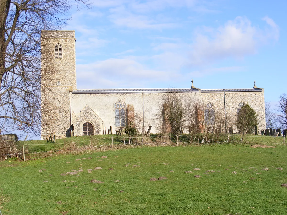
All Saints Church, Ellough
Historic churches · 0.4 km

Church of St Peter
Historic churches · 1.4 km

Weston War Memorial
Memorials & monuments · 1.4 km

Weston Village Sign
Public art & sculpture · 1.5 km

Weston
Villages · 1.8 km

Shadingfield Willingham St Mary Village Sign
Public art & sculpture · 2.2 km

Worlingham Manor
Manor houses · 2.3 km

Hulver Village Sign
Public art & sculpture · 2.3 km

Sotterley
Villages · 2.4 km

Church of St Margaret
Historic churches · 2.4 km

Sotterley Hall
Historic houses · 2.4 km

Sotterley Hall Estate
Historic houses · 2.5 km
Nearby
📷 3Historic churches · East of England
All Saints Church, Ellough
All Saints Church, Ellough — church in Ellough, Suffolk, England, UK.
📷 3Historic churches · East of England
Church of St Peter
Church of St Peter — Grade I listed church in Weston, Suffolk, England, UK.
📷 3Memorials & monuments · East of England
Weston War Memorial
Weston War Memorial — Grade II listed building-listed memorial in england-east, United Kingdom.
📷 3Public art & sculpture · East of England
Weston Village Sign
Weston Village Sign — a public art in england-east, United Kingdom.
📷 5📷 3Public art & sculpture · East of England
Shadingfield Willingham St Mary Village Sign
Shadingfield Willingham St Mary Village Sign — a public art in england-east, United Kingdom.
Where to eat & stay near Ellough
Places to stay
 📷 5
📷 5Hotels · East of England
The Kings Head Hotel
The Kings Head Hotel — a hotel in england east.
 📷 3
📷 3 📷 5
📷 5 📷 5
📷 5Campsites · East of England
Three Rivers Pitch & Paddle
Three Rivers Pitch & Paddle — a campsite in england east.
 📷 6
📷 6B&Bs · East of England
Old Reading Rooms
Old Reading Rooms — a bed-and-breakfast in england east.
 📷 5
📷 5Places to eat & drink
 📷 5
📷 5Historic pubs · East of England
Crown And Anchor Public House
Crown And Anchor Public House in England East, United Kingdom.
 📷 5
📷 5 📷 5
📷 5Historic pubs · East of England
Cherry Tree Public House
Cherry Tree Public House in England East, United Kingdom.
 📷 7
📷 7 📷 5
📷 5 📷 5
📷 5Historic pubs · East of England
The Top House Public House, Including Boundary Wall To Yard
The Top House Public House, Including Boundary Wall To Yard in England East, United Kingdom.
More places in this region


Frequently asked questions
- Where is Ellough?
- Ellough is in Suffolk, East of England, United Kingdom (postcode NR34 7TW), in the parish of Ellough.
- What is Ellough?
- Ellough — a village in england east.
- How do I get to Ellough?
- The nearest railway station is Beccles, about 3.9 km away. The nearest town is Barnby. Drivers can use postcode NR34 7TW.
- Is Ellough a protected site?
- Yes — Ellough is part of the Suffolk Coast & Heaths National Landscape (AONB).
- How do I get to Ellough?
- The nearest railway station is Beccles, about 3.9 km away. Drivers can navigate to postcode NR34 7TW.