
Historic churches · South West England
Easton, Bristol
Also known as: Easton
In or near Bristol.
Easton is an inner city area of the city of Bristol in the United Kingdom. Informally the area is considered to stretch east of Bristol city centre and the M32 motorway, centred on Lawrence Hill. Its

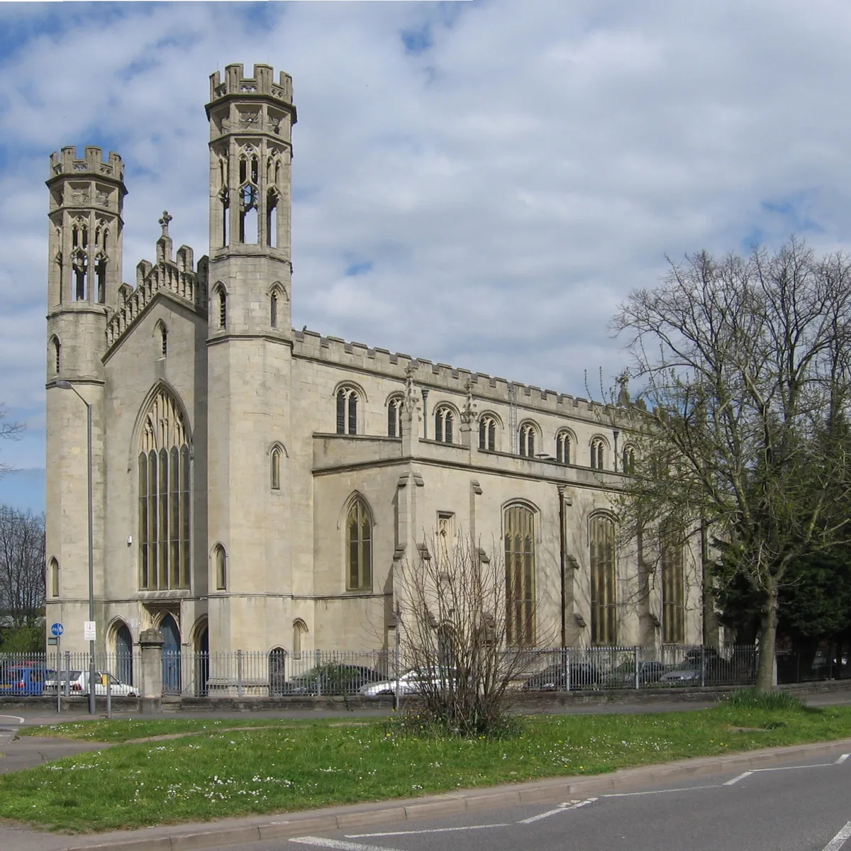
Stephen Richards — CC BY-SA 2.0 via Wikimedia Commons licence

Plan your visit
- Typical visit
- 30 min–1 h
- Nearest railway station
- Lawrence Hill · 0.4 km
- Free entry
Getting there & planning your visit
To visit Easton in Bristol, the nearest railway station is Lawrence Hill, located 0.4 km away. Entry to the church is free, and the postcode for sat-nav is BS5 0XB.
About
Easton is an inner city area of the city of Bristol in the United Kingdom. Informally the area is considered to stretch east of Bristol city centre and the M32 motorway, centred on Lawrence Hill. Its southern and eastern borders are less defined, merging into St Philip's Marsh and Eastville. The area includes the Lawrence Hill and Barton Hill estates. In administrative terms, Easton comprises the electoral wards of Easton and part of Lawrence Hill. It is located within the Bristol East constituency. The electoral ward of Easton includes parts of the localities of Netham and Whitehall, and a large part of Greenbank. The Bristol & Bath Railway Path passes through the ward. Easton is noted for its culturally diverse community, centred on the shopping streets of Stapleton Road and St Marks Road, the latter noted for the exuberant sculpted signs that hang above many of the shop doors and the architecturally striking illuminated dome of Easton Mosque. There are a number of East African and Indian subcontinent restaurants and shops specialising in organic and ethnic foods.
Photo gallery
Protected designations
- Site of Special Scientific Interest: Severn Estuary SSSI
Designations sourced from Natural England open data under OGL v3.
From the Wikipedia article
Easton is an inner city area of the city of Bristol in the United Kingdom. Informally the area is considered to stretch east of Bristol city centre and the M32 motorway, centred on Lawrence Hill. Its southern and eastern borders are less defined, merging into St Philip's Marsh and Eastville. The area includes the Lawrence Hill and Barton Hill estates. In administrative terms, Easton comprises the electoral wards of Easton and part of Lawrence Hill. It is located within the Bristol East constituency. The electoral ward of Easton includes parts of the localities of Netham and Whitehall, and a large part of Greenbank. The Bristol & Bath Railway Path passes through the ward. Easton is noted for its culturally diverse community, centred on the shopping streets of Stapleton Road and St Marks Road, the latter noted for the exuberant sculpted signs that hang above many of the shop doors and the architecturally striking illuminated dome of Easton Mosque. There are a number of East African and Indian subcontinent restaurants and shops specialising in organic and ethnic foods.
Excerpt from Wikipedia under CC BY-SA 4.0. See the source article linked in Sources below.
Background
History
In the medieval period Easton lay within the Royal Forest of Kingswood in the manor of Barton Regis. The name Easton is probably derived from the Anglo-Saxon East Tun meaning East Farm. The earliest documentary reference to Easton is Chester and Master's 1610 Map of Kingswood, which depicts three settlements: Upper Easton, which was centered on Easton Road, Lower Easton, which was centered on St Marks Road, and Baptist Mills, on the east bank of the River Frome. In the post-medieval period the area became increasingly industrial with large scale extraction of coal, clay and sand occurring across the area. In the 19th century most of Easton was developed for housing. In the late 1950s and…
Sourced from Wikipedia under CC BY-SA 4.0.
- Coordinates
- 51.4591, -2.5699
- District
- Bristol, City of
- Parish
- Bristol, City of, unparished area
- Postcode
- BS5 0XB
- Parliamentary constituency
- Bristol East
- Nearest railway station
- Lawrence Hill — 0.4 km
- Official site
- www.bristol.gov.uk
Sources
- wikipedia: Easton, Bristol (CC BY-SA 4.0)
Other places nearby
Ruby Helder
Memorials & monuments · 0.1 km
John William Henry Wall
Memorials & monuments · 0.1 km

Lawrence Hill, Bristol
Historic churches · 0.2 km

William Herapath
Memorials & monuments · 0.3 km

Gaunts Ham Park
Country parks · 0.3 km

Twinnell House
Gardens · 0.4 km

Stapleton Road Chapel
Museums · 0.4 km

Ben Tillett
Memorials & monuments · 0.4 km

Arbor
Breweries · 0.4 km
Trinity Centre
Historic churches · 0.4 km
Carol Williiams
Memorials & monuments · 0.5 km
Felix Road Adventure Playground
Memorials & monuments · 0.5 km
Nearby
📷 4Memorials & monuments · South West England
Ruby Helder
Ruby Helder — a memorial in england-south-west, United Kingdom.
📷 3Memorials & monuments · South West England
John William Henry Wall
John William Henry Wall — a memorial in england-south-west, United Kingdom.
📷 5Historic churches · South West England
Lawrence Hill, Bristol
Lawrence Hill is an electoral ward of Bristol, United Kingdom and includes the districts of Barton Hill, St Philips Marsh and Redcliffe, Temple Meads and parts of Easton and the Broadmead shopping are
📷 3Memorials & monuments · South West England
William Herapath
William Herapath — a memorial in england-south-west, United Kingdom.
📷 5📷 4Gardens · South West England
Twinnell House
Twinnell House — a garden in england-south-west, United Kingdom.
Where to eat & stay near Easton, Bristol
Places to stay
 📷 7
📷 7Hotels · South West England
Delta Hotels
Delta Hotels — a hotel in england south west.
 📷 5
📷 5Hotels · South West England
Hampton by Hilton Bristol City Centre
Hampton by Hilton Bristol City Centre — a hotel in england south west. 3-star. Brand: Hampton.
 📷 5
📷 5Hotels · South West England
Hilton Garden Inn Bristol City Centre
Hilton Garden Inn Bristol City Centre — a hotel in england south west. 4-star. Brand: Hilton Garden Inn.
 📷 5
📷 5Hostels · South West England
Full Moon
Full Moon — a hostel in england south west.
 📷 5
📷 5 📷 5
📷 5Places to eat & drink
 📷 7
📷 7Historic pubs · South West England
Old Castle Green Public House
Old Castle Green Public House in Wales South, United Kingdom.
 📷 7
📷 7Historic pubs · South West England
Palace Hotel, Bristol
Palace Hotel, Bristol in Wales South, United Kingdom.
 📷 7
📷 7Historic pubs · South West England
Masons Arms Public House
Masons Arms Public House in Wales South, United Kingdom.
 📷 5
📷 5Historic pubs · South West England
The Volunteer Tavern
The Volunteer Tavern in Wales South, United Kingdom.
 📷 5
📷 5Historic pubs · South West England
Old Market Tavern
Old Market Tavern in Wales South, United Kingdom.
 📷 5
📷 5Historic pubs · South West England
The Phoenix Public House
The Phoenix Public House in Wales South, United Kingdom.
More places in this region
 📷 5
📷 5Historic churches · South West England
Abbey Church of St Gregory the Great, Downside Abbey
Abbey Church of St Gregory the Great, Downside Abbey — church in Stratton-on-the-Fosse, Somerset, England, UK.
 📷 5
📷 5Historic churches · South West England
All Saints Church
All Saints Church — Grade I listed church in Woolley, Somerset, England, UK.
 📷 5
📷 5Historic churches · South West England
All Saints Church, Hampreston
All Saints Church, Hampreston — church in Hampreston, Dorset, England, UK.
 📷 5
📷 5Historic churches · South West England
All Saints Church, Nether Cerne
All Saints Church, Nether Cerne — church in Nether Cerne, Dorset, England, UK.
Frequently asked questions
- Where is Easton, Bristol?
- Easton, Bristol is in South-West England, United Kingdom (postcode BS5 0XB), in the parish of Bristol, City of, unparished area.
- What is Easton, Bristol?
- Easton is an inner city area of the city of Bristol in the United Kingdom. Informally the area is considered to stretch east of Bristol city centre and the M32 motorway, centred on Lawrence Hill. Its
- How do I get to Easton, Bristol?
- The nearest railway station is Lawrence Hill, about 0.4 km away. The nearest town is Bristol. Drivers can use postcode BS5 0XB.
- Is Easton, Bristol a protected site?
- Yes — Easton, Bristol is part of the Severn Estuary SSSI Site of Special Scientific Interest.
- Is Easton, Bristol free to visit?
- Yes, Easton, Bristol is free to enter.
- How do I get to Easton, Bristol?
- The nearest railway station is Lawrence Hill, about 0.4 km away. Drivers can navigate to postcode BS5 0XB.