
Watermills · Scottish Lowlands
East Cluden Mill
In or near Cargenbridge.
East Cluden Mill — category C listed building-listed watermill in scotland-lowlands, United Kingdom.

Darrin Antrobus — CC BY-SA 2.0 via Wikimedia Commons licence
_-_geograph.org.uk_-_490769.jpg)
Plan your visit
- Typical visit
- 30 min–1 h
- Nearest railway station
- Dumfries · 4.5 km
- Free entry
- Family-friendly
- Dog-friendly
Getting there & planning your visit
East Cluden Mill is located in the Scottish Lowlands, with the postcode DG2 0JA. The nearest railway station is Dumfries, which is 4.5 km away. Entry to the mill is free.
About
East Cluden Mill is a category C listed building-listed watermill in scotland-lowlands, United Kingdom, registered on the Historic Environment Scotland register (entry LB10203). Listed status protects buildings and structures of special architectural or historic interest. See the linked Wikipedia article for further details.
Photo gallery
Heritage listing
Category C Date Added 03/08/1971 Local Authority Dumfries And Galloway Planning Authority Dumfries And Galloway Parish Holywood NGR NX 94163 79343 Coordinates 294163, 579343 — Later 18th century, extended to east first half 19th century. Tall, rectangular-plan cornmill built beside River Cluden; converted 1973-4 to form house and kiln to east demolished - architects T I Morton & Son, Dumfries. 2/3 storeys, with low east wing. South elevation (to river) droved red ashlar with original openings retained (modern glazing), 2 large low-breast iron and timber wheels (these repaired circa 1983); other elevations painted rubble with modern slappings (plate glass windows)/blocked openings. Heavy band course below eaves; Single (modern) axial stack; roofed with graded slates. — 1786 datestone in circa 1930 Lean-to at west may date mill. Listed primarily for river elevation and wheels.
From Historic Environment Scotland under OGL v3.
Place summary
East Cluden Mill is a watermill located in the Scottish Lowlands. It is designated as a category C listed building, recognising its historical significance.
AI-generated from the structured facts on this page (operator, designation, listing, era). Not a substitute for visiting.
- Coordinates
- 55.0972, -3.6601
- District
- Dumfries and Galloway
- Postcode
- DG2 0JA
- Parliamentary constituency
- Dumfries and Galloway
- Nearest railway station
- Dumfries — 4.5 km
Sources
- wikidata: Q56617994 (CC0)
Other places nearby

Twelve Apostles
Archaeological sites · 0.5 km

Bridge, Newbridge, Dumfries
Historic bridges · 0.8 km

New Bridge
Historic bridges · 0.8 km

Holywood
Villages · 1.0 km

Holywood Parish Church And Churchyard
Historic churches · 1.4 km
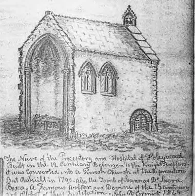
Dercongal Abbey
Abbeys & priories · 1.4 km
Dercongal Abbey
Cathedrals · 1.4 km

Terregles War Memorial
Memorials & monuments · 2.2 km

Irongray Bridge
Historic bridges · 2.5 km

Terregles Church
Historic churches · 2.6 km

Irongray Church And Churchyard
Historic churches · 2.7 km

The Lincluden Rhino
Public art & sculpture · 2.8 km
Nearby
📷 5Archaeological sites · Scottish Lowlands
Twelve Apostles
Twelve Apostles — archaeological in scotland lowlands.
📷 5Historic bridges · Scottish Lowlands
Bridge, Newbridge, Dumfries
Bridge, Newbridge, Dumfries — category B listed building-listed bridge in scotland-lowlands, United Kingdom.
📷 3Historic bridges · Scottish Lowlands
New Bridge
New Bridge is a historic bridge in the United Kingdom.
📷 5📷 5Historic churches · Scottish Lowlands
Holywood Parish Church And Churchyard
Holywood Parish Church And Churchyard — category B listed building-listed church in scotland-lowlands, United Kingdom.
📷 3Abbeys & priories · Scottish Lowlands
Dercongal Abbey
Dercongal Abbey — abbey in Dumfries and Galloway, Scotland, UK.
Where to eat & stay near East Cluden Mill
Places to stay
 📷 5
📷 5Hotels · Scottish Lowlands
Friars Carse Country House Hotel
Friars Carse Country House Hotel — a hotel in scotland lowlands.
 📷 5
📷 5Caravan parks · Scottish Lowlands
Dumfries Caravan Park
Dumfries Caravan Park — a caravan park in scotland lowlands.
 📷 5
📷 5Caravan parks · Scottish Lowlands
Partridge Cottage CAMC CL
Partridge Cottage CAMC CL — a caravan park in scotland lowlands.
 📷 3
📷 3Campsites · Scottish Lowlands
Barnsoul Caravan Park
Barnsoul Caravan Park — a campsite in scotland lowlands.
 📷 5
📷 5Hostels · Scottish Lowlands
Marthrown of Mabie
Marthrown of Mabie — a hostel in scotland lowlands.
📷 5Campsites · Scottish Lowlands
Marthrown of Mabie
Marthrown of Mabie — a campsite in scotland lowlands.
Places to eat & drink
 📷 5
📷 5Historic pubs · Scottish Lowlands
75 Friars Vennel, Dumfries
75 Friars Vennel, Dumfries in Scotland Lowlands, United Kingdom.
 📷 7
📷 7Historic pubs · Scottish Lowlands
Rob Roy Public House, 63-65 Queensberry Street, Dumfries
Rob Roy Public House, 63-65 Queensberry Street, Dumfries in Scotland Lowlands, United Kingdom.
 📷 5
📷 5Historic pubs · Scottish Lowlands
73-77 English Street, Dumfries
73-77 English Street, Dumfries in Scotland Lowlands, United Kingdom.
 📷 5
📷 5Historic pubs · Scottish Lowlands
The Globe Inn, 56 High Street, Dumfries
The Globe Inn, 56 High Street, Dumfries in Scotland Lowlands, United Kingdom.
 📷 5
📷 5Historic pubs · Scottish Lowlands
Queen O' The South Public House, 8-10 Nith Place, Dumfries
Queen O' The South Public House, 8-10 Nith Place, Dumfries in Scotland Lowlands, United Kingdom.
 📷 7
📷 7More watermills in this region
 📷 5
📷 5Watermills · Scottish Lowlands
Dalgarven Mill Museum
Dalgarven Mill Museum is a watermill in the United Kingdom.
 📷 3
📷 3 📷 5
📷 5Watermills · Scottish Lowlands
Scroggs Mill
Scroggs Mill — category C listed building-listed watermill in scotland-lowlands, United Kingdom.
 📷 5
📷 5Watermills · Scottish Lowlands
Skellywell Mill
Skellywell Mill — category C listed building-listed watermill in scotland-lowlands, United Kingdom.
Frequently asked questions
- Where is East Cluden Mill?
- East Cluden Mill is in the Scottish Lowlands, United Kingdom (postcode DG2 0JA).
- What is East Cluden Mill?
- East Cluden Mill — category C listed building-listed watermill in scotland-lowlands, United Kingdom.
- How do I get to East Cluden Mill?
- The nearest railway station is Dumfries, about 4.5 km away. Drivers can use postcode DG2 0JA.
- Is East Cluden Mill a listed building?
- East Cluden Mill is officially recognised as category C listed building listed.
- Is East Cluden Mill free to visit?
- Yes, East Cluden Mill is free to enter.
- How do I get to East Cluden Mill?
- The nearest railway station is Dumfries, about 4.5 km away. Drivers can navigate to postcode DG2 0JA.