Cathedrals · West Midlands
Eardisland
In or near Lucton.
Eardisland in Wales Mid, United Kingdom.

Jaggery — CC BY-SA 2.0 via Wikimedia Commons licence
Plan your visit
- Typical visit
- 1 h–2 h
- Best time of year
- Year-round
- Nearest railway station
- Leominster · 8.3 km
- Family-friendly
- Limited wheelchair access
Getting there & planning your visit
Eardisland is located in Herefordshire, County of, with the postcode HR6 9BD. The nearest railway station is Leominster, which is 8.3 km away. Entry is free, but wheelchair accessibility is limited.
About
Eardisland is a place of interest in Wales Mid, United Kingdom — drawn from open-data sources for visitor reference. See the linked Wikipedia article for the full description.
Photo gallery
Official information
Eardisland is a parish council that serves the local community by providing information about council meetings and activities. Residents can attend meetings and engage in discussions regarding local issues and initiatives.
Protected designations
- Site of Special Scientific Interest: River Lugg SSSI
- Site of Special Scientific Interest: River Teme SSSI
Designations sourced from Natural England open data under OGL v3.
From the Wikipedia article
Eardisland ( URDZ-lənd) is a village and civil parish on the River Arrow, about 5 miles (8 km) west of the market town of Leominster, Herefordshire. The civil parish includes the hamlets of Upper Hardwick, Lower Hardwick and Lower Burton. Eardisland is part of The Black and White Village Trail, which explores the villages of half-timbered, black and white houses to be found in this area of northern Herefordshire. The parish has rolling arable and pastoral farmland and ancient apple and cider apple orchards. The A44 Oxford to Aberystwyth road bypasses the south of Eardisland. (It formerly ran through the village centre, crossing the River Arrow there.) To the east the A4110 runs north/south, a little to the east of the course of the Watling Street Roman road which here, marks the eastern boundary of the parish. The Church of England parish church of St. Mary the Virgin has an early 13th-century nave, two early 14th-century tomb recesses and a 14th-century porch. The architect Henry Curzon substantially renewed the building in 1864. Just north of the church is the overgrown motte of Eardisland Castle, surrounded by a moat. Eardisland has a 17th-century dovecote, two public houses, tea rooms and a restored AA box which is the oldest in England. On 1 May 2010, a community shop was opened on the ground floor of the dovecote, staffed and run by volunteers. Burton Court, about 1 mile (1.6 km) south of Eardisland, includes an early 14th-century hall. Much of the remainder of the house was added in the 18th century. The architect Clough Williams-Ellis added the Tudor Revival front in 1912.
Excerpt from Wikipedia under CC BY-SA 4.0. See the source article linked in Sources below.
- Coordinates
- 52.2220, -2.8520
- District
- Herefordshire, County of
- Parish
- Eardisland
- Postcode
- HR6 9BD
- Parliamentary constituency
- North Herefordshire
- Nearest railway station
- Leominster — 8.3 km
- Official site
- www.eardisland-pc.gov.uk
Sources
- wikidata: Q3784223 (CC0)
- wikipedia: Eardisland (CC BY-SA 4.0)
Other places nearby
_-_geograph.org.uk_-_5922533.jpg?width=1200)
Knapp House
Historic houses · 0.0 km

Eardisland War Memorial
Memorials & monuments · 0.1 km

Eardisland Dovecote
Museums · 0.1 km

Arrow Bridge (Number 181)
Historic bridges · 0.2 km

Mound N of the church
Archaeological sites · 0.2 km

Eardisland Castle
Literary houses · 0.2 km

Staick House
Historic houses · 0.2 km

Arrow Bank Holiday Park
Caravan parks · 0.4 km

Legion Cross
Villages · 0.6 km
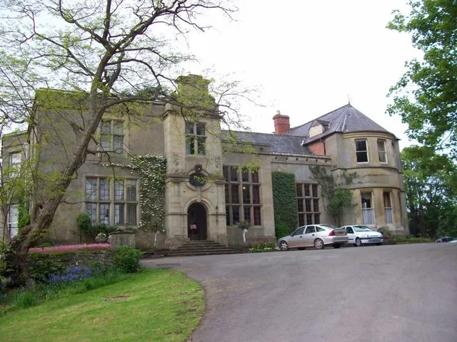
Burton Court
Stately homes · 1.4 km

Arrow Mill
Watermills · 1.8 km

Ox House railway station
Cathedrals · 2.4 km
Nearby
📷 3Historic houses · West Midlands
Knapp House
Knapp House — house in Eardisland, Herefordshire, England, UK.
📷 3Memorials & monuments · West Midlands
Eardisland War Memorial
Eardisland War Memorial — Grade II listed building-listed memorial in wales-mid, United Kingdom.
📷 3Museums · West Midlands
Eardisland Dovecote
Eardisland Dovecote — a museum in wales-mid, United Kingdom.
📷 3Historic bridges · West Midlands
Arrow Bridge (Number 181)
Arrow Bridge (Number 181) — Grade II listed building-listed bridge in wales-mid, United Kingdom.
📷 3Archaeological sites · West Midlands
Mound N of the church
Mound N of the church — archaeological site in Eardisland, Herefordshire, England, UK.
📷 5Literary houses · West Midlands
Eardisland Castle
Eardisland Castle — a literary house museum in wales mid.
Where to eat & stay near Eardisland
Places to stay
📷 5Caravan parks · West Midlands
Arrow Bank Holiday Park
Arrow Bank Holiday Park — a caravan park in wales mid.
 📷 5
📷 5 📷 5
📷 5Caravan parks · West Midlands
Pearl Lake Leisure Park
Pearl Lake Leisure Park — a caravan park in wales mid.
 📷 5
📷 5 📷 5
📷 5 📷 5
📷 5Places to eat & drink
 📷 7
📷 7 📷 5
📷 5 📷 5
📷 5Historic pubs · West Midlands
Shop Adjoining The Three Horseshoes Public House The Three Horseshoes Public House
Shop Adjoining The Three Horseshoes Public House The Three Horseshoes Public House in England West Midlands, United Kingdom.
 📷 3
📷 3Historic pubs · West Midlands
White Lion
White Lion — Historic pub — listed building or notable heritage status.
 Flagship📷 6
 📷 7
📷 7Historic pubs · Mid Wales
The Old Weymouth Arms And The Wharf
The Old Weymouth Arms And The Wharf in Wales Mid, United Kingdom.
More cathedrals in this region
 ★ Iconic📷 3
Cathedrals · West Midlands
Merevale Abbey, a Cistercian monastery, associated water control features and industrial remains
Merevale Abbey, a Cistercian monastery, associated water control features and industrial remains is a cathedral in the United Kingdom.
 ★ Iconic📷 4
Cathedrals · West Midlands
Birmingham Orthodox Cathedral
Birmingham Orthodox Cathedral — Greek Orthodox cathedral in Birmingham, West Midlands, England, UK.
 📷 3
📷 3Cathedrals · West Midlands
Dragon Tree
Dragon Tree is a place of interest in the United Kingdom.
 📷 5
📷 5Cathedrals · West Midlands
Holy Trinity Church, Coventry
Holy Trinity Church, Coventry — Grade I listed church in Coventry, West Midlands, England, UK.
Frequently asked questions
- Where is Eardisland?
- Eardisland is in Mid Wales, United Kingdom (postcode HR6 9BD), in the parish of Eardisland.
- What is Eardisland?
- Eardisland in Wales Mid, United Kingdom.
- How do I get to Eardisland?
- The nearest railway station is Leominster, about 8.3 km away. Drivers can use postcode HR6 9BD.
- Is Eardisland a protected site?
- Yes — Eardisland is part of the River Lugg SSSI Site of Special Scientific Interest and the River Teme SSSI Site of Special Scientific Interest.
- How do I get to Eardisland?
- Drivers can navigate to postcode HR6 9BD. It sits within the North Herefordshire parliamentary constituency.