
Natural landmarks · Mid Wales
Drygarn Fawr
In or near Llanwrtyd.
Drygarn Fawr — mountain (645m) in Powys, Wales.

Wikimedia Commons contributors — see linked file page for photographer and licence licence

Plan your visit
- Typical visit
- 1 h–2 h
- Free entry
- Dog-friendly
About
Drygarn Fawr is a named natural landmark in the United Kingdom. Wikidata describes it as: "mountain (645m) in Powys, Wales". Coordinates: 52.2121°, -3.6657°.
Photo gallery
From the Wikipedia article
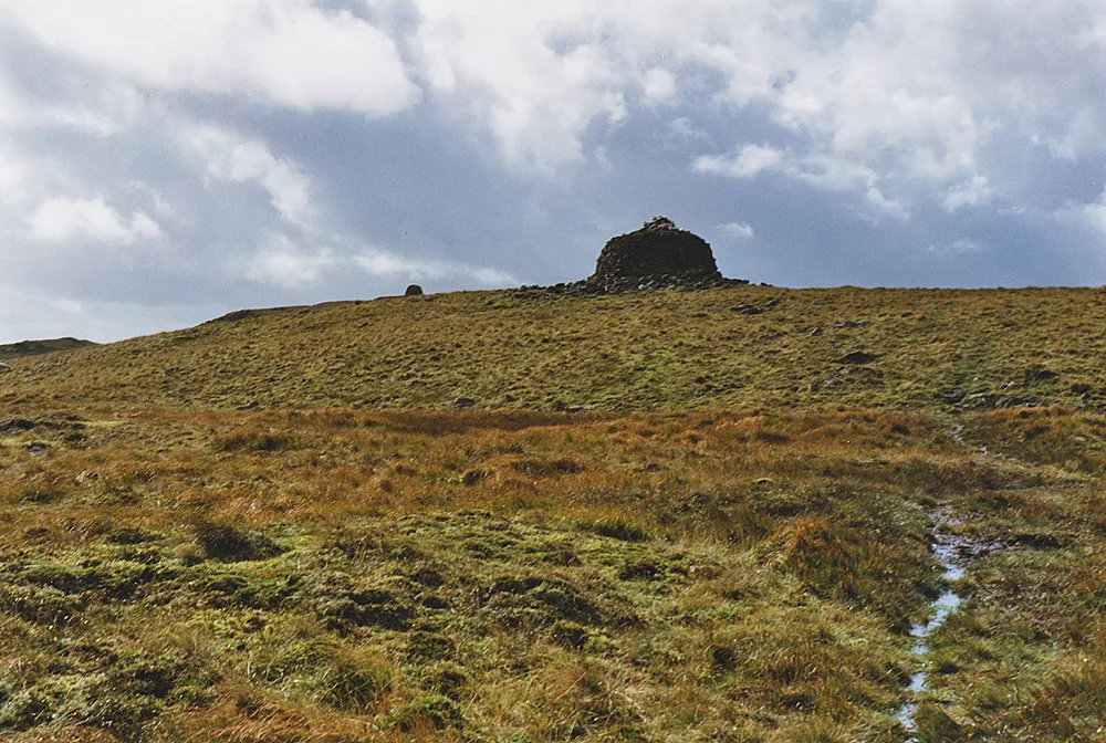
Drygarn Fawr is a mountain in the county of Powys, Wales. It is one of the highest summits in Mid Wales at 645 metres (2,116 ft) above sea level. It lies to the south of the Elan Valley Reservoirs. Rising above the remote moorland plateau of the Cambrian Mountains, and to the west of the peaks of Radnor Forest, the summit is topped by two distinctive, large cairns. The mountain has a gentle, grassy, conical shape with a few rocks near the summit. Nearby are the summits of Gorllwyn, Y Gamriw, and Drum yr Eira all over 600m.
Excerpt from Wikipedia under CC BY-SA 4.0. See the source article linked in Sources below.
Background
Visiting
There are two paths to the summit. From Llannerch Yrfa, a bridleway winds up through forests in the Nant y Fedw valley before skirting the southern edge of the mountain. An alternative route may be taken starting from Rhiwnant on the edge of the Caban Coch reservoir, one of the Elan Valley Reservoirs, and following the Nant Paradwys before turning off west towards the summit cairn. Both routes pass across wild moorland and peat bogs and the path may become difficult to follow and impassable, particularly after heavy rain.
Sourced from Wikipedia under CC BY-SA 4.0.
- Coordinates
- 52.2121, -3.6657
- Address
- Powys, Wales
Sources
- wikidata: Q3405710 (CC0)
- wikipedia: Drygarn Fawr (CC BY-SA 4.0)
- commons: Drygarn Fawr.jpg (CC BY-SA 4.0)
Other places nearby
Drygarn Fawr
Mountains & hills · 0.2 km

Cerrig-Llwyd y Rhestr
Mountains & hills · 2.7 km

Drum Nant y Gorlan
Mountains & hills · 3.0 km

Rhiw Ddalfa
Historic houses · 3.0 km

Esgair Gul
Waterfalls · 3.0 km

Maenhir Nant y Gorlan Stone
Archaeological sites · 3.0 km

Cyrn Gilfach
Historic houses · 3.1 km

Maenhir Pen maen Wern Stone
Archaeological sites · 3.6 km

Cluniau Fawr
Historic houses · 3.6 km

Pen Maen-wern
Mountains & hills · 3.7 km

Esgair Cloddiad
Mountains & hills · 4.0 km

Bryn Garw
Mountains & hills · 4.2 km
Nearby
📷 3📷 5Mountains & hills · Mid Wales
Cerrig-Llwyd y Rhestr
Cerrig-Llwyd y Rhestr — mountain in wales mid. Elevation: 590 m.
📷 5Mountains & hills · Mid Wales
Drum Nant y Gorlan
Drum Nant y Gorlan — mountain in wales mid. Elevation: 551 m.
📷 3📷 5📷 3Archaeological sites · Mid Wales
Maenhir Nant y Gorlan Stone
Maenhir Nant y Gorlan Stone — a archaeological in wales-mid, United Kingdom.
Where to eat & stay near Drygarn Fawr
Places to stay
 📷 5
📷 5Hostels · Mid Wales
Dolgoch Bunkhouse
Dolgoch Bunkhouse — a hostel in wales mid.
 📷 5
📷 5 📷 7
📷 7Hotels · Mid Wales
Neuadd Arms Hotel
Neuadd Arms Hotel — a hotel in wales mid.
 📷 5
📷 5Hostels · Mid Wales
Ty'n Cornel Hostel
Ty'n Cornel Hostel — a hostel in wales mid.
 📷 5
📷 5 📷 5
📷 5Caravan parks · Mid Wales
Doldowlod Static Caravan Park
Doldowlod Static Caravan Park — a caravan park in wales mid.
Places to eat & drink
 📷 5
📷 5 📷 7
📷 7More natural landmarks in this region
 📷 3
📷 3 📷 3
📷 3 📷 3
📷 3Natural landmarks · Mid Wales
Llyn Gwernan
Llyn Gwernan is a natural landmark in the United Kingdom.
 📷 3
📷 3Frequently asked questions
- Where is Drygarn Fawr?
- Drygarn Fawr is in Mid Wales, United Kingdom.
- What is Drygarn Fawr?
- Drygarn Fawr — mountain (645m) in Powys, Wales.
- How do I get to Drygarn Fawr?
- Its coordinates are 52.2121°, -3.6657°.
- Is Drygarn Fawr free to visit?
- Yes, Drygarn Fawr is free to enter.