
Manor houses · Northern Ireland
Drumadarragh House
In or near Ballyeaston.
Drumadarragh House — a manor in Northern Ireland, United Kingdom.

Kenneth Allen — CC BY-SA 2.0 via Wikimedia Commons licence

Plan your visit
- Typical visit
- 1 h–2 h
- Limited wheelchair access
About
Drumadarragh House is a manor located in Northern Ireland, United Kingdom. Sourced from OpenStreetMap (ODbL licence); see local listings for visitor information, opening hours and admission details.
Photo gallery
Place summary
Drumadarragh House is a manor located in Northern Ireland. It is noted for its architectural significance within the region. Further details regarding its history or designation are not specified.
AI-generated from the structured facts on this page (operator, designation, listing, era). Not a substitute for visiting.
- Coordinates
- 54.7743, -6.0521
- District
- Antrim and Newtownabbey
- Postcode
- BT39 0UF
- Parliamentary constituency
- South Antrim
Sources
- osm: way/1367183123 (ODbL)
Other places nearby

Rashee Graveyard
Cemeteries · 1.9 km

Cogry
Natural landmarks · 2.2 km

Antrim Upper
Natural landmarks · 2.5 km

Ballybracken
Natural landmarks · 2.7 km

the Doagh Holestone
Natural landmarks · 3.1 km
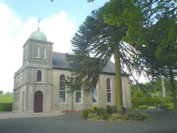
Second Ballyeaston Presbyterian Church
Historic churches · 3.2 km

Ballynashee railway station
Natural landmarks · 3.2 km

Doagh
Villages · 3.4 km

Painted Standing Stones
Public art & sculpture · 3.4 km

St. Agustines Church of Ireland
Historic houses · 3.4 km

Ballyeaston
Towns & cities · 3.5 km

Wee Collin
Mountains & hills · 3.6 km
Nearby
📷 3Cemeteries · Northern Ireland
Rashee Graveyard
Rashee Graveyard is a cemetery in the United Kingdom.
📷 4📷 3Natural landmarks · Northern Ireland
Antrim Upper
Antrim Upper in Northern Ireland, United Kingdom.
📷 3Natural landmarks · Northern Ireland
Ballybracken
Ballybracken in Northern Ireland, United Kingdom.
📷 3Natural landmarks · Northern Ireland
the Doagh Holestone
the Doagh Holestone — a place in Northern Ireland, United Kingdom.
📷 3Historic churches · Northern Ireland
Second Ballyeaston Presbyterian Church
Second Ballyeaston Presbyterian Church — church building in Ballyeaston, County Antrim, Northern Ireland.
Where to eat & stay near Drumadarragh House
Places to stay
 📷 5
Hotels · Northern Ireland
DoubleTree by Hilton Belfast Templepatrick
DoubleTree by Hilton Belfast Templepatrick — a hotel in northern ireland. 4-star. Brand: Hilton.
 📷 3
 📷 5
Caravan parks · Northern Ireland
Six Mile Water Caravan Park
Six Mile Water Caravan Park — a caravan park in northern ireland.
 📷 5
Caravan parks · Northern Ireland
Jordanstown Loughshore Caravan Park
Jordanstown Loughshore Caravan Park — a caravan park in northern ireland.
 📷 5
Hotels · Northern Ireland
Maldron Hotel Belfast International
Maldron Hotel Belfast International — a hotel in northern ireland. 3-star. Brand: Maldron Hotels.
 📷 5
Hostels · Northern Ireland
Simon Community Northern Ireland
Simon Community Northern Ireland — a hostel in northern ireland.
Places to eat & drink
 📷 5
Historic pubs · Northern Ireland
The Thatch Inn
The Thatch Inn in Northern Ireland, United Kingdom.
 📷 7
Historic pubs · Northern Ireland
Kelly's Cellars
Kelly's Cellars in Northern Ireland, United Kingdom.
 📷 5
 📷 5
Historic pubs · Northern Ireland
Kitchen Bar
Kitchen Bar in Northern Ireland, United Kingdom.
 📷 7
Historic pubs · Northern Ireland
Crown Liquor Saloon
Crown Liquor Saloon in Northern Ireland, United Kingdom.
 📷 3
Historic pubs · Northern Ireland
Red Lion Pub bombing
Red Lion Pub bombing in Northern Ireland, United Kingdom.
More places in this region
 📷 3
Manor houses · Northern Ireland
Magheramorne House
Magheramorne House — a manor in Northern Ireland, United Kingdom.
 📷 5
Manor houses · Northern Ireland
Holestone House
Holestone House — a manor in Northern Ireland, United Kingdom.
 📷 3
 📷 5
Manor houses · Northern Ireland
Redhall House
Redhall House — a manor in Northern Ireland, United Kingdom.
Frequently asked questions
- Where is Drumadarragh House?
- Drumadarragh House is in Northern Ireland, United Kingdom (postcode BT39 0UF).
- What is Drumadarragh House?
- Drumadarragh House — a manor in Northern Ireland, United Kingdom.
- How do I get to Drumadarragh House?
- The nearest town is Ballyeaston. Drivers can use postcode BT39 0UF.
- How do I get to Drumadarragh House?
- Drivers can navigate to postcode BT39 0UF. It sits within the South Antrim parliamentary constituency.