
Other places · Mid Wales
Dre-fach Felindre
In or near Llandysul.
Dre-fach Felindre in Wales Mid, United Kingdom.

Alan Hughes — CC BY-SA 2.0 via Wikimedia Commons licence

Plan your visit
- Typical visit
- 1 h–2 h
- Nearest railway station
- Henllan High Level · 2.1 km
Getting there & planning your visit
To visit Dre-fach Felindre, the nearest railway station is Henllan High Level, located 2.1 km away. The postcode for navigation is SA44 5UG. Entry details are not specified, so please check ahead for any fees, and accessibility information is not provided.
About
Dre-fach Felindre is a place of interest in Wales Mid, United Kingdom — drawn from open-data sources for visitor reference. See the linked Wikipedia article for the full description.
Photo gallery
From the Wikipedia article
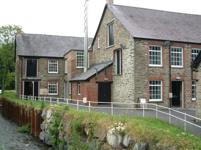
Dre-fach Felindre is a village in Carmarthenshire, West Wales. It is located four miles south-east of Newcastle Emlyn. It lies at the confluence of three fast-flowing streams, the Nant Bargod, Nant Esgair and Nant Brân, where their steep-sided valleys open out into the Teifi Valley. In the 19th and early 20th century it was an important centre for the woollen industry and was given the epithet, "the Huddersfield of Wales". As the population increased, the villages of Dre-fach (Welsh language, small town) and Felindre (Welsh language, mill town) extended and merged to form the present community. The Museum of the Welsh Woollen Industry, now the National Woollen Museum, was opened in 1976 in the Cambrian Mill.
Excerpt from Wikipedia under CC BY-SA 4.0. See the source article linked in Sources below.
Background
History
Little development happened in this area before the late 18th century and it is not clear why Dre-fach Felindre became such an important centre for the production of woollen cloth in Wales. By the early 19th century, four fulling mills were established at Pentrecwrt, Dolwyon, Drefach and Cwmpencraig. Spinning and weaving were done by hand or in small workshops at this time. In the 1850s, the power loom was introduced, the need for water power increased and there was a great expansion of the industry. Substantial mills, some employing 50-100 people, were built at Drefach, Felindre, Drefelin, Cwmpengraig, Cwmhiraeth and Pentre-cwrt by the first decade of the 20th century. The population…
Sourced from Wikipedia under CC BY-SA 4.0.
- Coordinates
- 52.0210, -4.4000
- District
- Carmarthenshire
- Parish
- Llangeler
- Postcode
- SA44 5UG
- Parliamentary constituency
- Caerfyrddin
- Nearest railway station
- Henllan High Level — 2.1 km
Sources
- wikidata: Q5306194 (CC0)
- wikipedia: Dre-fach Felindre (CC BY-SA 4.0)
Other places nearby
St Barnabas's Church
Historic churches · 0.2 km

Penrhiw Unitarian Chapel
Memorials & monuments · 0.2 km

Amgueddfa Wlân Cymru
Museums · 0.5 km
National Wool Museum
Museums · 0.6 km
Dinas Fawr, Llangeler
Vineyards · 0.9 km

Caer Llwyn Bedw
Vineyards · 1.1 km

Llangeler
Other places · 1.2 km

Henllan
Villages · 1.4 km

Cwmhiraeth
Other places · 1.5 km

Pont Henllan
Historic bridges · 1.5 km

Rhaeadrau Henllan / Henllan Falls
Waterfalls · 1.6 km
.jpg?width=1200)
Capel Eidalwyr
Chapels · 1.6 km
Nearby
📷 5Historic churches · Mid Wales
St Barnabas's Church
St Barnabas's Church — Grade II listed building-listed church in wales-mid, United Kingdom.
📷 3Memorials & monuments · Mid Wales
Penrhiw Unitarian Chapel
Penrhiw Unitarian Chapel — a memorial in wales-mid, United Kingdom.
📷 3Museums · Mid Wales
Amgueddfa Wlân Cymru
Amgueddfa Wlân Cymru — a museum in wales-mid, United Kingdom.
📷 5Museums · Mid Wales
National Wool Museum
National Wool Museum — museum of the woollen industry in Dre-fach Felindre, Wales, United Kingdom.
📷 2Vineyards · Mid Wales
Dinas Fawr, Llangeler
Dinas Fawr, Llangeler — a UK vineyard in wales mid, producing English or Welsh wine from cool-climate grape varieties.
Vineyards · Mid Wales
Caer Llwyn Bedw
Caer Llwyn Bedw — a UK vineyard in wales mid, producing English or Welsh wine from cool-climate grape varieties.
Where to eat & stay near Dre-fach Felindre
Places to stay
 📷 3
📷 3Campsites · Mid Wales
Afon Teifi Caravan and Camping Park
Afon Teifi Caravan and Camping Park — a campsite in wales mid.
 📷 5
📷 5Caravan parks · Mid Wales
Moelfryn Caravan and Camping Park
Moelfryn Caravan and Camping Park — a caravan park in wales mid.
 📷 5
📷 5 📷 5
📷 5
 📷 5
📷 5Places to eat & drink
 📷 3
📷 3Historic pubs · Mid Wales
The Bunch of Grapes
The Bunch of Grapes — Historic pub — listed building or notable heritage status.
 📷 3
📷 3Historic pubs · Mid Wales
The Three Horseshoes
The Three Horseshoes — Historic pub — listed building or notable heritage status.
 📷 5
📷 5Historic pubs · Mid Wales
White Hart
White Hart — Historic pub — listed building or notable heritage status.
 📷 5
📷 5 📷 5
📷 5 📷 3
📷 3Historic pubs · Mid Wales
The Pendre Inn
The Pendre Inn — Historic pub — listed building or notable heritage status.
More places in this region
 📷 5
📷 5 📷 3
📷 3Other places · Mid Wales
Sheep Music
Sheep Music is a three-day world music festival which takes place during July each year in Presteigne. It has 22 years of history, starting as a party on The Warden in 1991. Since moving to its curren
 📷 2
📷 2 📷 4
📷 4Frequently asked questions
- Where is Dre-fach Felindre?
- Dre-fach Felindre is in Mid Wales, United Kingdom (postcode SA44 5UG), in the parish of Llangeler.
- What is Dre-fach Felindre?
- Dre-fach Felindre in Wales Mid, United Kingdom.
- How do I get to Dre-fach Felindre?
- The nearest railway station is Henllan High Level, about 2.1 km away. Drivers can use postcode SA44 5UG.
- How do I get to Dre-fach Felindre?
- The nearest railway station is Henllan High Level, about 2.1 km away. Drivers can navigate to postcode SA44 5UG.