Towns & cities · East of England
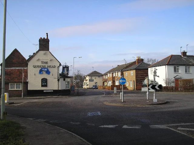
Drayton
Drayton — village and civil parish in Broadland, Norfolk, United Kingdom.

Wikimedia Commons contributors — see linked file page for photographer and licence licence
Plan your visit
- Typical visit
- 3 h–6 h
- Nearest railway station
- Norwich · 7.8 km
- Free entry
- Family-friendly
- Dog-friendly
Getting there & planning your visit
To visit Drayton, the nearest railway station is Norwich, located 7.8 km away. Entry to the town is free.
About
Drayton is a town, city, village or settlement in the United Kingdom. It covers approximately 6 km². Recent population estimates put it at around 5,150 people. Address: NR8. Wikidata describes it as: "village and civil parish in Broadland, Norfolk, United Kingdom". Coordinates: 52.6750°, 1.2250°.
Photo gallery
Protected designations
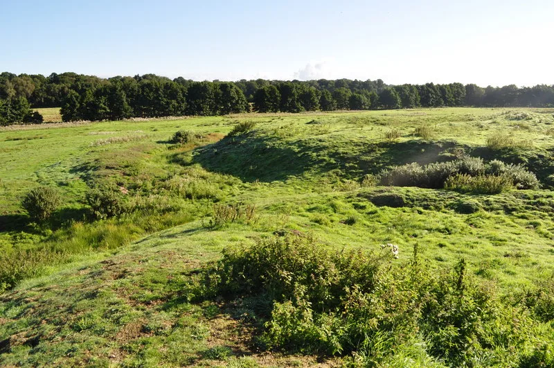
- Site of Special Scientific Interest: River Wensum SSSI
Designations sourced from Natural England open data under OGL v3.
From the Wikipedia article
Drayton is a suburban village and civil parish in the English county of Norfolk. It is located in the district of Broadland, 4.3 miles (6.9 km) north-west of Norwich and 8.3 miles (13.4 km) south of Aylsham. Today, Drayton is largely dominated by the Thorpe Marriott housing estate built in the late twentieth century.
Excerpt from Wikipedia under CC BY-SA 4.0. See the source article linked in Sources below.
Background
History
In the early twentieth century, several Roman artefacts including coins and pottery were unearthed close to the village, with a further Anglo-Saxon cemetery being discovered on the banks of the nearby River Wensum. The cemetery has yielded Anglo-Saxon brooches, daggers and pottery. In the Domesday Book, Drayton is listed as a settlement of ten households in the hundred of Taverham. In 1086, the village was part of the estates of Ralph de Beaufour. Throughout the mid-fifteenth century, Drayton was part of the estates of Sir John Fastolf, a prominent English soldier in the Hundred Years War and the basis of Shakespeare's Sir John Falstaff. Fastolf built Drayton Lodge in 1437, as a…
Sourced from Wikipedia under CC BY-SA 4.0.
- Coordinates
- 52.6750, 1.2250
- County
- Norfolk
- District
- Broadland
- Parish
- Drayton
- Postcode
- NR8
- Parliamentary constituency
- Norwich North
- Population
- 5,150
- Nearest railway station
- Norwich — 7.8 km
Sources
- wikidata: Q589226 (CC0)
- wikipedia: Drayton, Norfolk (CC BY-SA 4.0)
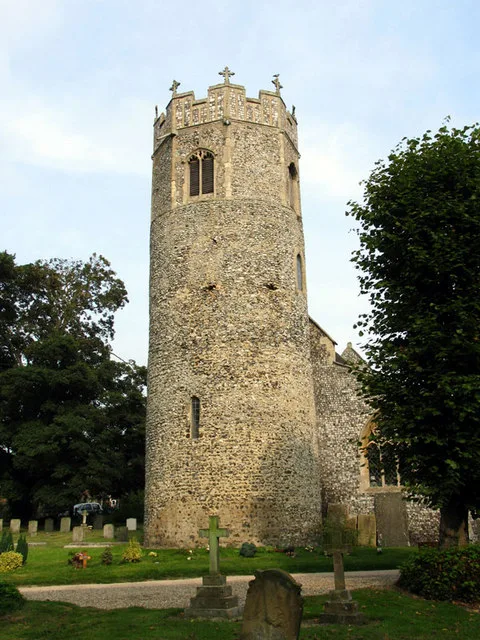
- commons: St Margaret, Drayton, Norfolk - geograph.org.uk - 319036.jpg (CC BY-SA 4.0)
Other places nearby

Drayton Village Sign
Public art & sculpture · 0.1 km

Village cross 160m south of St Margaret's Church
Historic churches · 0.1 km

Drayton War Memorial
Memorials & monuments · 0.3 km

Drayton Lodge
Historic houses · 0.6 km

Drayton
Villages · 1.1 km

Costessey War Memorial
Memorials & monuments · 1.1 km

Marriott's Way
Military museums · 1.4 km
Taverham
Towns & cities · 1.8 km

Kirklands / Hinshalwood Way / Old Costessey Village Sign
Public art & sculpture · 1.8 km

Costessey Village Sign
Public art & sculpture · 2.0 km

Costessey
Villages · 2.0 km

Taverham War Memorial
Memorials & monuments · 2.1 km
Drayton is a village located in Norfolk, in the East of England, with a population of 5,150. Our guide lists nearby attractions within reach.
At a glance
- Population
- 5,150
- Administrative county
- Norfolk
- Constituency
- Norwich North
- Top categories near here
Things to see in Drayton
36 attractions within 12 km — showing the 24 most editorially-significant. Full guide: things to do in Drayton →
 📷 3
📷 3Castles · East of England
Horsford Castle
Horsford Castle — castle in Horsford, Norfolk, England, UK.
 📷 3
📷 3Historic houses · East of England
The Gildencroft
The Gildencroft — Grade II listed house in Horsham St. Faith, Broadland, Norfolk, England, UK.
 📷 3
📷 3Natural landmarks · East of England
G-BMSD (PA28)
G-BMSD (PA28) — a other in england-east, United Kingdom.
📷 3Natural landmarks · East of England
G-EEGU (PA28-161 Warrior II)
G-EEGU (PA28-161 Warrior II) — a other in england-east, United Kingdom.
📷 3Natural landmarks · East of England
G-SEJW (PA28-161 Warrior II)
G-SEJW (PA28-161 Warrior II) — a other in england-east, United Kingdom.
📷 3Natural landmarks · East of England
G-JLCA (Piper Seneca II)
G-JLCA (Piper Seneca II) — a other in england-east, United Kingdom.
 📷 3
📷 3Natural landmarks · East of England
Transavia Boeing 737-800
Transavia Boeing 737-800 — a other in england-east, United Kingdom.
📷 3Historic houses · East of England
Drayton Lodge
Drayton Lodge — a historic house in england-east, United Kingdom.
 📷 3
📷 3Museums · East of England
City of Norwich Aviation Museum
City of Norwich Aviation Museum — a museum in england-east, United Kingdom.
📷 3Historic churches · East of England
Village cross 160m south of St Margaret's Church
Village cross 160m south of St Margaret's Church — a Grade II*-listed church in england-east, United Kingdom.
📷 3Memorials & monuments · East of England
Drayton War Memorial
Drayton War Memorial — Grade II listed building-listed memorial in england-east, United Kingdom.
📷 3Memorials & monuments · East of England
Costessey War Memorial
Costessey War Memorial — Grade II listed building-listed memorial in england-east, United Kingdom.
 📷 3
📷 3Memorials & monuments · East of England
Hellesdon War Memorial
Hellesdon War Memorial — Grade II listed building-listed memorial in england-east, United Kingdom.
 📷 3
📷 3Memorials & monuments · East of England
Horsford War Memorial
Horsford War Memorial — Grade II listed building-listed memorial in england-east, United Kingdom.
 📷 3
📷 3Memorials & monuments · East of England
Horsham St Faith War Memorial
Horsham St Faith War Memorial — Grade II listed building-listed memorial in england-east, United Kingdom.
 📷 3
📷 3Public art & sculpture · East of England
Hellesdon Village Sign
Hellesdon Village Sign — a public art in england-east, United Kingdom.
 📷 3
📷 3Public art & sculpture · East of England
Horsham St Faith Village Sign
Horsham St Faith Village Sign — a public art in england-east, United Kingdom.
📷 3Public art & sculpture · East of England
Costessey Village Sign
Costessey Village Sign — a public art in england-east, United Kingdom.
📷 3Public art & sculpture · East of England
Drayton Village Sign
Drayton Village Sign — a public art in england-east, United Kingdom.
 📷 3
📷 3Public art & sculpture · East of England
Horsford Village Sign
Horsford Village Sign — a public art in england-east, United Kingdom.
📷 3Public art & sculpture · East of England
Kirklands / Hinshalwood Way / Old Costessey Village Sign
Kirklands / Hinshalwood Way / Old Costessey Village Sign — a public art in england-east, United Kingdom.
📷 3Memorials & monuments · East of England
Horsford Roll of Honour
Horsford Roll of Honour — a memorial in england-east, United Kingdom.
 📷 5
📷 5Museums · East of England
Horsham St Faith
Horsham St Faith is a village in the English county of Norfolk, within the civil parish of Horsham St Faith and Newton St Faith. Horsham St Faith is located 8 miles (12.9 km) south of Aylsham and 5 mi
 📷 5
📷 5Museums · East of England
Avro Vulcan (XM612)
Avro Vulcan (XM612) — a museum in england-east, United Kingdom.
Nearby
📷 3Public art & sculpture · East of England
Drayton Village Sign
Drayton Village Sign — a public art in england-east, United Kingdom.
📷 3Historic churches · East of England
Village cross 160m south of St Margaret's Church
Village cross 160m south of St Margaret's Church — a Grade II*-listed church in england-east, United Kingdom.
📷 3Memorials & monuments · East of England
Drayton War Memorial
Drayton War Memorial — Grade II listed building-listed memorial in england-east, United Kingdom.
📷 3Historic houses · East of England
Drayton Lodge
Drayton Lodge — a historic house in england-east, United Kingdom.
📷 5📷 3Memorials & monuments · East of England
Costessey War Memorial
Costessey War Memorial — Grade II listed building-listed memorial in england-east, United Kingdom.
Where to eat & stay near Drayton
Places to stay
 📷 5
📷 5Hotels · East of England
Holiday Inn Express Norwich
Holiday Inn Express Norwich — a hotel in england east. 3-star. Brand: Holiday Inn Express.
📷 5Hotels · East of England
Mercure Norwich Hotel
Mercure Norwich Hotel — a hotel in england east.
 📷 7
📷 7Hotels · East of England
Elm Farm Country House
Elm Farm Country House — a hotel in england east.
 📷 5
📷 5 📷 5
📷 5Caravan parks · East of England
Costessey Short Stay Stopping Place
Costessey Short Stay Stopping Place — a caravan park in england east.
 📷 5
📷 5Places to eat & drink
 📷 5
📷 5Historic pubs · East of England
The Marlpit Public House
The Marlpit Public House in England East, United Kingdom.
 📷 5
📷 5Historic pubs · East of England
Gibraltar Gardens
Gibraltar Gardens in England East, United Kingdom.
 📷 5
📷 5 📷 5
📷 5Historic pubs · East of England
The Catherine Wheel Public House
The Catherine Wheel Public House in England East, United Kingdom.
 📷 5
📷 5Historic pubs · East of England
Cat And Fiddle Public House
Cat And Fiddle Public House in England East, United Kingdom.
 📷 5
📷 5More towns in this region
 Flagship📷 10
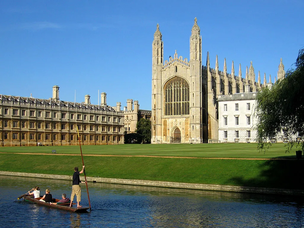 Flagship📷 10
Towns & cities · East of England
Cambridge
Cambridge — city in Cambridgeshire, England.
 Flagship📷 10
Towns & cities · East of England
Chelmsford
Chelmsford — city in Essex, United Kingdom.
 Flagship📷 10
Towns & cities · East of England
Colney Heath
Colney Heath — village and civil parish in St Albans, Hertfordshire, England, UK.
Frequently asked questions
- Where is Drayton?
- Drayton is in Norfolk, East of England, United Kingdom (postcode NR8), in the parish of Drayton.
- What is Drayton?
- Drayton — village and civil parish in Broadland, Norfolk, United Kingdom.
- How do I get to Drayton?
- The nearest railway station is Norwich, about 7.8 km away. Drivers can use postcode NR8.
- Is Drayton a protected site?
- Yes — Drayton is part of the River Wensum SSSI Site of Special Scientific Interest.
- Is Drayton free to visit?
- Yes, Drayton is free to enter.
- How do I get to Drayton?
- The nearest railway station is Norwich, about 7.8 km away. Drivers can navigate to postcode NR8.