
Historic churches · South East England
Dover
In or near Martin Mill.
Dover ( DOH-vər) is a town and major ferry port in Kent, England. It faces France across the Strait of Dover, the narrowest part of the English Channel at 33 kilometres (21 mi) from Cap Gris Nez in Fr

John Baker — CC BY-SA 2.0 via Wikimedia Commons licence

Plan your visit
- Typical visit
- 30 min–1 h
- Nearest railway station
- Dover Priory · 0.5 km
- Free entry
Getting there & planning your visit
To visit Dover church, you can take a train to Dover Priory station, which is 0.5 km away. The postcode for navigation is CT16 1DQ, and entry to the church is free.
About
Dover ( DOH-vər) is a town and major ferry port in Kent, England. It faces France across the Strait of Dover, the narrowest part of the English Channel at 33 kilometres (21 mi) from Cap Gris Nez in France. It lies southeast of Canterbury and east of Maidstone. The town is the administrative centre of the Dover District and home of the Port of Dover. Archaeological finds have revealed that the area has always been a focus for peoples entering and leaving Britain. The name derives from the River Dour that flows through it. In recent times the town has undergone transformations, with a high-speed rail link to London, new retail in town with St James' area opened in 2018, and a revamped promenade and beachfront. This followed in 2019, with a new 500 m pier to the west of the harbour, and new marina unveiled as part of a £330 million investment in the area. It has also been a point of destination for many illegal migrant crossings. The Port of Dover provides much of the town's employment, as does tourism, including to the landmark White Cliffs of Dover. There were 368,000 tourists visiting Dover castle in 2019. Dover is classified as a Large-Port Town, due to its large volumes of port traffic and low urban population.
Photo gallery
Protected designations
- Area of Outstanding Natural Beauty: Kent Downs
Designations sourced from Natural England open data under OGL v3.
From the Wikipedia article
Dover ( DOH-vər) is a town and major ferry port in Kent, England. It faces France across the Strait of Dover, the narrowest part of the English Channel at 33 kilometres (21 mi) from Cap Gris Nez in France. It lies southeast of Canterbury and east of Maidstone. The town is the administrative centre of the Dover District and home of the Port of Dover. Archaeological finds have revealed that the area has always been a focus for peoples entering and leaving Britain. The name derives from the River Dour that flows through it. In recent times the town has undergone transformations, with a high-speed rail link to London, new retail in town with St James' area opened in 2018, and a revamped promenade and beachfront. This followed in 2019, with a new 500 m pier to the west of the harbour, and new marina unveiled as part of a £330 million investment in the area. It has also been a point of destination for many illegal migrant crossings. The Port of Dover provides much of the town's employment, as does tourism, including to the landmark White Cliffs of Dover. There were 368,000 tourists visiting Dover castle in 2019. Dover is classified as a Large-Port Town, due to its large volumes of port traffic and low urban population.
Excerpt from Wikipedia under CC BY-SA 4.0. See the source article linked in Sources below.
Background
History
, by Richard Wilson, 1746-47]] , 1832]] Archaeological finds have shown that there were Stone Age people in the area, and that some Iron Age finds also exist. During the Roman period, the area became part of the Roman communications network. It was connected by road to Canterbury and Watling Street and it became Portus Dubris, a fortified port. Dover has a partly preserved Roman lighthouse (the tallest surviving Roman structure in Britain) and the remains of a villa with preserved Roman wall paintings. Dover later figured in the Domesday Book (1086). Forts were built above the port and lighthouses were constructed to guide passing ships. It is one of the Cinque Ports. and has served as a…
Description
Louis VIII of France landed his army, seeking to depose King Henry III, on Dover's mainland beach. Henry III ambushed Louis' army with approximately 400 bowmen atop The White Cliffs of Dover and his cavalry attacking the invaders on the beach. However, the French slaughtered the English cavalry and made their way up the cliffs to disperse the bowmen. Louis' army seized Dover village, forcing the English back to Canterbury. French control of Dover lasted for three months after which English troops pushed back, forcing the French to surrender and return home.
Sourced from Wikipedia under CC BY-SA 4.0.
- Coordinates
- 51.1295, 1.3089
- County
- Kent
- District
- Dover
- Parish
- Dover
- Postcode
- CT16 1DQ
- Parliamentary constituency
- Dover and Deal
- Nearest railway station
- Dover Priory — 0.5 km
- Official site
- web.archive.org
Sources
- wikipedia: Dover (CC BY-SA 4.0)
Other places nearby

Dover Masjid
Historic churches · 0.1 km

Maison Dieu
Gardens · 0.2 km

Dover District
Historic churches · 0.2 km

People Of Dover War Memorial
Memorials & monuments · 0.2 km
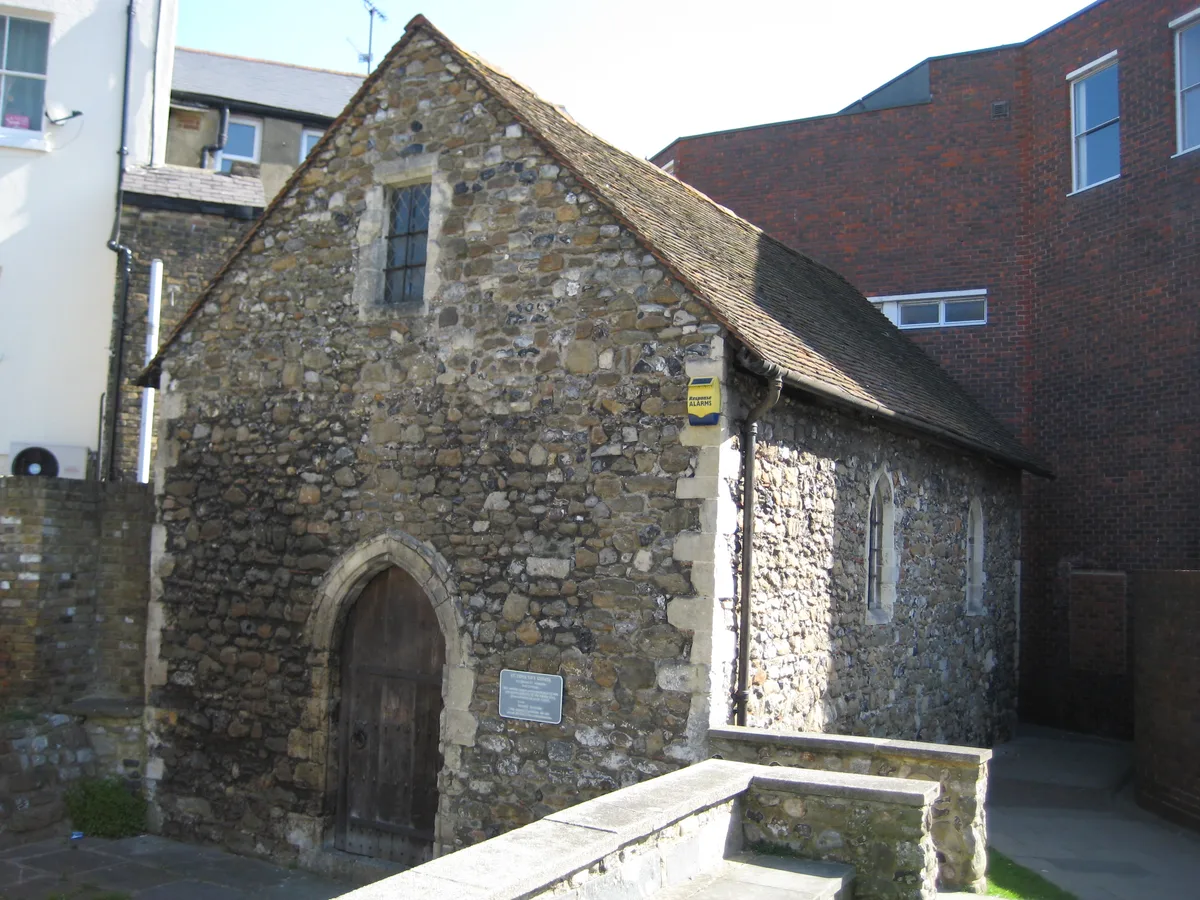
St Edmund's Chapel
Historic churches · 0.2 km

Gaumont Dover
Theatres · 0.4 km

War Memorial in the Churchyard of the Parish Church of St Mary the Virgin, Dover
Memorials & monuments · 0.5 km

Thomas Pattenden
Memorials & monuments · 0.5 km

St Mary's Church, Dover
Historic churches · 0.5 km

Roman Painted House
Archaeological sites · 0.5 km

Essoldo Dover
Theatres · 0.5 km

Silver Screen Cinema
Theatres · 0.6 km
Nearby
📷 5Historic churches · South East England
Dover Masjid
Dover Masjid — a church in england-south-east, United Kingdom.
📷 5Gardens · South East England
Maison Dieu
Maison Dieu — a garden in england-south-east, United Kingdom.
📷 5Historic churches · South East England
Dover District
Dover District — a church in england-south-east, United Kingdom.
📷 5Memorials & monuments · South East England
People Of Dover War Memorial
People Of Dover War Memorial — Grade II* listed building-listed memorial in england-south-east, United Kingdom.
📷 5Historic churches · South East England
St Edmund's Chapel
St Edmund's Chapel — wayside chapel in Dover, Kent, England, UK.
📷 5Theatres · South East England
Gaumont Dover
Gaumont Dover — a cinema heritage in england-south-east, United Kingdom.
Where to eat & stay near Dover
Places to stay
 📷 5
📷 5 📷 5
📷 5 📷 5
📷 5Caravan parks · South East England
St Margarets Bay Holiday Park
St Margarets Bay Holiday Park — a caravan park in england south east. Brand: Parkdean Resorts.
 📷 5
📷 5Campsites · South East England
Hawthorn Farm (Keat farm)
Hawthorn Farm (Keat farm) — a campsite in england south east.
 📷 5
📷 5 📷 5
📷 5Campsites · South East England
Greenhill Glamping
Greenhill Glamping — a campsite in england south east.
Places to eat & drink
 📷 7
📷 7Restaurants · South East England
The Swingate Inn, Namaste Curry House
The Swingate Inn, Namaste Curry House — a restaurant in england south east. Cuisine: indian.
 📷 7
📷 7 📷 5
📷 5Historic pubs · South East England
The Martello Public House
The Martello Public House in England South East, United Kingdom.
 📷 5
📷 5Historic pubs · South East England
The Samuel Peto
The Samuel Peto in England South East, United Kingdom.
 📷 7
📷 7Restaurants · South East England
81 Beach Street
81 Beach Street — a restaurant in england south east.
 📷 5
📷 5Historic pubs · South East England
Black Robin Public House
Black Robin Public House in England South East, United Kingdom.
More places in this region
 📷 5
📷 5Historic churches · South East England
All Saints Church, Frindsbury
All Saints Church, Frindsbury — church in Medway, UK.
 📷 5
📷 5Historic churches · South East England
All Saints Church, Maidstone
All Saints Church, Maidstone — parish church associated with the Archbishop's Palace, Maidstone, Kent, England, UK.
 📷 5
📷 5Historic churches · South East England
All Saints Church, West Farleigh
All Saints Church, West Farleigh — Grade I listed church in West Farleigh, Maidstone, Kent, England, UK.
 📷 5
📷 5Historic churches · South East England
All Souls' Church, Sutton Green
All Souls' Church, Sutton Green — church in Guildford, England.
Frequently asked questions
- Where is Dover?
- Dover is in Kent, South-East England, United Kingdom (postcode CT16 1DQ), in the parish of Dover.
- What is Dover?
- Dover ( DOH-vər) is a town and major ferry port in Kent, England. It faces France across the Strait of Dover, the narrowest part of the English Channel at 33 kilometres (21 mi) from Cap Gris Nez in Fr
- How do I get to Dover?
- The nearest railway station is Dover Priory, about 0.5 km away. The nearest town is Martin Mill. Drivers can use postcode CT16 1DQ.
- Is Dover a protected site?
- Yes — Dover is part of the Kent Downs National Landscape (AONB).
- Is Dover free to visit?
- Yes, Dover is free to enter.
- How do I get to Dover?
- The nearest railway station is Dover Priory, about 0.5 km away. Drivers can navigate to postcode CT16 1DQ.