
Mountains & hills · Mid Wales
Disgwilfa
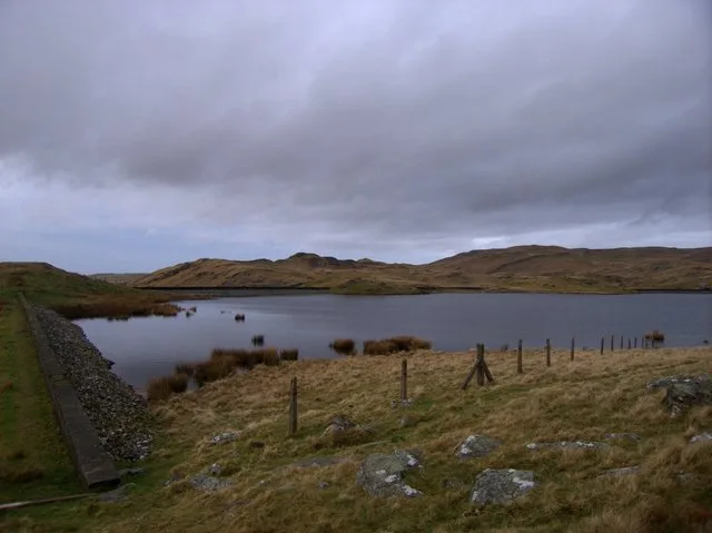
Disgwilfa — a mountain in wales-mid, United Kingdom, 459 m.

Rudi Winter — CC BY-SA 2.0 via Wikimedia Commons licence

Plan your visit
- Typical visit
- 3 h–8 h
- Best time of year
- Late spring – early autumn (May–Oct)
- Free entry
- Dog-friendly
About
Disgwilfa is a named summit in wales-mid, United Kingdom, with an elevation of approximately 459 metres. Listed in the Wikidata register of UK peaks; see the Wikipedia article for further details on the mountain's location, geology and walking routes.
Photo gallery
Place summary
Disgwilfa is a mountain located in Mid Wales. It is known for its rugged terrain and scenic views, characteristic of the region's natural landscape. The mountain contributes to the diverse topography of the area, attracting outdoor enthusiasts.
AI-generated from the structured facts on this page (operator, designation, listing, era). Not a substitute for visiting.
- Coordinates
- 52.2839, -3.7919
- District
- Ceredigion
- Parish
- Ystrad Fflur
- Postcode
- SY25 6ET
- Parliamentary constituency
- Ceredigion Preseli
Sources
- wikidata: Q106710427 (CC0)
Other places nearby

Hafod Frith Deserted Rural Settlement
Vineyards · 0.4 km
Llyn Teifi
Reservoirs & lochs · 1.1 km

Graig Felen
Mountains & hills · 1.1 km

Abandoned Settlement 300m NE of Troed-y-Rhiw
Vineyards · 1.4 km

Llyn Egnant
Reservoirs & lochs · 1.5 km

Dibyn Du
Mountains & hills · 1.6 km

Hafod Eidos Rural Settlement
Vineyards · 2.0 km

Rhos Gargoed
Natural landmarks · 2.0 km

Caemadog quarry
Quarries · 2.4 km

Penlan
Historic houses · 2.4 km

Pilgrim Sculpture
Public art & sculpture · 2.7 km

Pen-y-bwlch
Mountains & hills · 2.9 km
Nearby
📷 5Vineyards · Mid Wales
Hafod Frith Deserted Rural Settlement
Hafod Frith Deserted Rural Settlement — a UK vineyard in wales mid, producing English or Welsh wine from cool-climate grape varieties.
📷 3📷 3Mountains & hills · Mid Wales
Graig Felen
Graig Felen — a mountain in wales-mid, United Kingdom, 461 m.
📷 5Vineyards · Mid Wales
Abandoned Settlement 300m NE of Troed-y-Rhiw
Abandoned Settlement 300m NE of Troed-y-Rhiw — a UK vineyard in wales mid, producing English or Welsh wine from cool-climate grape varieties.
📷 3📷 3Mountains & hills · Mid Wales
Dibyn Du
Dibyn Du — a mountain in wales-mid, United Kingdom, 535 m.
Where to eat & stay near Disgwilfa
Places to stay
 📷 5
📷 5 📷 5
📷 5Caravan parks · Mid Wales
Bryn-y-gors Holiday Park
Bryn-y-gors Holiday Park — a caravan park in wales mid.
 📷 5
📷 5 📷 5
📷 5Hostels · Mid Wales
Dolgoch Bunkhouse
Dolgoch Bunkhouse — a hostel in wales mid.
 📷 5
📷 5Caravan parks · Mid Wales
Woodlands Caravan Park Devils Bridge
Woodlands Caravan Park Devils Bridge — a caravan park in wales mid.
 📷 5
📷 5Campsites · Mid Wales
Woodlands Touring Park
Woodlands Touring Park — a campsite in wales mid.
Places to eat & drink
 📷 5
📷 5Cafés · Mid Wales
Llywernog Silver Lead Mine
Llywernog Silver Lead Mine — a café in wales mid.
 📷 4
📷 4 📷 5
📷 5More mountains in this region
 📷 3
📷 3 📷 3
📷 3 📷 3
📷 3 📷 3
📷 3Frequently asked questions
- Where is Disgwilfa?
- Disgwilfa is in Mid Wales, United Kingdom (postcode SY25 6ET), in the parish of Ystrad Fflur.
- What is Disgwilfa?
- Disgwilfa — a mountain in wales-mid, United Kingdom, 459 m.
- How do I get to Disgwilfa?
- Drivers can use postcode SY25 6ET.
- Is Disgwilfa free to visit?
- Yes, Disgwilfa is free to enter.
- How do I get to Disgwilfa?
- Drivers can navigate to postcode SY25 6ET. It sits within the Ceredigion Preseli parliamentary constituency.