
Castles · Central Scotland
Dirleton Castle
In or near Gullane.
Dirleton Castle in Scotland Islands, United Kingdom.

Glaspark — CC BY-SA 4.0 via Wikimedia Commons licence
.jpg)
Plan your visit
- Typical visit
- 1.5 h–3 h
- Nearest railway station
- North Berwick · 3.2 km
- Family-friendly
- Limited wheelchair access
Getting there & planning your visit
Dirleton Castle is located in East Lothian, postcode EH39 5ER, and the nearest railway station is North Berwick, which is 3.2 km away. Entry details are not provided, and wheelchair accessibility is limited.
About
Dirleton Castle is a place of interest in Scotland Islands, United Kingdom — drawn from open-data sources for visitor reference. See the linked Wikipedia article for the full description.
Photo gallery
Official information
Dirleton Castle is a historic fortress that served three noble families over 400 years. It features picturesque ruins and splendid gardens, including the world's longest herbaceous border, making it a notable site for visitors interested in Scottish history and heritage.
From the Wikipedia article
Dirleton Castle is a medieval fortress in the village of Dirleton, East Lothian, Scotland. It lies around 2 miles (3.2 km) west of North Berwick, and around 19 miles (31 km) east of Edinburgh. The oldest parts of the castle date to the 13th century, and it was abandoned by the end of the 17th century. Begun in around 1240 by John De Vaux, the castle was heavily damaged during the Wars of Scottish Independence, when it was twice taken by the English. In the 14th century, Dirleton was repaired by the Haliburton family, and it was acquired by the Ruthvens in 1505. The Ruthvens were involved in several plots against Mary, Queen of Scots, and King James VI, and eventually forfeited the castle in 1600. Dirleton ceased to be a residence, although Oliver Cromwell was forced to besiege the castle to flush out a band of "mosstroopers" (marauders), during the Third English Civil War in 1650. The damaged castle was then acquired by John Nisbet, Lord Dirleton, who decided to build a new country house on the nearby Archerfield Estate. The Nisbet family of Dirleton continued to maintain the castle's gardens, before handing Dirleton into state care in 1923. The ruins and gardens are now maintained by Historic Environment Scotland. Dirleton Castle stands on a rocky outcrop, at the heart of the rich agricultural lands of the barony of Dirleton, and guards the coastal approach to Edinburgh from England, via the port of North Berwick. The ruins comprise a 13th-century keep, and a 16th-century house which the Ruthvens built adjacent. Only the basement levels survive of the 14th- and 15th-century additions built by the Haliburtons, although these comprised a large hall and tower house along the east range. Other buildings within the courtyard have also been demolished. Surrounding the castle are gardens, which may have been first laid out in the 16th century, although the present planting is largely of the 20th century. The garden walls enclose a 16th-century doocot, or pigeon house.
Excerpt from Wikipedia under CC BY-SA 4.0. See the source article linked in Sources below.
Background
Description
The castle is built on a natural rocky outcrop, on a low ridge overlooking the farmland of East Lothian. It comprises a kite-shaped courtyard, 40 m by 27 m, flanked by buildings on the south and east sides. The most substantial remains are the Ruthven Lodging, the gatehouse, and the de Vaux keep to the south, while only the basement of the east range survives. Fragments of the north and west curtain walls outline the courtyard, which was formerly divided in two by further 16th-century buildings. The castle was originally approached from the south, via a bridge and 3.4 m drawbridge, across a 15 m wide ditch. In the 16th century, steps were built to access the Ruthven lodging from the west.
Sourced from Wikipedia under CC BY-SA 4.0.
- Coordinates
- 56.0458, -2.7784
- District
- East Lothian
- Postcode
- EH39 5ER
- Parliamentary constituency
- Lothian East
- Nearest railway station
- North Berwick — 3.2 km
- Official site
- www.historicenvironment.scot
Sources
- wikidata: Q1955420 (CC0)
- wikipedia: Dirleton Castle (CC BY-SA 4.0)
Featured in this guide
Other places nearby

Courtyard
Natural landmarks · 0.0 km

Dirleton Castle Tower
Literary houses · 0.2 km

War Memorial, Manse Road, Dirleton
Memorials & monuments · 0.3 km

Dirleton Parish Church Hall, Manse Road, Dirleton
Historic churches · 0.4 km
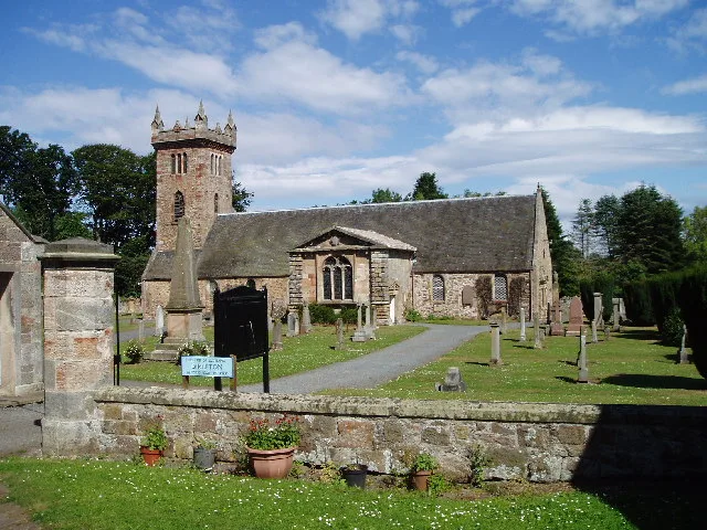
Dirleton Kirk
Historic churches · 0.5 km

Dirleton
Wildlife reserves · 0.5 km

Craig’s Quarry
Vineyards · 0.9 km

Archerfield Estate and Links
Historic houses · 1.1 km

Yellowcraig Caravan & Motorhome Club Site
Caravan parks · 1.3 km

Picture frame
Public art & sculpture · 1.6 km
Picture frame with butterfly wings
Public art & sculpture · 1.6 km
Willow Spiral
Public art & sculpture · 1.6 km
Nearby
📷 3Natural landmarks · Central Scotland
Courtyard
Courtyard — a other in scotland-central, United Kingdom.
📷 5Literary houses · Central Scotland
Dirleton Castle Tower
Dirleton Castle Tower — a literary house museum in scotland central.
📷 5Memorials & monuments · Central Scotland
War Memorial, Manse Road, Dirleton
War Memorial, Manse Road, Dirleton — category C listed building-listed memorial in scotland-central, United Kingdom.
📷 5Historic churches · Central Scotland
Dirleton Parish Church Hall, Manse Road, Dirleton
Dirleton Parish Church Hall, Manse Road, Dirleton — category B listed building-listed church in scotland-central, United Kingdom.
📷 3Historic churches · Central Scotland
Dirleton Kirk
Dirleton Kirk — church in East Lothian, Scotland, UK.
📷 5Wildlife reserves · Central Scotland
Dirleton
Dirleton in Scotland Islands, United Kingdom.
Where to eat & stay near Dirleton Castle
Places to stay
📷 5Caravan parks · Central Scotland
Yellowcraig Caravan & Motorhome Club Site
Yellowcraig Caravan & Motorhome Club Site — a caravan park in scotland central.
 📷 5
📷 5Caravan parks · Central Scotland
Gilsland Caravan Park
Gilsland Caravan Park — a caravan park in scotland central.
 📷 5
📷 5Caravan parks · Central Scotland
Station Park Caravan Site
Station Park Caravan Site — a caravan park in scotland central.
 📷 5
📷 5Campsites · Central Scotland
Tantallon Caravan & Camping Park
Tantallon Caravan & Camping Park — a campsite in scotland central.
 📷 5
📷 5Caravan parks · Central Scotland
East Fortune Farm CL
East Fortune Farm CL — a caravan park in scotland central.
 📷 5
📷 5Campsites · Central Scotland
Aberlady Caravan Park
Aberlady Caravan Park — a campsite in scotland central.
Places to eat & drink
 📷 5
📷 5Historic pubs · Central Scotland
Gardner's Arms Public House, Market Street, Haddington
Gardner's Arms Public House, Market Street, Haddington in Scotland Central, United Kingdom.
 📷 5
📷 5Historic pubs · Central Scotland
The Crown & Kitchen
The Crown & Kitchen in Scotland Central, United Kingdom.
 📷 5
📷 5Historic pubs · Central Scotland
Gothenburg Tavern, High Street, Prestonpans
Gothenburg Tavern, High Street, Prestonpans in Scotland Central, United Kingdom.
 📷 7
📷 7Historic pubs · Central Scotland
Balcarres Arms Hotel, 59 Main Street, Colinsburgh
Balcarres Arms Hotel, 59 Main Street, Colinsburgh in Scotland Central, United Kingdom.
 📷 7
📷 7Historic pubs · Central Scotland
Railway Tavern, 14, 16 High Street West, Anstruther Wester
Railway Tavern, 14, 16 High Street West, Anstruther Wester in Scotland Central, United Kingdom.
 📷 7
📷 7Historic pubs · Central Scotland
12 Shore Street, Anstruther Easter
12 Shore Street, Anstruther Easter in Scotland Central, United Kingdom.
More castles in this region
 📷 3
📷 3 📷 2
📷 2 📷 4
📷 4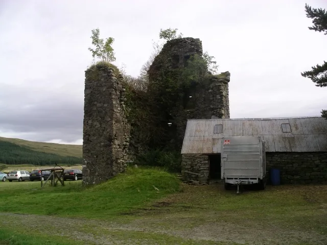 📷 3
📷 3Castles · Central Scotland
Achallader Castle
Achallader Castle — castle in Argyll and Bute, Scotland, UK.
Frequently asked questions
- Where is Dirleton Castle?
- Dirleton Castle is in the Scottish Highlands, United Kingdom (postcode EH39 5ER).
- What is Dirleton Castle?
- Dirleton Castle in Scotland Islands, United Kingdom.
- How do I get to Dirleton Castle?
- The nearest railway station is North Berwick, about 3.2 km away. Drivers can use postcode EH39 5ER.
- Who owns Dirleton Castle?
- Dirleton Castle is owned by Historic Environment Scotland.
- Does Dirleton Castle charge admission?
- Dirleton Castle typically charges admission. Check the official site for current ticket prices and opening hours.
- How do I get to Dirleton Castle?
- The nearest railway station is North Berwick, about 3.2 km away. Drivers can navigate to postcode EH39 5ER.