
Memorials & monuments · Mid Wales
Dinas Island
Dinas Island (Welsh: Ynys Dinas) is a peninsula, partially detached from the mainland, in the community of Dinas Cross between Fishguard and Newport, Pembrokeshire, in southwest Wales. A triangulation

Brendan Patchell — CC BY-SA 2.0 via Wikimedia Commons licence

Plan your visit
- Typical visit
- 15 min–45 min
- Nearest railway station
- Fishguard Harbour · 5.9 km
- Free entry
- Dog-friendly
Getting there & planning your visit
To visit Dinas Island, the nearest railway station is Fishguard Harbour, located 5.9 km away. The postcode for navigation is SA42 0SN, and entry to the site is free.
About
Dinas Island (Welsh: Ynys Dinas) is a peninsula, partially detached from the mainland, in the community of Dinas Cross between Fishguard and Newport, Pembrokeshire, in southwest Wales. A triangulation point shows 466 feet (142 m) above sea level at Pen-y-fan. Although Dinas Head is the northernmost part of the promontory where the cliffs meet the sea, the name is sometimes loosely used to refer to this highest point. Dinas Island is contained within the Pembrokeshire Coast National Park and the headland is under the care of the National Trust.
Photo gallery
From the Wikipedia article
Dinas Island (Welsh: Ynys Dinas) is a peninsula, partially detached from the mainland, in the community of Dinas Cross between Fishguard and Newport, Pembrokeshire, in southwest Wales. A triangulation point shows 466 feet (142 m) above sea level at Pen-y-fan. Although Dinas Head is the northernmost part of the promontory where the cliffs meet the sea, the name is sometimes loosely used to refer to this highest point. Dinas Island is contained within the Pembrokeshire Coast National Park and the headland is under the care of the National Trust.
Excerpt from Wikipedia under CC BY-SA 4.0. See the source article linked in Sources below.
- Coordinates
- 52.0270, -4.9040
- District
- Pembrokeshire
- Parish
- Dinas Cross
- Postcode
- SA42 0SN
- Parliamentary constituency
- Ceredigion Preseli
- Nearest railway station
- Fishguard Harbour — 5.9 km
Sources
- wikipedia: Dinas Island (CC BY-SA 4.0)
Other places nearby

Dinas Island Campsite
Campsites · 0.3 km

Dinas Island Castell
Literary houses · 0.5 km

Cwm-yr-Eglwys Caravan Club
Caravan parks · 0.7 km

Pen y Fan
Mountains & hills · 0.7 km

Saint Brynach's Belfry
Archaeological sites · 0.7 km

Traeth Mawr
Beaches · 0.8 km
.jpg?width=1200)
Brynhenllan Chapel
Chapels · 0.9 km

Dinas Head
Viewpoints · 0.9 km

Dinas
Villages · 1.2 km

Aberfforest Beach
Beaches · 1.9 km

Aberfforest Waterfall
Waterfalls · 2.0 km
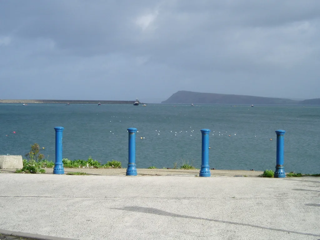
Fishguard Bay
Mountains & hills · 2.3 km
Nearby
📷 5Campsites · Mid Wales
Dinas Island Campsite
Dinas Island Campsite — a campsite in wales mid.
📷 5Literary houses · Mid Wales
Dinas Island Castell
Dinas Island Castell — a literary house museum in wales mid.
📷 5Caravan parks · Mid Wales
Cwm-yr-Eglwys Caravan Club
Cwm-yr-Eglwys Caravan Club — a caravan park in wales mid.
📷 5📷 3Archaeological sites · Mid Wales
Saint Brynach's Belfry
Saint Brynach's Belfry — a archaeological in wales-mid, United Kingdom.
📷 5Where to eat & stay near Dinas Island
Places to stay
📷 5Campsites · Mid Wales
Dinas Island Campsite
Dinas Island Campsite — a campsite in wales mid.
📷 5Caravan parks · Mid Wales
Cwm-yr-Eglwys Caravan Club
Cwm-yr-Eglwys Caravan Club — a caravan park in wales mid.
 📷 5
📷 5Caravan parks · Mid Wales
Fishguard Bay Caravan and Camping Park
Fishguard Bay Caravan and Camping Park — a caravan park in wales mid.
 📷 5
📷 5 📷 5
📷 5 📷 5
📷 5Campsites · Mid Wales
Conifers Pentraeth
Conifers Pentraeth — a campsite in wales mid.
Places to eat & drink
 📷 4
📷 4Historic pubs · Mid Wales
Dyffryn Arms
Dyffryn Arms — Historic pub — listed building or notable heritage status.
 📷 5
📷 5Historic pubs · Mid Wales
The Grosvenor
The Grosvenor — Historic pub — listed building or notable heritage status.
 📷 5
📷 5Restaurants · Mid Wales
Fusion Bar and Restaurant
Fusion Bar and Restaurant — a restaurant in wales mid.
 📷 3
📷 3Historic pubs · Mid Wales
Bar 45
Bar 45 — Historic pub — listed building or notable heritage status.
 📷 4
📷 4Historic pubs · Mid Wales
Cardiff Arms
Cardiff Arms — Historic pub — listed building or notable heritage status.
 📷 4
📷 4Historic pubs · Mid Wales
Crymmych Arms railway station
Crymmych Arms railway station in Wales Mid, United Kingdom.
More memorials in this region
 📷 5
📷 5Memorials & monuments · Mid Wales
Carreg Coetan Arthur
Carreg Coetan Arthur is a Neolithic dolmen in Newport, Pembrokeshire, Wales. Carreg Coetan Arthur dates from around 3000 BC and is the remains of a Neolithic burial chamber (also known as a quoit). Th
 📷 3
📷 3Memorials & monuments · Mid Wales
Rodney's Pillar
Rodney's Pillar is a memorial in the United Kingdom.
 📷 3
📷 3Memorials & monuments · Mid Wales
Alberbury War Memorial
Alberbury War Memorial — Grade II listed building-listed memorial in wales-north, United Kingdom.
 📷 3
📷 3Memorials & monuments · Mid Wales
Rehoboth ruïne
Rehoboth ruïne — a memorial in wales-north, United Kingdom.
Frequently asked questions
- Where is Dinas Island?
- Dinas Island is in South-East England, United Kingdom (postcode SA42 0SN), in the parish of Dinas Cross.
- What is Dinas Island?
- Dinas Island (Welsh: Ynys Dinas) is a peninsula, partially detached from the mainland, in the community of Dinas Cross between Fishguard and Newport, Pembrokeshire, in southwest Wales. A triangulation
- How do I get to Dinas Island?
- The nearest railway station is Fishguard Harbour, about 5.9 km away. Drivers can use postcode SA42 0SN.
- Is Dinas Island free to visit?
- Yes, Dinas Island is free to enter.
- How do I get to Dinas Island?
- The nearest railway station is Fishguard Harbour, about 5.9 km away. Drivers can navigate to postcode SA42 0SN.