Mountains & hills · North Wales
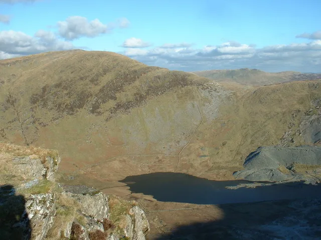
Dinas Emrys
In or near Beddgelert.
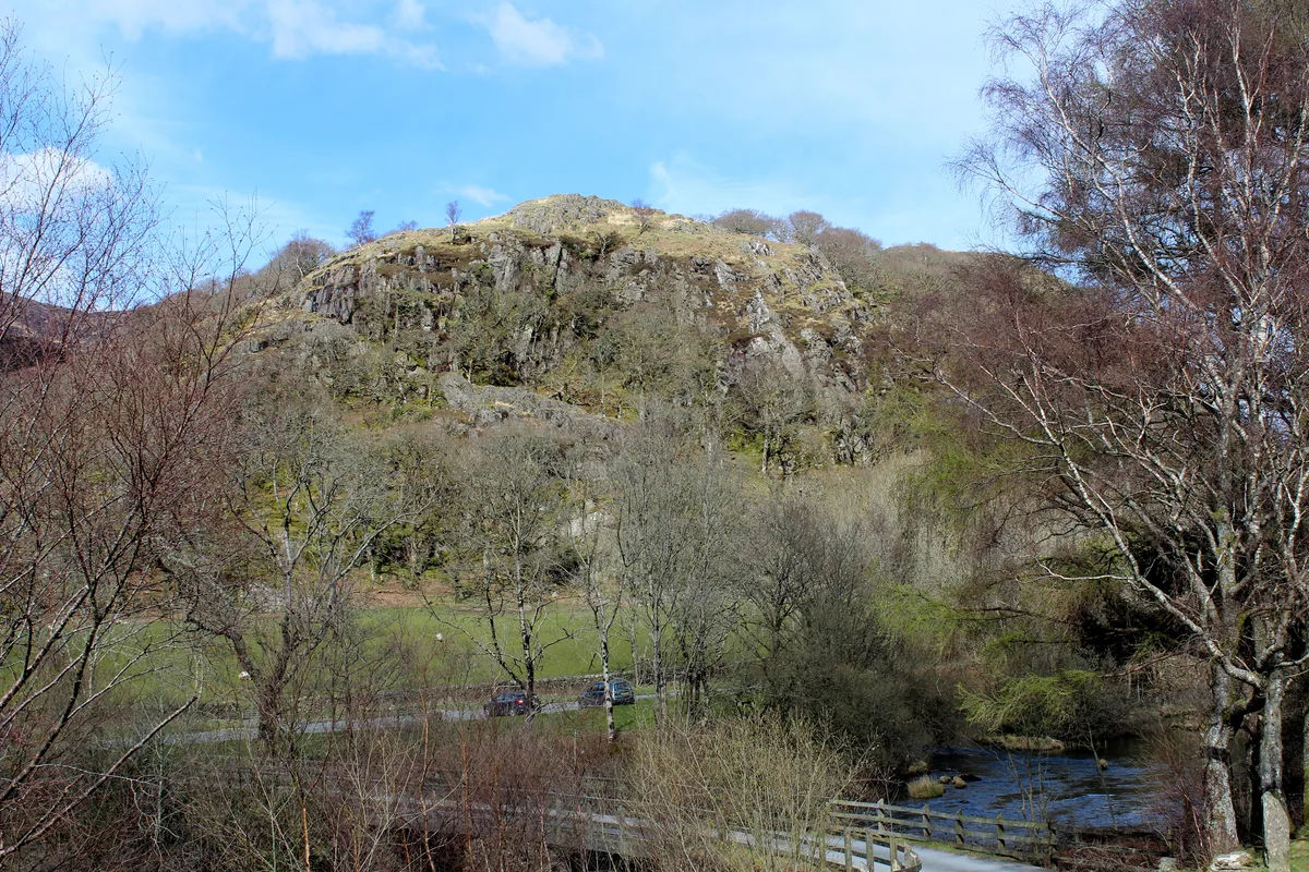
Dinas Emrys — Named summit at 137 m.

Wikimedia Commons contributors — see linked file page for photographer and licence licence
Plan your visit
- Typical visit
- 3 h–8 h
- Best time of year
- Late spring – early autumn (May–Oct)
- Nearest railway station
- Beddgelert · 2.2 km
- Free entry
- Dog-friendly
Getting there & planning your visit
To visit Dinas Emrys, the nearest railway station is Beddgelert, located 2.2 km away. The postcode for navigation is LL55 4NE, and entry to the site is free.
About
Dinas Emrys is a named summit in the United Kingdom. Wikidata describes it as: "Named summit at 137 m.". Coordinates: 53.0219°, -4.0791°.
Photo gallery
Official information
Sygun Copper Mine offers an exciting underground adventure where visitors can explore the rich industrial heritage of the site. Guests can also enjoy scenic views of Snowdonia National Park and participate in activities like gold panning.
From the Wikipedia article
Dinas Emrys (Welsh for 'Emrys's city') is a rocky and wooded hillock near Beddgelert in Gwynedd, north-west Wales. Rising some 76 m (250 ft) above the floor of the Glaslyn river valley, it overlooks the southern end of Llyn Dinas in Snowdonia. Little remains of the Iron Age hillfort or castle structures that once stood here, save its stone ramparts and the base of a keep [Grid reference SH 60669 49228]. Some believe the castle was erected by Llewelyn the Last to guard the road to the mountain pass of Snowdon.
Excerpt from Wikipedia under CC BY-SA 4.0. See the source article linked in Sources below.
Background
Description
's A tour in Wales, 1778]] Little remains of the structures that once stood on the hill. Such remains as are visible today, including three series of ramparts and other walls and some foundations, mostly date to the Middle Ages. Archaeologist H. N. Savory described the fortifications as consisting of stone walls between 2.5 and thick, which exploited every irregularity in the rocky hill-top, enclosing an irregular area of about a in size. The original means of access was by a steep path on the western side of the hillfort. The present entrance from the north-east is a later addition. Excavations in 1910 and 1954–56 revealed several periods of habitation at the site. The earliest elements…
Sourced from Wikipedia under CC BY-SA 4.0.
- Coordinates
- 53.0219, -4.0791
- District
- Gwynedd
- Parish
- Beddgelert
- Postcode
- LL55 4NE
- Parliamentary constituency
- Dwyfor Meirionnydd
- Phone
- 01766 549795
- Nearest railway station
- Beddgelert — 2.2 km
- Official site
- www.syguncoppermine.co.uk
Sources
- osm: n3533978110 (ODbL)
- wikipedia: Dinas Emrys (CC BY-SA 4.0)
- commons: Dinas Emrys Spring 2016.jpg (CC BY-SA 4.0)
Other places nearby
Dinas Emrys
Castles · 0.0 km

Dinas Emrys Castle
Castles · 0.0 km

Beddau 'r Dewiniaid
Archaeological sites · 0.3 km

Sygun Copper Mine
Mines & mining heritage · 0.4 km

Grib Ddu
Mountains & hills · 0.9 km

Cae Du Campsite
Campsites · 1.0 km

Llyn Dinas
Lakes · 1.0 km
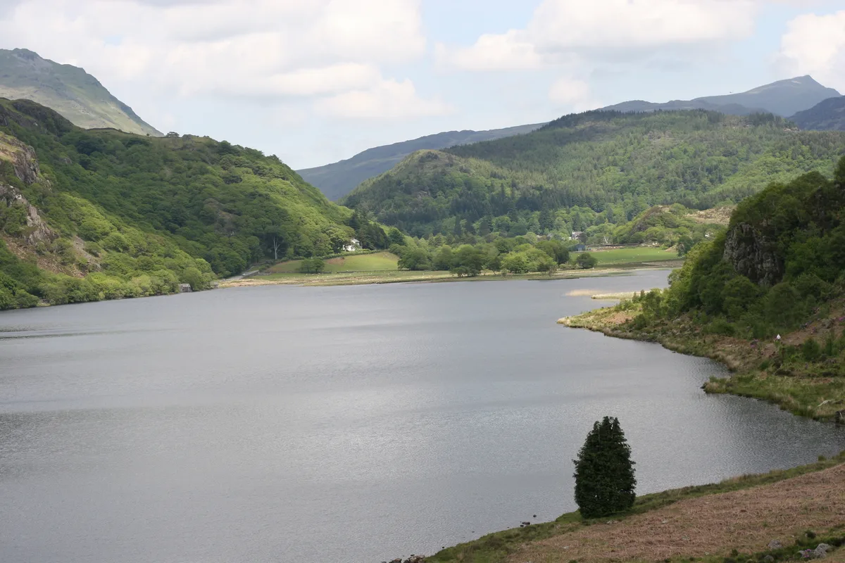
Llyn Dinas
Natural landmarks · 1.0 km

Dinas Hill
Mountains & hills · 1.2 km

Dinas
Mountains & hills · 1.5 km
Dinas, Beddgelert
Vineyards · 1.5 km

Moel y Dyniewyd
Mountains & hills · 1.6 km
Nearby
📷 3Castles · North Wales
Dinas Emrys
Dinas Emrys — Iron Age hillfort and castle probably erected by Prince Llewelyn II to guard the road to the mountain pass of Snowdon.
📷 5📷 3Archaeological sites · North Wales
Beddau 'r Dewiniaid
Beddau 'r Dewiniaid — a archaeological in wales-north, United Kingdom.
📷 3Mines & mining heritage · North Wales
Sygun Copper Mine
Sygun Copper Mine — a other in wales-north, United Kingdom.
📷 3Mountains & hills · North Wales
Grib Ddu
Grib Ddu — a mountain in wales-north, United Kingdom, 318 m.
📷 5Campsites · North Wales
Cae Du Campsite
Cae Du Campsite — a campsite in wales north.
Where to eat & stay near Dinas Emrys
Places to stay
📷 5Campsites · North Wales
Cae Du Campsite
Cae Du Campsite — a campsite in wales north.
 📷 5
📷 5Hostels · North Wales
Bryn Dinas Camping Pods
Bryn Dinas Camping Pods — a hostel in wales north.
 📷 6
📷 6 📷 5
📷 5Hostels · North Wales
Hertfordshire Snowdownia Centre
Hertfordshire Snowdownia Centre — a hostel in wales north.
 📷 5
📷 5Campsites · North Wales
Macs Pebyll Hafod Y Llan
Macs Pebyll Hafod Y Llan — a campsite in wales north.
 📷 5
📷 5Hostels · North Wales
Snowdon Bryn Gwynant
Snowdon Bryn Gwynant — a hostel in wales north.
Places to eat & drink
 📷 5
📷 5 📷 5
📷 5Restaurants · North Wales
Dylan's Restaurant
Dylan's Restaurant — a restaurant in wales north. Cuisine: burger;cake;coffee shop;fish;italian;italian pizza;pasta;pizza;seafood.
 📷 5
📷 5 📷 7
📷 7Restaurants · North Wales
Tafarn Tryfan
Tafarn Tryfan — a restaurant in wales north.
 📷 5
📷 5 📷 7
📷 7More mountains in this region
 📷 5
📷 5Mountains & hills · North Wales
Cemlyn Bay and lagoon
Cemlyn Bay and lagoon — Site of Special Scientific Interest in Wales.
 📷 3
📷 3Mountains & hills · North Wales
Aberffraw Bay
Aberffraw Bay — bay on the west coast of Anglesey, in Wales, UK.
 📷 3
📷 3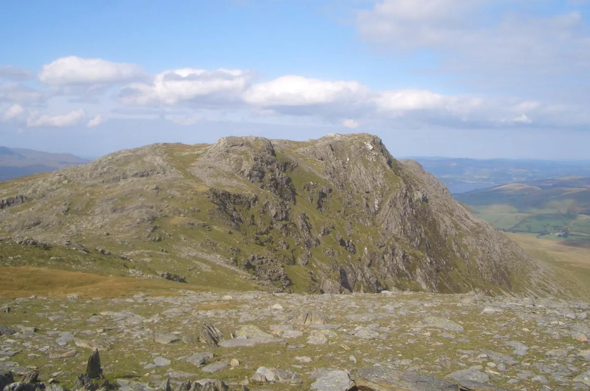 📷 3
📷 3Mountains & hills · North Wales
Aran Benllyn
Aran Benllyn — Named summit at 884 m.
Frequently asked questions
- Where is Dinas Emrys?
- Dinas Emrys is in North Wales, United Kingdom (postcode LL55 4NE), in the parish of Beddgelert.
- What is Dinas Emrys?
- Dinas Emrys — Named summit at 137 m.
- How do I get to Dinas Emrys?
- The nearest railway station is Beddgelert, about 2.2 km away. Drivers can use postcode LL55 4NE.
- Is Dinas Emrys free to visit?
- Yes, Dinas Emrys is free to enter.
- How do I get to Dinas Emrys?
- The nearest railway station is Beddgelert, about 2.2 km away. Drivers can navigate to postcode LL55 4NE.