
Historic bridges · South West England
Devil's Backbone Bridge
In or near South Brent.
Devil's Backbone Bridge — Grade II listed building-listed bridge in england-south-west, United Kingdom.

Derek Harper — CC BY-SA 2.0 via Wikimedia Commons licence

Plan your visit
- Typical visit
- 15 min–30 min
- Nearest railway station
- Ivybridge · 6.8 km
- Free entry
- Dog-friendly
Getting there & planning your visit
To visit Devil's Backbone Bridge, the nearest railway station is Ivybridge, located 6.8 km away. The postcode for sat-nav is TQ10 9ET, and entry to the bridge is free.
About
Devil's Backbone Bridge is a Grade II listed building-listed bridge in england-south-west, United Kingdom, registered on the National Heritage List for England (NHLE entry 1325036). Listed status protects buildings and structures of special architectural or historic interest. See the linked Wikipedia article for further details.
Photo gallery
Heritage listing
Details NORTH HUISH SX75NW 4/475 HORSEBROOK Devil's Backbone Bridge or Old Bridge 11.11.52 GV II Road bridge over River Avon, originally a packhorse bridge. Probably C17, widened probably in C18 or early C19. Stone rubble with dressed stone arch rings. Large single round arch of about 8m span. Originally a packhorse bridge of about 2m wide overall and possibly without parapets. In the C18 or early C19 it was widened by about 1m on the upstream west side and parapets added on both sides. The original arch showing on the downstream east side has unchamfered double arch rings above which the later parapet is corbelled out on large rough slates; the parapet coping on this side is of stone rubble. On the west upstream side the arch ring is single and also unchamfered and the parapet has granite coping. The abutments splay out at either end of the bridge and are built on the exposed slate bedrock of the river banks. A C20 buttress on the east side of the north abutment. This entry was subject to a Minor Amendment on 29 September 2016. Legacy The contents of this record have been generated from a legacy data system. Legacy System number: 101386 Legacy System: LBS
From the Historic England List Entry under OGL v3.
Protected designations
- Area of Outstanding Natural Beauty: South Devon
Designations sourced from Natural England open data under OGL v3.
Place summary
Devil's Backbone Bridge is a Grade II listed bridge located in South-West England. It is noted for its distinctive design and historical significance within the region.
AI-generated from the structured facts on this page (operator, designation, listing, era). Not a substitute for visiting.
- Coordinates
- 50.4116, -3.8130
- County
- Devon
- District
- South Hams
- Parish
- North Huish
- Postcode
- TQ10 9ET
- Parliamentary constituency
- South Devon
- Nearest railway station
- Ivybridge — 6.8 km
Sources
- wikidata: Q26610620 (CC0)
Other places nearby

Diptford Downs
Mountains & hills · 1.7 km

Oakenham Bridge
Historic bridges · 1.8 km
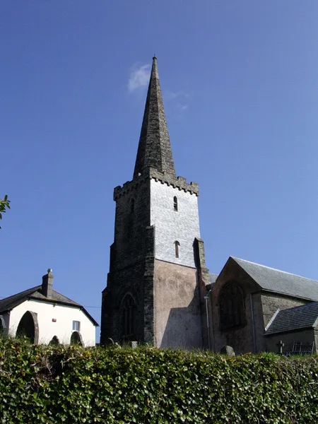
St Mary's Church, North Huish
Historic churches · 1.9 km

Brent Mill Bridge
Historic bridges · 1.9 km

North Huish
Villages · 1.9 km

Marley Thatch Hill
Mountains & hills · 2.1 km

Yellowberries Copse
Vineyards · 2.1 km

Bridge Immediately South East Of Glazebrook Lodge
Historic bridges · 2.1 km

The Pack Horse Inn
B&Bs · 2.2 km

Church of St Mary
Historic churches · 2.2 km

Station House
Cafés · 2.3 km

Diptford
Villages · 2.3 km
Nearby
📷 5Mountains & hills · South West England
Diptford Downs
Diptford Downs — a hill or mountain in england south west.
📷 3Historic bridges · South West England
Oakenham Bridge
Oakenham Bridge — Grade II listed building-listed bridge in england-south-west, United Kingdom.
📷 3Historic churches · South West England
St Mary's Church, North Huish
St Mary's Church, North Huish — church in North Huish, Devon, England, UK.
📷 4Historic bridges · South West England
Brent Mill Bridge
Brent Mill Bridge — Grade II listed building-listed bridge in england-south-west, United Kingdom.
📷 5📷 5Mountains & hills · South West England
Marley Thatch Hill
Marley Thatch Hill — a hill or mountain in england south west.
Where to eat & stay near Devil's Backbone Bridge
Places to stay
📷 7B&Bs · South West England
The Pack Horse Inn
The Pack Horse Inn — a bed-and-breakfast in england south west.
 📷 5
📷 5Campsites · South West England
Holsome Park Campsite
Holsome Park Campsite — a campsite in england south west.
 📷 2
📷 2Campsites · South West England
Ashbourne Woods Campsite
Ashbourne Woods Campsite — a campsite in england south west.
 📷 5
📷 5Campsites · South West England
Brackenhill Glamping
Brackenhill Glamping — a campsite in england south west.
 📷 5
📷 5Campsites · South West England
California Cross Camping and Caravan Club Site
California Cross Camping and Caravan Club Site — a campsite in england south west.
 📷 5
📷 5Campsites · South West England
Dunwell Farm Campsite
Dunwell Farm Campsite — a campsite in england south west.
Places to eat & drink
📷 5Cafés · South West England
Station House
Station House — a café in england south west.
 📷 5
📷 5Historic pubs · South West England
Church House Inn
Church House Inn in England South West, United Kingdom.
 📷 5
📷 5Historic pubs · South West England
Maltsters Arms
Maltsters Arms in England South West, United Kingdom.
 📷 7
📷 7Historic pubs · South West England
White Hart Hotel And The Assembly Rooms
White Hart Hotel And The Assembly Rooms in England South West, United Kingdom.
 📷 5
📷 5Restaurants · South West England
Furzeleigh Mill
Furzeleigh Mill — a restaurant in england south west.
 📷 7
📷 7More bridges in this region
 📷 5
📷 5Historic bridges · South West England
Avoncliff Aqueduct
Avoncliff Aqueduct is a historic bridge in the United Kingdom.
📷 5Historic bridges · South West England
Avoncliff Aqueduct
Avoncliff Aqueduct is a historic bridge in the United Kingdom.
 📷 5
📷 5Historic bridges · South West England
Bradford Viaduct
Bradford Viaduct is a historic bridge in the United Kingdom.
 📷 5
📷 5Historic bridges · South West England
Chippenham Viaduct
Chippenham Viaduct is a historic bridge in the United Kingdom.
Frequently asked questions
- Where is Devil's Backbone Bridge?
- Devil's Backbone Bridge is in Devon, South-West England, United Kingdom (postcode TQ10 9ET), in the parish of North Huish.
- What is Devil's Backbone Bridge?
- Devil's Backbone Bridge — Grade II listed building-listed bridge in england-south-west, United Kingdom.
- How do I get to Devil's Backbone Bridge?
- The nearest railway station is Ivybridge, about 6.8 km away. Drivers can use postcode TQ10 9ET.
- Is Devil's Backbone Bridge a listed building?
- Devil's Backbone Bridge is officially recognised as Grade II listed building listed.
- Is Devil's Backbone Bridge a protected site?
- Yes — Devil's Backbone Bridge is part of the South Devon National Landscape (AONB).
- Is Devil's Backbone Bridge free to visit?
- Yes, Devil's Backbone Bridge is free to enter.
- How do I get to Devil's Backbone Bridge?
- The nearest railway station is Ivybridge, about 6.8 km away. Drivers can navigate to postcode TQ10 9ET.