
Other places · North East England
Deckham
In or near Felling.
Deckham in England North East, United Kingdom.

JThomas — CC BY-SA 2.0 via Wikimedia Commons licence

Plan your visit
- Typical visit
- 1 h–2 h
- Nearest railway station
- Gateshead Stadium · 0.9 km
Getting there & planning your visit
To visit Deckham, the nearest railway station is Gateshead Stadium, located 0.9 km away. The postcode for navigation is NE8 3UT. Entry details are not provided, so please check in advance for accessibility options.
About
Deckham is a place of interest in England North East, United Kingdom — drawn from open-data sources for visitor reference. See the linked Wikipedia article for the full description.
Photo gallery
From the Wikipedia article
Deckham is a residential suburb in the Metropolitan Borough of Gateshead in Tyne and Wear, England. It is bordered by Gateshead town centre to the north, Sheriff Hill to the south, Felling and Carr Hill to the east and Shipcote to the west. It lies on the B1296, the route of the old Great North Road, 1 mile (1.6 km) south of Gateshead town centre, 1.5 miles (2.4 km) south of Newcastle-upon-Tyne and 13 miles (21 km) north of the city of Durham. In 2011, Deckham had a population of 9,938. Deckham's history is sparsely documented but suggests that the settlement was established at the junction of Carr Hill Road and the Old Durham Road in the early 19th century alongside the estate of Deckham Hall, built several centuries earlier and inhabited at one time by Thomas Deckham. The village grew, and at the turn of the 20th century was enveloped by urban spawl when neighbouring Gateshead absorbed its outlying villages and settlements. Deckham is largely distinguished from other areas by a commercial area on Old Durham Road which is the principal route through the suburb. Historically, Deckham was a village in County Durham and was incorporated into the Metropolitan Borough of Gateshead by the Local Government Act 1972. Deckham has steep topography which has shaped the character of the suburb. Residents can enjoy striking views towards Newcastle upon Tyne and across the Team Valley. The settlement is governed locally by a Parliamentary Labour council and elects a Labour MP. Deckham is an area of social and economic deprivation, in the top ten per cent of such areas according to the Index of Multiple Deprivation. Housing stock is predominantly council housing and is, in many places, outdated and in need of modernisation. Whilst once the site of a coal mine, there is today no major employer in Deckham, which is considered a residential suburb of Gateshead. The main economic activity is in a commercial development on Old Durham Road. Deckham has a number of public houses, one…
Excerpt from Wikipedia under CC BY-SA 4.0. See the source article linked in Sources below.
Background
History
Map of the early Deckham settlement (marked in red) on which Deckhall Hall and the two public houses are clearly evidenced]] Unlike Sheriff Hill, Carr Hill and Low Fell, Deckham's history is sparsely recorded. It indicates that, by the middle of the 19th century, there was a small settlement which was part of Gateshead Fell; a wild and treacherous area of common land notable for the criminality of the tinkers and hawkers who lived there. Ordnance survey mapping illustrates the sparsity of buildings in 1860; the area contained little except Deckham Hall, a few other dwellings and two public houses at the point where the old turnpike road branched off towards Carr's Hill. and 'The Ship'. It…
Description
The Elgin Centre is on Elgin Road at the south–east boundary between Deckham and Carr Hill. Whilst geographically outside Deckham, the centre provides "the key cluster" of community provisions for its residents. These facilities contribute to the regeneration of the suburb. The facilities are utilized by the Route 26 Community Project; a registered charity based at the centre which aims to work towards the betterment of lives in Deckham and neighbouring wards. The project works with Gateshead Council and the Gateshead Housing Company to provide a community cafe promoting healthy eating (the 'T–Junction'), a gymnasium, indoor sports hall, outdoor Five-a-side football pitches and a meeting…
Sourced from Wikipedia under CC BY-SA 4.0.
- Coordinates
- 54.9500, -1.5910
- District
- Gateshead
- Parish
- Gateshead, unparished area
- Postcode
- NE8 3UT
- Parliamentary constituency
- Gateshead Central and Whickham
- Nearest railway station
- Gateshead Stadium — 0.9 km
Sources
Other places nearby

Carr Hill
Other places · 0.5 km

Shipcote Hall
Theatres · 0.5 km

Sheriff Hill
Villages · 0.5 km

Gateshead War Memorial
Memorials & monuments · 0.5 km
Cenotaph
Memorials & monuments · 0.5 km
Metropolitan Borough of Gateshead
Museums · 0.6 km

Sunderland Talmudical College
Other places · 0.6 km
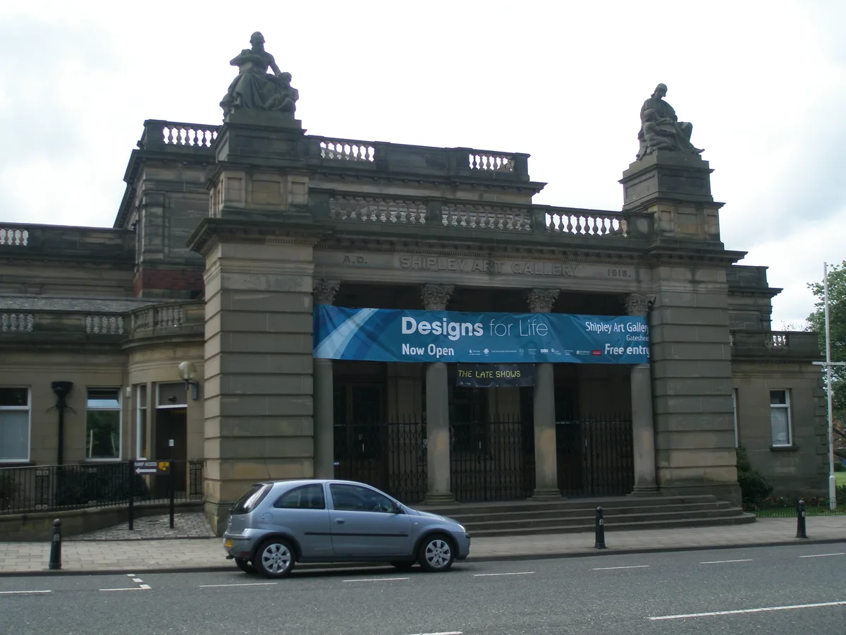
Shipley Art Gallery
Galleries · 0.7 km

Little Theatre Gateshead
Theatres · 0.7 km

Little Theatre Gateshead
Open-air theatres · 0.7 km
Gateshead Leisure Centre
Other places · 0.8 km

Gateshead
Cathedrals · 0.8 km
Nearby
📷 4Other places · North East England
Carr Hill
Carr Hill in England North East, United Kingdom.
📷 3Theatres · North East England
Shipcote Hall
Shipcote Hall in England North East, United Kingdom.
📷 5📷 3Memorials & monuments · North East England
Gateshead War Memorial
Gateshead War Memorial — Grade II listed building-listed memorial in scotland-lowlands, United Kingdom.
📷 4Memorials & monuments · North East England
Cenotaph
Cenotaph is a memorial in the United Kingdom.
📷 5Museums · North East England
Metropolitan Borough of Gateshead
Metropolitan Borough of Gateshead — a museum in scotland-lowlands, United Kingdom.
Where to eat & stay near Deckham
Places to stay
 📷 5
📷 5Hotels · North East England
Hilton Newcastle Gateshead
Hilton Newcastle Gateshead — a hotel in scotland lowlands. 4-star. Brand: Hilton.
 📷 5
📷 5Hotels · North East England
Rivers Hotel
Rivers Hotel — a hotel in scotland lowlands.
 📷 5
📷 5Hotels · North East England
Exchange Buildings
Exchange Buildings — a hotel in scotland lowlands.
 📷 5
📷 5 📷 5
📷 5Hotels · North East England
Vermont Hotel
Vermont Hotel — a hotel in scotland lowlands.
 📷 5
📷 5Hotels · North East England
Hotel du Vin
Hotel du Vin — a hotel in scotland lowlands.
Places to eat & drink
 📷 5
📷 5Restaurants · North East England
Sambuca
Sambuca — a restaurant in scotland lowlands.
 📷 3
📷 3Historic pubs · North East England
The Crown Posada
Newcastle's Quayside Victorian pub, with William Morris stained glass.
 📷 5📷 5
Restaurants · North East England
Cilantro
Cilantro — a restaurant in scotland lowlands.
 📷 5
📷 5Historic pubs · North East England
Liberty House
Liberty House in Scotland Lowlands, United Kingdom.
 📷 5
📷 5Historic pubs · North East England
The Cluny
The Cluny in England North East, United Kingdom.
More places in this region
 📷 5
📷 5Other places · North East England
Appleby Horse Fair
The Appleby Horse Fair, previously known as Appleby New Fair, is an annual gathering of Romani people (Gypsies) and Travellers in Appleby-in-Westmorland in Cumbria, England. The horse fair is held eac
 📷 5
📷 5Other places · North East England
Crosby Garrett
Crosby Garrett in England North East, United Kingdom.
 📷 5
📷 5Other places · North East England
Ravenstonedale
Ravenstonedale in England North East, United Kingdom.
 📷 5
📷 5Frequently asked questions
- Where is Deckham?
- Deckham is in North-East England, United Kingdom (postcode NE8 3UT), in the parish of Gateshead, unparished area.
- What is Deckham?
- Deckham in England North East, United Kingdom.
- How do I get to Deckham?
- The nearest railway station is Gateshead Stadium, about 0.9 km away. Drivers can use postcode NE8 3UT.
- How do I get to Deckham?
- The nearest railway station is Gateshead Stadium, about 0.9 km away. Drivers can navigate to postcode NE8 3UT.