
Museums · South West England
De Lank River
In or near Blisland.
The De Lank River (Cornish: Dowr Dinlonk, meaning ravine fort river) is a small river in north Cornwall, England. It is a tributary of the River Camel and is approximately nine miles (14 km) long from

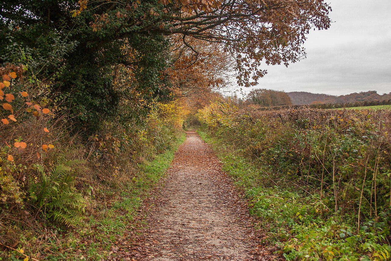
Sheron Vowden — CC BY-SA 2.0 via Wikimedia Commons licence

Plan your visit
- Typical visit
- 1.5 h–3 h
- Best time of year
- Year-round
- Nearest railway station
- Bodmin General · 7.1 km
- Family-friendly
- Limited wheelchair access
Getting there & planning your visit
To visit De Lank River, the nearest railway station is Bodmin General, located 7.1 km away. The postcode for sat-nav is PL30 4QL. Please note that accessibility is limited for wheelchair users.
About
The De Lank River (Cornish: Dowr Dinlonk, meaning ravine fort river) is a small river in north Cornwall, England. It is a tributary of the River Camel and is approximately nine miles (14 km) long from its source on Bodmin Moor to its confluence with the Camel two miles (3.2 km) south of St Breward. The De Lank River springs from Rough Tor Marsh between the two highest peaks on Bodmin Moor, Rough Tor and Brown Willy. Initially, its course is south between the peaks before turning southwest, past the southern foot of Garrow Tor, heading for the Camel. The De Lank's course is within the civil parish of St Breward. The river flows through an isolated area with few riverside settlements. Its upper reaches cross a bare moorland plateau and its lower reaches are characterised by ancient deciduous woodland. At Lank, near the confluence with the River Camel, the river flows through De Lank Quarries (the site of a Geological SSSI). The De Lank River is an important wildlife habitat noted for diverse and abundant flora and fauna. Together with the River Camel, the De Lank is an important habitat for the otter which is present along the whole length of the river. The De Lank is included in the Camel Special Area of Conservation (SAC) and River Camel SSSI.
Photo gallery
Protected designations
- Site of Special Scientific Interest: River Camel Valley and Tributaries SSSI
- Area of Outstanding Natural Beauty: Cornwall
Designations sourced from Natural England open data under OGL v3.
From the Wikipedia article
The De Lank River (Cornish: Dowr Dinlonk, meaning ravine fort river) is a small river in north Cornwall, England. It is a tributary of the River Camel and is approximately nine miles (14 km) long from its source on Bodmin Moor to its confluence with the Camel two miles (3.2 km) south of St Breward. The De Lank River springs from Rough Tor Marsh between the two highest peaks on Bodmin Moor, Rough Tor and Brown Willy. Initially, its course is south between the peaks before turning southwest, past the southern foot of Garrow Tor, heading for the Camel. The De Lank's course is within the civil parish of St Breward. The river flows through an isolated area with few riverside settlements. Its upper reaches cross a bare moorland plateau and its lower reaches are characterised by ancient deciduous woodland. At Lank, near the confluence with the River Camel, the river flows through De Lank Quarries (the site of a Geological SSSI). The De Lank River is an important wildlife habitat noted for diverse and abundant flora and fauna. Together with the River Camel, the De Lank is an important habitat for the otter which is present along the whole length of the river. The De Lank is included in the Camel Special Area of Conservation (SAC) and River Camel SSSI.
Excerpt from Wikipedia under CC BY-SA 4.0. See the source article linked in Sources below.
- Coordinates
- 50.5293, -4.7039
- District
- Cornwall
- Parish
- St. Breward
- Postcode
- PL30 4QL
- Parliamentary constituency
- North Cornwall
- Nearest railway station
- Bodmin General — 7.1 km
- Official site
- www.cartogiraffe.com
Sources
- wikipedia: De Lank River (CC BY-SA 4.0)
Other places nearby

Keybridge Bridge And Sundial In South West Cutwater
Historic bridges · 0.6 km

Bodrigan
Historic houses · 0.6 km
Helligan Hill
Mountains & hills · 1.2 km

Medieval wayside cross at Blisland
Historic houses · 1.5 km

Church of St Protus and St Hyacinth
Historic churches · 1.6 km

Mansion House
Historic houses · 1.6 km

Blisland
Towns & cities · 1.6 km

Bridge At Wenfordbridge
Historic bridges · 1.7 km

St Protus's Cross
Historic houses · 1.9 km

Bridge To South East Of St Protus' Cross
Historic bridges · 2.0 km

Jubilee Rock
Memorials & monuments · 2.1 km

Lank
Towns & cities · 2.1 km
Nearby
📷 3Historic bridges · South West England
Keybridge Bridge And Sundial In South West Cutwater
Keybridge Bridge And Sundial In South West Cutwater — Grade II listed building-listed bridge in england-south-west, United Kingdom.
📷 3📷 5Mountains & hills · South West England
Helligan Hill
Helligan Hill — a hill or mountain in england south west.
📷 3Historic houses · South West England
Medieval wayside cross at Blisland
Medieval wayside cross at Blisland — a Grade II*-listed historic house in england-south-west, United Kingdom.
📷 4Historic churches · South West England
Church of St Protus and St Hyacinth
Church of St Protus and St Hyacinth — Grade I listed building-listed church in england-south-west, United Kingdom.
📷 5Historic houses · South West England
Mansion House
Mansion House — house in Blisland, Cornwall, England, UK.
Where to eat & stay near De Lank River
Places to stay
 📷 5
📷 5Campsites · South West England
South Penquite Farm
South Penquite Farm — a campsite in england south west.
 📷 7
📷 7Hotels · South West England
Tredethy House
Tredethy House — a hotel in england south west.
 📷 5
📷 5Caravan parks · South West England
St. Mabyn Holiday Park
St. Mabyn Holiday Park — a caravan park in england south west.
 📷 5
📷 5Caravan parks · South West England
Michaelstow Manor Holiday Park
Michaelstow Manor Holiday Park — a caravan park in england south west.
 📷 5
📷 5Caravan parks · South West England
Lanarth Caravan Park
Lanarth Caravan Park — a caravan park in england south west.
 📷 5
📷 5B&Bs · South West England
The White Hart Inn
The White Hart Inn — a bed-and-breakfast in england south west.
Places to eat & drink
 📷 7
📷 7Historic pubs · South West England
Methodist Chapel
Methodist Chapel in England South West, United Kingdom.
 📷 5
📷 5 📷 7
📷 7Restaurants · South West England
Nathan Outlaw
Nathan Outlaw — a restaurant in england south west.
 📷 7
📷 7Restaurants · South West England
Outlaws Fish Kitchen
Outlaws Fish Kitchen — a restaurant in england south west.
 📷 7
📷 7Restaurants · South West England
Slipway Hotel
Slipway Hotel — a restaurant in england south west.
 📷 6
📷 6Historic pubs · South West England
The Shipwrights
The Shipwrights in England South West, United Kingdom.
More museums in this region
 📷 5
📷 5Museums · South West England
Alexander Keiller Museum
Alexander Keiller Museum — museum in South West England, United Kingdom.
 📷 5
📷 5Museums · South West England
American Museum and Gardens
American Museum and Gardens — culture and arts museum near Bath, England, United Kingdom.
 📷 5
📷 5Museums · South West England
Atwell-Wilson Motor Museum
Atwell-Wilson Motor Museum — museum in Calne, England, UK.
 📷 5
📷 5Museums · South West England
Bath Abbey Heritage Vaults
Bath Abbey Heritage Vaults — museum in Bath Abbey, Bath, England, UK.
Frequently asked questions
- Where is De Lank River?
- De Lank River is in South-West England, United Kingdom (postcode PL30 4QL), in the parish of St. Breward.
- What is De Lank River?
- The De Lank River (Cornish: Dowr Dinlonk, meaning ravine fort river) is a small river in north Cornwall, England. It is a tributary of the River Camel and is approximately nine miles (14 km) long from
- How do I get to De Lank River?
- The nearest railway station is Bodmin General, about 7.1 km away. Drivers can use postcode PL30 4QL.
- Is De Lank River a protected site?
- Yes — De Lank River is part of the River Camel Valley and Tributaries SSSI Site of Special Scientific Interest and the Cornwall National Landscape (AONB).
- How do I get to De Lank River?
- The nearest railway station is Bodmin General, about 7.1 km away. Drivers can navigate to postcode PL30 4QL.