
Historic bridges · South East England
Danesfield Bridge (Over A4155 Road)
In or near Bockmer End.
Danesfield Bridge (Over A4155 Road) — Grade II listed building-listed bridge in england-south-east, United Kingdom.

Andrew Smith — CC BY-SA 2.0 via Wikimedia Commons licence

Plan your visit
- Typical visit
- 15 min–30 min
- Nearest railway station
- Marlow · 4.3 km
- Free entry
- Dog-friendly
Getting there & planning your visit
To visit Danesfield Bridge, the nearest railway station is Marlow, located 4.3 km away. The postcode for sat-nav is SL7 2EE, and entry to the bridge is free.
About
Danesfield Bridge (Over A4155 Road) is a Grade II listed building-listed bridge in england-south-east, United Kingdom, registered on the National Heritage List for England (NHLE entry 1159834). Listed status protects buildings and structures of special architectural or historic interest. See the linked Wikipedia article for further details.
Photo gallery
See it from the streetimagery from 2024
Imagery © Mapillary contributors, CC BY-SA 4.0
Heritage listing
Details MEDMENHAM HENLEY ROAD SU 88 SW (DANESFIELD) 8/142 Danesfield Bridge (over A4155 Road) 2.1.74 - II Bridge. Mid C19. Cast iron bridge of flat span, supported by 2 pairs of slender cast iron octagonal columns. Columns rest on knapped flint and brick piers. End retaining walls also knapped flint and brick. Balustrade is of diagonal lattic pattern with rounded handrail. Built to connect former Danesfield House with kitchen gardens. Listing NGR: SU8161284867 Legacy The contents of this record have been generated from a legacy data system. Legacy System number: 47025 Legacy System: LBS
From the Historic England List Entry under OGL v3.
Protected designations
- Area of Outstanding Natural Beauty: Chilterns
Designations sourced from Natural England open data under OGL v3.
Place summary
Danesfield Bridge is a Grade II listed bridge located over the A4155 road in South-East England. This structure is recognised for its historical significance and architectural merit within the region.
AI-generated from the structured facts on this page (operator, designation, listing, era). Not a substitute for visiting.
- Coordinates
- 51.5568, -0.8242
- District
- Buckinghamshire
- Parish
- Medmenham
- Postcode
- SL7 2EE
- Parliamentary constituency
- Wycombe
- Nearest railway station
- Marlow — 4.3 km
Sources
- wikidata: Q26453517 (CC0)
Other places nearby

Danesfield House Hotel and Spa
Hotels · 0.5 km
.jpg?width=1200)
Bockmer End
Towns & cities · 0.5 km
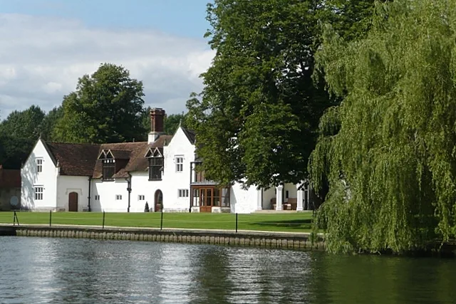
Medmenham Abbey
Abbeys & priories · 0.5 km

Medmenham Camp
Vineyards · 0.9 km

Medmenham
Towns & cities · 1.0 km

Hurley Riverside Park
Caravan parks · 1.0 km
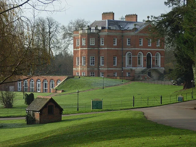
Harleyford Manor
Stately homes · 1.1 km

Bridge In Grounds Of Chapter House, 30 Metres North Of The House
Historic bridges · 1.2 km
.JPG?width=1200)
Hurley Lock
Canal locks · 1.2 km

Bridge In Grounds Of The Refectory, 150 Metres North East From The House
Historic bridges · 1.3 km

Medmenham Abbey Folly
Follies · 1.4 km
.jpg?width=1200)
Medmenham Abbey, Abbey House and Wall with Arch to Forecourt
Historic houses · 1.4 km
Nearby
📷 5Hotels · South East England
Danesfield House Hotel and Spa
Danesfield House Hotel and Spa — a hotel in england south east.
📷 5Towns & cities · South East England
Bockmer End
Bockmer End — village in Buckinghamshire, United Kingdom.
📷 5Abbeys & priories · South East England
Medmenham Abbey
Medmenham Abbey — Cistercian abbey in Medmenham, Buckinghamshire, England, UK.
📷 5Vineyards · South East England
Medmenham Camp
Medmenham Camp — a UK vineyard in england south east, producing English or Welsh wine from cool-climate grape varieties.
📷 5Towns & cities · South East England
Medmenham
Medmenham — village in Buckinghamshire, United Kingdom.
📷 5Caravan parks · South East England
Hurley Riverside Park
Hurley Riverside Park — a caravan park in england south east.
Where to eat & stay near Danesfield Bridge (Over A4155 Road)
Places to stay
📷 5Hotels · South East England
Danesfield House Hotel and Spa
Danesfield House Hotel and Spa — a hotel in england south east.
📷 5Caravan parks · South East England
Hurley Riverside Park
Hurley Riverside Park — a caravan park in england south east.
 📷 5
📷 5Hotels · South East England
The Olde Bell
The Olde Bell — a hotel in england south east.
 📷 5
📷 5Hotels · South East England
Compleat Angler
Compleat Angler — a hotel in england south east.
 📷 5
📷 5Campsites · South East England
Embers Henley
Embers Henley — a campsite in england south east.
 📷 5
📷 5Campsites · South East England
Chiltern Retreat, Park Field Camping
Chiltern Retreat, Park Field Camping — a campsite in england south east.
Places to eat & drink
 📷 7
📷 7Restaurants · South East England
The Coach
The Coach — a restaurant in england south east.
 📷 5
📷 5Historic pubs · South East England
Chequers Hotel
Chequers Hotel in England South East, United Kingdom.
 📷 5
📷 5Historic pubs · South East England
The George And Dragon Hotel
The George And Dragon Hotel in England South East, United Kingdom.
 📷 5
📷 5Historic pubs · South East England
Seven Stars Public House And Attached Stables
Seven Stars Public House And Attached Stables in England South East, United Kingdom.
 📷 7
📷 7Historic pubs · South East England
The Little Angel
The Little Angel in England South East, United Kingdom.
 📷 7
📷 7Historic pubs · South East England
The Red Cross Public House
The Red Cross Public House in England South East, United Kingdom.
More bridges in this region
 📷 5
📷 5Historic bridges · South East England
Briary Hill Bridge east
Briary Hill Bridge east is a historic bridge in the United Kingdom.
 📷 5
📷 5Historic bridges · South East England
Briary Hill Bridge west
Briary Hill Bridge west is a historic bridge in the United Kingdom.
 📷 5
📷 5Historic bridges · South East England
Bridge 157 VIR (Bath Hard Road)
Bridge 157 VIR (Bath Hard Road) is a historic bridge in the United Kingdom.
 📷 5
📷 5Historic bridges · South East England
Dorking Arch Bridge
Dorking Arch Bridge is a historic bridge in the United Kingdom.
Frequently asked questions
- Where is Danesfield Bridge (Over A4155 Road)?
- Danesfield Bridge (Over A4155 Road) is in South-East England, United Kingdom (postcode SL7 2EE), in the parish of Medmenham.
- What is Danesfield Bridge (Over A4155 Road)?
- Danesfield Bridge (Over A4155 Road) — Grade II listed building-listed bridge in england-south-east, United Kingdom.
- How do I get to Danesfield Bridge (Over A4155 Road)?
- The nearest railway station is Marlow, about 4.3 km away. Drivers can use postcode SL7 2EE.
- Is Danesfield Bridge (Over A4155 Road) a listed building?
- Danesfield Bridge (Over A4155 Road) is officially recognised as Grade II listed building listed.
- Is Danesfield Bridge (Over A4155 Road) a protected site?
- Yes — Danesfield Bridge (Over A4155 Road) is part of the Chilterns National Landscape (AONB).
- Is Danesfield Bridge (Over A4155 Road) free to visit?
- Yes, Danesfield Bridge (Over A4155 Road) is free to enter.
- How do I get to Danesfield Bridge (Over A4155 Road)?
- The nearest railway station is Marlow, about 4.3 km away. Drivers can navigate to postcode SL7 2EE.