
Memorials & monuments · South West England
D-Day
In or near Dartington.
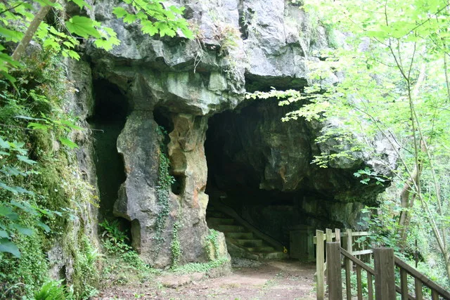
D-Day — a memorial in england-south-west, United Kingdom.

Derek Harper — CC BY-SA 2.0 via Wikimedia Commons licence

Plan your visit
- Typical visit
- 15 min–45 min
- Nearest railway station
- Buckfastleigh · 1.1 km
- Free entry
- Dog-friendly
- Wheelchair accessible
Getting there & planning your visit
To visit the D-Day memorial in Devon, the nearest railway station is Buckfastleigh, located 1.1 km away. Entry to the memorial is free, and it is wheelchair accessible. The postcode for sat-nav is TQ11 0AL.
About
D-Day is a memorial located in england-south-west, United Kingdom. Sourced from OpenStreetMap (ODbL licence); see local listings for visitor information, opening hours and admission details.
Photo gallery
See it from the streetimagery from 2025
Imagery © Mapillary contributors, CC BY-SA 4.0
From the Wikipedia article
The Normandy landings were the landing operations and associated airborne operations on 6 June 1944 of the Allied invasion of Normandy in Operation Overlord during the Second World War. Codenamed Operation Neptune and often referred to as D-Day (after the military term), it is the largest seaborne invasion in history. The operation began the liberation of France, and the rest of Western Europe, and laid the foundations for the Allied victory on the Western Front. Planning for the operation began in 1943. In the months leading up to the invasion, the Allies conducted a substantial military deception, codenamed Operation Bodyguard, to mislead the Germans as to the date and location of the main Allied landings. The weather on the day selected for D-Day was not ideal, and the operation had to be delayed 24 hours; a further postponement would have meant a delay of at least two weeks, as the planners had requirements for the phase of the moon, the tides, and time of day, that meant only a few days each month were deemed suitable. German leader Adolf Hitler placed Field Marshal Erwin Rommel in command of German forces and developing fortifications along the Atlantic Wall in anticipation of an invasion. US president Franklin D. Roosevelt placed Major General Dwight D. Eisenhower in command of Allied forces. The invasion began shortly after midnight on the morning of 6 June with extensive aerial and naval bombardment as well as an airborne assault—the landing of 24,000 American, British, and Canadian airborne troops. The early morning aerial assault was soon followed by Allied amphibious landings on the coast of France c. 06:30. The target 80-kilometre (50 mi) stretch of the Normandy coast was divided into five sectors: Utah, Omaha, Gold, Juno, and Sword. Strong winds blew the landing craft east of their intended positions, particularly at Utah and Omaha. The men landed under heavy fire from gun emplacements overlooking the beaches, and the shore was mined and covered with obstacles such as wooden stakes, metal tripods, and barbed wire, making the work of the beach-clearing teams difficult and dangerous. The highest number of casualties was at Omaha, with its high cliffs. At Gold, Juno, and Sword, several fortified towns were cleared in house-to-house fighting, and two major gun emplacements at Gold were disabled using specialised tanks. The Allies were able to establish beachheads at each of the five landing sites on the first day, but Carentan, Saint-Lô, and Bayeux remained in German hands. Caen, a major objective, was not captured until 21 July. Only two of the beaches (Juno and Gold) were linked on the first day, and all five beachheads were not connected until 12 June. German casualties on D-Day have been estimated at 4,000 to 9,000 men. Allied casualties were at least 10,000, with 4,414 confirmed dead.
Excerpt from Wikipedia under CC BY-SA 4.0. See the source article linked in Sources below.
- Coordinates
- 50.4799, -3.7836
- County
- Devon
- District
- Teignbridge
- Parish
- Buckfastleigh
- Postcode
- TQ11 0AL
- Parliamentary constituency
- Central Devon
- Nearest railway station
- Buckfastleigh — 1.1 km
Sources
- osm: node/7091598115 (ODbL)
- wikipedia: D-Day (CC BY-SA 4.0)
Other places nearby

South Dartmoor Bunkhouse (Groups only)
Hostels · 0.1 km

Jellyfish Art Gallery and Cafe
Public art & sculpture · 0.3 km
Jellyfish Art Gallery
Museums · 0.3 km

Buckfastleigh
Museums · 0.4 km

The Valliant Soldier Museum & Heritage Centre
Museums · 0.6 km

Churchill Farm Campsite
Caravan parks · 0.7 km

Bakers Pit
Caves · 0.8 km

Buckfastleigh War Memorial
Memorials & monuments · 0.9 km
Joint Mitnor Cave
Mountains & hills · 0.9 km

Parish Church of Holy Trinity
Historic churches · 0.9 km

Reeds cave
Caves · 0.9 km

Rift Cave
Caves · 0.9 km
Nearby
📷 5Hostels · South West England
South Dartmoor Bunkhouse (Groups only)
South Dartmoor Bunkhouse (Groups only) — a hostel in england south west.
📷 3Public art & sculpture · South West England
Jellyfish Art Gallery and Cafe
Jellyfish Art Gallery and Cafe — a public art in england-south-west, United Kingdom.
📷 3Museums · South West England
Jellyfish Art Gallery
Jellyfish Art Gallery — a museum in england-south-west, United Kingdom.
📷 5Museums · South West England
Buckfastleigh
Buckfastleigh is a market town and civil parish in the Teignbridge district, in Devon, England situated beside the Devon Expressway (A38) at the edge of the Dartmoor National Park. For ecclesiastical
📷 3Museums · South West England
The Valliant Soldier Museum & Heritage Centre
The Valliant Soldier Museum & Heritage Centre — a museum in england-south-west, United Kingdom.
📷 5Caravan parks · South West England
Churchill Farm Campsite
Churchill Farm Campsite — a caravan park in england south west.
Where to eat & stay near D-Day
Places to stay
📷 5Hostels · South West England
South Dartmoor Bunkhouse (Groups only)
South Dartmoor Bunkhouse (Groups only) — a hostel in england south west.
📷 5Caravan parks · South West England
Churchill Farm Campsite
Churchill Farm Campsite — a caravan park in england south west.
 📷 5
📷 5Campsites · South West England
Beara Farm Campsite
Beara Farm Campsite — a campsite in england south west.
 📷 5
📷 5Hotels · South West England
The Dartmoor Lodge Hotel
The Dartmoor Lodge Hotel — a hotel in england south west.
 📷 5
📷 5Campsites · South West England
Summerhill Farm
Summerhill Farm — a campsite in england south west.
 📷 5
📷 5Campsites · South West England
Walled Garden Campsite
Walled Garden Campsite — a campsite in england south west.
Places to eat & drink
 📷 5
📷 5Restaurants · South West England
Furzeleigh Mill
Furzeleigh Mill — a restaurant in england south west.
 📷 7
📷 7 📷 7
📷 7Historic pubs · South West England
Royal Oak Public House
Royal Oak Public House in England South West, United Kingdom.
 📷 5
📷 5Historic pubs · South West England
Church House Inn
Church House Inn in England South West, United Kingdom.
 📷 5
📷 5Historic pubs · South West England
The Victoria Inn
The Victoria Inn in England South West, United Kingdom.
 📷 5
📷 5Cafés · South West England
Station House
Station House — a café in england south west.
More memorials in this region
 📷 5
📷 5Memorials & monuments · South West England
Bath Cenotaph
Bath Cenotaph is a memorial in the United Kingdom.
 📷 5
📷 5Memorials & monuments · South West England
Cross of Sacrifice
Cross of Sacrifice is a memorial in the United Kingdom.
 📷 5
📷 5Memorials & monuments · South West England
Grange Arch
Grange Arch is a memorial in the United Kingdom.
.jpg?width=1200) 📷 5
📷 5Memorials & monuments · South West England
King Alfred Memorial
King Alfred Memorial is a memorial in the United Kingdom.
Frequently asked questions
- Where is D-Day?
- D-Day is in Devon, South-West England, United Kingdom (postcode TQ11 0AL), in the parish of Buckfastleigh.
- What is D-Day?
- D-Day — a memorial in england-south-west, United Kingdom.
- How do I get to D-Day?
- The nearest railway station is Buckfastleigh, about 1.1 km away. Drivers can use postcode TQ11 0AL.
- Is D-Day free to visit?
- Yes, D-Day is free to enter.
- How do I get to D-Day?
- The nearest railway station is Buckfastleigh, about 1.1 km away. Drivers can navigate to postcode TQ11 0AL.