
Natural landmarks · Northern Ireland
Cushendall
Also known as: Bun Abhann Dalla
In or near Knocknacarry.
Cushendall in Northern Ireland, United Kingdom.

N Chadwick — CC BY-SA 2.0 via Wikimedia Commons licence

Plan your visit
- Typical visit
- 1 h–2 h
- Free entry
- Dog-friendly
About
Cushendall is a place of interest in Northern Ireland, United Kingdom — drawn from open-data sources for visitor reference. See the linked Wikipedia article for the full description.
Photo gallery
From the Wikipedia article
Cushendall (from Irish Cois Abhann Dalla, meaning 'foot of the River Dall'), formerly known as Newtownglens, is a coastal village and townland (of 153 acres) in County Antrim, Northern Ireland. It is located in the historic barony of Glenarm Lower and the civil parish of Layd, and is part of Causeway Coast and Glens district. Located on the A2 coast road between Glenariff and Cushendun, Cushendall is in the Antrim Coast and Glens an Area of Outstanding Natural Beauty. It lies in the shadow of the table topped Lurigethan Mountain and at the meeting point of three of the Glens of Antrim: Glenaan, Glenballyemon and Glencorp. This part of the Northern Irish coastline is separated from Scotland by the North Channel, with the Mull of Kintyre about 16 miles away. In the 2021 census, Cushendall had a population of 1,180 people. Much of the historic character of the 19th century settlement on the north bank of the River Dall remains, including the mostly-intact Irish Georgian buildings of the town's four original streets. In 1973, it was the second village in Northern Ireland to be designated as a Conservation Area. Since 1990, Cushendall has hosted the Heart Of The Glens festival every August. Thomas D'Arcy McGee, a father of Canadian Confederation, spent his childhood in Cushendall when his father, who worked for the Coast Guard Service, was posted there.
Excerpt from Wikipedia under CC BY-SA 4.0. See the source article linked in Sources below.
Background
History
During The Troubles in Northern Ireland from 1920 to 1922, a shooting occurred in Cushendall. Several lorries of Ulster Special Constabulary (USC) personnel, accompanied by British Army soldiers, drove into Cushendall on the night of 23 June 1922 to enforce the nightly curfew. The USC proceeded to open fire on a crowd of onlookers, killing three Catholic men: James McAllister, John Gore and John Hill. After the incident, the USC claimed they were ambushed by the Irish Republican Army and returned fire, but a British government inquiry, which was declassified almost a century later, concluded that the constabulary's version of events was false. There were further violent incidents during the…
Visiting
Holiday accommodation in the area ranges from Self Catering to Bed & Breakfast and caravan and camping. Cushendall has three caravan and camping sites. Cushendall has a number of shops, which offer local gifts and crafts, as well as many other items. There is also an annual vintage car rally which is held in the village.
Sourced from Wikipedia under CC BY-SA 4.0.
- Coordinates
- 55.0829, -6.0590
- District
- Causeway Coast and Glens
- Postcode
- BT44 0NG
- Parliamentary constituency
- East Antrim
Sources
- wikidata: Q2580652 (CC0)
- wikipedia: Cushendall (CC BY-SA 4.0)
Other places nearby

The Glens of Antrim
Viewpoints · 0.3 km

Drunks’ Tower
Natural landmarks · 0.4 km
Cottage Park
Parks · 0.4 km

Cushendall Caravan Holiday Park
Caravan parks · 0.7 km

Moyle Cinema
Theatres · 0.8 km

Layd Church
Archaeological sites · 0.9 km

Red bay Lifeboat Station
Natural landmarks · 0.9 km

Layd Old Church (ruins)
Historic houses · 1.2 km

Cross Slieve
Mountains & hills · 1.6 km
Croisshliabh
Mountains & hills · 1.6 km
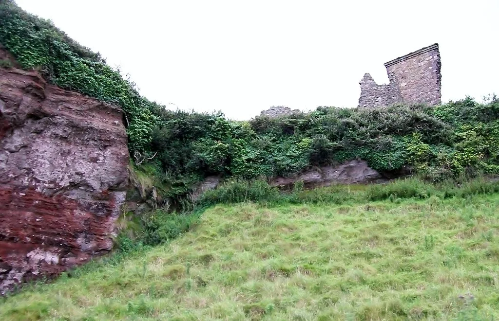
Red Bay Castle
Castles · 1.7 km

Ballybrack
Natural landmarks · 2.0 km
Nearby
📷 3Viewpoints · Northern Ireland
The Glens of Antrim
The Glens of Antrim is a viewpoint in the United Kingdom.
📷 3Natural landmarks · Northern Ireland
Drunks’ Tower
Drunks’ Tower — a other in northern-ireland, United Kingdom.
📷 3Parks · Northern Ireland
Cottage Park
Cottage Park — a other in northern-ireland, United Kingdom.
📷 5Caravan parks · Northern Ireland
Cushendall Caravan Holiday Park
Cushendall Caravan Holiday Park — a caravan park in northern ireland.
📷 3📷 5Archaeological sites · Northern Ireland
Layd Church
Layd Church — a archaeological site in northern ireland.
Where to eat & stay near Cushendall
Places to stay
📷 5Caravan parks · Northern Ireland
Cushendall Caravan Holiday Park
Cushendall Caravan Holiday Park — a caravan park in northern ireland.
 📷 5
📷 5Caravan parks · Northern Ireland
Cushendun Caravan Park
Cushendun Caravan Park — a caravan park in northern ireland.
 📷 4
📷 4 📷 2
📷 2 📷 5
📷 5Campsites · Northern Ireland
Glenarm Castle Ocean View Pods
Glenarm Castle Ocean View Pods — a campsite in northern ireland.
 📷 5
📷 5Caravan parks · Northern Ireland
Maguire's Stranf Caravan Park
Maguire's Stranf Caravan Park — a caravan park in northern ireland.
Places to eat & drink
 📷 7
📷 7Historic pubs · Northern Ireland
House of McDonnell
House of McDonnell in Northern Ireland, United Kingdom.
 📷 5
📷 5More natural landmarks in this region
 Flagship📷 4
Natural landmarks · Northern Ireland
Lough Erne
Lough Erne — lake in County Fermanagh, Northern Ireland, UK.
 Flagship📷 4
Natural landmarks · Northern Ireland
Lough Neagh
Lough Neagh — large lake in Northern Ireland.
 📷 3
📷 3Natural landmarks · Northern Ireland
Ballysaggart Lough
Ballysaggart Lough — lake in the United Kingdom.
 📷 5
📷 5Natural landmarks · Northern Ireland
Belmore Mountain
Belmore Mountain — mountain in the United Kingdom.
Frequently asked questions
- Where is Cushendall?
- Cushendall is in Northern Ireland, United Kingdom (postcode BT44 0NG).
- What is Cushendall?
- Cushendall in Northern Ireland, United Kingdom.
- How do I get to Cushendall?
- Drivers can use postcode BT44 0NG.
- Is Cushendall free to visit?
- Yes, Cushendall is free to enter.
- How do I get to Cushendall?
- Drivers can navigate to postcode BT44 0NG. It sits within the East Antrim parliamentary constituency.