Mountains & hills · Scottish Highlands
Crungie Clach
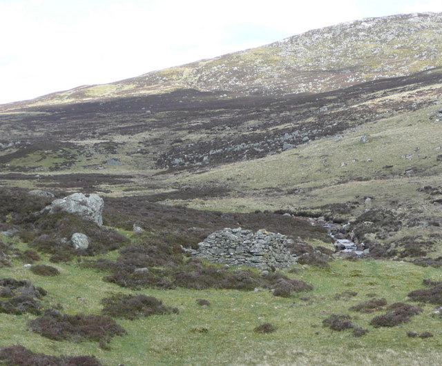
Crungie Clach — mountain in scotland highlands. Elevation: 616 m.
Russel Wills — CC BY-SA 2.0 via Wikimedia Commons licence
Plan your visit
- Typical visit
- 3 h–8 h
- Best time of year
- Late spring – early autumn (May–Oct)
About
Crungie Clach is a mountain located in scotland highlands. Elevation: 616 m. A named British peak recorded in OpenStreetMap. Peaks are typically named on Ordnance Survey 1:50k mapping.
Photo gallery
Place summary
Crungie Clach is a mountain located in the Scottish Highlands. It is known for its rugged terrain and scenic views typical of the region. Visitors can expect a challenging environment suited for experienced walkers and climbers. The area offers opportunities for exploration and appreciation of the natural landscape.
AI-generated from the structured facts on this page (operator, designation, listing, era). Not a substitute for visiting.
- Coordinates
- 56.7721, -3.6585
Sources
- osm: n2444393903 (ODbL)
Other places nearby
Loading nearby places…
Nearby
 📷 2
📷 2Mountains & hills · Scottish Highlands
Crungie Clach
Crungie Clach — a mountain in scotland-highlands, United Kingdom.
 📷 5
📷 5Mountains & hills · Scottish Highlands
Gurlet
Gurlet — mountain in scotland highlands. Elevation: 607 m.
📷 5Mountains & hills · Scottish Highlands
Gurlet
Gurlet — a hill or mountain in scotland highlands.
 📷 4
📷 4Mountains & hills · Scottish Highlands
Cnoc Dubh
Cnoc Dubh — a mountain in scotland-highlands, United Kingdom, 545 m.

Mountains & hills · Scottish Highlands
Creag Chlacharnach
Creag Chlacharnach — a mountain in scotland-highlands, United Kingdom.
 📷 5
📷 5Mountains & hills · Scottish Highlands
Ben Skievie
Ben Skievie — mountain in scotland highlands. Elevation: 521 m.
Where to eat & stay near Crungie Clach
Places to stay
 📷 5
📷 5Hostels · Scottish Highlands
Pitlochry Youth Hostel
Pitlochry Youth Hostel — a hostel in scotland highlands.
 📷 5
📷 5Hotels · Scottish Highlands
Knockendarroch
Knockendarroch — a hotel in scotland highlands.
 📷 5
📷 5Hotels · Scottish Highlands
Birchwood Pitlochry
Birchwood Pitlochry — a hotel in scotland highlands.
 📷 5
📷 5Caravan parks · Scottish Highlands
Faskally Caravan Park
Faskally Caravan Park — a caravan park in scotland highlands.
 📷 5
📷 5Hotels · Scottish Highlands
Acarsaid Hotel
Acarsaid Hotel — a hotel in scotland highlands.
 📷 5
📷 5Hostels · Scottish Highlands
Pitlochry Backpackers Hotel
Pitlochry Backpackers Hotel — a hostel in scotland highlands.
Places to eat & drink
 📷 5
📷 5Historic pubs · Scottish Highlands
Dundarach Hotel, Perth Road
Dundarach Hotel, Perth Road in Scotland Highlands, United Kingdom.
 📷 5
📷 5Historic pubs · Scottish Highlands
Balnaguard Inn
Balnaguard Inn in Scotland Highlands, United Kingdom.
 📷 5
📷 5Historic pubs · Scottish Highlands
Weem Hotel
Weem Hotel in Scotland Highlands, United Kingdom.
More mountains in this region
 📷 3
📷 3Mountains & hills · Scottish Highlands
A' Bhuidheanach Bheag
A' Bhuidheanach Bheag — Named summit at 936 m.
 📷 3
📷 3Mountains & hills · Scottish Highlands
A' Chailleach
A' Chailleach — Named summit at 997 m.
 📷 3
📷 3Mountains & hills · Scottish Highlands
A' Chailleach
A' Chailleach — Named summit at 930 m.
 📷 3
📷 3Mountains & hills · Scottish Highlands
A' Chaoirnich
A' Chaoirnich — Named summit at 875 m.
Frequently asked questions
- Where is Crungie Clach?
- Crungie Clach is in the Scottish Highlands, United Kingdom.
- What is Crungie Clach?
- Crungie Clach — mountain in scotland highlands. Elevation: 616 m.
- How do I get to Crungie Clach?
- Its coordinates are 56.7721°, -3.6585°.