
Historic churches · East Midlands
Cross in St Peter and St Paul's churchyard
In or near Torksey.
Cross in St Peter and St Paul's churchyard — a Grade II*-listed church in england-east-midlands, United Kingdom.

Ian S — CC BY-SA 2.0 via Wikimedia Commons licence

Plan your visit
- Typical visit
- 30 min–1 h
- Nearest railway station
- Saxilby · 4.3 km
- Free entry
Getting there & planning your visit
To visit the Cross in St Peter and St Paul's churchyard, the nearest railway station is Saxilby, located 4.3 km away. The postcode for the site is LN1 2GZ, and entry is free.
About
Cross in St Peter and St Paul's churchyard is a Grade II*-listed building in england-east-midlands, United Kingdom. Grade II* status is conferred by Historic England (or Cadw, Historic Environment Scotland or NIEA equivalents) on buildings of exceptional national interest. See the linked Wikipedia article for full historical and architectural details.
Photo gallery
Heritage listing
Details SK 87 NW KETTLETHORPE HALL LANE 2/38 churchyard cross G.V. II Churchyard cross. C14 with C19 restoration. Ashlar. 3 steps to square base block with facetted angles having pyramidal- stops, from which rises approx. 4'O" of the original square shaft with facetted angles. Above a Cl.9 octagonal sh<+it rises to a crucifixion with a gablette over. Listing NGR: SK8482175679 Legacy The contents of this record have been generated from a legacy data system. Legacy System number: 197002 Legacy System: LBS
From the Historic England List Entry under OGL v3.
Place summary
The Cross in St Peter and St Paul's churchyard is a Grade II* listed structure located in Kettlethorpe, Lincolnshire, within the East Midlands. This notable churchyard cross serves as a significant historical landmark, reflecting the architectural heritage of the region.
AI-generated from the structured facts on this page (operator, designation, listing, era). Not a substitute for visiting.
- Coordinates
- 53.2713, -0.7296
- County
- Lincolnshire
- District
- West Lindsey
- Parish
- Kettlethorpe
- Postcode
- LN1 2GZ
- Parliamentary constituency
- Gainsborough
- Nearest railway station
- Saxilby — 4.3 km
Sources
- wikidata: Q17673478 (CC0)
Other places nearby

Kettlethorpe, Lincolnshire
Historic churches · 0.2 km

Kettlethorpe
Villages · 0.6 km
Fenton
Villages · 0.6 km

Fenton, West Lindsey
Historic churches · 1.1 km

Hardwick, West Lindsey
Historic churches · 2.1 km

Newton on Trent Village Sign
Public art & sculpture · 2.1 km

Newton on Trent
Villages · 2.3 km

Little London Park
Caravan parks · 2.3 km

White Swan Inn
Historic pubs · 2.5 km

Dunham
Villages · 2.5 km

The Elms
Caravan parks · 2.6 km
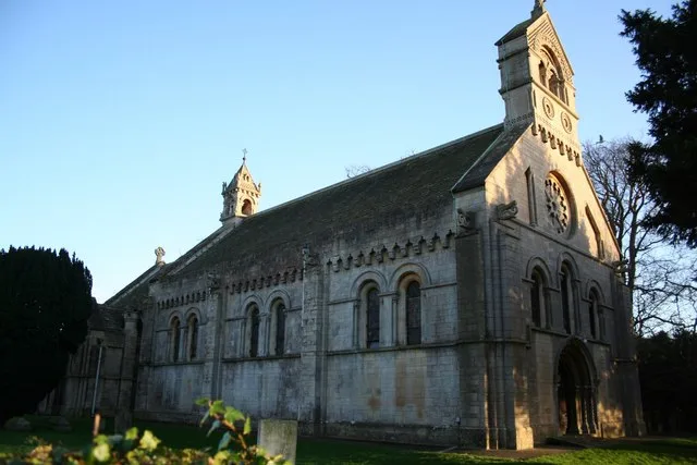
St Helen's Church, Thorney
Historic churches · 3.0 km
Nearby
📷 5Historic churches · East Midlands
Kettlethorpe, Lincolnshire
Kettlethorpe is a village and civil parish in the West Lindsey district of Lincolnshire, England. It is situated 10 miles (16 km) west of Lincoln. The villages of Drinsey Nook and Laughterton lie with
📷 5📷 5📷 5Historic churches · East Midlands
Fenton, West Lindsey
Fenton, West Lindsey — a church in england-east-midlands, United Kingdom.
📷 5Historic churches · East Midlands
Hardwick, West Lindsey
Hardwick, West Lindsey — a church in england-east-midlands, United Kingdom.
📷 3Public art & sculpture · East Midlands
Newton on Trent Village Sign
Newton on Trent Village Sign — a public art in england-east-midlands, United Kingdom.
Where to eat & stay near Cross in St Peter and St Paul's churchyard
Places to stay
📷 5Caravan parks · East Midlands
Little London Park
Little London Park — a caravan park in england east midlands.
📷 5 📷 5
📷 5Campsites · East Midlands
Trentfield Farm
Trentfield Farm — a campsite in england east midlands.
 📷 5
📷 5Caravan parks · East Midlands
Manor House Caravan Park
Manor House Caravan Park — a caravan park in england east midlands.
 📷 5
📷 5Campsites · East Midlands
Brownlow Arms Camp Site
Brownlow Arms Camp Site — a campsite in england east midlands.
📷 5Caravan parks · East Midlands
Trentside Caravan Park
Trentside Caravan Park — a caravan park in england east midlands.
Places to eat & drink
📷 5 📷 5
📷 5Historic pubs · East Midlands
Ingelby Arms Public House
Ingelby Arms Public House in England Yorkshire, United Kingdom.
 📷 5
📷 5Historic pubs · East Midlands
The Newcastle Arms
The Newcastle Arms in England East Midlands, United Kingdom.
 📷 5
📷 5Cafés · East Midlands
Little Lincoln Cafe
Little Lincoln Cafe — a café in england east midlands.
 📷 5
📷 5 📷 5
📷 5Restaurants · East Midlands
Cafe Zoot
Cafe Zoot — a restaurant in england east midlands.
More places in this region
 📷 5
📷 5Historic churches · East Midlands
All Saints' Church, Stamford
All Saints' Church, Stamford — church in Stamford, Lincolnshire, England, UK.
 📷 5
📷 5Historic churches · East Midlands
Church of All Saints
Church of All Saints — church in Little Casterton, Rutland, United Kingdom.
 📷 5
📷 5Historic churches · East Midlands
Church of All Saints
Church of All Saints — church in Fenland, UK.
 📷 5
📷 5Historic churches · East Midlands
Church of St Leonard
Church of St Leonard — church in Fenland, UK.
Frequently asked questions
- Where is Cross in St Peter and St Paul's churchyard?
- Cross in St Peter and St Paul's churchyard is in Lincolnshire, the East Midlands, United Kingdom (postcode LN1 2GZ), in the parish of Kettlethorpe.
- What is Cross in St Peter and St Paul's churchyard?
- Cross in St Peter and St Paul's churchyard — a Grade II*-listed church in england-east-midlands, United Kingdom.
- How do I get to Cross in St Peter and St Paul's churchyard?
- The nearest railway station is Saxilby, about 4.3 km away. Drivers can use postcode LN1 2GZ.
- Is Cross in St Peter and St Paul's churchyard a listed building?
- Cross in St Peter and St Paul's churchyard is officially recognised as Grade II* listed.
- Is Cross in St Peter and St Paul's churchyard free to visit?
- Yes, Cross in St Peter and St Paul's churchyard is free to enter.
- How do I get to Cross in St Peter and St Paul's churchyard?
- The nearest railway station is Saxilby, about 4.3 km away. Drivers can navigate to postcode LN1 2GZ.