
Museums · East Midlands
Cromwell, Nottinghamshire
In or near Holme.
Cromwell is a village and civil parish in Nottinghamshire, England. It is located 5 miles (8 km) north of Newark. According to the 2001 census it had a population of 188, increasing to 232 at the 2011

Richard Croft — CC BY-SA 2.0 via Wikimedia Commons licence

Plan your visit
- Typical visit
- 1.5 h–3 h
- Best time of year
- Year-round
- Nearest railway station
- Collingham · 4.0 km
- Family-friendly
- Limited wheelchair access
Getting there & planning your visit
To visit the museum in Cromwell, Nottinghamshire, the nearest railway station is Collingham, which is 4 km away. The postcode for the location is NG23 6JG. Please note that wheelchair accessibility is limited.
About
Cromwell is a village and civil parish in Nottinghamshire, England. It is located 5 miles (8 km) north of Newark. According to the 2001 census it had a population of 188, increasing to 232 at the 2011 census, and 271 at the 2021 census. St. Giles' Church, Cromwell is 13th century, with a tower built c. 1427. The Old Rectory was built c. 1680 as a dower house for the Earl of Clare, and in use as a rectory before 1714. Between the village and the River Trent lies an extensive area of Roman fields with associated villa. Parts of a timber and stone bridge have also been recorded close by. Cromwell is one of the four Thankful Villages in Nottinghamshire – those rare places that suffered no fatalities during the Great War of 1914 to 1918. Just to the east of the village is Cromwell Lock, the point where the non-tidal River Trent ends and the so-called Tideway starts. From Cromwell Lock, commercial traffic and pleasure craft may navigate north towards Torksey, Gainsborough and ultimately the Trent Falls, where the River Trent meets the Yorkshire Ouse and becomes the Humber. Navigators on the Trent must wait till the tide is ebbing or flooding in their favour to ensure a safe and efficient passage.
Photo gallery
From the Wikipedia article
Cromwell is a village and civil parish in Nottinghamshire, England. It is located 5 miles (8 km) north of Newark. According to the 2001 census it had a population of 188, increasing to 232 at the 2011 census, and 271 at the 2021 census. St. Giles' Church, Cromwell is 13th century, with a tower built c. 1427. The Old Rectory was built c. 1680 as a dower house for the Earl of Clare, and in use as a rectory before 1714. Between the village and the River Trent lies an extensive area of Roman fields with associated villa. Parts of a timber and stone bridge have also been recorded close by. Cromwell is one of the four Thankful Villages in Nottinghamshire – those rare places that suffered no fatalities during the Great War of 1914 to 1918. Just to the east of the village is Cromwell Lock, the point where the non-tidal River Trent ends and the so-called Tideway starts. From Cromwell Lock, commercial traffic and pleasure craft may navigate north towards Torksey, Gainsborough and ultimately the Trent Falls, where the River Trent meets the Yorkshire Ouse and becomes the Humber. Navigators on the Trent must wait till the tide is ebbing or flooding in their favour to ensure a safe and efficient passage.
Excerpt from Wikipedia under CC BY-SA 4.0. See the source article linked in Sources below.
- Coordinates
- 53.1400, -0.8100
- County
- Nottinghamshire
- District
- Newark and Sherwood
- Parish
- Cromwell
- Postcode
- NG23 6JG
- Parliamentary constituency
- Newark
- Nearest railway station
- Collingham — 4 km
Sources
- wikipedia: Cromwell, Nottinghamshire (CC BY-SA 4.0)
Other places nearby
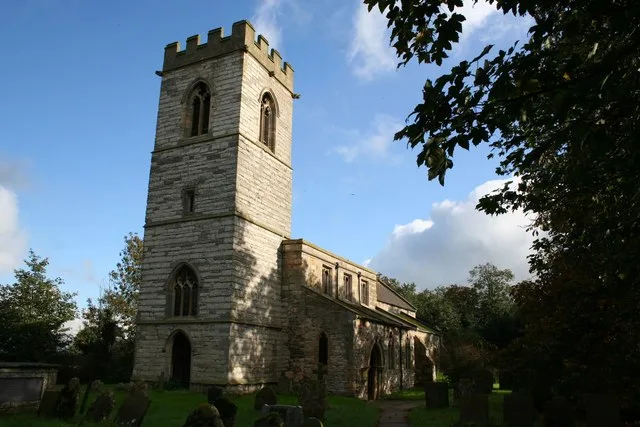
St. Giles' Church, Cromwell
Historic churches · 0.6 km

Cromwell
Villages · 0.7 km

Cromwell Lock
Canal locks · 1.2 km

Milestone Caravan Park
Caravan parks · 1.3 km
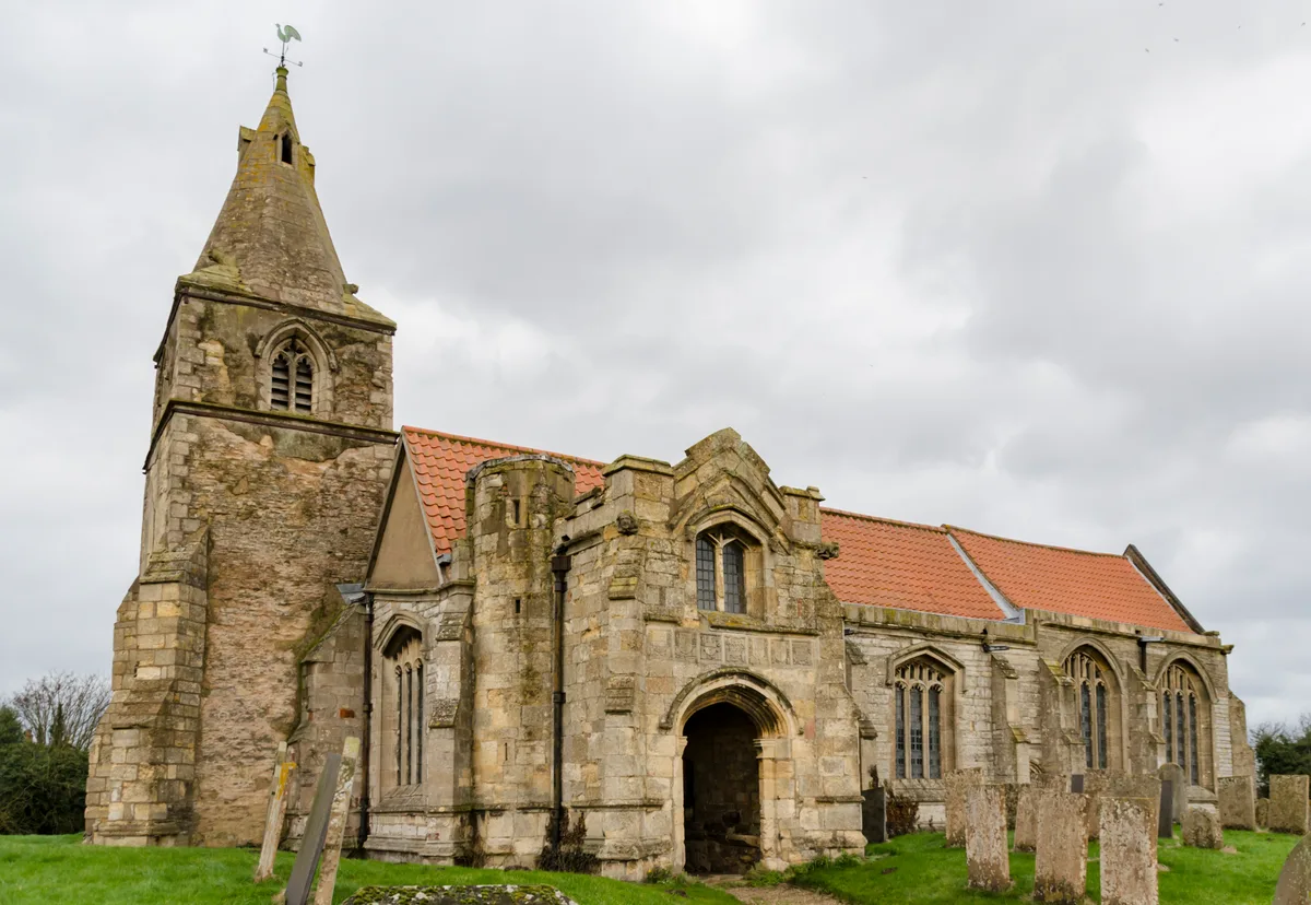
St Giles' Church, Holme
Historic churches · 1.9 km
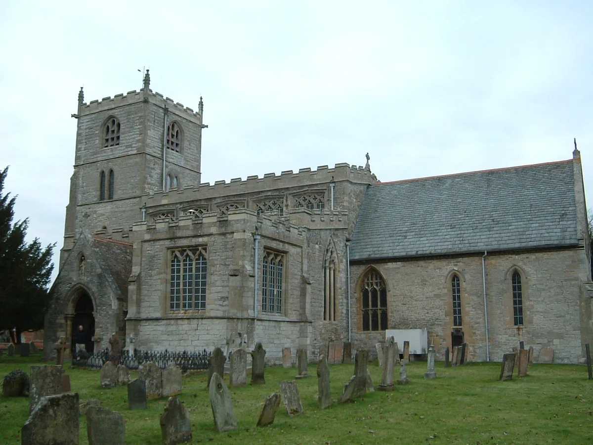
St. Laurence's Church, Norwell
Historic churches · 2.2 km

North Muskham
Villages · 2.2 km

Holme marching camp
Archaeological sites · 2.2 km

Norwell War Memorial
Memorials & monuments · 2.3 km

Holme
Towns & cities · 2.3 km
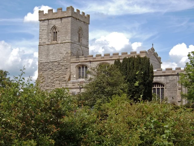
St. Wilfrid's Church, North Muskham
Historic churches · 2.3 km

Norwell
Villages · 2.6 km
Nearby
📷 4Historic churches · East Midlands
St. Giles' Church, Cromwell
St. Giles' Church, Cromwell — church in Newark and Sherwood, Nottinghamshire, England, UK.
📷 5📷 3Canal locks · East Midlands
Cromwell Lock
Cromwell Lock — lock in Cromwell, Nottinghamshire, England, UK.
📷 5Caravan parks · East Midlands
Milestone Caravan Park
Milestone Caravan Park — a caravan park in england east midlands.
📷 5Historic churches · East Midlands
St Giles' Church, Holme
St Giles' Church, Holme — church in Newark and Sherwood, Nottinghamshire, England, UK.
📷 5Historic churches · East Midlands
St. Laurence's Church, Norwell
St. Laurence's Church, Norwell — church in Newark and Sherwood, Nottinghamshire, England, UK.
Where to eat & stay near Cromwell, Nottinghamshire
Places to stay
📷 5Caravan parks · East Midlands
Milestone Caravan Park
Milestone Caravan Park — a caravan park in england east midlands.
 📷 5
📷 5 📷 5
📷 5Campsites · East Midlands
Oakhill Leisure Ltd
Oakhill Leisure Ltd — a campsite in england east midlands.
 📷 5
📷 5Campsites · East Midlands
Marnham Lake Fishing and Camping
Marnham Lake Fishing and Camping — a campsite in england east midlands.
 📷 5
📷 5 📷 5
📷 5Caravan parks · East Midlands
Marnham Meadows Holiday Park and Fishing Lake
Marnham Meadows Holiday Park and Fishing Lake — a caravan park in england east midlands.
Places to eat & drink
 📷 6
📷 6Historic pubs · East Midlands
The Old Malt Shovel Public House
The Old Malt Shovel Public House in England East Midlands, United Kingdom.
 📷 5
📷 5Historic pubs · East Midlands
Old King's Arms Public House
Old King's Arms Public House in England East Midlands, United Kingdom.
 📷 5
📷 5Restaurants · East Midlands
The Ram
The Ram — a restaurant in england east midlands.
 📷 5
📷 5Historic pubs · East Midlands
Sir John Arderne
Sir John Arderne in England East Midlands, United Kingdom.
 📷 5
📷 5Historic pubs · East Midlands
The Woolpack Public House
The Woolpack Public House in England East Midlands, United Kingdom.
 📷 5
📷 5Historic pubs · East Midlands
The White Hind Public House
The White Hind Public House in England East Midlands, United Kingdom.
More museums in this region
 📷 5
📷 5Museums · East Midlands
Stamford Town Hall
Stamford Town Hall — building in Stamford, Lincolnshire, England, UK.
 📷 5
📷 5Museums · East Midlands
Thorney Museum
Thorney Museum — a museum in england-london, United Kingdom.
 📷 5
📷 5Museums · East Midlands
Octavia Hill Birthplace Museum
Octavia Hill Birthplace Museum — a museum in england-london, United Kingdom.
 📷 5
📷 5Museums · East Midlands
Museum of Technology
Museum of Technology — a museum in england-london, United Kingdom.
Frequently asked questions
- Where is Cromwell, Nottinghamshire?
- Cromwell, Nottinghamshire is in Nottinghamshire, the East Midlands, United Kingdom (postcode NG23 6JG), in the parish of Cromwell.
- What is Cromwell, Nottinghamshire?
- Cromwell is a village and civil parish in Nottinghamshire, England. It is located 5 miles (8 km) north of Newark. According to the 2001 census it had a population of 188, increasing to 232 at the 2011
- How do I get to Cromwell, Nottinghamshire?
- The nearest railway station is Collingham, about 4.0 km away. Drivers can use postcode NG23 6JG.
- How do I get to Cromwell, Nottinghamshire?
- The nearest railway station is Collingham, about 4.0 km away. Drivers can navigate to postcode NG23 6JG.