Mountains & hills · North Wales
Crib Goch
Also known as: Y Grib Goch
In or near Q1638504.
Crib Goch — Named summit at 923 m.

Wikimedia Commons contributors — see linked file page for photographer and licence licence
Plan your visit
- Typical visit
- 3 h–8 h
- Best time of year
- Late spring – early autumn (May–Oct)
- Nearest railway station
- Y Copa · 1.7 km
- Free entry
- Dog-friendly
Getting there & planning your visit
To visit Crib Goch, the nearest railway station is Y Copa, located 1.7 km away. Entry to the site is free. There are no specific accessibility details provided.
About
Crib Goch is a named summit in the United Kingdom. Wikidata describes it as: "Named summit at 923 m.". Coordinates: 53.0763°, -4.0546°.
Photo gallery
Official information
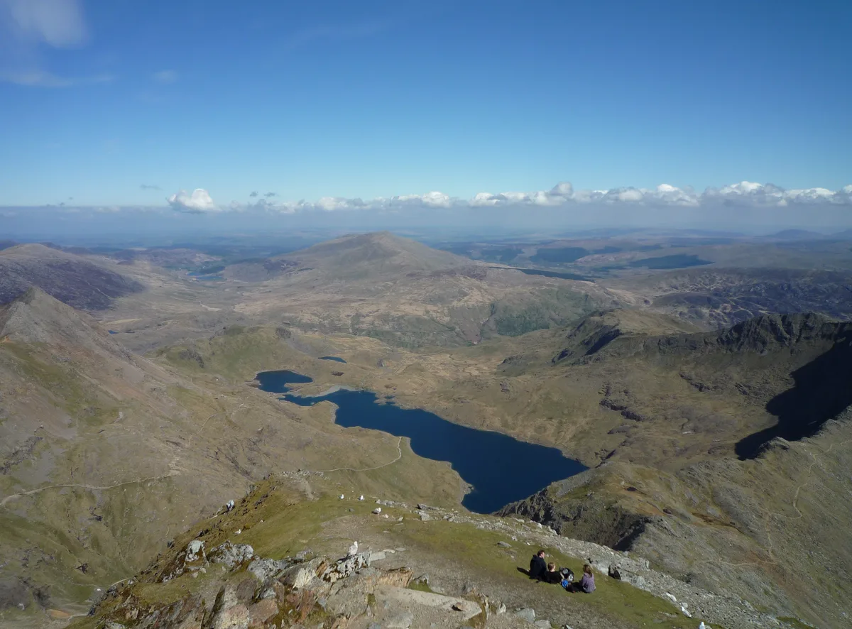
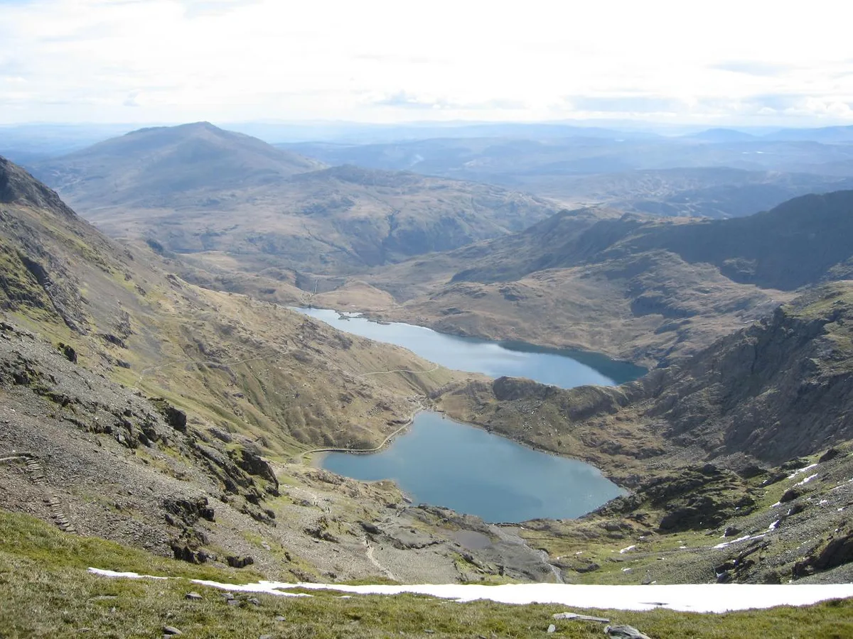
Crib Goch is a prominent ridge located in Snowdonia, Wales, known for its challenging hiking routes and stunning views. It attracts outdoor enthusiasts and climbers looking for an exhilarating experience in a dramatic mountain landscape.
From the Wikipedia article
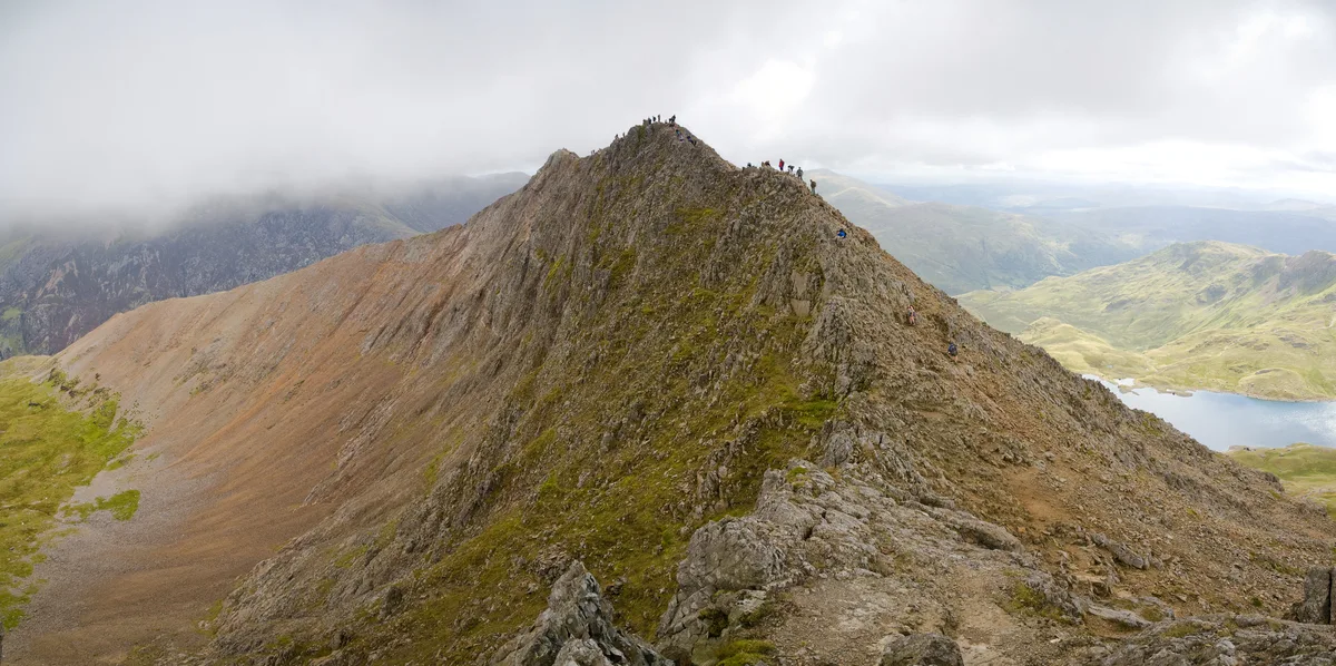
Crib Goch is a knife-edged arête in the Snowdonia National Park in Gwynedd, Wales. The name means "red ridge" in Welsh. The highest point on the arête is 923 metres (3,028 ft) above sea level. All routes which tackle Crib Goch are considered mountaineering routes in winter or scrambles in summer—meaning that they must cross "graded territory" as defined in Steve Ashton's Scrambles in Snowdonia. The easiest of these lines (the ‘bad step’ part of the route) is given a scrambling grade of Grade 1 (the most difficult being Grade 3—routes more difficult than Grade 3 are considered rock climbs).
Excerpt from Wikipedia under CC BY-SA 4.0. See the source article linked in Sources below.
- Coordinates
- 53.0763, -4.0546
- Address
- Gwynedd, Wales
- Nearest railway station
- Y Copa — 1.7 km
- Official site
- www.outdoorsmagic.com
Sources
- osm: n3686236093 (ODbL)
- wikipedia: Crib Goch (CC BY-SA 4.0)
- commons: Crib Goch, Snowdonia, Wales - August 2007.jpg (CC BY-SA 4.0)
Other places nearby
Crib Goch
Natural landmarks · 0.1 km

Bwlch Coch
Mountain passes · 0.3 km

Clogwyn y Person
Mountains & hills · 0.8 km

Pass of Llanberis
Mountain passes · 0.8 km
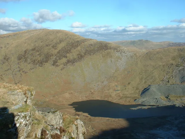
Llyn Llydaw
Natural landmarks · 1.0 km
Glaslyn
Reservoirs & lochs · 1.0 km

Craig Fach
Mountains & hills · 1.0 km

Dinas Mot
Climbing & bouldering crags · 1.1 km

Dinas Mot (Plexus Buttress)
Climbing & bouldering crags · 1.1 km
Dinas Mot
Climbing & bouldering crags · 1.1 km
Clogwyn Gafr
Climbing & bouldering crags · 1.1 km
Dinas Mot
Climbing & bouldering crags · 1.1 km
Nearby
📷 5Natural landmarks · North Wales
Crib Goch
Crib Goch — mountain (923m) in Gwynedd.
📷 5📷 5Mountains & hills · North Wales
Clogwyn y Person
Clogwyn y Person — mountain in wales north. Elevation: 800 m.
📷 5Flagship📷 5Natural landmarks · North Wales
Llyn Llydaw
Llyn Llydaw is a natural landmark in the United Kingdom.
📷 3Where to eat & stay near Crib Goch
Places to stay
 📷 5
📷 5Hostels · North Wales
Snowdon Pen-y-Pass Youth Hostel
Snowdon Pen-y-Pass Youth Hostel — a hostel in wales north.
 📷 7
📷 7 📷 5
📷 5 📷 5
📷 5Campsites · North Wales
Llyn Gwynant Campsite
Llyn Gwynant Campsite — a campsite in wales north.
 📷 5
📷 5Campsites · North Wales
Macs Pebyll Hafod Y Llan
Macs Pebyll Hafod Y Llan — a campsite in wales north.
 📷 5
📷 5Places to eat & drink
 📷 5
📷 5 📷 7
📷 7Restaurants · North Wales
Tafarn Tryfan
Tafarn Tryfan — a restaurant in wales north.
 📷 6
📷 6 📷 5
📷 5 📷 5
📷 5 📷 5
📷 5More mountains in this region
 📷 5
📷 5Mountains & hills · North Wales
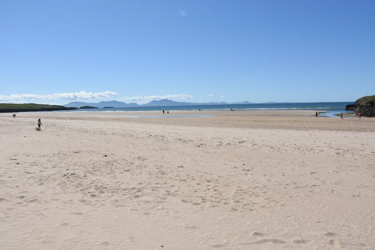
Cemlyn Bay and lagoon
Cemlyn Bay and lagoon — Site of Special Scientific Interest in Wales.
 📷 3
📷 3Mountains & hills · North Wales
Aberffraw Bay
Aberffraw Bay — bay on the west coast of Anglesey, in Wales, UK.
 📷 3
📷 3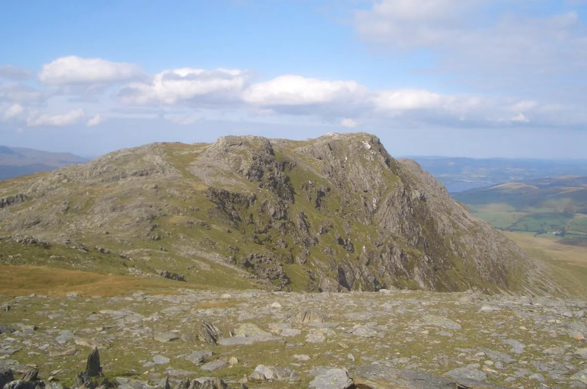 📷 3
📷 3Mountains & hills · North Wales
Aran Benllyn
Aran Benllyn — Named summit at 884 m.
Frequently asked questions
- Where is Crib Goch?
- Crib Goch is in North Wales, United Kingdom.
- What is Crib Goch?
- Crib Goch — Named summit at 923 m.
- How do I get to Crib Goch?
- The nearest railway station is Y Copa, about 1.7 km away. Its coordinates are 53.0763°, -4.0546°.
- Is Crib Goch free to visit?
- Yes, Crib Goch is free to enter.
- How do I get to Crib Goch?
- The nearest railway station is Y Copa, about 1.7 km away.