
Historic houses · South West England
Cranmore Tower
In or near Coleford.
Cranmore Tower — a Grade II*-listed historic house in england-south-east, United Kingdom.

Rick Crowley — CC BY-SA 2.0 via Wikimedia Commons licence

Plan your visit
- Typical visit
- 1 h–2 h
- Nearest railway station
- Cranmore · 2.2 km
- Family-friendly
- Limited wheelchair access
Getting there & planning your visit
To visit Cranmore Tower, the nearest railway station is Cranmore, located 2.2 km away. The postcode for sat-nav is BA4 4SD. Accessibility is limited for wheelchair users.
About
Cranmore Tower is a Grade II*-listed building in england-south-east, United Kingdom. Grade II* status is conferred by Historic England (or Cadw, Historic Environment Scotland or NIEA equivalents) on buildings of exceptional national interest. See the linked Wikipedia article for full historical and architectural details.
Photo gallery
Heritage listing
The Cranmore Tower is a 45 metres (148 ft) tall 19th century folly in the parish of Cranmore, Somerset, England. The site is 280 metres (919 ft) above sea level, and is the highest point on the Mendip Way. The tower was built in 1862-1864, by Thomas Henry Wyatt for John Moore Paget of Cranmore Hall (now part of All Hallows Preparatory School). There is a viewing area at the top with pair of semi-circular headed openings to each face with a restored iron-railed balcony beneath each pair. A similar balcony just over halfway up is continued right round the tower. It has been designated by English Heritage as a grade II listed building. In World War II it was used as a lookout tower by the Home Guard and the Royal Corps of Signals.
From the Historic England List Entry under OGL v3.
From the Wikipedia article
The Cranmore Tower is a 45 metres (148 ft) tall 19th century folly in the parish of Cranmore, Somerset, England. The site is 280 metres (919 ft) above sea level, and is the highest point on the Mendip Way. The tower was built in 1862-1864, by Thomas Henry Wyatt for John Moore Paget of Cranmore Hall (now part of All Hallows Preparatory School). There is a viewing area at the top with pair of semi-circular headed openings to each face with a restored iron-railed balcony beneath each pair. A similar balcony just over halfway up is continued right round the tower. It has been designated by English Heritage as a grade II listed building. In World War II it was used as a lookout tower by the Home Guard and the Royal Corps of Signals. By 1984 the tower had fallen into disrepair and was sold to Donald Beaton who undertook repairs. During the course of the repairs the remains of a Roman fort with a hoard of coins was discovered adjacent to the tower. In 1988 it was sold again, this time to Nick Ridge who opened it to the public. The tower was then acquired by followers of the Baháʼí Faith. Further restorations were carried out, including the installation of a new timber staircase to allow access to the balconies at the top of the tower at a height of 320 metres (1,050 ft) above sea level. From early 2008 the tower was open to the public, in particular being marketed as a romantic setting for proposals of marriage. The tower and its grounds are is now privately owned and visitors are no longer permitted.
Excerpt from Wikipedia under CC BY-SA 4.0. See the source article linked in Sources below.
- Coordinates
- 51.2036, -2.4642
- District
- Somerset
- Parish
- Cranmore
- Postcode
- BA4 4SD
- Parliamentary constituency
- Frome and East Somerset
- Established
- 1864
- Nearest railway station
- Cranmore — 2.2 km
- Official site
- www.cranmore-somerset.co.uk
Sources
- wikidata: Q5182227 (CC0)
- wikipedia: Cranmore Tower (CC BY-SA 4.0)
Other places nearby

Cranmore Hill
Mountains & hills · 0.6 km

Dinies Camp
Vineyards · 0.8 km

East Cranmore
Villages · 1.3 km

All Hallows Preparatory School
Historic houses · 1.4 km

Collonade
Museums · 1.4 km

Downhead
Villages · 1.7 km

Cranmore, Somerset
Museums · 1.9 km

Torr Works
Quarries · 1.9 km

Church of St Bartholomew, Cranmore
Historic churches · 1.9 km

Monument To Humphrey Parfitt In Churchyard, 2 Metres West Of Churchyard Cross, Church Of St Bartholomew
Memorials & monuments · 1.9 km

Strode Arms Inn
Historic pubs · 1.9 km

Cranmore
Villages · 2.0 km
Nearby
📷 5Mountains & hills · South West England
Cranmore Hill
Cranmore Hill — a hill or mountain in england south east.
📷 3Vineyards · South West England
Dinies Camp
Dinies Camp — a UK vineyard in england south east, producing English or Welsh wine from cool-climate grape varieties.
📷 5📷 5Historic houses · South West England
All Hallows Preparatory School
All Hallows Preparatory School — co-educational Catholic prep school near the town of Frome, Somerset, England, UK.
📷 5📷 5Where to eat & stay near Cranmore Tower
Places to stay
 📷 5
📷 5 📷 5
📷 5Caravan parks · South West England
Old Down Touring Park
Old Down Touring Park — a caravan park in england south west.
 📷 5
📷 5B&Bs · South West England
The Old Priory
The Old Priory — a bed-and-breakfast in england south east.
 📷 5
📷 5Hotels · South West England
The Radstock Hotel
The Radstock Hotel — a hotel in england south east.
 📷 5
📷 5 📷 5
📷 5Places to eat & drink
📷 5Historic pubs · South West England
Strode Arms Inn
Strode Arms Inn in England South West, United Kingdom.
 📷 7
📷 7Historic pubs · South West England
Knatchbull Arms
Knatchbull Arms in England South West, United Kingdom.
 📷 7
📷 7 📷 7
📷 7Historic pubs · South West England
The Wine Vaults, Public House
The Wine Vaults, Public House in England South West, United Kingdom.
 📷 5
📷 5 📷 5
📷 5Historic pubs · South West England
The Talbot Inn
The Talbot Inn in England South West, United Kingdom.
Other works by Henry Goodridge
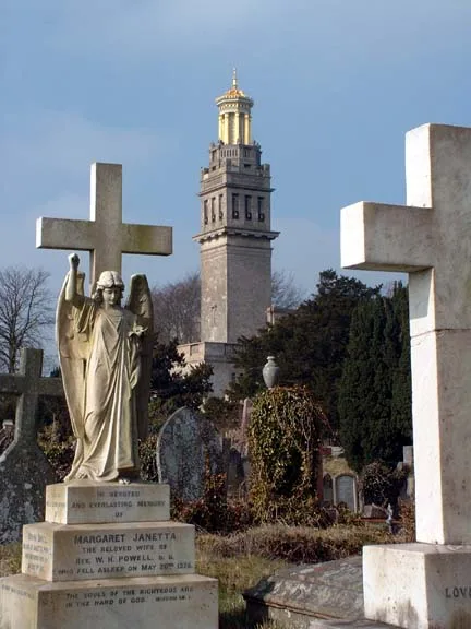 📷 5
📷 5Museums · South West England
Beckford's Tower and Museum
Beckford's Tower and Museum — architectural folly and museum on Lansdown Hill, just outside Bath, Somerset, England, United Kingdom.
More historic houses in this region
 📷 5
📷 5Historic houses · South West England
1 South Parade
1 South Parade — Grade I listed house in Bath, Somerset, England, UK.
_(geograph_6440799).jpg?width=1200) 📷 5
📷 5Historic houses · South West England
1-4 Lansdowne Grove, Morris Lane
1-4 Lansdowne Grove, Morris Lane — houses in Devizes, Wiltshire, England, UK.
 📷 5
📷 5Historic houses · South West England
2 North Parade
2 North Parade — building in Bath, UK; part of Abbey Hotel.
 📷 5
📷 5Historic houses · South West England
2, South Place, Lacock Road
2, South Place, Lacock Road — house in Corsham, Wiltshire, England, UK.
Frequently asked questions
- Where is Cranmore Tower?
- Cranmore Tower is in South-East England, United Kingdom (postcode BA4 4SD), in the parish of Cranmore.
- What is Cranmore Tower?
- Cranmore Tower — a Grade II*-listed historic house in england-south-east, United Kingdom.
- How do I get to Cranmore Tower?
- The nearest railway station is Cranmore, about 2.2 km away. Drivers can use postcode BA4 4SD.
- When was Cranmore Tower built?
- Built or established in 1864. Designed by Henry Goodridge.
- Is Cranmore Tower a listed building?
- Cranmore Tower is officially recognised as Grade II* listed.
- How do I get to Cranmore Tower?
- The nearest railway station is Cranmore, about 2.2 km away. Drivers can navigate to postcode BA4 4SD.