Golf courses · Central Scotland
Crail Golfing Society
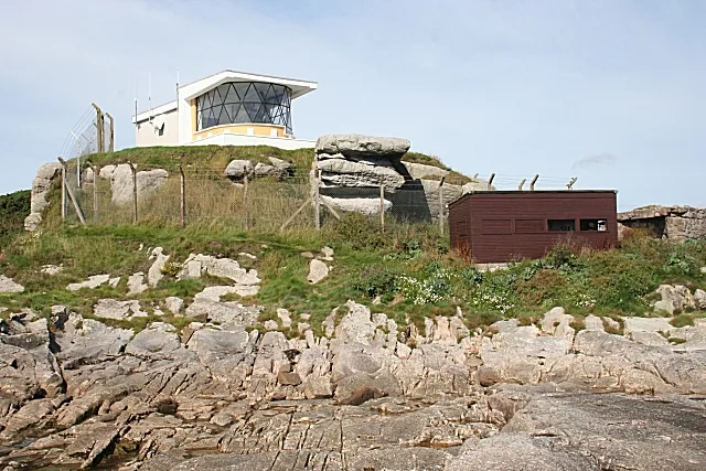
Crail Golfing Society — golf club in Fife, Scotland, UK.
Wikimedia Commons licence
Plan your visit
- Typical visit
- 3 h–6 h
About
Crail Golfing Society is a golf course in the United Kingdom. Records date its origin to 1786. Wikidata describes it as: "golf club in Fife, Scotland, UK". Coordinates: 56.2769°, -2.5947°.
Photo gallery
From the Wikipedia article
The Crail Golfing Society is a Scottish golf club established in February 1786 in the Golf Hotel, Crail, Fife. The society is the seventh oldest golf club in the world. Its oldest course, Balcomie, was formally laid out by Old Tom Morris in 1894, but competitions were played there since the 1850s. The courses are two miles (three kilometres) northeast of the fishing town of Crail, and the land upon which golf is played straddles the easternmost promontory of Fife, known as Fife Ness. The East Coast of Fife is particularly dense in links courses and is popular for golf tourism. Crail is 10 miles (16 kilometres) south of St Andrews and four miles (six kilometres) from Kingsbarns. To the south west are the links of Elie, Anstruther, Lundin and Leven. Within an hour to the north are Scotscraig, Carnoustie, Monifieth and Panmure. Crail Golfing Society owns and operates two courses, Balcomie and Craighead, which differ in character. Balcomie, designed by Old Tom Morris in 1895, is a traditional links, retaining original holes, and a diverse and distinctive set of Par 3s. The 14th is the most photographed hole, a Par 3 with an elevated tee high above the beach dropping down to a heavily bunkered green. Longer holes, such as the 4th and 5th, feature doglegs around the sea edge. From Balcomie, on the north of the promontory, can be seen the mountain Lochnagar in the Balmoral estate, in addition to the Tay estuary, and much of eastern Scotland. Craighead, designed by American architect Gil Hanse is longer, a modern links, with rolling greens, native walls and wildlife typical of the Fife coast. The two links are on north and south edges of Fifeness, respectively, and have different views. Craighead allows views to the Forth Estuary and beyond, with the Bass Rock, Edinburgh and St Abbs Head visible 60 miles (100 kilometres) away, and borders a nature reserve.
Excerpt from Wikipedia under CC BY-SA 4.0. See the source article linked in Sources below.
- Coordinates
- 56.2769, -2.5947
- District
- Fife
- Postcode
- KY10 3XN
- Parliamentary constituency
- North East Fife
- Established
- 1786
- Official site
- www.crailgolfingsociety.co.uk
Sources
- wikidata: Q2528067 (CC0)
- wikipedia: Crail Golfing Society (CC BY-SA 4.0)
Other places nearby
Loading nearby places…
Nearby
 📷 3
📷 3Caves · Central Scotland
Constantine's Cave
Constantine's Cave is a cave in the United Kingdom.
 📷 4
📷 4Lighthouses · Scottish Highlands
Fife Ness
Fife Ness in Scotland Islands, United Kingdom.
 📷 3
📷 3Lighthouses · Central Scotland
Fife Ness Lighthouse
Fife Ness Lighthouse — lighthouse at Fife Ness, Scotland.
 📷 3
📷 3Beaches · Central Scotland
Balcomie Sands
Balcomie Sands is a beach in the United Kingdom.
 📷 5
📷 5Castles · Central Scotland
Balcomie Castle
Balcomie Castle — category B listed building-listed castle in scotland-central, United Kingdom.
 📷 5
📷 5Castles · Central Scotland
Balcomie Castle (historical)
Balcomie Castle (historical) — a castle in scotland central.
Other places from this era
More places in this region
 📷 3
📷 3Golf courses · Central Scotland
Aberfoyle Golf Club
Aberfoyle Golf Club — golf club in Aberfoyle, Stirling.
 📷 3
📷 3Golf courses · Central Scotland
Ballochmyle Golf Course
Ballochmyle Golf Course — golf course in East Ayrshire, Scotland, UK.
 📷 4
📷 4Golf courses · Central Scotland
Bruntsfield Links
Bruntsfield Links — parkland in Edinburgh, Scotland, UK.
 📷 3
📷 3Golf courses · Central Scotland
Carnoustie Golf Links
Carnoustie Golf Links — golf course in Angus, Scotland, UK.
Frequently asked questions
- Where is Crail Golfing Society?
- Crail Golfing Society is in central Scotland, United Kingdom (postcode KY10 3XN).
- What is Crail Golfing Society?
- Crail Golfing Society — golf club in Fife, Scotland, UK.
- How do I get to Crail Golfing Society?
- Drivers can use postcode KY10 3XN.
- When was Crail Golfing Society built?
- Built or established in 1786.
- Who owns Crail Golfing Society?
- Crail Golfing Society is owned by | operator =.
- How do I get to Crail Golfing Society?
- Drivers can navigate to postcode KY10 3XN. It sits within the North East Fife parliamentary constituency.