Mountains & hills · Central Scotland
Craigmore
Craigmore — Named summit at 387 m.

Wikimedia Commons contributors — see linked file page for photographer and licence licence
Plan your visit
- Typical visit
- 3 h–8 h
- Best time of year
- Late spring – early autumn (May–Oct)
- Free entry
- Dog-friendly
About
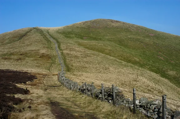
Craigmore is a named summit in the United Kingdom. Wikidata describes it as: "Named summit at 387 m.". Coordinates: 56.1880°, -4.4023°.
Photo gallery
From the Wikipedia article
Craigmore is a prominent hill, 387 metres high, above the village of Aberfoyle in the council area of Stirling in Scotland.
Excerpt from Wikipedia under CC BY-SA 4.0. See the source article linked in Sources below.
Background
History
On the steep, south face of the hill is an old quarry that once supplied blue-grey dolerite for the traditional buildings of Aberfoyle. About a kilometre north of the summit are Aberfoyle Quarries, disused slate quarries that were used to supply roofing material for the railways and for much of central Scotland. The route of the old tramway, which transported men and material from the quarries to the local branch line, is still discernible.
Sourced from Wikipedia under CC BY-SA 4.0.
- Coordinates
- 56.1880, -4.4023
- District
- Stirling
- Postcode
- FK8 3TD
- Parliamentary constituency
- Stirling and Strathallan
Sources
- osm: n843785732 (ODbL)
- wikipedia: Craigmore (hill) (CC BY-SA 4.0)
- commons: Aberfoyle and Craigmore - geograph.org.uk - 1718115.jpg (CC BY-SA 4.0)
Other places nearby
Loading nearby places…
Nearby
 📷 4
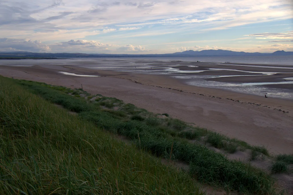
📷 4Other places · Scottish Highlands
Duchray Water
Duchray Water in Scotland Islands, United Kingdom.
 📷 5
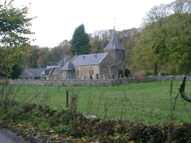
📷 5Historic churches · Central Scotland
Aberfoyle Parish Church, Lochard Road, Aberfoyle
Aberfoyle Parish Church, Lochard Road, Aberfoyle — category B listed building-listed church in scotland-central, United Kingdom.
📷 3Memorials & monuments · Central Scotland
Aberfoyle War Memorial
Aberfoyle War Memorial — a memorial in scotland-central, United Kingdom.
📷 5Watermills · Central Scotland
The Corn Mill, Milton
The Corn Mill, Milton — category C listed building-listed watermill in scotland-central, United Kingdom.
 📷 3
📷 3Memorials & monuments · Central Scotland
Womens Timber Corps Memorial
Womens Timber Corps Memorial — a memorial in scotland-central, United Kingdom.
 📷 5
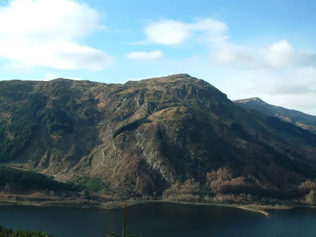
📷 5Mountains & hills · Central Scotland
Craig Gownan
Craig Gownan — a hill or mountain in scotland central.
Where to eat & stay near Craigmore
Places to stay
 📷 5
📷 5Campsites · Central Scotland
Cobleland Campsite
Cobleland Campsite — a campsite in scotland central.
 📷 5
📷 5Campsites · Central Scotland
Loch Achray Campsite
Loch Achray Campsite — a campsite in scotland central.
 📷 5
📷 5Campsites · Central Scotland
Loch Achray South camping permit area March-September
Loch Achray South camping permit area March-September — a campsite in scotland central.
 📷 5
📷 5Hotels · Central Scotland
Macdonald Forest Hills Hotel & Spa
Macdonald Forest Hills Hotel & Spa — a hotel in scotland central.
 📷 5
📷 5Campsites · Central Scotland
Loch Ard camping permit area March-September
Loch Ard camping permit area March-September — a campsite in scotland central.
 📷 5
📷 5Campsites · Central Scotland
Loch Katrine Eco Camp
Loch Katrine Eco Camp — a campsite in scotland central.
More mountains in this region
 📷 3
📷 3Mountains & hills · Central Scotland
Abbey Hill
Abbey Hill — Named summit at 278 m.
 📷 3
📷 3Mountains & hills · Central Scotland
Aberlady Bay
Aberlady Bay — bay on the north coast of East Lothian, Scotland, UK.
 📷 3
📷 3Mountains & hills · Central Scotland
Allermuir Hill
Allermuir Hill — Named summit at 493 m.
 📷 3
📷 3Mountains & hills · Central Scotland
Ardnandave
Ardnandave — Named summit at 715 m.
Frequently asked questions
- Where is Craigmore?
- Craigmore is in central Scotland, United Kingdom (postcode FK8 3TD).
- What is Craigmore?
- Craigmore — Named summit at 387 m.
- How do I get to Craigmore?
- Drivers can use postcode FK8 3TD.
- Is Craigmore free to visit?
- Yes, Craigmore is free to enter.
- How do I get to Craigmore?
- Drivers can navigate to postcode FK8 3TD. It sits within the Stirling and Strathallan parliamentary constituency.