
Natural landmarks · South East England
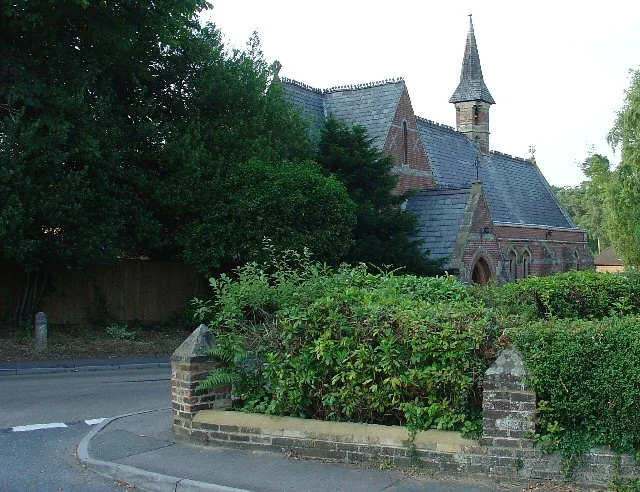
Cottesmore School
In or near Pease Pottage.
Cottesmore School — a school heritage in england-south-east, United Kingdom.

Geoff Cole — CC BY-SA 2.0 via Wikimedia Commons licence

Plan your visit
- Typical visit
- 1 h–2 h
- Nearest railway station
- Ifield · 3.1 km
- Free entry
- Dog-friendly
About
Cottesmore School is a school heritage located in england-south-east, United Kingdom. Catalogued from Wikidata's UK heritage register; see the Wikipedia article for further historical and visitor details.
Photo gallery
Protected designations
- Area of Outstanding Natural Beauty: High Weald
- Area of Outstanding Natural Beauty: Surrey Hills
Designations sourced from Natural England open data under OGL v3.
Place summary
Cottesmore School is located in South-East England. It is a co-educational independent school known for its emphasis on academic excellence and personal development.
AI-generated from the structured facts on this page (operator, designation, listing, era). Not a substitute for visiting.
Background
History
Cottesmore was founded by Geoffrey Davison Brown in 1894 in Hove, East Sussex. He named the school after Cottesmore, Rutland, where he was born. The new buildings for the preparatory school were officially opened on 19 June 1897. Davison Brown served as headmaster until his death in 1929, aged 60. In 1940 the school was evacuated from the south coast of England, to Wales, initially to the Oakeley Arms Hotel, Tan-y-bwlch, Merioneth, and later to a former workhouse in Cors-y-Gedol Hall, near Barmouth, until the end of the war. The school moved to its present site at Pease Pottage after World War II in 1946. The school is housed in a Grade II-listed Victorian mansion known as Buchan Hill that…
Sourced from Wikipedia under CC BY-SA 4.0.
- Coordinates
- 51.0876, -0.2160
- County
- West Sussex
- District
- Horsham
- Parish
- Colgate
- Postcode
- RH11 9AU
- Parliamentary constituency
- Horsham
- Established
- 1894
- Nearest railway station
- Ifield — 3.1 km
- Official site
- reports.isi.net
Sources
- wikidata: Q5175608 (CC0)
- wikipedia: Cottesmore School (CC BY-SA 4.0)
Other places nearby

Stanford (Scout Campsite)
Campsites · 0.4 km

Crawley Mosque
Historic churches · 1.1 km

Pease Pottage
Towns & cities · 1.2 km

Bewbush Manor
Manor houses · 1.6 km

Broadfield House, Crawley
Historic houses · 1.7 km

A random kayak in the earth
Historic houses · 1.7 km
Colgate
Towns & cities · 2.1 km

The Giant Football
Public art & sculpture · 2.1 km

Tilgate Zoo
Zoos & aquariums · 2.3 km

St Wilfrid's Catholic School, Crawley
Historic churches · 2.6 km

Tilgate Forest Singletrack
Mountain bike trails · 2.6 km

Beacon Hill Scout Campsite
Campsites · 2.7 km
Nearby
📷 5Campsites · South East England
Stanford (Scout Campsite)
Stanford (Scout Campsite) — a campsite in england south east.
📷 5Historic churches · South East England
Crawley Mosque
Crawley Mosque — a church in england-south-east, United Kingdom.
📷 5Towns & cities · South East England
Pease Pottage
Pease Pottage — village in West Sussex, England, UK.
📷 5Manor houses · South East England
Bewbush Manor
Bewbush Manor — Grade II listed building-listed manor in england-south-east, United Kingdom.
📷 5Historic houses · South East England
Broadfield House, Crawley
Broadfield House, Crawley — a Grade II*-listed historic house in england-south-east, United Kingdom.
📷 5Historic houses · South East England
A random kayak in the earth
A random kayak in the earth — a historic house in england-south-east, United Kingdom.
Where to eat & stay near Cottesmore School
Places to stay
📷 5Campsites · South East England
Stanford (Scout Campsite)
Stanford (Scout Campsite) — a campsite in england south east.
📷 5Campsites · South East England
Beacon Hill Scout Campsite
Beacon Hill Scout Campsite — a campsite in england south east.
 📷 5
📷 5Hotels · South East England
Trivelles Gatwick Hotel
Trivelles Gatwick Hotel — a hotel in england south east. 4-star. Brand: Trivelles.
 📷 5
📷 5Campsites · South East England
Embers
Embers — a campsite in england south east.
 📷 5
📷 5Caravan parks · South East England
Woodside Park
Woodside Park — a caravan park in england south east.
 📷 5
📷 5Places to eat & drink
 📷 5
📷 5Historic pubs · South East England
White Hart Inn
White Hart Inn in England South East, United Kingdom.
 📷 5
📷 5Historic pubs · South East England
Old Punch Bowl
Old Punch Bowl in England South East, United Kingdom.
 📷 5
📷 5Historic pubs · South East England
The Jolly Tanners Public House
The Jolly Tanners Public House in England South East, United Kingdom.
 📷 5
📷 5 📷 5
📷 5Restaurants · South East England
Mekong House
Mekong House — a restaurant in england south east.
 📷 7
📷 7More natural landmarks in this region
 📷 5
📷 5Natural landmarks · South East England
Queen Victoria Statue
Queen Victoria Statue — Public artwork (statue) by Victor Ferdinand Franz Eugen Gustaf Adolf Constantin Friedrich of Hohenlohe-Langenburg.
 📷 5
📷 5Natural landmarks · South East England
Silent Pool
Silent Pool — lake in the United Kingdom.
 📷 5
📷 5Natural landmarks · South East England
Thomas & Jane Holloway Statue
Thomas & Jane Holloway Statue — Public artwork (statue) by Victor Ferdinand Franz Eugen Gustaf Adolf Constantin Friedrich of Hohenlohe-Langenburg.
 📷 5
📷 5Natural landmarks · South East England
Polesden Lacey
Polesden Lacey — a other in england-london, United Kingdom.
Frequently asked questions
- Where is Cottesmore School?
- Cottesmore School is in West Sussex, South-East England, United Kingdom (postcode RH11 9AU), in the parish of Colgate.
- What is Cottesmore School?
- Cottesmore School — a school heritage in england-south-east, United Kingdom.
- How do I get to Cottesmore School?
- The nearest railway station is Ifield, about 3.1 km away. Drivers can use postcode RH11 9AU.
- When was Cottesmore School built?
- Built or established in 1894.
- Is Cottesmore School a protected site?
- Yes — Cottesmore School is part of the High Weald National Landscape (AONB) and the Surrey Hills National Landscape (AONB).
- Is Cottesmore School free to visit?
- Yes, Cottesmore School is free to enter.
- How do I get to Cottesmore School?
- The nearest railway station is Ifield, about 3.1 km away. Drivers can navigate to postcode RH11 9AU.