
Castles · South East England
Cooling Castle
In or near Hoo St Werburgh.
Cooling Castle is a 14th-century quadrangular castle in the village of Cooling, Kent on the Hoo Peninsula about 6 miles (9.7 km) north of Rochester. It was built in the 1380s by the Cobham family, the

Nigel Thompson — CC BY-SA 2.0 via Wikimedia Commons licence

Plan your visit
- Typical visit
- 1.5 h–3 h
- Nearest railway station
- Higham · 5.1 km
- Family-friendly
- Limited wheelchair access
Getting there & planning your visit
To visit Cooling Castle, the nearest railway station is Higham, which is 5.1 km away. The postcode for sat-nav is ME3 8DT. Entry has limited wheelchair accessibility.
About
Cooling Castle is a 14th-century quadrangular castle in the village of Cooling, Kent on the Hoo Peninsula about 6 miles (9.7 km) north of Rochester. It was built in the 1380s by the Cobham family, the local lords of the manor, to guard the area against French raids into the Thames Estuary. The castle has an unusual layout, comprising two walled wards of unequal size next to each other, surrounded by moats and ditches. It was the earliest English castle designed for the use of gunpowder weapons by its defenders. Despite this distinction, the use of gunpowder weapons against the castle proved devastating. It was captured after only eight hours when Sir Thomas Wyatt besieged it in January 1554 during his unsuccessful rebellion against Queen Mary. His attack badly damaged the castle, and it was subsequently abandoned and allowed to fall into disrepair. A farmhouse and outbuildings were constructed among the ruins a century later. Today the farmhouse is the home of the musician Jools Holland, while the nearby barn is used as a wedding venue.
Photo gallery
Protected designations
- Site of Special Scientific Interest: South Thames Estuary and Marshes SSSI
- Ramsar wetland: Thames Estuary & Marshes
Designations sourced from Natural England open data under OGL v3.
From the Wikipedia article
Cooling Castle is a 14th-century quadrangular castle in the village of Cooling, Kent on the Hoo Peninsula about 6 miles (9.7 km) north of Rochester. It was built in the 1380s by the Cobham family, the local lords of the manor, to guard the area against French raids into the Thames Estuary. The castle has an unusual layout, comprising two walled wards of unequal size next to each other, surrounded by moats and ditches. It was the earliest English castle designed for the use of gunpowder weapons by its defenders. Despite this distinction, the use of gunpowder weapons against the castle proved devastating. It was captured after only eight hours when Sir Thomas Wyatt besieged it in January 1554 during his unsuccessful rebellion against Queen Mary. His attack badly damaged the castle, and it was subsequently abandoned and allowed to fall into disrepair. A farmhouse and outbuildings were constructed among the ruins a century later. Today the farmhouse is the home of the musician Jools Holland, while the nearby barn is used as a wedding venue.
Excerpt from Wikipedia under CC BY-SA 4.0. See the source article linked in Sources below.
Background
Architecture
The castle was originally built on the south bank of the Thames, although the shoreline has since receded as a result of land reclamation; the river is now about 2 mi north of the castle, separated from it by marshes. It was constructed by John de Cobham, 3rd Baron Cobham (d. 1408), of nearby Cobham Hall, whose family had acquired the manor of Cooling in the mid-13th century. In 1379, during the second phase of the Hundred Years' War, a French raid devastated towns and villages along the Thames Estuary. Cobham appealed to the Crown for licence to fortify his manor and received permission in February 1380. The building work was completed by 1385. Surviving records indicate that the prominent…
Description
Cooling Castle has an unusual layout that was perhaps dictated by the marshy ground on which it was constructed. Most quadrangular castles were constructed on a single moated island within which was a system of inner wards or courtyards. Cooling Castle differed in that within its 8 acre perimeter it had two wards of different sizes arranged side by side. Each stood on a mound within a figure of eight-shaped system of moats and ditches. The inner ward, in the western part of the castle, appears to have been surrounded by a moat that may have been up to 20 m wide. The larger outer ward, in the eastern part of the castle, was flanked on its western side by the moat, and a dry ditch up to 6 m…
Sourced from Wikipedia under CC BY-SA 4.0.
- Coordinates
- 51.4554, 0.5231
- District
- Medway
- Parish
- Cooling
- Postcode
- ME3 8DT
- Parliamentary constituency
- Rochester and Strood
- Nearest railway station
- Higham — 5.1 km
- Official site
- www.coolingparishcouncil.org
Sources
- wikipedia: Cooling Castle (CC BY-SA 4.0)
Other places nearby

Cooling Castle
Literary houses · 0.0 km
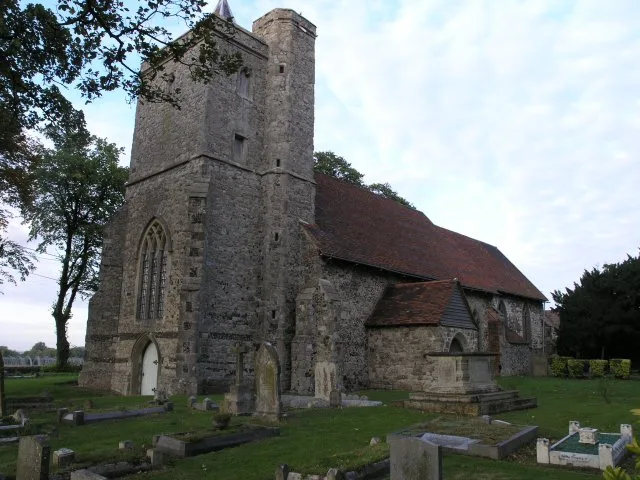
St James' Church, Cooling
Historic churches · 0.2 km

Shades house
Viewpoints · 1.3 km

RSPB Northward Hill
Natural landmarks · 1.8 km
Bird Hide
Viewpoints · 1.8 km

Cliffe
Villages · 1.9 km

Cliffe, Kent
Natural landmarks · 1.9 km

Harvey Monument 20 Yards South West Of South Porch Of Church Of St Helen
Memorials & monuments · 1.9 km

Cooling Radio Station
Historic houses · 2.1 km

Northward Hill Woodland Viewpoint
Viewpoints · 2.3 km

Northward Hill
Mountains & hills · 2.7 km

The Red Dog Public House
Historic pubs · 2.7 km
Nearby
📷 5Literary houses · East of England
Cooling Castle
Cooling Castle — a literary house museum in england london.
📷 5Historic churches · East of England
St James' Church, Cooling
St James' Church, Cooling — church in Cooling, Medway, Kent, England, UK.
📷 4📷 5Natural landmarks · East of England
RSPB Northward Hill
RSPB Northward Hill — a other in england-london, United Kingdom.
📷 5📷 5Where to eat & stay near Cooling Castle
Places to stay
 📷 5
📷 5Campsites · East of England
Thames View Camping
Thames View Camping — a campsite in england london.
 📷 7
📷 7Hotels · South East England
The Royal Victoria and Bull Hotel
The Royal Victoria and Bull Hotel — a hotel in england london.
 📷 5
📷 5Hotels · South East England
Travelodge Rochester
Travelodge Rochester — a hotel in england london.
 📷 5
📷 5Campsites · East of England
Thorney Bay Camp
Thorney Bay Camp — a campsite in england london.
 📷 5
📷 5 📷 5
📷 5Places to eat & drink
📷 7Historic pubs · South East England
The Red Dog Public House
The Red Dog Public House in England South East, United Kingdom.
 📷 5
📷 5Historic pubs · East of England
The Lobster Smack Public House
The Lobster Smack Public House in England South East, United Kingdom.
 📷 7
📷 7Historic pubs · South East England
Sir John Falstaff Public House
Sir John Falstaff Public House in England South East, United Kingdom.
 📷 7
📷 7 📷 5
📷 5Cafés · South East England
Bruno's Bakes and Coffee
Bruno's Bakes and Coffee — a café in england london.
 📷 7
📷 7Restaurants · South East England
The Cheese Room Botanicals
The Cheese Room Botanicals — a restaurant in england london.
More castles in this region
 📷 5
📷 5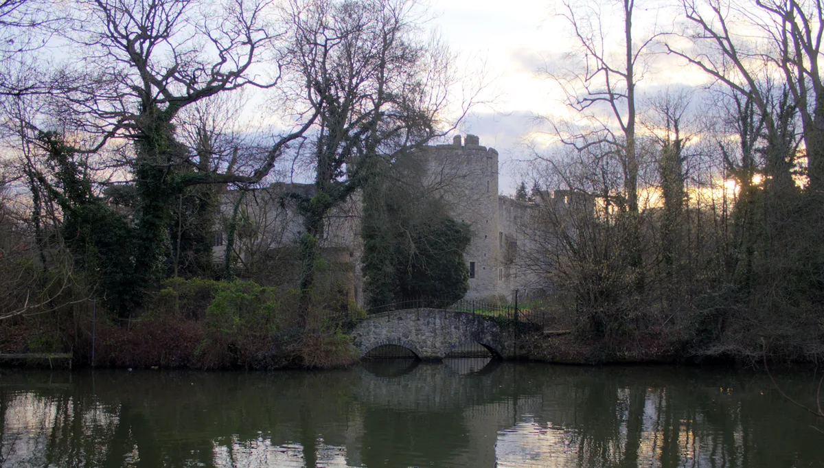 📷 5
📷 5Castles · South East England
Allington Castle
Allington Castle — stone-built moated castle in Allington, England.
 📷 5
📷 5Castles · South East England
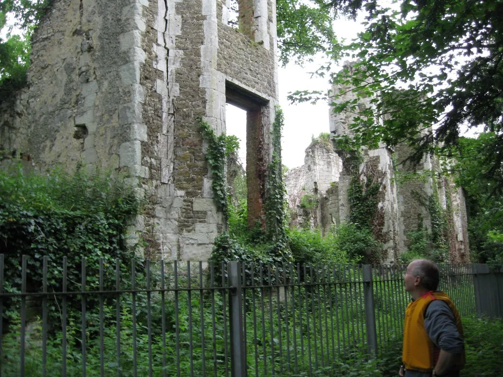
Betchworth Castle
Betchworth Castle — castle in Brockham, Mole Valley, Surrey, England, UK.
 📷 5
📷 5Castles · South East England
Bletchingley Castle
Bletchingley Castle — castle in Surrey, England, UK.
Frequently asked questions
- Where is Cooling Castle?
- Cooling Castle is in South-East England, United Kingdom (postcode ME3 8DT), in the parish of Cooling.
- What is Cooling Castle?
- Cooling Castle is a 14th-century quadrangular castle in the village of Cooling, Kent on the Hoo Peninsula about 6 miles (9.7 km) north of Rochester. It was built in the 1380s by the Cobham family, the
- How do I get to Cooling Castle?
- The nearest railway station is Higham, about 5.1 km away. Drivers can use postcode ME3 8DT.
- Is Cooling Castle a protected site?
- Yes — Cooling Castle is part of the South Thames Estuary and Marshes SSSI Site of Special Scientific Interest and the Thames Estuary & Marshes Ramsar wetland.
- Does Cooling Castle charge admission?
- Cooling Castle typically charges admission. Check the official site for current ticket prices and opening hours.
- How do I get to Cooling Castle?
- The nearest railway station is Higham, about 5.1 km away. Drivers can navigate to postcode ME3 8DT.