Mountains & hills · Scottish Highlands
Conachreag
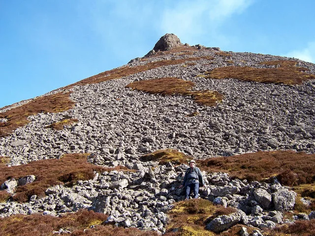
Conachreag — mountain in scotland highlands. Elevation: 288 m.

Richard Webb — CC BY-SA 2.0 via Wikimedia Commons licence
Plan your visit
- Typical visit
- 3 h–8 h
- Best time of year
- Late spring – early autumn (May–Oct)
About
Conachreag is a mountain located in scotland highlands. Elevation: 288 m. A named British peak recorded in OpenStreetMap. Peaks are typically named on Ordnance Survey 1:50k mapping.
Photo gallery
Place summary
Conachreag is a mountain located in the Scottish Highlands. It is part of the rugged landscape characteristic of the region. Visitors can expect challenging terrain and scenic views typical of Highland mountains. The area is suitable for experienced hikers and those seeking outdoor exploration.
AI-generated from the structured facts on this page (operator, designation, listing, era). Not a substitute for visiting.
- Coordinates
- 58.2617, -3.6113
Sources
- osm: n707036629 (ODbL)
Other places nearby
Loading nearby places…
Nearby
 📷 5
📷 5Historic bridges · Scottish Highlands
Braemore Bridge
Braemore Bridge — category B listed building-listed bridge in scotland-highlands, United Kingdom.
 📷 3
📷 3Mountains & hills · Scottish Highlands
Maiden Pap
Maiden Pap — Named summit at 484 m.
 📷 5
📷 5Lakes · Scottish Highlands
Lochan nam Bò Riabhach
Lochan nam Bò Riabhach — a lake in scotland highlands.
📷 5Mountains & hills · Scottish Highlands
Overcaig Hill
Overcaig Hill — mountain in scotland highlands. Elevation: 295 m.

Vineyards · Scottish Highlands
Berriedale Water,homestead & hut circles S of
Berriedale Water,homestead & hut circles S of — a UK vineyard in scotland highlands, producing English or Welsh wine from cool-climate grape varieties.
 📷 5
📷 5Mountains & hills · Scottish Highlands
Smean
Smean — mountain in scotland highlands. Elevation: 509 m.
Where to eat & stay near Conachreag
Places to stay
 📷 5
📷 5Campsites · Scottish Highlands
Inver Caravan Park & BB
Inver Caravan Park & BB — a campsite in scotland highlands.
 📷 5
📷 5Campsites · Scottish Highlands
Dunbeath Harbour Camping
Dunbeath Harbour Camping — a campsite in scotland highlands.
 📷 5
📷 5Campsites · Scottish Highlands
Wildcamp latheronwheel
Wildcamp latheronwheel — a campsite in scotland highlands.
 📷 5
📷 5Hostels · Scottish Highlands
Helmsdale Hostel
Helmsdale Hostel — a hostel in scotland highlands.
More mountains in this region
 📷 3
📷 3Mountains & hills · Scottish Highlands
A' Bhuidheanach Bheag
A' Bhuidheanach Bheag — Named summit at 936 m.
 📷 3
📷 3Mountains & hills · Scottish Highlands
A' Chailleach
A' Chailleach — Named summit at 997 m.
 📷 3
📷 3Mountains & hills · Scottish Highlands
A' Chailleach
A' Chailleach — Named summit at 930 m.
 📷 3
📷 3Mountains & hills · Scottish Highlands
A' Chaoirnich
A' Chaoirnich — Named summit at 875 m.
Frequently asked questions
- Where is Conachreag?
- Conachreag is in the Scottish Highlands, United Kingdom.
- What is Conachreag?
- Conachreag — mountain in scotland highlands. Elevation: 288 m.
- How do I get to Conachreag?
- Its coordinates are 58.2617°, -3.6113°.