Natural landmarks · Scottish Lowlands
Cold Fell
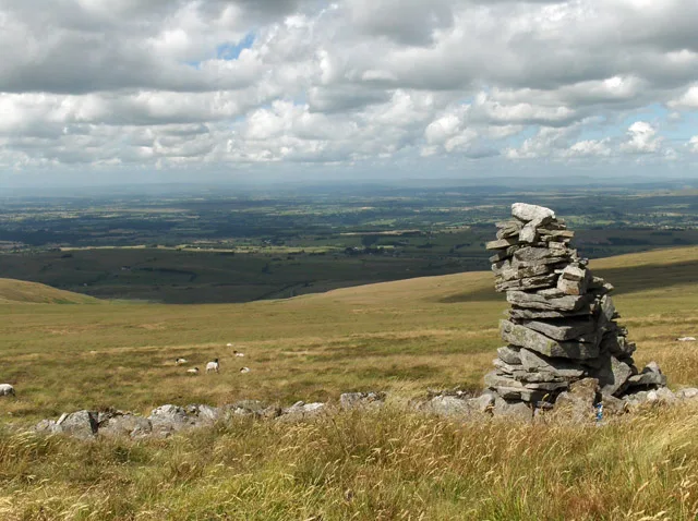
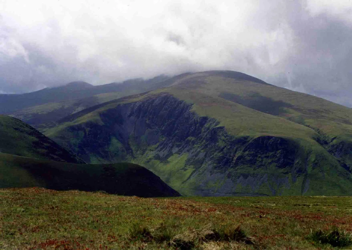
Cold Fell — mountain in Cumbria, England, UK.

Wikimedia Commons contributors — see linked file page for photographer and licence licence
Plan your visit
- Typical visit
- 1 h–2 h
- Nearest railway station
- Brampton · 7.0 km
- Free entry
- Dog-friendly
About
Cold Fell is a named natural landmark in the United Kingdom. Wikidata describes it as: "mountain in Cumbria, England, UK". Coordinates: 54.8939°, -2.6163°.
Photo gallery
Protected designations
- Site of Special Scientific Interest: Geltsdale & Glendue Fells SSSI
- Site of Special Scientific Interest: River Eden and Tributaries SSSI
- Area of Outstanding Natural Beauty: North Pennines
Designations sourced from Natural England open data under OGL v3.
From the Wikipedia article
Cold Fell is a mountain in the northern Pennines, in Cumbria, England. Lying among the northernmost uplands of the North Pennines AONB, it is the most northerly mountain in Cumbria and is listed as a Marilyn due to its prominence of 168m.
Excerpt from Wikipedia under CC BY-SA 4.0. See the source article linked in Sources below.
- Coordinates
- 54.8939, -2.6163
- Address
- Pennines, England
- Nearest railway station
- Brampton — 7 km
Sources
- wikidata: Q5142254 (CC0)
- wikipedia: Cold Fell (Pennines) (CC BY-SA 4.0)
- commons: Cold Fell - geograph.org.uk - 213099.jpg (CC BY-SA 4.0)
Other places nearby
Loading nearby places…
Nearby
 📷 3
📷 3Mountains & hills · Scottish Lowlands
Cold Fell
Cold Fell — Named summit at 621 m.
 📷 4
📷 4Other places · North East England
Geltsdale & Glendue Fells
Geltsdale & Glendue Fells in England North East, United Kingdom.
 📷 3
📷 3Wildlife reserves · Scottish Lowlands
Geltsdale RSPB reserve
Geltsdale RSPB reserve — RSPB nature reserve in the United Kingdom.
 📷 3
📷 3Historic houses · Scottish Lowlands
Tarn House
Tarn House — house in Midgeholme, Cumbria, United Kingdom.
 📷 4
📷 4Castles · North East England
Castle Carrock
Castle Carrock in England North East, United Kingdom.
 📷 5
📷 5Museums · North East England
Tindale
Tindale in England North East, United Kingdom.
More natural landmarks in this region
 Flagship📷 3
Natural landmarks · Scottish Lowlands
Bassenthwaite Lake
Bassenthwaite Lake — lake in Cumbria, England, UK.
 Flagship📷 3
Natural landmarks · Scottish Lowlands
Loch Enoch
Loch Enoch — lake in Dumfries and Galloway, Scotland, UK.
 📷 5
📷 5Natural landmarks · Scottish Lowlands
Annandale Water
Annandale Water — lake in Dumfries and Galloway, Scotland, UK.
 📷 3
📷 3Natural landmarks · Scottish Lowlands
Bakestall
Bakestall — mountain in United Kingdom.
Frequently asked questions
- Where is Cold Fell?
- Cold Fell is in the Scottish Lowlands, United Kingdom.
- Is Cold Fell a protected site?
- Yes — Cold Fell is part of the Geltsdale & Glendue Fells SSSI Site of Special Scientific Interest and the River Eden and Tributaries SSSI Site of Special Scientific Interest.
- Is Cold Fell free to visit?
- Yes, Cold Fell is free to enter.
- How do I get to Cold Fell?
- The nearest railway station is Brampton, about 7.0 km away.