
Towns & cities · East of England
Coddenham
Coddenham — village and civil parish in Suffolk, UK.

Geographer — CC BY-SA 2.0 via Wikimedia Commons licence

Plan your visit
- Typical visit
- 3 h–6 h
- Nearest railway station
- Needham Market · 4.4 km
- Free entry
- Family-friendly
- Dog-friendly
Getting there & planning your visit
To visit Coddenham, the nearest railway station is Needham Market, located 4.4 km away. Entry to the town is free.
About
Coddenham is a town, city, village or settlement in the United Kingdom. Recent population estimates put it at around 521 people. Address: IP6. Wikidata describes it as: "village and civil parish in Suffolk, UK". Coordinates: 52.1450°, 1.1190°.
Photo gallery
See it from the streetimagery from 2025
Imagery © Mapillary contributors, CC BY-SA 4.0
Protected designations
- Area of Outstanding Natural Beauty: Suffolk Coast & Heaths
Designations sourced from Natural England open data under OGL v3.
From the Wikipedia article
Coddenham is a village and civil parish in the Mid Suffolk district of Suffolk in eastern England. Located to the north of the A14 road, 8 miles north of Ipswich, the parish also includes the hamlet of Coddenham Green. In 2005 its population was 570, increasing to 620 at the 2011 Census. At the 2021 census its population was 630. Village facilities include a community village shop and café, a country club offering themed evenings, darts, pool and snooker, and the Coddenham Centre.
Excerpt from Wikipedia under CC BY-SA 4.0. See the source article linked in Sources below.
Background
History
During the Roman occupation of Britain, Coddenham was the largest settlement in Suffolk. There were two Roman forts at the site at Baylham House, which was known as Combretovium. The Roman road from Colchester (then Camulodunum) to Caistor St Edmund (then Venta Icenorum) in Norfolk ran through the town. The place-name 'Coddenham' is first attested in the Domesday Book of 1086, where it appears as Codenham. The name means 'Codda's homestead'. The village was struck by an F1/T3 tornado on 23 November 1981, as part of the record-breaking nationwide tornado outbreak on that day.
Sourced from Wikipedia under CC BY-SA 4.0.
- Coordinates
- 52.1450, 1.1190
- County
- Suffolk
- District
- Mid Suffolk
- Parish
- Coddenham
- Postcode
- IP6
- Parliamentary constituency
- Central Suffolk and North Ipswich
- Population
- 521
- Nearest railway station
- Needham Market — 4.4 km
- Official site
- web.archive.org
Sources
Other places nearby

Gryffon House
Historic houses · 0.1 km

Coddenham Village Sign
Public art & sculpture · 0.1 km

Coddenham War Memorial
Memorials & monuments · 0.2 km

Hemingstone Hall And Attached Garden Walls On The South West Side
Gardens · 0.6 km
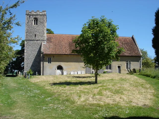
Church of St Gregory
Historic churches · 1.1 km

Hemingstone
Towns & cities · 1.6 km

Bridge in the 'wild garden' at Shrubland Hall
Historic bridges · 2.0 km

The Highwayman
Historic pubs · 2.6 km

Bridge Over River Gipping With Attached Lock Immediately East Of Baylham Mill
Historic bridges · 2.7 km
Bridge And Lock, Immediately South West Of Baylham Mill
Historic bridges · 2.7 km

The Greyhound, Gosbeck
Historic pubs · 2.7 km

Baylham Rare Breeds Farm
Farms (open to visitors) · 2.7 km
Coddenham is a town in Suffolk, located in the East of England. Visitors can explore the Church of St Mary and the Baylham Watermill And Mill House. The Hemingstone Hall And Attached Garden Walls On The South West Side offers another point of interest for those seeking local charm.
At a glance
- Population
- 521
- Administrative county
- Suffolk
- Constituency
- Central Suffolk and North Ipswich
- Top categories near here
Things to see in Coddenham
32 attractions within 12 km — showing the 24 most editorially-significant. Full guide: things to do in Coddenham →
 📷 3
📷 3Historic churches · East of England
Church of St John the Baptist
Church of St John the Baptist — Grade I listed church in Needham Market, Suffolk, England, UK.
 📷 4
📷 4Historic churches · East of England
Church of St Mary
Church of St Mary — church in Great Blakenham, Suffolk, England, UK.
📷 3Historic houses · East of England
Gryffon House
Gryffon House — house in Coddenham, Mid Suffolk, England, UK.
📷 4Gardens · East of England
Hemingstone Hall And Attached Garden Walls On The South West Side
Hemingstone Hall And Attached Garden Walls On The South West Side — a garden in england-east, United Kingdom.
📷 3Farms (open to visitors) · East of England
Baylham Rare Breeds Farm
Baylham Rare Breeds Farm — a place in East of England, United Kingdom.
 📷 5
📷 5Heritage railway stations · East of England
Needham Market railway station
Needham Market railway station — a Grade II-listed railway station in england-east, United Kingdom.
 📷 3
📷 3Windmills · East of England
Creeting St Mary Windmill
Creeting St Mary Windmill — a Grade II-listed windmill in england-east, United Kingdom.
📷 3Historic bridges · East of England
Bridge Over River Gipping With Attached Lock Immediately East Of Baylham Mill
Bridge Over River Gipping With Attached Lock Immediately East Of Baylham Mill — Grade II listed building-listed bridge in england-east, United Kingdom.
 📷 3
📷 3Historic bridges · East of England
Stowmarket Navigation Creeting Lock And Bridge
Stowmarket Navigation Creeting Lock And Bridge — Grade II listed building-listed bridge in england-east, United Kingdom.
📷 3Historic bridges · East of England
Bridge And Lock, Immediately South West Of Baylham Mill
Bridge And Lock, Immediately South West Of Baylham Mill — Grade II listed building-listed bridge in england-east, United Kingdom.
📷 3Historic bridges · East of England
Bridge in the 'wild garden' at Shrubland Hall
Bridge in the 'wild garden' at Shrubland Hall — Grade II listed building-listed bridge in england-east, United Kingdom.
📷 3Watermills · East of England
Baylham Watermill And Mill House
Baylham Watermill And Mill House — Grade II* listed building-listed watermill in england-east, United Kingdom.
📷 3Memorials & monuments · East of England
Coddenham War Memorial
Coddenham War Memorial — Grade II listed building-listed memorial in england-east, United Kingdom.
 📷 3
📷 3Memorials & monuments · East of England
Creeting St Mary War Memorial
Creeting St Mary War Memorial — Grade II listed building-listed memorial in england-east, United Kingdom.
 📷 3
📷 3Public art & sculpture · East of England
Tree trunk climbing frame; birds, fish and boat
Tree trunk climbing frame; birds, fish and boat — a public art in East of England, United Kingdom.
 📷 3
📷 3Public art & sculpture · East of England
Friends of the Lake
Friends of the Lake — a public art in East of England, United Kingdom.
 📷 3
📷 3Public art & sculpture · East of England
Creeting St Mary Village Sign
Creeting St Mary Village Sign — a public art in East of England, United Kingdom.
📷 3Public art & sculpture · East of England
Coddenham Village Sign
Coddenham Village Sign — a public art in East of England, United Kingdom.
 📷 3
📷 3Public art & sculpture · East of England
Great Blakenham Village Sign
Great Blakenham Village Sign — a public art in East of England, United Kingdom.
 📷 3
📷 3Public art & sculpture · East of England
Needham Market Village Sign
Needham Market Village Sign — a public art in East of England, United Kingdom.
 📷 3
📷 3Public art & sculpture · East of England
Barham Village Sign
Barham Village Sign — a public art in East of England, United Kingdom.
 📷 3
📷 3Memorials & monuments · East of England
CattleTunnel
CattleTunnel — a memorial in East of England, United Kingdom.
 📷 3
📷 3Memorials & monuments · East of England
Enemy Bombing
Enemy Bombing — a memorial in East of England, United Kingdom.
 📷 4
📷 4Memorials & monuments · East of England
George Ewart Evans
George Ewart Evans — a memorial in East of England, United Kingdom.
Nearby
📷 3Historic houses · East of England
Gryffon House
Gryffon House — house in Coddenham, Mid Suffolk, England, UK.
📷 3Public art & sculpture · East of England
Coddenham Village Sign
Coddenham Village Sign — a public art in East of England, United Kingdom.
📷 3Memorials & monuments · East of England
Coddenham War Memorial
Coddenham War Memorial — Grade II listed building-listed memorial in england-east, United Kingdom.
📷 4Gardens · East of England
Hemingstone Hall And Attached Garden Walls On The South West Side
Hemingstone Hall And Attached Garden Walls On The South West Side — a garden in england-east, United Kingdom.
📷 3Historic churches · East of England
Church of St Gregory
Church of St Gregory — church in Hemingstone, Suffolk, England, UK.
📷 3Towns & cities · East of England
Hemingstone
Hemingstone — village in Suffolk, England, UK.
Where to eat & stay near Coddenham
Places to stay
 📷 7
📷 7Hotels · East of England
Limes Hotel
Limes Hotel — a hotel in england east.
 📷 5
📷 5Campsites · East of England
Broughton Hall Caravan Club CL
Broughton Hall Caravan Club CL — a campsite in england east.
 📷 7
📷 7 📷 5
📷 5 📷 5
📷 5 📷 5
📷 5Places to eat & drink
📷 7📷 7Historic pubs · East of England
The Greyhound, Gosbeck
The Greyhound, Gosbeck in England East, United Kingdom.
 📷 5
📷 5Historic pubs · East of England
The Suffolk Punch
The Suffolk Punch in England East, United Kingdom.
 📷 5
📷 5Historic pubs · East of England
The Meadlands Public House
The Meadlands Public House in England East, United Kingdom.
 📷 7
📷 7Historic pubs · East of England
Half Moon and Star
Half Moon and Star in England East, United Kingdom.
 📷 6
📷 6More towns in this region
 Flagship📷 10
 Flagship📷 10
Towns & cities · East of England
Cambridge
Cambridge — city in Cambridgeshire, England.
 Flagship📷 10
Towns & cities · East of England
Chelmsford
Chelmsford — city in Essex, United Kingdom.
 Flagship📷 10
Towns & cities · East of England
Colney Heath
Colney Heath — village and civil parish in St Albans, Hertfordshire, England, UK.
Frequently asked questions
- Where is Coddenham?
- Coddenham is in Suffolk, East of England, United Kingdom (postcode IP6), in the parish of Coddenham.
- What is Coddenham?
- Coddenham — village and civil parish in Suffolk, UK.
- How do I get to Coddenham?
- The nearest railway station is Needham Market, about 4.4 km away. Drivers can use postcode IP6.
- Is Coddenham a protected site?
- Yes — Coddenham is part of the Suffolk Coast & Heaths National Landscape (AONB).
- Is Coddenham free to visit?
- Yes, Coddenham is free to enter.
- How do I get to Coddenham?
- The nearest railway station is Needham Market, about 4.4 km away. Drivers can navigate to postcode IP6.