
Villages · South East England
Cocking
In or near Lodsworth.
Cocking — a village in england south east.

David Howard — CC BY-SA 2.0 via Wikimedia Commons licence

Plan your visit
- Typical visit
- 1 h–2 h
About
A British village — settlements of this size traditionally cluster a green, parish church, pub and post office around historic land routes.
Photo gallery
360° viewimagery from 2026
Imagery © Mapillary contributors, CC BY-SA 4.0
Place summary
Cocking is a village located in South-East England, with a population of approximately 420 residents. It is characterised by its rural setting and traditional English village atmosphere. The area is typical of the region, featuring local architecture and community amenities.
AI-generated from the structured facts on this page (operator, designation, listing, era). Not a substitute for visiting.
- Coordinates
- 50.9504, -0.7518
- County
- West Sussex
- District
- Chichester
- Parish
- Cocking
- Postcode
- GU29 0HN
- Parliamentary constituency
- Arundel and South Downs
- Population
- 420
Sources
- manual: geonames-2652671 (CC BY 4.0)
Other places nearby

History Column
Natural landmarks · 0.1 km
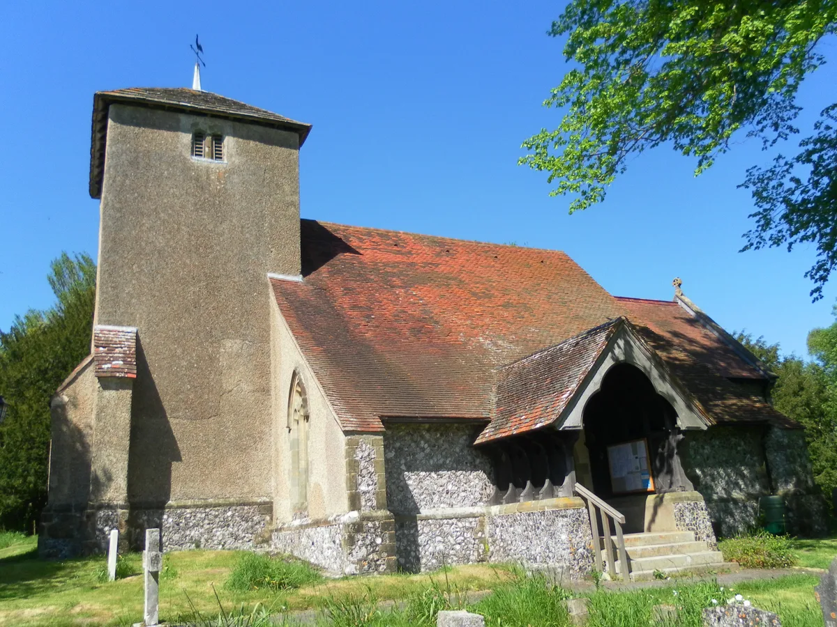
St Catherine of Siena Church, Cocking
Historic churches · 0.2 km

Park House Hotel
Hotels · 2.0 km

Heyshott
Villages · 2.0 km

Heyshott Down
Mountains & hills · 2.4 km

Linch Down
Mountains & hills · 2.9 km
Linch Down
Mountains & hills · 3.0 km

Heyshott Down Round Barrow Cemetery.
Burial mounds & barrows · 3.2 km

Downley House
Archaeological sites · 3.3 km
Dimmer Reserve
Natural landmarks · 3.5 km

Levin Down
Mountains & hills · 3.7 km
Levin Down
Mountains & hills · 3.7 km
Nearby
📷 5Natural landmarks · South East England
History Column
History Column — a other in england-south-east, United Kingdom.
📷 5Historic churches · South East England
St Catherine of Siena Church, Cocking
St Catherine of Siena Church, Cocking — church in Chichester, UK.
📷 5📷 5📷 5Mountains & hills · South East England
Heyshott Down
Heyshott Down — mountain in england south east. Elevation: 233 m.
📷 5Mountains & hills · South East England
Linch Down
Linch Down — a hill or mountain in england south east.
Where to eat & stay near Cocking
Places to stay
📷 5 📷 5
📷 5Hotels · South East England
Spread Eagle Hotel
Spread Eagle Hotel — a hotel in england south east.
 📷 7
📷 7Hotels · South East England
Woodstock House Hotel
Woodstock House Hotel — a hotel in england south east.
 📷 5
📷 5Campsites · South East England
Newhouse Farm Camping
Newhouse Farm Camping — a campsite in england south east.
 📷 5
📷 5Campsites · South East England
West Dean Campsite
West Dean Campsite — a campsite in england south east.
 📷 5
📷 5Caravan parks · South East England
New House Farm
New House Farm — a caravan park in england south east.
Places to eat & drink
 📷 5
📷 5Historic pubs · South East England
The Partridge Inn
The Partridge Inn in England South East, United Kingdom.
 📷 5
📷 5Historic pubs · South East England
The Foresters Public House
The Foresters Public House in England South East, United Kingdom.
 📷 5
📷 5Historic pubs · South East England
Page's Stores The White Horse Inn
Page's Stores The White Horse Inn in England South East, United Kingdom.
 📷 7
📷 7Historic pubs · South East England
Keepers Arms
Keepers Arms — Historic pub — listed building or notable heritage status.
 📷 5
📷 5Historic pubs · South East England
The Hollist Arms Public House
The Hollist Arms Public House in England South East, United Kingdom.
 📷 5
📷 5Historic pubs · South East England
The Duke Of Cumberland Public House
The Duke Of Cumberland Public House in England South East, United Kingdom.
More places in this region
 📷 5
📷 5 📷 5
📷 5 📷 5
📷 5 📷 5
📷 5Frequently asked questions
- Where is Cocking?
- Cocking is in West Sussex, South-East England, United Kingdom (postcode GU29 0HN), in the parish of Cocking.
- What is Cocking?
- Cocking — a village in england south east.
- How do I get to Cocking?
- Drivers can use postcode GU29 0HN.
- How do I get to Cocking?
- Drivers can navigate to postcode GU29 0HN. It sits within the Arundel and South Downs parliamentary constituency.