
Castles · Central Scotland
Cockburnspath
Cockburnspath ( KOH-bərnz-path) is a village in Berwickshire in the Scottish Borders. It lies near the North Sea coast between Berwick-upon-Tweed and Dunbar. Cockburnspath is the eastern terminus of t

Jennifer Petrie — CC BY-SA 2.0 via Wikimedia Commons licence

Plan your visit
- Typical visit
- 1.5 h–3 h
- Family-friendly
- Limited wheelchair access
About
Cockburnspath ( KOH-bərnz-path) is a village in Berwickshire in the Scottish Borders. It lies near the North Sea coast between Berwick-upon-Tweed and Dunbar. Cockburnspath is the eastern terminus of the Southern Upland Way as well as the northern terminus of the Berwickshire Coastal Path. At the nearby village of Cove, there is a small fishing harbour.
Photo gallery
From the Wikipedia article
Cockburnspath ( KOH-bərnz-path) is a village in Berwickshire in the Scottish Borders. It lies near the North Sea coast between Berwick-upon-Tweed and Dunbar. Cockburnspath is the eastern terminus of the Southern Upland Way as well as the northern terminus of the Berwickshire Coastal Path. At the nearby village of Cove, there is a small fishing harbour.
Excerpt from Wikipedia under CC BY-SA 4.0. See the source article linked in Sources below.
Background
History
The area has many archeological remains which indicate it has been lived in and fought over since the Bronze Age. It lies close to the old invasion route from England into Scotland. Cockburnspath was originally known as "Colbrand's Path", after a folkloric giant. Sir Adam de Hepburn (d. before 1371), in the reign of David II, had a charter of the lands of Traprain, and Southalls and Northalls (united as Hailes) in Haddingtonshire, as well as the lands of Mersingtoun, Cockburnspath, and Rollanstoun in Berwickshire. ' at Siccar Point shows gently sloping Devonian Old Red Sandstone layers forming an eroded capping over much older vertically bedded Silurian greywacke rocks.]] The lands of…
Sourced from Wikipedia under CC BY-SA 4.0.
- Coordinates
- 55.9329, -2.3602
- District
- Scottish Borders
- Postcode
- TD13 5XA
- Parliamentary constituency
- Berwickshire, Roxburgh and Selkirk
- Official site
- www.scotborders.gov.uk
Sources
- wikipedia: Cockburnspath (CC BY-SA 4.0)
Other places nearby
Berwickshire Coastal Path
Military museums · 0.0 km

Cockburnspath Parish Church
Historic churches · 0.2 km

Dunglass
Villages · 0.4 km

Cove Harbour
Marinas · 1.1 km

Clifton Hill
Vineyards · 1.1 km

New Bridge, Dunglass
Historic bridges · 1.1 km

Tod's Hole
Caves · 1.1 km

Dunglass Viaduct
Historic bridges · 1.1 km

Dunglass Castle
Castles · 1.1 km

Dunglass Bridge
Historic bridges · 1.1 km
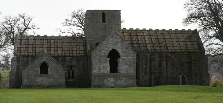
Dunglass Collegiate Church
Historic churches · 1.2 km

Old Bridge, Dunglass
Historic bridges · 1.2 km
Nearby
📷 5Military museums · Central Scotland
Berwickshire Coastal Path
Berwickshire Coastal Path — a military museum in scotland central.
📷 5Historic churches · Central Scotland
Cockburnspath Parish Church
Cockburnspath Parish Church — category A listed building-listed church in scotland-central, United Kingdom.
📷 5📷 5📷 5Vineyards · Central Scotland
Clifton Hill
Clifton Hill — a UK vineyard in scotland central, producing English or Welsh wine from cool-climate grape varieties.
📷 5Historic bridges · Central Scotland
New Bridge, Dunglass
New Bridge, Dunglass — category B listed building-listed bridge in scotland-central, United Kingdom.
Where to eat & stay near Cockburnspath
Places to stay
 📷 5
📷 5Caravan parks · Central Scotland
Pease Bay Leisure Park
Pease Bay Leisure Park — a caravan park in scotland central.
 📷 5
📷 5Caravan parks · Central Scotland
Chesterfield Caravan Park
Chesterfield Caravan Park — a caravan park in scotland central.
 📷 5
📷 5Caravan parks · Central Scotland
Thurston Manor Caravan Park
Thurston Manor Caravan Park — a caravan park in scotland central.
 📷 5
📷 5Caravan parks · Central Scotland
Highview Caravan Park
Highview Caravan Park — a caravan park in scotland central.
 📷 5
📷 5Caravan parks · Central Scotland
Dunbar Camping and Caravanning Club Site
Dunbar Camping and Caravanning Club Site — a caravan park in scotland central.
 📷 5
📷 5Hostels · Central Scotland
The Dolphin Inn
The Dolphin Inn — a hostel in scotland central.
Places to eat & drink
 📷 7
📷 7Historic pubs · Central Scotland
The Royal Bar, 15 Market Square, Duns
The Royal Bar, 15 Market Square, Duns in Scotland Central, United Kingdom.
 📷 5
📷 5Historic pubs · Central Scotland
The Crown & Kitchen
The Crown & Kitchen in Scotland Central, United Kingdom.
More castles in this region
 📷 3
📷 3 📷 2
📷 2 📷 4
📷 4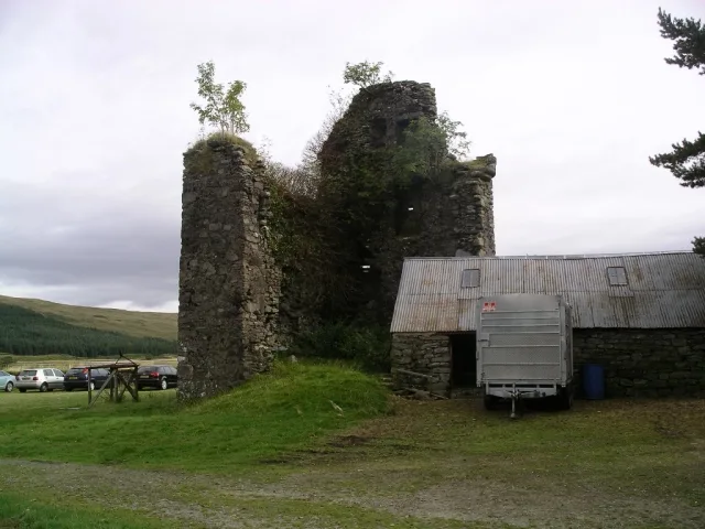 📷 3
📷 3Castles · Central Scotland
Achallader Castle
Achallader Castle — castle in Argyll and Bute, Scotland, UK.
Frequently asked questions
- Where is Cockburnspath?
- Cockburnspath is in central Scotland, United Kingdom (postcode TD13 5XA).
- What is Cockburnspath?
- Cockburnspath ( KOH-bərnz-path) is a village in Berwickshire in the Scottish Borders. It lies near the North Sea coast between Berwick-upon-Tweed and Dunbar. Cockburnspath is the eastern terminus of t
- How do I get to Cockburnspath?
- Drivers can use postcode TD13 5XA.
- Does Cockburnspath charge admission?
- Cockburnspath typically charges admission. Check the official site for current ticket prices and opening hours.
- How do I get to Cockburnspath?
- Drivers can navigate to postcode TD13 5XA. It sits within the Berwickshire, Roxburgh and Selkirk parliamentary constituency.