
Other places · Mid Wales
Coalbrookdale Formation
In or near Llanfair Waterdine.
Coalbrookdale Formation in Wales Mid, United Kingdom.

Anthony Parkes — CC BY-SA 2.0 via Wikimedia Commons licence

Plan your visit
- Typical visit
- 1 h–2 h
- Nearest railway station
- Hopton Heath · 6.6 km
Getting there & planning your visit
To visit the Coalbrookdale Formation, the nearest railway station is Hopton Heath, located 6.6 km away. The postcode for the site is SY7 0JA. Entry details are not provided, so please check in advance.
About
Coalbrookdale Formation is a place of interest in Wales Mid, United Kingdom — drawn from open-data sources for visitor reference. See the linked Wikipedia article for the full description.
Photo gallery
Protected designations
- Site of Special Scientific Interest: River Teme SSSI
- Area of Outstanding Natural Beauty: Shropshire Hills
Designations sourced from Natural England open data under OGL v3.
From the Wikipedia article
Coalbrookdale Formation, earlier known as Wenlock Shale or Wenlock Shale Formation and also referred to as Herefordshire Lagerstätte in palaeontology, is a fossil-rich deposit (Konservat-Lagerstätte) in Powys and Herefordshire at the England–Wales border in UK. It belongs to the Wenlock Series of the Silurian Period within the Homerian Age (about 430 million years ago). It is known for its well-preserved fossils of various invertebrate animals many of which are in their three-dimensional structures. Some of the fossils are regarded as earliest evidences and evolutionary origin of some of the major groups of modern animals. Roderick Murchison first described the geological setting of Coalbrookdale Formation by which he gave the name Silurian in 1935, referring to the Silures, a Celtic tribe of Wales. It is assigned to the Wenlock Group in 1978 based on the age of crustacean fossils found around the region. Robert J. King of the University of Leicester discovered the first unique fossil in 1990. The fossil, an arthropod was reported in 1996 and described in 2000 as Offacolus kingi. Since then, over 30 species of arthropods, polychaete worms, sponges, mollusks, echinoderms, and lobopods have been described; with about 30 species in store yet to be identified.
Excerpt from Wikipedia under CC BY-SA 4.0. See the source article linked in Sources below.
Background
History
Roderick Murchison, at the time vice-president both of the Geological Society and the Geographical Society of London (later Royal Geographical Society), was the first geologist to systematically investigate the Coalbrookdale Formation and the nearby regions including Herefordshire, Shropshire, Brecknockshire, Radnorshire, Monmouthshire, and Carmarthenshire in the early 1830s. In 1835, he named the sedimentary sequences "Silurian" for a Celtic tribe of Wales, the Silures, inspired by his friend Adam Sedgwick, who had named the period of his study the Cambrian, from the Latin name for Wales. The same year, the two men presented a joint paper, under the title "On the Silurian and Cambrian…
Sourced from Wikipedia under CC BY-SA 4.0.
- Coordinates
- 52.4167, -3.0000
- District
- Shropshire
- Parish
- Clun
- Postcode
- SY7 0JA
- Parliamentary constituency
- South Shropshire
- Nearest railway station
- Hopton Heath — 6.6 km
Sources
- wikidata: Q110516918 (CC0)
- wikipedia: Coalbrookdale Formation (CC BY-SA 4.0)
Other places nearby

The Hurst
Historic houses · 0.6 km

Black Hill
Mountains & hills · 1.4 km

Radnor Wood
Mountains & hills · 1.4 km
Black Hill
Mountains & hills · 1.4 km

Radnor Wood Earthworks
Archaeological sites · 1.4 km

Radnor Wood Camp
Vineyards · 1.4 km

Clunton
Other places · 1.6 km

Pen-Y-Wern Hill
Mountains & hills · 1.7 km

YHA Clun Mill
Hostels · 2.0 km

Clun War Memorial
Memorials & monuments · 2.1 km
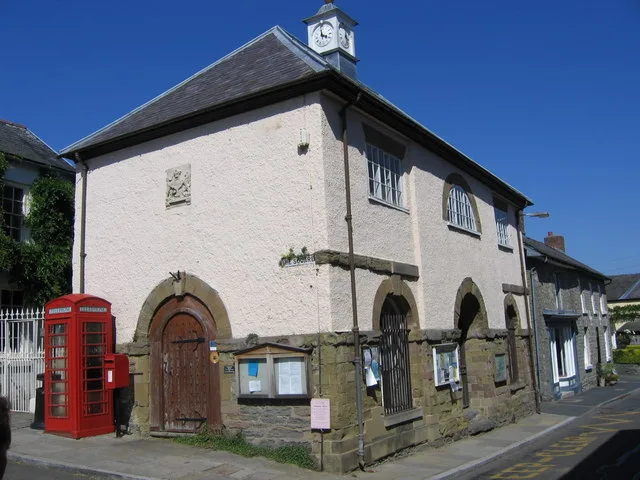
Clun Museum
Museums · 2.1 km

Town Hall (museum)
Museums · 2.1 km
Nearby
📷 3📷 5📷 5📷 5📷 3Archaeological sites · Mid Wales
Radnor Wood Earthworks
Radnor Wood Earthworks — a archaeological in wales-mid, United Kingdom.
📷 5Vineyards · Mid Wales
Radnor Wood Camp
Radnor Wood Camp — a UK vineyard in wales mid, producing English or Welsh wine from cool-climate grape varieties.
Where to eat & stay near Coalbrookdale Formation
Places to stay
📷 5 📷 5
📷 5Caravan parks · Mid Wales
Chapel Lawn Farm Campsite
Chapel Lawn Farm Campsite — a caravan park in wales mid.
 📷 5
📷 5Campsites · Mid Wales
Walcot Hall Caravan & Camping Park
Walcot Hall Caravan & Camping Park — a campsite in wales mid.
 📷 5
📷 5 📷 5
📷 5 📷 5
📷 5Places to eat & drink
 📷 4
📷 4 📷 7
📷 7Historic pubs · Mid Wales
The Six Bells And Former Stables To Rear
The Six Bells And Former Stables To Rear in Wales Mid, United Kingdom.
 📷 5
📷 5Historic pubs · Mid Wales
The Black Lion And Forecourt Railings
The Black Lion And Forecourt Railings in Wales Mid, United Kingdom.
 📷 5
📷 5 📷 5
📷 5 📷 4
📷 4More places in this region
 📷 5
📷 5 📷 3
📷 3Other places · Mid Wales
Sheep Music
Sheep Music is a three-day world music festival which takes place during July each year in Presteigne. It has 22 years of history, starting as a party on The Warden in 1991. Since moving to its curren
 📷 5
📷 5 📷 4
📷 4Frequently asked questions
- Where is Coalbrookdale Formation?
- Coalbrookdale Formation is in Mid Wales, United Kingdom (postcode SY7 0JA), in the parish of Clun.
- What is Coalbrookdale Formation?
- Coalbrookdale Formation in Wales Mid, United Kingdom.
- How do I get to Coalbrookdale Formation?
- The nearest railway station is Hopton Heath, about 6.6 km away. The nearest town is Llanfair Waterdine. Drivers can use postcode SY7 0JA.
- Is Coalbrookdale Formation a protected site?
- Yes — Coalbrookdale Formation is part of the River Teme SSSI Site of Special Scientific Interest and the Shropshire Hills National Landscape (AONB).
- How do I get to Coalbrookdale Formation?
- The nearest railway station is Hopton Heath, about 6.6 km away. Drivers can navigate to postcode SY7 0JA.