
Mountains & hills · Scottish Lowlands
Cnocna Ceille
In or near Brodick.
Cnocna Ceille — mountain in scotland highlands. Elevation: 209 m.

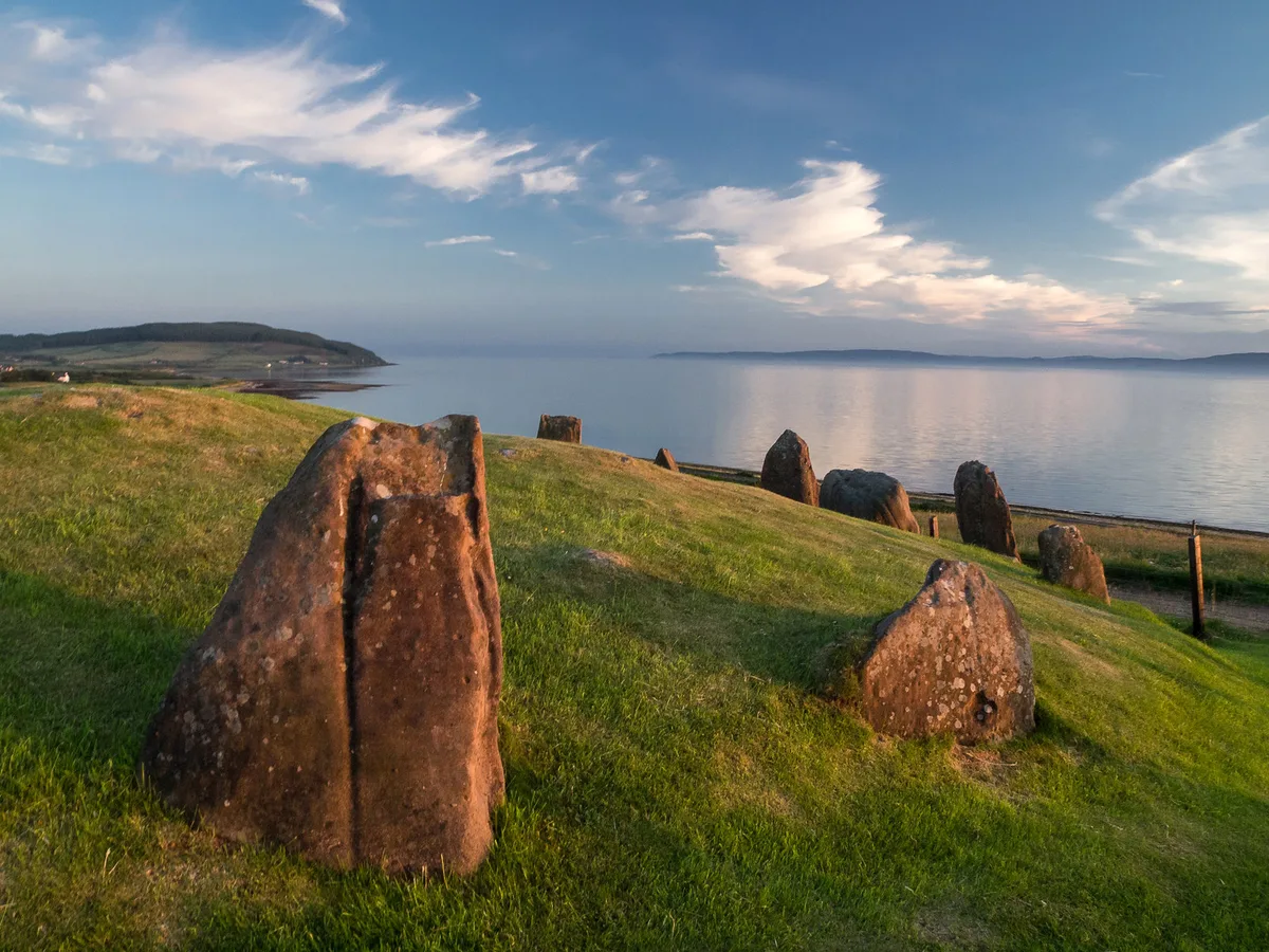
Leslie Barrie — CC BY-SA 2.0 via Wikimedia Commons licence

Plan your visit
- Typical visit
- 3 h–8 h
- Best time of year
- Late spring – early autumn (May–Oct)
- Dog-friendly
About
Cnocna Ceille is a mountain located in scotland highlands. Elevation: 209 m. A named British peak recorded in OpenStreetMap. Peaks are typically named on Ordnance Survey 1:50k mapping.
Photo gallery
Place summary
Cnocna Ceille is a mountain located in the Scottish Highlands. It is notable for its rugged terrain and scenic views characteristic of the region. The area offers opportunities for hiking and exploring the natural landscape. Visitors can expect a remote and tranquil environment, typical of the Highlands.
AI-generated from the structured facts on this page (operator, designation, listing, era). Not a substitute for visiting.
- Coordinates
- 55.5647, -5.3029
- District
- North Ayrshire
- Postcode
- KA27 8DS
- Parliamentary constituency
- North Ayrshire and Arran
Sources
- osm: n2008727917 (ODbL)
Other places nearby

standing stone 1100m NE of Machrie Farm
Windmills · 1.0 km
Garbh Thorr
Mountains & hills · 1.6 km

Cnoc a' Choire Mhòir
Mountains & hills · 1.9 km

Beinn Chóarach
Mountains & hills · 2.0 km
Loch Iorsa
Lakes · 2.2 km

Ballymichael Burn Stone Circle
Stone circles · 2.5 km
Auchagallon Stone Circle
Hill forts · 2.6 km
Beinn Lochain
Mountains & hills · 2.6 km
Beinn Lochain
Mountains & hills · 2.7 km

Machrie Moor Stone Circle 11
Stone circles · 2.7 km

Eas Bàn
Waterfalls · 2.7 km

Uamh Bhriste
Caves · 2.7 km
Nearby
📷 3Windmills · Scottish Lowlands
standing stone 1100m NE of Machrie Farm
standing stone 1100m NE of Machrie Farm — a post mill in scotland-highlands, United Kingdom.
📷 5Mountains & hills · Scottish Lowlands
Garbh Thorr
Garbh Thorr — mountain in scotland highlands. Elevation: 303 m.
📷 5Mountains & hills · Scottish Lowlands
Cnoc a' Choire Mhòir
Cnoc a' Choire Mhòir — mountain in scotland highlands. Elevation: 175 m.
📷 5Mountains & hills · Scottish Lowlands
Beinn Chóarach
Beinn Chóarach — mountain in scotland highlands. Elevation: 279 m.
📷 5📷 5Stone circles · Scottish Lowlands
Ballymichael Burn Stone Circle
Ballymichael Burn Stone Circle — a stone circle in Scottish Lowlands, United Kingdom.
Where to eat & stay near Cnocna Ceille
Places to stay
 📷 5
📷 5Campsites · Scottish Lowlands
Balmichael Glamping
Balmichael Glamping — a campsite in scotland highlands.
 📷 5
📷 5 📷 5
📷 5Campsites · Scottish Lowlands
Glen Rosa Campsite
Glen Rosa Campsite — a campsite in scotland highlands.
 📷 5
📷 5Hostels · Scottish Lowlands
Shore Lodge
Shore Lodge — a hostel in scotland highlands.
 📷 5
📷 5Hostels · Scottish Lowlands
Brodick Bunkhouse
Brodick Bunkhouse — a hostel in scotland highlands.
 📷 5
📷 5Caravan parks · Scottish Lowlands
Park Avenue Caravan Site
Park Avenue Caravan Site — a caravan park in scotland highlands.
Places to eat & drink
 📷 6
📷 6Historic pubs · Scottish Lowlands
Corrie Hotel
Corrie Hotel in Scotland Central, United Kingdom.
 📷 5
📷 5Historic pubs · Scottish Lowlands
40 Main Street, Campbeltown
40 Main Street, Campbeltown in Northern Ireland, United Kingdom.
 📷 5
📷 5Cafés · Scottish Lowlands
Glenbarr Abbey - Clan Macalister Museum & Tea Room
Glenbarr Abbey - Clan Macalister Museum & Tea Room — a café in scotland highlands.
More mountains in this region
 📷 3
📷 3 📷 5
📷 5Mountains & hills · Scottish Lowlands
Aros Bay
Aros Bay — bay on Islay, Argyll and Bute, Scotland, UK.
 📷 3
📷 3Mountains & hills · Scottish Lowlands
Beinn Bharrain
Beinn Bharrain — Named summit at 717 m.
 📷 5
📷 5Frequently asked questions
- Where is Cnocna Ceille?
- Cnocna Ceille is in the Scottish Lowlands, United Kingdom (postcode KA27 8DS).
- What is Cnocna Ceille?
- Cnocna Ceille — mountain in scotland highlands. Elevation: 209 m.
- How do I get to Cnocna Ceille?
- The nearest town is Brodick. Drivers can use postcode KA27 8DS.
- How do I get to Cnocna Ceille?
- Drivers can navigate to postcode KA27 8DS. It sits within the North Ayrshire and Arran parliamentary constituency.