
Historic bridges · Scottish Lowlands
Cloncaird Castle Bridge
In or near Dailly.
Cloncaird Castle Bridge — category C listed building-listed bridge in scotland-lowlands, United Kingdom.

Oliver Dixon — CC BY-SA 2.0 via Wikimedia Commons licence

Plan your visit
- Typical visit
- 15 min–30 min
- Nearest railway station
- Maybole · 6.5 km
- Free entry
- Dog-friendly
Getting there & planning your visit
Cloncaird Castle Bridge is located in the Scottish Lowlands, with the nearest railway station being Maybole, which is 6.5 km away. The postcode for the bridge is KA19 7LU, and entry is free.
About
Cloncaird Castle Bridge is a category C listed building-listed bridge in scotland-lowlands, United Kingdom, registered on the Historic Environment Scotland register (entry LB13782). Listed status protects buildings and structures of special architectural or historic interest. See the linked Wikipedia article for further details.
Photo gallery
Heritage listing
Category C Date Added 06/11/2006 Local Authority South Ayrshire Planning Authority South Ayrshire Parish Kirkmichael (S Ayrshire) NGR NS 35866 07622 Coordinates 235866, 607622 — Single tall rounded arc bridge over Kelsie Burn, which traverses the policies through the ravine. Formed part of the defences of the early estate. — Cloncaird Castle, which stands on a precipitous slope alongside the Kelsie Burn, was built around a 16th century core in 1814 for Henry Ritchie of Craiton and Busbie. Ritchie was succeeded by his second son William Wallace in 1843 and it remained in the Wallace family until sold in 1905 to Mrs Dubs, the widow of an industrialist. Colonel Wallace, who had sold the castle to Mrs Dubs, went on to marry her in 1908, reinstating himself as a result. Most of the interior remodeling of the castle is thought to date to the renovations by Mrs Dubs around this time. This included the introduction of fine ornate plasterwork, one plaque of which is signed by W Hubert Paton. On Mrs Dubs death in 1947 the castle became aconvalescent home, run by the local authority. It was returned to private residential use in the later 20th century.
From Historic Environment Scotland under OGL v3.
Place summary
Cloncaird Castle Bridge is a bridge located in the Scottish Lowlands. It is designated as a category C listed building, highlighting its historical significance within the region.
AI-generated from the structured facts on this page (operator, designation, listing, era). Not a substitute for visiting.
- Coordinates
- 55.3352, -4.5893
- District
- South Ayrshire
- Postcode
- KA19 7LU
- Parliamentary constituency
- Ayr, Carrick and Cumnock
- Nearest railway station
- Maybole — 6.5 km
Sources
- wikidata: Q56620251 (CC0)
Other places nearby
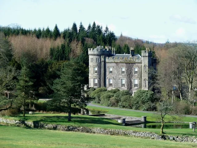
Cloncaird Castle
Castles · 0.1 km

Blairquhan Bridge
Historic bridges · 0.7 km

Kirkmichael
Villages · 1.7 km

Kirkmichael Parish Church, Patna Road, Kirkmichael
Historic churches · 1.9 km

Old Bridge, Kirkmichael
Historic bridges · 1.9 km

The White House and Adjoining Joiner's Shop, Kirkmichael Arms, Straiton Road, Kirkmichael
Historic pubs · 2.2 km
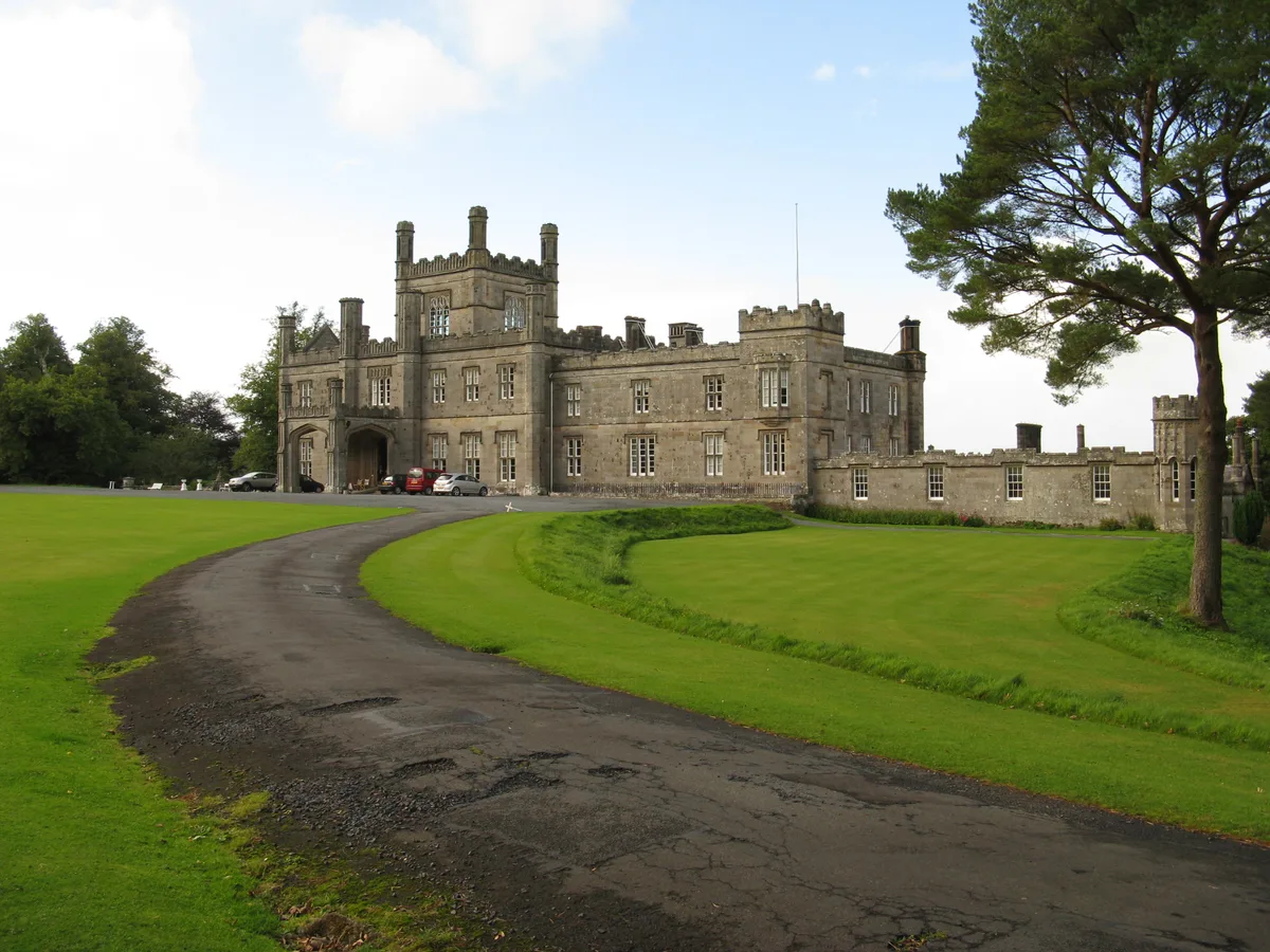
Blairquhan Castle
Castles · 2.3 km

Old Bridge of Blairquhan
Historic bridges · 2.8 km

Crosshill
Villages · 3.3 km

Guiltree Hill
Mountains & hills · 3.4 km

Crosshill War Memorial
Memorials & monuments · 3.5 km
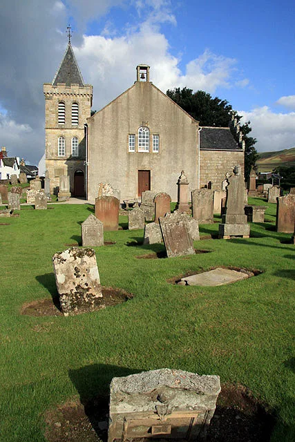
Straiton Parish Church
Historic churches · 3.5 km
Nearby
📷 3Castles · Scottish Lowlands
Cloncaird Castle
Cloncaird Castle — Castle in South Ayrshire, Scotland, UK.
📷 5Historic bridges · Scottish Lowlands
Blairquhan Bridge
Blairquhan Bridge — category B listed building-listed bridge in scotland-lowlands, United Kingdom.
📷 5📷 5Historic churches · Scottish Lowlands
Kirkmichael Parish Church, Patna Road, Kirkmichael
Kirkmichael Parish Church, Patna Road, Kirkmichael — category B listed building-listed church in scotland-lowlands, United Kingdom.
📷 5Historic bridges · Scottish Lowlands
Old Bridge, Kirkmichael
Old Bridge, Kirkmichael — category B listed building-listed bridge in scotland-lowlands, United Kingdom.
📷 5Historic pubs · Scottish Lowlands
The White House and Adjoining Joiner's Shop, Kirkmichael Arms, Straiton Road, Kirkmichael
The White House and Adjoining Joiner's Shop, Kirkmichael Arms, Straiton Road, Kirkmichael in Scotland Lowlands, United Kingdom.
Where to eat & stay near Cloncaird Castle Bridge
Places to stay
 📷 5
📷 5 📷 6
📷 6 📷 5
📷 5Campsites · Scottish Lowlands
Culzean Castle Camping and Caravanning Club Site
Culzean Castle Camping and Caravanning Club Site — a campsite in scotland lowlands.
 📷 5
📷 5 📷 5
📷 5Caravan parks · Scottish Lowlands
Crofthead Holiday Park
Crofthead Holiday Park — a caravan park in scotland lowlands.
 📷 5
📷 5Caravan parks · Scottish Lowlands
Craig Tara
Craig Tara — a caravan park in scotland lowlands.
Places to eat & drink
📷 5Historic pubs · Scottish Lowlands
The White House and Adjoining Joiner's Shop, Kirkmichael Arms, Straiton Road, Kirkmichael
The White House and Adjoining Joiner's Shop, Kirkmichael Arms, Straiton Road, Kirkmichael in Scotland Lowlands, United Kingdom.
 📷 5
📷 5Historic pubs · Scottish Lowlands
Doon Tavern, High Street, Dalmellington
Doon Tavern, High Street, Dalmellington in Scotland Lowlands, United Kingdom.
 📷 5
📷 5Historic pubs · Scottish Lowlands
Railway Tavern, 18 Smith Street, Ayr
Railway Tavern, 18 Smith Street, Ayr in Scotland Lowlands, United Kingdom.
 📷 7
📷 7Historic pubs · Scottish Lowlands
Commercial Inn, 1-3 Mill Street, Ochiltree
Commercial Inn, 1-3 Mill Street, Ochiltree in Scotland Lowlands, United Kingdom.
 📷 5
📷 5Historic pubs · Scottish Lowlands
The Sun Inn, 23 The Square, Cumnock
The Sun Inn, 23 The Square, Cumnock in Scotland Lowlands, United Kingdom.
More bridges in this region
 📷 5
📷 5 📷 3
📷 3Historic bridges · Scottish Lowlands
Spittal-on-Rule
Spittal-on-Rule in England North East, United Kingdom.
 📷 4
📷 4Historic bridges · Scottish Lowlands
Coldstream Bridge
Coldstream Bridge in England North East, United Kingdom.
 📷 3
📷 3Frequently asked questions
- Where is Cloncaird Castle Bridge?
- Cloncaird Castle Bridge is in the Scottish Lowlands, United Kingdom (postcode KA19 7LU).
- What is Cloncaird Castle Bridge?
- Cloncaird Castle Bridge — category C listed building-listed bridge in scotland-lowlands, United Kingdom.
- How do I get to Cloncaird Castle Bridge?
- The nearest railway station is Maybole, about 6.5 km away. The nearest town is Dailly. Drivers can use postcode KA19 7LU.
- Is Cloncaird Castle Bridge a listed building?
- Cloncaird Castle Bridge is officially recognised as category C listed building listed.
- Is Cloncaird Castle Bridge free to visit?
- Yes, Cloncaird Castle Bridge is free to enter.
- How do I get to Cloncaird Castle Bridge?
- The nearest railway station is Maybole, about 6.5 km away. Drivers can navigate to postcode KA19 7LU.