
Museums · North West England
Cleator Moor
In or near St Bees.
Cleator Moor is a town and civil parish in the Cumberland district of Cumbria, England. The parish was historically called Cleator. During the Industrial Revolution in the 19th century, the new settl

David Medcalf — CC BY-SA 2.0 via Wikimedia Commons licence

Plan your visit
- Typical visit
- 1.5 h–3 h
- Best time of year
- Year-round
- Nearest railway station
- Corkickle · 5.1 km
- Family-friendly
- Limited wheelchair access
Getting there & planning your visit
To visit Cleator Moor, the nearest railway station is Corkickle, located 5.1 km away. The postcode for navigation is CA25 5LD. Please note that wheelchair accessibility is limited.
About
Cleator Moor is a town and civil parish in the Cumberland district of Cumbria, England. The parish was historically called Cleator. During the Industrial Revolution in the 19th century, the new settlement of Cleator Moor was built on the moorland to the north of Cleator village, based around mining and the iron industry. There was a significant influx of Irish immigrants in the latter half of the 19th century, leading to the colloquial title of Little Ireland. Cleator Moor grew to become the main settlement in the parish, which was formally renamed Cleator Moor in 1934. Cleator village remains part of the parish, and is now classed as part of the built up area of Cleator Moor by the Office for National Statistics. The town stands below Dent Fell, and is on the 190 miles (310 km) Coast to Coast Walk that spans Northern England.
Photo gallery
Protected designations
- Site of Special Scientific Interest: River Derwent and Tributaries SSSI
- Site of Special Scientific Interest: River Ehen (Ennerdale Water to Keekle Confluence) SSSI
Designations sourced from Natural England open data under OGL v3.
From the Wikipedia article
Cleator Moor is a town and civil parish in the Cumberland district of Cumbria, England. The parish was historically called Cleator. During the Industrial Revolution in the 19th century, the new settlement of Cleator Moor was built on the moorland to the north of Cleator village, based around mining and the iron industry. There was a significant influx of Irish immigrants in the latter half of the 19th century, leading to the colloquial title of Little Ireland. Cleator Moor grew to become the main settlement in the parish, which was formally renamed Cleator Moor in 1934. Cleator village remains part of the parish, and is now classed as part of the built up area of Cleator Moor by the Office for National Statistics. The town stands below Dent Fell, and is on the 190 miles (310 km) Coast to Coast Walk that spans Northern England.
Excerpt from Wikipedia under CC BY-SA 4.0. See the source article linked in Sources below.
Background
History
The name Cleator derives from the Old English word clāte meaning 'burdock' and the Old Norse erg meaning 'shieling'. The town grew up to serve the iron works industry. The town had several iron ore mines and excessive mining caused subsidence. Some parts of the town have been demolished due to undermining in the area, most notably the whole of Montreal Street including the original Montreal Primary School. The iron works was served by two railways. The Whitehaven, Cleator and Egremont Railway (WC&ER) was the first, opening for goods traffic in 1855, then two years later for passenger traffic. The WC&ER sold out to the London and North Western Railway in 1878 but when the Furness Railway…
Sourced from Wikipedia under CC BY-SA 4.0.
- Coordinates
- 54.5211, -3.5119
- District
- Cumberland
- Parish
- Cleator Moor
- Postcode
- CA25 5LD
- Parliamentary constituency
- Whitehaven and Workington
- Nearest railway station
- Corkickle — 5.1 km
Sources
- wikipedia: Cleator Moor (CC BY-SA 4.0)
Other places nearby

Cleator Moor War Memorial
Memorials & monuments · 0.8 km

Ennerdale Country House Hotel
Hotels · 1.3 km

Cleator War Memorial
Memorials & monuments · 1.6 km

Moor Row and Scalegill War Memorial
Memorials & monuments · 1.9 km

Kinniside Cop
Mountains & hills · 1.9 km

Cleator
Villages · 2.0 km

Weddicar Hall
Historic houses · 2.4 km

Dent (Wainwright summit)
Mountains & hills · 2.5 km

Frizington
Villages · 2.6 km
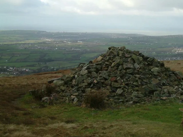
Dent
Natural landmarks · 2.8 km
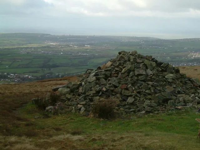
Dent
Mountains & hills · 2.9 km

Meadley Reservoir
Reservoirs & lochs · 2.9 km
Nearby
📷 3Memorials & monuments · North West England
Cleator Moor War Memorial
Cleator Moor War Memorial — Grade II listed building-listed memorial in england-north-east, United Kingdom.
📷 5Hotels · North West England
Ennerdale Country House Hotel
Ennerdale Country House Hotel — a hotel in england north east.
📷 3Memorials & monuments · North West England
Cleator War Memorial
Cleator War Memorial — Grade II listed building-listed memorial in england-north-east, United Kingdom.
📷 3Memorials & monuments · North West England
Moor Row and Scalegill War Memorial
Moor Row and Scalegill War Memorial — Grade II listed building-listed memorial in england-north-east, United Kingdom.
📷 5Mountains & hills · North West England
Kinniside Cop
Kinniside Cop — mountain in england north east. Elevation: 180 m.
📷 5Where to eat & stay near Cleator Moor
Places to stay
📷 5Hotels · North West England
Ennerdale Country House Hotel
Ennerdale Country House Hotel — a hotel in england north east.
 📷 5
📷 5Hotels · North West England
Waverley Hotel
Waverley Hotel — a hotel in england north east.
 📷 5
📷 5B&Bs · North West England
Abbey Farm House
Abbey Farm House — a bed-and-breakfast in england north west.
 📷 5
📷 5Hostels · North West England
Scouts - Ennerdale Campsite
Scouts - Ennerdale Campsite — a hostel in england north east.
 📷 5
📷 5Caravan parks · North West England
Seacote Park (Beachcomber Site)
Seacote Park (Beachcomber Site) — a caravan park in england north west.
 📷 5
📷 5Places to eat & drink
 📷 5
📷 5Historic pubs · North West England
Fox and Grapes
Fox and Grapes in England North West, United Kingdom.
 📷 7
📷 7Cafés · North West England
Grange Bridge Cottage
Grange Bridge Cottage — a café in england north east.
 📷 7
📷 7Historic pubs · North West England
The Pheasant Inn
The Pheasant Inn in Scotland Lowlands, United Kingdom.
More museums in this region
 📷 3
📷 3Museums · North West England
Cube Gallery
Cube Gallery — former architecture museum in Manchester, England.
 📷 3
📷 3Museums · North West England
Cuckooland Museum
Cuckooland Museum — horological museum in England, UK.
 📷 4
📷 4Museums · North West England
Elizabeth Gaskell's House
Elizabeth Gaskell's House — museum in Manchester.
 📷 3
📷 3Museums · North West England
Englesea Brook Chapel and Museum of Primitive Methodism
Englesea Brook Chapel and Museum of Primitive Methodism — Primitive Methodist chapel and museum, United Kingdom.
Frequently asked questions
- Where is Cleator Moor?
- Cleator Moor is in North-West England, United Kingdom (postcode CA25 5LD), in the parish of Cleator Moor.
- What is Cleator Moor?
- Cleator Moor is a town and civil parish in the Cumberland district of Cumbria, England. The parish was historically called Cleator. During the Industrial Revolution in the 19th century, the new settl
- How do I get to Cleator Moor?
- The nearest railway station is Corkickle, about 5.1 km away. The nearest town is St Bees. Drivers can use postcode CA25 5LD.
- Is Cleator Moor a protected site?
- Yes — Cleator Moor is part of the River Derwent and Tributaries SSSI Site of Special Scientific Interest and the River Ehen (Ennerdale Water to Keekle Confluence) SSSI Site of Special Scientific Interest.
- How do I get to Cleator Moor?
- The nearest railway station is Corkickle, about 5.1 km away. Drivers can navigate to postcode CA25 5LD.