Other places · Yorkshire & the Humber
Clayton, Manchester
In or near Manchester.
Clayton, Manchester — a other in england-west-midlands, United Kingdom.

Stephen Richards — CC BY-SA 2.0 via Wikimedia Commons licence
Plan your visit
- Typical visit
- 1 h–2 h
- Nearest railway station
- Ashburys · 1.9 km
- Free entry
- Wheelchair accessible
About
Clayton, Manchester is a other in england-west-midlands, United Kingdom, listed in the Wikipedia register of British heritage and tourism sites. See the linked Wikipedia article for full details.
Photo gallery
Official information
Clayton Hall is a living history museum that offers visitors a glimpse into the past with hands-on experiences in its Victorian rooms. The site features regular history talks and is run entirely by volunteers, making it a community-focused attraction.
Place summary
Clayton is an area located in Manchester, within the West Midlands. It is known for its industrial heritage and residential developments, reflecting the region's historical significance in the textile industry.
AI-generated from the structured facts on this page (operator, designation, listing, era). Not a substitute for visiting.
Background
History
Historically in Lancashire, Clayton takes its name from the Clayton family who owned large parts of land around the area, including Clayton Vale, through which the River Medlock flows, separating Clayton from Newton Heath. Clayton was under the township of Droylsden until around 1890 when alterations to the Manchester boundary took place. Other towns added to Manchester around this time were Blackley, Crumpsall, Moston, Openshaw and Gorton. In 1894 Clayton became a separate civil parish, being formed from the part of the parish of Droylsden in the County Borough of Manchester, on 26 March 1896 the parish was abolished to form North Manchester.
Sourced from Wikipedia under CC BY-SA 4.0.
- Coordinates
- 53.4853, -2.1783
- District
- Manchester
- Parish
- Manchester, unparished area
- Postcode
- M11 4TX
- Parliamentary constituency
- Manchester Central
- Nearest railway station
- Ashburys — 1.9 km
- Official site
- claytonhall.org
Sources
- wikipedia: Clayton, Manchester (CC BY-SA 4.0)
Other places nearby

Clayton Hall
Museums · 0.2 km

Bridge Over Moat To Clayton Hall
Historic bridges · 0.3 km
Church of St Cross, Clayton
Historic churches · 0.3 km

ABC Ashton New Road
Theatres · 0.5 km

Stockport Branch Canal
Canals · 0.6 km

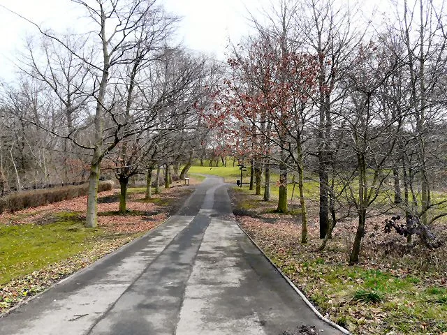
Clayton Vale
Gardens · 0.7 km

Carlton Super Cinema
Theatres · 0.9 km
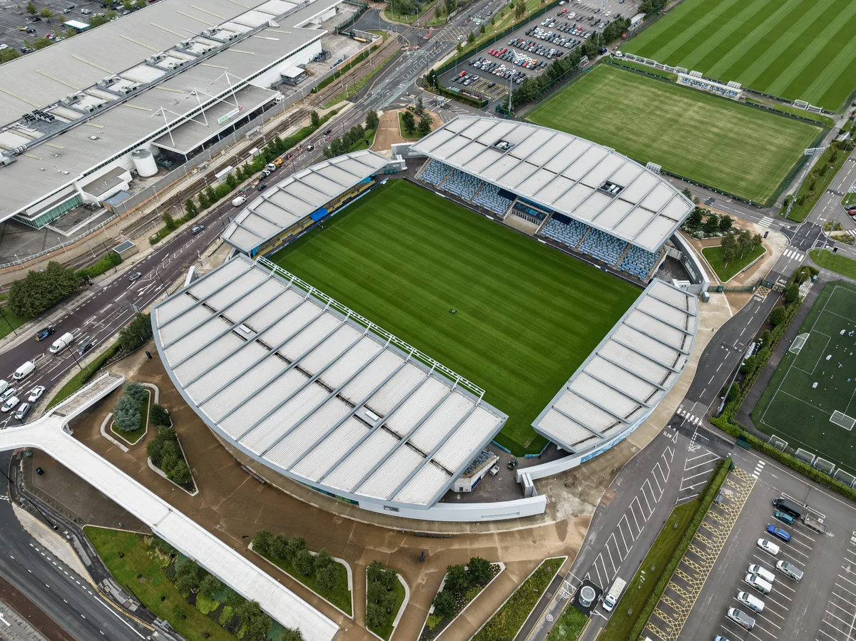
Academy Stadium
Stadiums · 1.1 km

Philips Park Cemetery
Cemeteries · 1.1 km
Philips Park
Parks · 1.2 km

B of the Bang
Public art & sculpture · 1.2 km

Bradford Pit Memorial
Memorials & monuments · 1.2 km
Nearby
📷 3Museums · Yorkshire & the Humber
Clayton Hall
Clayton Hall — a museum in england-west-midlands, United Kingdom.
📷 3Historic bridges · Yorkshire & the Humber
Bridge Over Moat To Clayton Hall
Bridge Over Moat To Clayton Hall — Grade II listed building-listed bridge in england-west-midlands, United Kingdom.
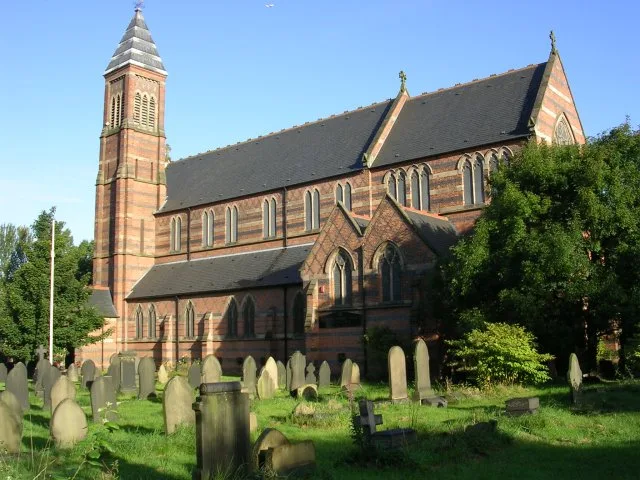
📷 3Historic churches · Yorkshire & the Humber
Church of St Cross, Clayton
Church of St Cross, Clayton — church in Manchester, UK.
📷 5Theatres · Yorkshire & the Humber
ABC Ashton New Road
ABC Ashton New Road — a cinema heritage in england-west-midlands, United Kingdom.
📷 3Canals · Yorkshire & the Humber
Stockport Branch Canal
Stockport Branch Canal — former canal in Manchester, England.
📷 3Gardens · Yorkshire & the Humber
Clayton Vale
Clayton Vale — valley in Clayton, Manchester, England, UK.
Where to eat & stay near Clayton, Manchester
Places to stay
 📷 5
📷 5Hostels · North West England
Hatters Hostel
Hatters Hostel — a hostel in england west midlands.
 📷 5
📷 5Hotels · North West England
DoubleTree by Hilton Hotel Manchester - Piccadilly
DoubleTree by Hilton Hotel Manchester - Piccadilly — a hotel in england west midlands. 4-star. Brand: DoubleTree.
 📷 5
📷 5Hostels · North West England
Malacuna
Malacuna — a hostel in england west midlands.
 📷 5
📷 5Hotels · North West England
Whitworth Locke, Civic Quarter
Whitworth Locke, Civic Quarter — a hotel in england west midlands. Brand: Locke.
 📷 7
📷 7Hotels · North West England
Maldron Hotel Manchester City Centre
Maldron Hotel Manchester City Centre — a hotel in england west midlands. 4-star. Brand: Maldron Hotels.
 📷 5
📷 5Hotels · North West England
King Street Townhouse
King Street Townhouse — a hotel in england west midlands. 4-star. Brand: Eclectic Hotels.
Places to eat & drink
 📷 7
📷 7Historic pubs · North West England
The Plough, Gorton
The Plough, Gorton in England North West, United Kingdom.
 📷 5
📷 5Historic pubs · North West England
The Star and Garter
The Star and Garter in England North West, United Kingdom.
 📷 7
📷 7Historic pubs · North West England
Crown And Kettle Public House
Crown And Kettle Public House in England North West, United Kingdom.
 📷 7
📷 7Historic pubs · North West England
Marble Arch Inn
Marble Arch Inn in England North West, United Kingdom.
 📷 5
📷 5Historic pubs · North West England
The Brunswick Hotel
The Brunswick Hotel in England North West, United Kingdom.
 Flagship📷 3
Historic pubs · North West England
The Marble Arch Inn
Manchester's 1888 pub with a sloping mosaic floor and 100% surviving interior.
More places in this region
_Brill.jpg?width=1200) 📷 3
📷 3Other places · Yorkshire & the Humber
Brill
Brill is a place of interest in the United Kingdom.
 📷 3
📷 3Other places · Yorkshire & the Humber
Cod
Cod is a place of interest in the United Kingdom.
 📷 3
📷 3Other places · Yorkshire & the Humber
Doncaster Market
Doncaster Market is a place of interest in the United Kingdom.
_Electric_Eel.jpg?width=1200) 📷 3
📷 3Other places · Yorkshire & the Humber
Electric Eel
Electric Eel is a place of interest in the United Kingdom.
Frequently asked questions
- Where is Clayton, Manchester?
- Clayton, Manchester is in the West Midlands, United Kingdom (postcode M11 4TX), in the parish of Manchester, unparished area.
- What is Clayton, Manchester?
- Clayton, Manchester — a other in england-west-midlands, United Kingdom.
- How do I get to Clayton, Manchester?
- The nearest railway station is Ashburys, about 1.9 km away. Drivers can use postcode M11 4TX.
- How do I get to Clayton, Manchester?
- The nearest railway station is Ashburys, about 1.9 km away. Drivers can navigate to postcode M11 4TX.