Mountains & hills · North West England
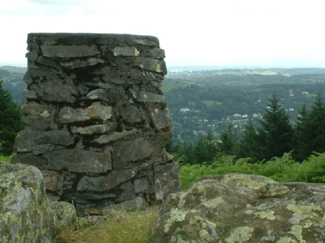
Claife Heights
In or near Hawkshead.
Claife Heights — Named summit at 270 m.

Wikimedia Commons contributors — see linked file page for photographer and licence licence
Plan your visit
- Typical visit
- 3 h–8 h
- Best time of year
- Late spring – early autumn (May–Oct)
- Nearest railway station
- Windermere · 3.4 km
- Free entry
- Dog-friendly
Getting there & planning your visit
To visit Claife Heights, the nearest railway station is Windermere, located 3.4 km away. Entry is free, and the postcode for sat-nav is LA22 0LR.
About
Claife Heights is a named summit in the United Kingdom. Wikidata describes it as: "Named summit at 270 m.". Coordinates: 54.3679°, -2.9526°.
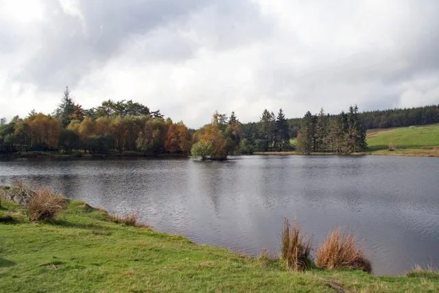
Photo gallery
Protected designations
- Site of Special Scientific Interest: Claife Tarns and Mires SSSI
- Site of Special Scientific Interest: River Eden and Tributaries SSSI
Designations sourced from Natural England open data under OGL v3.
From the Wikipedia article
Claife Heights is an upland area in the Lake District, near to Windermere in Cumbria, England. It has a topographic prominence of 177 metres (581 ft) so is classified as a Marilyn (a hill with prominence of at least 150m). It is the subject of a chapter of Wainwright's book The Outlying Fells of Lakeland. He describes a clockwise circuit starting at Far Sawrey and passing Moss Eccles Tarn. He says "Claife Heights is delightful. It was more so before forestry curtailed walking and restricted the views." and describes it as "No definite summit. Highest parts about 900ft."
Excerpt from Wikipedia under CC BY-SA 4.0. See the source article linked in Sources below.
- Coordinates
- 54.3679, -2.9526
- District
- Westmorland and Furness
- Parish
- Claife
- Postcode
- LA22 0LR
- Parliamentary constituency
- Westmorland and Lonsdale
- Nearest railway station
- Windermere — 3.4 km
Sources
- osm: n5785216870 (ODbL)
- wikipedia: Claife Heights (CC BY-SA 4.0)
- commons: Claife Heights - geograph.org.uk - 7938.jpg (CC BY-SA 4.0)
Other places nearby
Claife Heights
Natural landmarks · 0.0 km

High Pate Crag
Mountains & hills · 0.3 km

Strawberry Gardens
Caravan parks · 0.6 km

Seavy Mire Hill
Mountains & hills · 0.6 km

Scale Head
Mountains & hills · 0.7 km

Scale Ivy
Mountains & hills · 0.9 km
Moss Eccles Tarn
Natural landmarks · 1.1 km

Windermere
Natural landmarks · 1.3 km

Windermere
Lakes · 1.3 km
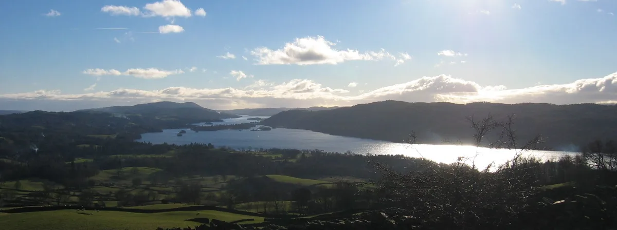
Windermere
Natural landmarks · 1.5 km

Wilson Knott
Mountains & hills · 1.6 km

Windermere Way
Military museums · 1.7 km
Nearby
📷 3Natural landmarks · North West England
Claife Heights
Claife Heights — mountain in United Kingdom.
📷 5Mountains & hills · North West England
High Pate Crag
High Pate Crag — mountain in england north west. Elevation: 254 m.
📷 5Caravan parks · North West England
Strawberry Gardens
Strawberry Gardens — a caravan park in england north west.
📷 5Mountains & hills · North West England
Seavy Mire Hill
Seavy Mire Hill — mountain in england north west. Elevation: 220 m.
📷 5Mountains & hills · North West England
Scale Head
Scale Head — mountain in england north west. Elevation: 253 m.
📷 5Mountains & hills · North West England
Scale Ivy
Scale Ivy — mountain in england north west. Elevation: 229 m.
Where to eat & stay near Claife Heights
Places to stay
📷 5Caravan parks · North West England
Strawberry Gardens
Strawberry Gardens — a caravan park in england north west.
 📷 5
📷 5Caravan parks · North West England
Fallbarrow Holiday Park
Fallbarrow Holiday Park — a caravan park in england north west. Brand: Parkdean Resorts.
 📷 5📷 7
 📷 5
📷 5Hotels · North West England
The Belsfield
The Belsfield — a hotel in england north west.
 📷 7
📷 7B&Bs · North West England
Laurel Cottage
Laurel Cottage — a bed-and-breakfast in england north west.
Places to eat & drink
 📷 7
📷 7Cafés · North West England
Joey's Cafe
Joey's Cafe — a café in england north west.
 📷 7
📷 7Historic pubs · North West England
Hole in t'Wall public house, With Attached Buildings To South
Hole in t'Wall public house, With Attached Buildings To South in England North West, United Kingdom.
 📷 5
📷 5Historic pubs · North West England
Sun Cottage Sun Inn Public House
Sun Cottage Sun Inn Public House in England North West, United Kingdom.
 📷 5
📷 5Historic pubs · North West England
Holbeck Ghyll
Holbeck Ghyll in England North West, United Kingdom.
📷 5Restaurants · North West England
Holbeck Ghyll Restaurant
Holbeck Ghyll Restaurant — a restaurant in england north west.
 📷 4
📷 4Restaurants · North West England
Holbeck Ghyll
Holbeck Ghyll is a restaurant located in Windermere, Cumbria, England. "The late 19th century building was once Lord Lonsdale's hunting lodge and only became a hotel in the 1970s. It won a Michelin st
More mountains in this region
 📷 5
📷 5Mountains & hills · North West England
Appleton Park
Appleton Park — a hill or mountain in england west midlands.
 📷 5
📷 5Mountains & hills · North West England
High Warren
High Warren — mountain in england west midlands. Elevation: 105 m.
 📷 5
📷 5Mountains & hills · North West England
Alderley Edge
Alderley Edge — mountain in england west midlands. Elevation: 194 m.
 📷 3
📷 3Frequently asked questions
- Where is Claife Heights?
- Claife Heights is in North-West England, United Kingdom (postcode LA22 0LR), in the parish of Claife.
- What is Claife Heights?
- Claife Heights — Named summit at 270 m.
- How do I get to Claife Heights?
- The nearest railway station is Windermere, about 3.4 km away. Drivers can use postcode LA22 0LR.
- Is Claife Heights a protected site?
- Yes — Claife Heights is part of the Claife Tarns and Mires SSSI Site of Special Scientific Interest and the River Eden and Tributaries SSSI Site of Special Scientific Interest.
- Is Claife Heights free to visit?
- Yes, Claife Heights is free to enter.
- How do I get to Claife Heights?
- The nearest railway station is Windermere, about 3.4 km away. Drivers can navigate to postcode LA22 0LR.