
Historic churches · East of England
City of Peterborough
In or near Peterborough.
The City of Peterborough, is a district with city status in the ceremonial county of Cambridgeshire, England. The district is named after its largest settlement, Peterborough, but also covers a wider

Stephen Craven — CC BY-SA 2.0 via Wikimedia Commons licence
_-_geograph.org.uk_-_5027834.jpg)
Plan your visit
- Typical visit
- 30 min–1 h
- Nearest railway station
- Peterborough · 0.5 km
- Free entry
Getting there & planning your visit
To visit the City of Peterborough, you can take a train to Peterborough station, which is 0.5 km away. Entry to the site is free. The postcode for sat-nav is PE1 1XH.
About
The City of Peterborough, is a district with city status in the ceremonial county of Cambridgeshire, England. The district is named after its largest settlement, Peterborough, but also covers a wider area of outlying villages and hamlets. The district is administered by Peterborough City Council, a unitary authority. The district's area covers parts of the historic counties of Northamptonshire and Huntingdonshire, as well as a small part of Cambridgeshire. In 1965, the area became part of the short-lived county of Huntingdon and Peterborough before becoming a district of Cambridgeshire in 1974. Located in the East Anglia region of England, the area borders the surrounding counties of Lincolnshire and Northamptonshire. The population of the district was 202,259 making it the second-largest district by population in East Anglia (after East Suffolk). Most of the contemporary district was formerly part of the Soke of Peterborough, a liberty within the historic county of Northamptonshire. Between 1889 and 1965, Peterborough was governed by the Soke of Peterborough County Council, making the Soke of Peterborough a completely autonomous, self-governing part of Northamptonshire, while the rest of that county was governed by Northamptonshire County Council. Today, the City of Peterborough district holds a similar status as part of Cambridgeshire to that which the Soke of Peterborough had as part of Northamptonshire, in that the contemporary district is a Unitary Authority with its own
Photo gallery
See it from the streetimagery from 2019
Imagery © Mapillary contributors, CC BY-SA 4.0
Official information
Peterborough's new war memorial is located on Bridge Street and was dedicated during a ceremony attended by veterans. The memorial, made of Ancaster white limestone, was funded by public donations and serves as a prominent tribute to the city's veterans.
From the Wikipedia article
The City of Peterborough, is a district with city status in the ceremonial county of Cambridgeshire, England. The district is named after its largest settlement, Peterborough, but also covers a wider area of outlying villages and hamlets. The district is administered by Peterborough City Council, a unitary authority. The district's area covers parts of the historic counties of Northamptonshire and Huntingdonshire, as well as a small part of Cambridgeshire. In 1965, the area became part of the short-lived county of Huntingdon and Peterborough before becoming a district of Cambridgeshire in 1974. Located in the East Anglia region of England, the area borders the surrounding counties of Lincolnshire and Northamptonshire. The population of the district was 202,259 making it the second-largest district by population in East Anglia (after East Suffolk). Most of the contemporary district was formerly part of the Soke of Peterborough, a liberty within the historic county of Northamptonshire. Between 1889 and 1965, Peterborough was governed by the Soke of Peterborough County Council, making the Soke of Peterborough a completely autonomous, self-governing part of Northamptonshire, while the rest of that county was governed by Northamptonshire County Council. Today, the City of Peterborough district holds a similar status as part of Cambridgeshire to that which the Soke of Peterborough had as part of Northamptonshire, in that the contemporary district is a Unitary Authority with its own council, and a self-governing part of Cambridgeshire while the rest of that county is governed by Cambridgeshire County Council. Peterborough was a Saxon settlement during the Anglo-Saxon era. The district also includes outlying villages such as Thorney, Old Fletton, Werrington, Parnwell, Dogsthorpe, Eye Green, Glinton, Northborough, Maxey, Wittering, Wansford and Ailsworth. The district borders North Northamptonshire, Huntingdonshire, Fenland, South Kesteven and South Holland.
Excerpt from Wikipedia under CC BY-SA 4.0. See the source article linked in Sources below.
- Coordinates
- 52.5725, -0.2431
- District
- Peterborough
- Parish
- Peterborough, unparished area
- Postcode
- PE1 1XH
- Parliamentary constituency
- Peterborough
- Nearest railway station
- Peterborough — 0.5 km
Sources
- wikipedia: City of Peterborough (CC BY-SA 4.0)
Other places nearby
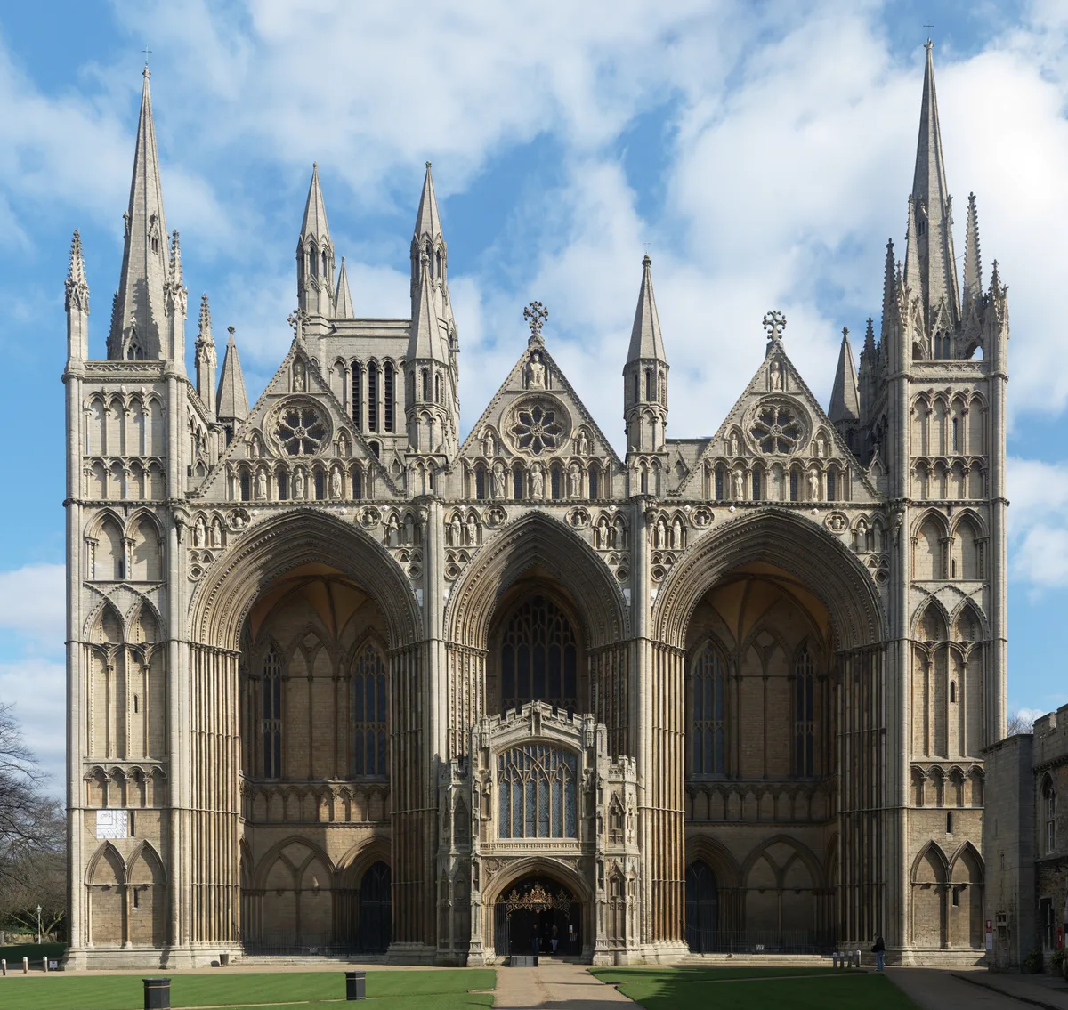
Peterborough
Towns & cities · 0.0 km

Church of St John the Baptist, Peterborough
Historic churches · 0.1 km

Chapel Of St Thomas Of Canterbury
Chapels · 0.1 km

Bridge Street War Memorial
Memorials & monuments · 0.1 km

Deanery Gateway And Wall
Historic houses · 0.2 km

City Cinema
Theatres · 0.2 km
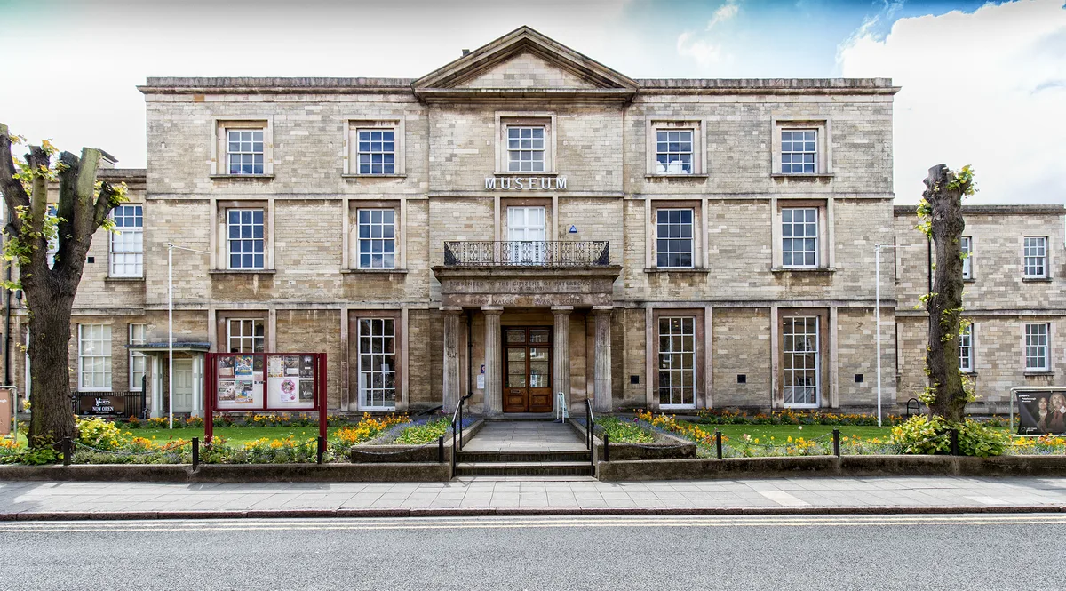
Peterborough Museum and Art Gallery
Galleries · 0.2 km

Peterborough Cathedral
Cathedrals · 0.2 km

Park Inn
Hotels · 0.2 km

The Bull Hotel
Historic houses · 0.2 km

Garden Wall And Gates To Laurel Court
Gardens · 0.2 km

Hostry Passage And Little Dorter
Historic houses · 0.3 km
Nearby
Flagship📷 10Towns & cities · East of England
Peterborough
Peterborough — cathedral city in Cambridgeshire, England.
Flagship📷 5Historic churches · East of England
Church of St John the Baptist, Peterborough
Church of St John the Baptist, Peterborough — a Grade I-listed church in england-london, United Kingdom.
📷 5Chapels · East of England
Chapel Of St Thomas Of Canterbury
Chapel Of St Thomas Of Canterbury — Grade I listed chapel in Peterborough, Cambridgeshire, England, UK.
📷 5Memorials & monuments · East of England
Bridge Street War Memorial
Bridge Street War Memorial — War memorial, dating to 2012-06-25.
📷 5Historic houses · East of England
Deanery Gateway And Wall
Deanery Gateway And Wall — a Grade I-listed historic house in england-london, United Kingdom.
📷 3Where to eat & stay near City of Peterborough
Places to stay
📷 7 📷 5
📷 5Campsites · East of England
Ferry Meadows
Ferry Meadows — a campsite in england london.
 📷 5📷 5
 📷 5
📷 5Campsites · East of England
Lakeview Campsite
Lakeview Campsite — a campsite in england london.
📷 5Campsites · East of England
Glade Campsite
Glade Campsite — a campsite in england london.
Places to eat & drink
 📷 5
📷 5Restaurants · East of England
The Banyan Tree
The Banyan Tree — a restaurant in england london.
 📷 5
📷 5 📷 5
📷 5 📷 7
📷 7Historic pubs · East of England
Prince Of Wales Feathers
Prince Of Wales Feathers in England East, United Kingdom.
 📷 7
📷 7Historic pubs · East of England
Wheatsheaf Public House
Wheatsheaf Public House in England East, United Kingdom.
 📷 5
📷 5Historic pubs · East of England
The Blue Bell Public House
The Blue Bell Public House in England East, United Kingdom.
More places in this region
 📷 5
📷 5Historic churches · East of England
All Saints Church
All Saints Church — church on Jesus Lane in central Cambridge, England.
 📷 5
📷 5Historic churches · East of England
All Saints Church, Conington
All Saints Church, Conington — church in Conington, Huntingdonshire, Cambridgeshire, England, UK.
 📷 5
📷 5Historic churches · East of England
All Saints Church, Vange
All Saints Church, Vange — church in Basildon, Essex, England, UK.
 📷 5
📷 5Historic churches · East of England
All Saints Parish Church, Kirtling
All Saints Parish Church, Kirtling — church in East Cambridgeshire, England, UK.
Frequently asked questions
- Where is City of Peterborough?
- City of Peterborough is in East of England, United Kingdom (postcode PE1 1XH), in the parish of Peterborough, unparished area.
- What is City of Peterborough?
- The City of Peterborough, is a district with city status in the ceremonial county of Cambridgeshire, England. The district is named after its largest settlement, Peterborough, but also covers a wider
- How do I get to City of Peterborough?
- The nearest railway station is Peterborough, about 0.5 km away. The nearest town is Peterborough. Drivers can use postcode PE1 1XH.
- Who owns City of Peterborough?
- City of Peterborough is owned by Peterborough City Council.
- Is City of Peterborough free to visit?
- Yes, City of Peterborough is free to enter.
- How do I get to City of Peterborough?
- The nearest railway station is Peterborough, about 0.5 km away. Drivers can navigate to postcode PE1 1XH.