
Historic churches · South East England
Church of St Peter, Manningford Bruce
In or near Bottlesford.
Church of St Peter, Manningford Bruce — church in Manningford Bruce, Wiltshire, England, UK.

Wikimedia Commons contributors — see linked file page for photographer and licence licence

Plan your visit
- Typical visit
- 30 min–1 h
- Nearest railway station
- Pewsey · 3.1 km
- Free entry
Getting there & planning your visit
The Church of St Peter in Manningford Bruce is located in Wiltshire, with the nearest railway station being Pewsey, approximately 3.1 km away. Entry to the church is free, and it is accessible to visitors. The postcode for sat-nav is SN9 6JW.
About
Church of St Peter, Manningford Bruce is a parish church in South-East England. Officially recognised as Grade I listed building. The site is within the Cotswolds National Landscape (AONB), and is a designated Site of Special Scientific Interest. The nearest railway station is Pewsey, about 3.1 km away.
Photo gallery
Heritage listing
Details MANNINGFORD MANNINGFORD BRUCE SU 15 NW 2/86 Church of St. Peter 27.5.64 I Anglican parish church on site of Roman building. Early C12, C13 and C15, restored 1882 by J.L. Pearson. Romanesque work in coursed herringbone flint, with limestone quoining, later work random flint. C19 lead roofs, replaced by tile over nave. Nave, apsidal chancel, and south porch. Nave has one C12 window on north, and chancel two, single splayed with flush voussoirs, the outer arris slightly chamfered. No east window. West window C13, three-light bar tracery. C15 two-light windows inserted to south side of nave and chancel. Limestone quoins at springing of apse. Nave and chancel reroofed to steep pitch in 1882 and south porch rebuilt in C14 style. Over west end of nave, lead covered belltower with pyramidal roof and open traceried gallery. Interior: Simple Romanesque 2-cell structure, the nave 5.73m x 10.25m, walls 1.02m thick. Wide chancel arch with 2 rings of voussoirs, interlocked 'V'-wise towards nave only. Tall north and south doors, with taller rere-arches, also without decoration. C19 wagon roof. Chancel with two aumbries. Barrel vault C19, boarded in parquet fashion and semi-dome over apse. Walls painted by Clayton & Bell, the upper parts outlined as ashlar in C14 style, perhaps restoring original. Two glass windows also by Clayton & Bell. Fittings: Font, C19 square, in Romanesque style. Pulpit c1920. Pews and stalls by Pearson. Painted reredos designed by Pearson, executed by Clayton & Bell. C19 iron openwork sanctuary rail. South door to nave boarded and cross battened with iron banding on face, probably C12 rehung in C19. Organ, early C19 in later case. Monuments: In chancel 3 wall tablets on north side, white marble: from east (a) coloured arms over segmental pediment on fra
From the Historic England List Entry under OGL v3.
Official information
The Church of St Peter in Manningford Bruce is an ancient Norman church with historical significance, featuring elements from the Saxon period. Visitors can explore its thick walls, original wooden door, and the churchyard where burials continue among listed tombs.
Protected designations
- Site of Special Scientific Interest: River Avon System SSSI
- Area of Outstanding Natural Beauty: Cotswolds
- Area of Outstanding Natural Beauty: North Wessex Downs
Designations sourced from Natural England open data under OGL v3.
Place summary
The Church of St Peter is located in Manningford Bruce, South-East England. This Grade I listed building is part of the River Avon System SSSI and lies within the Cotswolds and North Wessex Downs Areas of Outstanding Natural Beauty.
AI-generated from the structured facts on this page (operator, designation, listing, era). Not a substitute for visiting.
- Coordinates
- 51.3212, -1.8010
- District
- Wiltshire
- Parish
- Manningford
- Postcode
- SN9 6JW
- Parliamentary constituency
- East Wiltshire
- Nearest railway station
- Pewsey — 3.1 km
- Official site
- www.themanningfords.co.uk
Sources
- wikidata: Q17529925 (CC0)
- commons: St Peters Church, Manningford Bruce-geograph.org.uk-4221915.jpg (CC BY-SA 4.0)
Other places nearby

Manningford Bohune
Villages · 0.4 km

Manningford Bruce
Villages · 0.4 km

Manningford Abbots
Villages · 0.5 km

Fowle Monument In Churchyard, 12 Metres South East Of Chancel Of Village Church
Memorials & monuments · 0.7 km

Melcock Monument In Churchyard, 9 Metres South Of Nave, Church Of St James
Memorials & monuments · 1.0 km
Cliff Monument In Churchyard, 15 Metres South Of Nave, Church Of St James
Memorials & monuments · 1.0 km

The Woodbridge Camp SIte
Campsites · 1.1 km

Denny Sutton Hipend
Mountains & hills · 1.8 km
_-_geograph.org.uk_-_5357180.jpg?width=1200)
Sharcott Manor House
Historic houses · 1.8 km
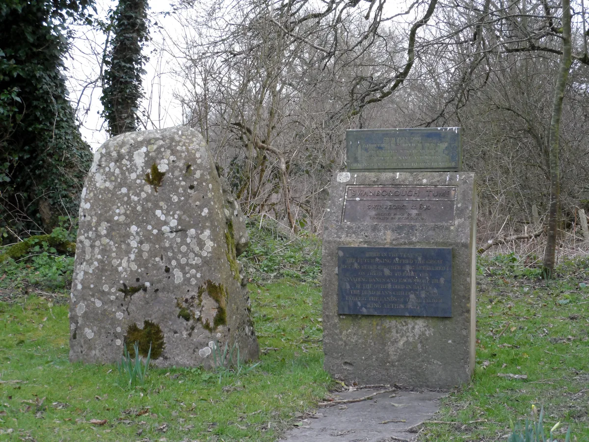
Swanborough Tump
Archaeological sites · 2.3 km

Rushall Manor Park Bridge
Historic bridges · 2.3 km

Upavon Hill
Mountains & hills · 2.4 km
Nearby
📷 5Villages · South East England
Manningford Bohune
Manningford Bohune — a village in england south east.
📷 5📷 5Villages · South East England
Manningford Abbots
Manningford Abbots — a village in england south east.
📷 5Memorials & monuments · South East England
Fowle Monument In Churchyard, 12 Metres South East Of Chancel Of Village Church
Fowle Monument In Churchyard, 12 Metres South East Of Chancel Of Village Church — Grade II listed building-listed memorial in england-south-east, United Kingdom.
📷 5Memorials & monuments · South East England
Melcock Monument In Churchyard, 9 Metres South Of Nave, Church Of St James
Melcock Monument In Churchyard, 9 Metres South Of Nave, Church Of St James — Grade II listed building-listed memorial in england-south-east, United Kingdom.
📷 5Memorials & monuments · South East England
Cliff Monument In Churchyard, 15 Metres South Of Nave, Church Of St James
Cliff Monument In Churchyard, 15 Metres South Of Nave, Church Of St James — Grade II listed building-listed memorial in england-south-east, United Kingdom.
Where to eat & stay near Church of St Peter, Manningford Bruce
Places to stay
📷 5Campsites · South East England
The Woodbridge Camp SIte
The Woodbridge Camp SIte — a campsite in england south east.
 📷 5
📷 5Caravan parks · South East England
Charlton Manor
Charlton Manor — a caravan park in england south east.
 📷 5
📷 5B&Bs · South West England
Puckshipton House
Puckshipton House — a bed-and-breakfast in england south east.
 📷 5
📷 5Campsites · South East England
Totteridge Farm
Totteridge Farm — a campsite in england south east.
 📷 5
📷 5Campsites · South East England
The Bruce Arms Campsite
The Bruce Arms Campsite — a campsite in england south east.
 📷 5
📷 5Places to eat & drink
 📷 7
📷 7Cafés · South East England
St Peter's and St Paul's
St Peter's and St Paul's — a café in england south east.
 📷 7
📷 7 📷 7
📷 7Historic pubs · South West England
The Queens Head Inn
The Queens Head Inn in England South West, United Kingdom.
 📷 5
📷 5 📷 7
📷 7Historic pubs · South West England
Black Swan Hotel
Black Swan Hotel in England South West, United Kingdom.
 📷 5
📷 5More places in this region
 📷 5
📷 5Historic churches · South East England
All Saints Church, Frindsbury
All Saints Church, Frindsbury — church in Medway, UK.
 📷 5
📷 5Historic churches · South East England
All Saints Church, Maidstone
All Saints Church, Maidstone — parish church associated with the Archbishop's Palace, Maidstone, Kent, England, UK.
 📷 5
📷 5Historic churches · South East England
All Saints Church, West Farleigh
All Saints Church, West Farleigh — Grade I listed church in West Farleigh, Maidstone, Kent, England, UK.
 📷 5
📷 5Historic churches · South East England
All Souls' Church, Sutton Green
All Souls' Church, Sutton Green — church in Guildford, England.
Frequently asked questions
- Where is Church of St Peter, Manningford Bruce?
- Church of St Peter, Manningford Bruce is in South-East England, United Kingdom (postcode SN9 6JW), in the parish of Manningford.
- What is Church of St Peter, Manningford Bruce?
- Church of St Peter, Manningford Bruce — church in Manningford Bruce, Wiltshire, England, UK.
- How do I get to Church of St Peter, Manningford Bruce?
- The nearest railway station is Pewsey, about 3.1 km away. Drivers can use postcode SN9 6JW.
- Is Church of St Peter, Manningford Bruce a listed building?
- Church of St Peter, Manningford Bruce is officially recognised as Grade I listed building listed.
- Is Church of St Peter, Manningford Bruce a protected site?
- Yes — Church of St Peter, Manningford Bruce is part of the River Avon System SSSI Site of Special Scientific Interest and the Cotswolds National Landscape (AONB).
- Is Church of St Peter, Manningford Bruce free to visit?
- Yes, Church of St Peter, Manningford Bruce is free to enter.
- How do I get to Church of St Peter, Manningford Bruce?
- The nearest railway station is Pewsey, about 3.1 km away. Drivers can navigate to postcode SN9 6JW.