
Historic churches · South Wales
Church of St Mary, Angle
In or near Johnston.
Church of St Mary, Angle — Grade II listed building-listed church in wales-south, United Kingdom.

Basher Eyre — CC BY-SA 2.0 via Wikimedia Commons licence

Plan your visit
- Typical visit
- 30 min–1 h
- Nearest railway station
- Milford Haven · 4.8 km
- Free entry
Getting there & planning your visit
To visit the Church of St Mary in Angle, the nearest railway station is Milford Haven, located 4.8 km away. The postcode for the church is SA71 5AP, which you can use for sat-nav coordinates. Entry to the church is free.
About
Church of St Mary, Angle is a Grade II listed building-listed church in wales-south, United Kingdom, registered on the Cadw register of listed buildings (Wales) (entry 5921). Listed status protects buildings and structures of special architectural or historic interest. See the linked Wikipedia article for further details.
Photo gallery
Heritage listing
History: Mediaeval W tower. Most of the original church was demolished in the early C19. The present nave, chancel, transept, vestry and porch are by R K Penson, 1853. Part of N wall of nave is mediaeval. Exterior: The tower has a pointed vault at 1st floor level which opens into the nave. Domed and tiled tower roof with corbelled and crenellated parapet. Stairs turret at SW corner with a slight projection at each face. The entrance to the stairs from within the tower is about 1.4 m below the present floor level. The W window in the tower at ground storey is of late mediaeval type with an irregular hood mould and cinquefoil light heads, much restored. There is a blocked W door opening beneath. Belfry openings with stone louvres. The church was rebuilt in Early English and Decorated styles. The external masonry is generally in uncoursed ashlar, but the N elevation is in a rougher technique to blend with the retained mediaeval masonry in part of N nave wall. Red tile roof, some recently relaid. Interior: Mirehouse family memorials are in the nave. Some older memorials of other families were found in fragments, repaired and installed in the N transept after the rebuilding. Font of Norman cushion type, scraped.
From Cadw under OGL v3.
Place summary
The Church of St Mary is a Grade II listed building located in Angle, South Wales. It exemplifies the architectural heritage of the region.
AI-generated from the structured facts on this page (operator, designation, listing, era). Not a substitute for visiting.
- Coordinates
- 51.6843, -5.0880
- District
- Pembrokeshire
- Parish
- Angle
- Postcode
- SA71 5AP
- Parliamentary constituency
- Mid and South Pembrokeshire
- Nearest railway station
- Milford Haven — 4.8 km
Sources
- wikidata: Q29485275 (CC0)
Other places nearby

Angle Castle
Literary houses · 0.1 km

Monument to John Mirehouse
Memorials & monuments · 0.1 km

Pele Tower
Literary houses · 0.1 km
Castle Farm Camping
Campsites · 0.2 km

North Hill
Mountains & hills · 0.6 km

North Hill, Angle
Literary houses · 0.6 km
Chapel Bay
Natural landmarks · 0.9 km

Windmill adapted as machine-gun post
Windmills · 1.0 km

Chapel Bay Fort
Historic houses · 1.0 km

Chapel Bay Fort
Archaeological sites · 1.0 km
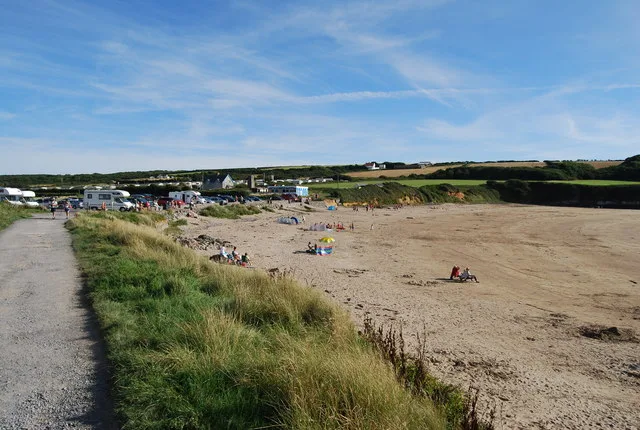
West Angle Bay
Beaches · 1.3 km

Angle Bay
Mountains & hills · 1.5 km
Nearby
📷 5📷 5Memorials & monuments · South Wales
Monument to John Mirehouse
Monument to John Mirehouse — Grade II listed building-listed memorial in wales-south, United Kingdom.
📷 5📷 5📷 5📷 5Literary houses · South Wales
North Hill, Angle
North Hill, Angle — a literary house museum in wales south.
Where to eat & stay near Church of St Mary, Angle
Places to stay
📷 5 📷 5
📷 5 📷 5
📷 5 📷 5
📷 5 📷 5
📷 5 📷 5
📷 5Places to eat & drink
 📷 5
📷 5
 📷 7
📷 7 📷 3
📷 3More places in this region
 📷 3
📷 3Historic churches · South Wales
All Saints Church, Wraxall
All Saints Church, Wraxall — church in Wraxall, North Somerset, England, UK.
 📷 4
📷 4Historic churches · South Wales
All Saints' Church
All Saints' Church — church in Oystermouth, Swansea, Wales.
 📷 3
📷 3Historic churches · South Wales
Bethania Presbyterian Church
Bethania Presbyterian Church — Calvinistic Methodist chapel in Aberdare.
 📷 3
📷 3Historic churches · South Wales
Bethel, Abernant
Bethel, Abernant — church in Rhondda Cynon Taf, UK.
Frequently asked questions
- Where is Church of St Mary, Angle?
- Church of St Mary, Angle is in South Wales, United Kingdom (postcode SA71 5AP), in the parish of Angle.
- What is Church of St Mary, Angle?
- Church of St Mary, Angle — Grade II listed building-listed church in wales-south, United Kingdom.
- How do I get to Church of St Mary, Angle?
- The nearest railway station is Milford Haven, about 4.8 km away. Drivers can use postcode SA71 5AP.
- Is Church of St Mary, Angle a listed building?
- Church of St Mary, Angle is officially recognised as Grade II listed building listed.
- Is Church of St Mary, Angle free to visit?
- Yes, Church of St Mary, Angle is free to enter.
- How do I get to Church of St Mary, Angle?
- The nearest railway station is Milford Haven, about 4.8 km away. Drivers can navigate to postcode SA71 5AP.