
Historic churches · South West England
Church of St Leonard and St Dilp
In or near Tamerton Foliot.
Church of St Leonard and St Dilp — Grade I listed building-listed church in england-south-west, United Kingdom.

Sarah Charlesworth — CC BY-SA 2.0 via Wikimedia Commons licence

Plan your visit
- Typical visit
- 30 min–1 h
- Nearest railway station
- Saltash · 2.8 km
- Free entry
Getting there & planning your visit
The Church of St Leonard and St Dilp is located in Cornwall, postcode PL12 6NG. The nearest railway station is Saltash, which is 2.8 km away. Entry to the church is free.
About
Church of St Leonard and St Dilp is a Grade I listed building-listed church in england-south-west, United Kingdom, registered on the National Heritage List for England (NHLE entry 1140179). Listed status protects buildings and structures of special architectural or historic interest. See the linked Wikipedia article for further details.
Photo gallery
Heritage listing
The Church of St Leonard and St Dilpe is a Grade I listed parish church in Landulph, a village in south-east Cornwall, England. The church was probably built in the 14th century on an earlier foundation and was enlarged in the 15th century with the addition of the tower, aisles, and south porch. It was restored in the late 19th century, when the nave roof was raised to form a clerestory.
From the Historic England List Entry under OGL v3.
Protected designations
- Site of Special Scientific Interest: Tamar-Tavy Estuary SSSI
- Area of Outstanding Natural Beauty: Tamar Valley
- Area of Outstanding Natural Beauty: Cornwall
Designations sourced from Natural England open data under OGL v3.
From the Wikipedia article
The Church of St Leonard and St Dilpe is a Grade I listed parish church in Landulph, a village in south-east Cornwall, England. The church was probably built in the 14th century on an earlier foundation and was enlarged in the 15th century with the addition of the tower, aisles, and south porch. It was restored in the late 19th century, when the nave roof was raised to form a clerestory.
Excerpt from Wikipedia under CC BY-SA 4.0. See the source article linked in Sources below.
Background
History
The church was likely built in the 14th century on the foundation of an earlier foundation. It stands in an oval churchyard of Celtic origin, known as a “lan,” near the River Tamar. The west tower was added in the early 15th century, and the north and south aisles, together with the south porch, were added in the late 15th century. The church is dedicated to St. Dilpe, possibly identified with St. Dylic, and to St. Leonard, whose dedication was added in the Middle Ages. The church was restored in the late 19th century, when the nave roof was rebuilt and raised to form a clerestory, and a vestry was added to the east of the south aisle.
Architecture
The church is built of stone with slate roofs, and consists of a nave and chancel in one continuous space, with a west tower, north and south aisles, and a south porch. The chancel has a 19th-century three-light east window in the Perpendicular style. The aisles retain 15th-century windows with cusped lights and tracery, and are supported by buttresses. The north aisle has four bays and the south aisle has five bays, with the south porch in the western bay. A projecting rood stair turret rises from the south side of the aisle. The gabled south porch has a moulded doorway with a four-centred arch. The inner doorway also has a four-centred arch with moulded details. The west tower is of three…
Sourced from Wikipedia under CC BY-SA 4.0.
- Coordinates
- 50.4324, -4.2104
- District
- Cornwall
- Parish
- Landulph
- Postcode
- PL12 6NG
- Parliamentary constituency
- South East Cornwall
- Established
- 1350
- Nearest railway station
- Saltash — 2.8 km
Sources
- wikidata: Q17529043 (CC0)
- wikipedia: Church of St Leonard and St Dilpe (CC BY-SA 4.0)
Other places nearby

Landulph
Historic churches · 0.1 km

Skinham Point
Viewpoints · 0.8 km

Warleigh Point
Viewpoints · 1.5 km

Warren Point
Viewpoints · 1.6 km

Moditonham Dovecote
Memorials & monuments · 1.8 km

Tavy Bridge
Historic bridges · 1.9 km

Martyn Monument
Memorials & monuments · 2.3 km

Warleigh House
Historic houses · 2.6 km

Cornish Cross
Public art & sculpture · 2.6 km

Burraton
Historic churches · 2.6 km

Saltash Heritage Museum
Museums · 2.6 km
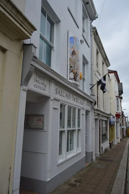
Saltash Heritage
Museums · 2.6 km
Nearby
📷 5Historic churches · South West England
Landulph
Landulph — a church in england-south-west, United Kingdom.
📷 3Viewpoints · South West England
Skinham Point
Skinham Point is a viewpoint in the United Kingdom.
📷 3Viewpoints · South West England
Warleigh Point
Warleigh Point is a viewpoint in the United Kingdom.
📷 3📷 3Memorials & monuments · South West England
Moditonham Dovecote
Moditonham Dovecote — a memorial in england-south-west, United Kingdom.
📷 5Historic bridges · South West England
Tavy Bridge
Tavy Bridge — a Grade II*-listed bridge in england-south-west, United Kingdom.
Where to eat & stay near Church of St Leonard and St Dilp
Places to stay
 📷 5
📷 5 📷 2
📷 2Campsites · South West England
Bush Farm Wild Campsite
Bush Farm Wild Campsite — a campsite in england south west.
 📷 5
📷 5
Campsites · South West England
Copper Pot Campsite
Copper Pot Campsite — a campsite in england south west.
 📷 5
📷 5B&Bs · South West England
The Cider House
The Cider House — a bed-and-breakfast in england south west.
 📷 5
📷 5Hostels · South West England
Plymouth Backpackers
Plymouth Backpackers — a hostel in england south west.
Places to eat & drink
 📷 5
📷 5Restaurants · South West England
Toby Carvery
Toby Carvery — a restaurant in england south west. Cuisine: british. Brand: Toby Carvery.
 📷 7
📷 7Historic pubs · South West England
The Lugger Public House
The Lugger Public House in England South West, United Kingdom.
 📷 5
📷 5Historic pubs · South West England
The Western Public House
The Western Public House in England South West, United Kingdom.
 📷 5
📷 5Historic pubs · South West England
The Bank Public House
The Bank Public House in England South West, United Kingdom.
 📷 5
📷 5Cafés · South West England
The Orangery
The Orangery — a café in england south west.
 📷 5
📷 5Historic pubs · South West England
Minerva Inn (Number 31)
Minerva Inn (Number 31) in England South West, United Kingdom.
More places in this region
 📷 5
📷 5Historic churches · South West England
Abbey Church of St Gregory the Great, Downside Abbey
Abbey Church of St Gregory the Great, Downside Abbey — church in Stratton-on-the-Fosse, Somerset, England, UK.
 📷 5
📷 5Historic churches · South West England
All Saints Church
All Saints Church — Grade I listed church in Woolley, Somerset, England, UK.
 📷 5
📷 5Historic churches · South West England
All Saints Church, Hampreston
All Saints Church, Hampreston — church in Hampreston, Dorset, England, UK.
 📷 5
📷 5Historic churches · South West England
All Saints Church, Nether Cerne
All Saints Church, Nether Cerne — church in Nether Cerne, Dorset, England, UK.
Frequently asked questions
- Where is Church of St Leonard and St Dilp?
- Church of St Leonard and St Dilp is in South-West England, United Kingdom (postcode PL12 6NG), in the parish of Landulph.
- What is Church of St Leonard and St Dilp?
- Church of St Leonard and St Dilp — Grade I listed building-listed church in england-south-west, United Kingdom.
- How do I get to Church of St Leonard and St Dilp?
- The nearest railway station is Saltash, about 2.8 km away. Drivers can use postcode PL12 6NG.
- When was Church of St Leonard and St Dilp built?
- Built or established in 1350.
- Is Church of St Leonard and St Dilp a listed building?
- Church of St Leonard and St Dilp is officially recognised as Grade I listed building listed.
- Is Church of St Leonard and St Dilp a protected site?
- Yes — Church of St Leonard and St Dilp is part of the Tamar-Tavy Estuary SSSI Site of Special Scientific Interest and the Tamar Valley National Landscape (AONB).
- Is Church of St Leonard and St Dilp free to visit?
- Yes, Church of St Leonard and St Dilp is free to enter.
- How do I get to Church of St Leonard and St Dilp?
- The nearest railway station is Saltash, about 2.8 km away. Drivers can navigate to postcode PL12 6NG.