
Historic churches · South West England
Church of St Anietus, St Neot
In or near St Keyne.
Church of St Anietus, St Neot — Grade I listed building-listed church in england-south-west, United Kingdom.

Michael Garlick — CC BY-SA 2.0 via Wikimedia Commons licence

Plan your visit
- Typical visit
- 30 min–1 h
- Nearest railway station
- Coombe Junction Halt · 6.8 km
- Free entry
Getting there & planning your visit
The Church of St Anietus is located in St Neot, Cornwall, with the postcode PL14 6NA. The nearest railway station is Coombe Junction Halt, which is 6.8 km away. Entry to the church is free.
About
Church of St Anietus, St Neot is a Grade I listed building-listed church in england-south-west, United Kingdom, registered on the National Heritage List for England (NHLE entry 1329212). Listed status protects buildings and structures of special architectural or historic interest. See the linked Wikipedia article for further details.
Photo gallery
Heritage listing
Details ST NEOT ST NEOT SX 16 NE 9/129 Church of St Anietus (formerly listed - as Parish Church of st Neot) GV I Parish church. C15, with C19 restoration. Granite ashlar. Slate roofs with raised coped verges and cross finials. Plan: Nave and chancel in one; north aisle with south porch and west tower. Perpendicular style. Nave: enclosed by aisles. Chancel: slightly advanced at the east end, with 4-light east window, with cusped lights, 4-centred arch and hood mould. There is no plinth to the nave and chancel. North and aisle: of 5 bays, on hollow-chamfered plinth, with weathered moulded buttresses and diagonal buttresses. Small C19 gabled vestry attached to west bay. All 4-light windows to north, with cusped lights and flat head; at east end a doorway with cambered head and chamfered surround, C19 Gothic panelled door. Between the 2 windows to east, rood stair tower with pitched roof. 4-light east window with Y- tracery, cusped lights, 4-centred arch and hood mould; same window to west. Single storey rubble lean-to in the angle between the north aisle and the tower. South aisle: of 5 bays, with porch in western bay; on moulded plinth with weathered butresses and diagonal buttresses, with embattled parapet and crocketted pinnacles between each bay. 5 windows, all with 4-centred arch, cusped lights, Y-tracery and hoodmould, with moulded string course above. The end bay to east has a 4-centred arched hollow-chamfered priest's door, with C19 Gothic panelled door. Slate tablet over with crest, to Richard Martyn, 1704. On buttress to east of door, slate sundial with gnomon dated 1682. Large 5-light east window with Perpendicular tracery. 3 slate ledger stones attached to east wall, to Mary Thomas, 1705, one unidentified, and one unidentified with Latin verses, dated 1705. 4-l
From the Historic England List Entry under OGL v3.
Protected designations
- Area of Outstanding Natural Beauty: Cornwall
Designations sourced from Natural England open data under OGL v3.
Place summary
The Church of St Anietus is located in St Neot, South-West England. This Grade I listed building is notable for its historical significance and architectural details.
AI-generated from the structured facts on this page (operator, designation, listing, era). Not a substitute for visiting.
- Coordinates
- 50.4824, -4.5582
- District
- Cornwall
- Parish
- St. Neot
- Postcode
- PL14 6NA
- Parliamentary constituency
- South East Cornwall
- Established
- 1450
- Nearest railway station
- Coombe Junction Halt — 6.8 km
Sources
- wikidata: Q17529676 (CC0)
Other places nearby
Trewane Cross
Historic churches · 0.0 km

St Neot, Cornwall
Historic churches · 0.1 km

St Neot Bridge
Historic bridges · 0.2 km

Saint Neot
Villages · 0.2 km
St Neot War Memorial
Memorials & monuments · 0.2 km
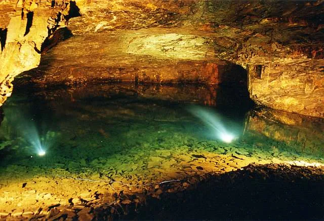
Carnglaze Caverns
Mountains & hills · 1.1 km

Carnglaze Cavern
Caves · 1.1 km

Wayside cross at Polmenna, 730m north east of Ley Green Farm
Farms (open to visitors) · 1.4 km

Earlier prehistoric hillfort with outwork and outlying stone hut circle known as Berry Castle
Vineyards · 1.5 km

hole
Archaeological sites · 1.7 km

Treverbyn Mill
Watermills · 2.0 km

Trenant Bridge
Historic bridges · 2.4 km
Nearby
📷 3Historic churches · South West England
Trewane Cross
Trewane Cross — a Grade II*-listed church in england-south-west, United Kingdom.
📷 5Historic churches · South West England
St Neot, Cornwall
St Neot ( NEE-uut) (Cornish: Loveni) is a village and civil parish in Cornwall, England, United Kingdom. The parish population at the 2011 census was 947. It is between the towns of Bodmin and Liskear
📷 3Historic bridges · South West England
St Neot Bridge
St Neot Bridge — Grade II listed building-listed bridge in england-south-west, United Kingdom.
📷 5📷 3Memorials & monuments · South West England
St Neot War Memorial
St Neot War Memorial — Grade II listed building-listed memorial in england-south-west, United Kingdom.
📷 5Mountains & hills · South West England
Carnglaze Caverns
Carnglaze Caverns — artificial caves in Cornwall, UK.
Where to eat & stay near Church of St Anietus, St Neot
Places to stay
 📷 5
📷 5Caravan parks · South West England
Pine Green Caravan & Camping Park
Pine Green Caravan & Camping Park — a caravan park in england south west.
 📷 5
📷 5Campsites · South West England
Siblyback Lake Campsite
Siblyback Lake Campsite — a campsite in england south west.
 📷 5
📷 5Campsites · South West England
Colliford Tavern Camp Site
Colliford Tavern Camp Site — a campsite in england south west.
 📷 5
📷 5Campsites · South West England
Cheesewring Farm Campsite
Cheesewring Farm Campsite — a campsite in england south west.
📷 5Caravan parks · South West England
Cheesewring Farm Caravan site
Cheesewring Farm Caravan site — a caravan park in england south west.
 📷 5
📷 5Campsites · South West England
Penbugle Organic Farm
Penbugle Organic Farm — a campsite in england south west.
Places to eat & drink
 📷 7
📷 7Historic pubs · South West England
The Albion Public House
The Albion Public House in England South West, United Kingdom.
 📷 7
📷 7Historic pubs · South West England
Tavernan Carow Public House
Tavernan Carow Public House in England South West, United Kingdom.
 📷 7
📷 7Restaurants · South West England
Himalayan Spice
Himalayan Spice — a restaurant in england south west.
 📷 7
📷 7Historic pubs · South West England
The Barley Sheaf Public House
The Barley Sheaf Public House in England South West, United Kingdom.
 📷 5
📷 5 📷 7
📷 7Historic pubs · South West England
Methodist Chapel
Methodist Chapel in England South West, United Kingdom.
More places in this region
 📷 5
📷 5Historic churches · South West England
Abbey Church of St Gregory the Great, Downside Abbey
Abbey Church of St Gregory the Great, Downside Abbey — church in Stratton-on-the-Fosse, Somerset, England, UK.
 📷 5
📷 5Historic churches · South West England
All Saints Church
All Saints Church — Grade I listed church in Woolley, Somerset, England, UK.
 📷 5
📷 5Historic churches · South West England
All Saints Church, Hampreston
All Saints Church, Hampreston — church in Hampreston, Dorset, England, UK.
 📷 5
📷 5Historic churches · South West England
All Saints Church, Nether Cerne
All Saints Church, Nether Cerne — church in Nether Cerne, Dorset, England, UK.
Frequently asked questions
- Where is Church of St Anietus, St Neot?
- Church of St Anietus, St Neot is in South-West England, United Kingdom (postcode PL14 6NA), in the parish of St. Neot.
- What is Church of St Anietus, St Neot?
- Church of St Anietus, St Neot — Grade I listed building-listed church in england-south-west, United Kingdom.
- How do I get to Church of St Anietus, St Neot?
- The nearest railway station is Coombe Junction Halt, about 6.8 km away. Drivers can use postcode PL14 6NA.
- When was Church of St Anietus, St Neot built?
- Built or established in 1450.
- Is Church of St Anietus, St Neot a listed building?
- Church of St Anietus, St Neot is officially recognised as Grade I listed building listed.
- Is Church of St Anietus, St Neot a protected site?
- Yes — Church of St Anietus, St Neot is part of the Cornwall National Landscape (AONB).
- Is Church of St Anietus, St Neot free to visit?
- Yes, Church of St Anietus, St Neot is free to enter.
- How do I get to Church of St Anietus, St Neot?
- The nearest railway station is Coombe Junction Halt, about 6.8 km away. Drivers can navigate to postcode PL14 6NA.