
Towns & cities · East of England
Chrishall
Chrishall — village in Essex, England.

Wikimedia Commons contributors — see linked file page for photographer and licence licence

Plan your visit
- Typical visit
- 3 h–6 h
- Nearest railway station
- Great Chesterford · 6.5 km
- Free entry
- Family-friendly
- Dog-friendly
Getting there & planning your visit
To visit Chrishall, the nearest railway station is Great Chesterford, which is 6.5 km away. Entry to the town is free.
About
Chrishall is a town, city, village or settlement in the United Kingdom. Recent population estimates put it at around 507 people. Address: SG8. Wikidata describes it as: "village in Essex, England". Coordinates: 52.0320°, 0.1090°.
Photo gallery
From the Wikipedia article
Chrishall (pronounced Chris hall) is a small village and civil parish in the Uttlesford district of Essex, England. The village lies close to the borders with Cambridgeshire and Hertfordshire, 12 miles (20 km) south of Cambridge and equidistant [6 miles (10 km)] between the two medieval market towns of Saffron Walden and Royston. At the 2021 census the parish had a population of 577. The village was listed in the Domesday Book as Cristeshalla, or "nook of land dedicated to Christ". In 1422 (1 Henry VI), it appears in a record as "Cristeshale". The Icknield Way, a Neolithic track, passes through the parish. Chrishall's location is key to its character; as the village sits at the highest point in Essex, at 147 metres (482 ft) above sea level, road construction has avoided this high ground and therefore Chrishall is off the beaten track. Despite its relative isolation the village retains facilities such as a pre-school as well as a primary school. The village also boasts a sports field, a new playground, a church, a village hall and many clubs and societies as well as the Red Cow public house. Notable residents include the composer, John Rutter.
Excerpt from Wikipedia under CC BY-SA 4.0. See the source article linked in Sources below.
Background
History
Following the Norman Conquest, the area around Chrishall was given to Eustace of Boulogne, who built and occupied a house on a hill to the south of the current church. He named the house "Flanders", and it was there that his daughter Matilda of Boulogne, later wife of King Stephen, was raised. A letter survives that the queen wrote to Hubert the Chamberlain, ordering that the residents of Chrishall be looked after. The house survived until the 15th century, and is believed to have stood on the site of Chiswick Hall, itself built in the 17th century by Sir John James (d.1676). The village has been home to a church for over a thousand years. Prior to the Norman invasion a small church…
Architecture
The village has a pub, church, primary school, village hall and adventure playground. The barn attached to The Red Cow public house is the oldest building in Chrishall apart from the church, and is believed to date to 1500. There was once a village shop in front of the pub, however this is now closed. Holy Trinity Church, a 12th-century Grade I Listed Building, is situated on the edge of the main village. A comprehensive set of images and the detailed history of Holy Trinity appear on the parish website. In the centre of the village lies Chrishall Holy Trinity and St. Nicholas C of E Primary School, Jigney's meadow and the adventure playground. The village hall has recently been relocated…
Sourced from Wikipedia under CC BY-SA 4.0.
- Coordinates
- 52.0320, 0.1090
- County
- Essex
- District
- Uttlesford
- Parish
- Chrishall
- Postcode
- SG8
- Parliamentary constituency
- North West Essex
- Population
- 507
- Nearest railway station
- Great Chesterford — 6.5 km
Sources
- wikidata: Q125781 (CC0)
- wikipedia: Chrishall (CC BY-SA 4.0)
- commons: Chrishall church - geograph.org.uk - 4493.jpg (CC BY-SA 4.0)
Other places nearby

Chrishall War Memorial
Memorials & monuments · 0.3 km

Chrishall Village Sign
Public art & sculpture · 0.3 km

Chrishall Park Wood
Castles · 0.6 km
Chrishall Park Wood Castle
Literary houses · 0.6 km

The Elmdon Dial
Historic pubs · 1.4 km

Elmdon Castle Grove
Castles · 1.5 km
Castle Grove
Literary houses · 1.5 km

St Dunstan's Church
Historic churches · 1.6 km

Heydon
Villages · 1.8 km

Wood Green Animal Shelter (Heydon)
Forests & woodlands · 1.8 km
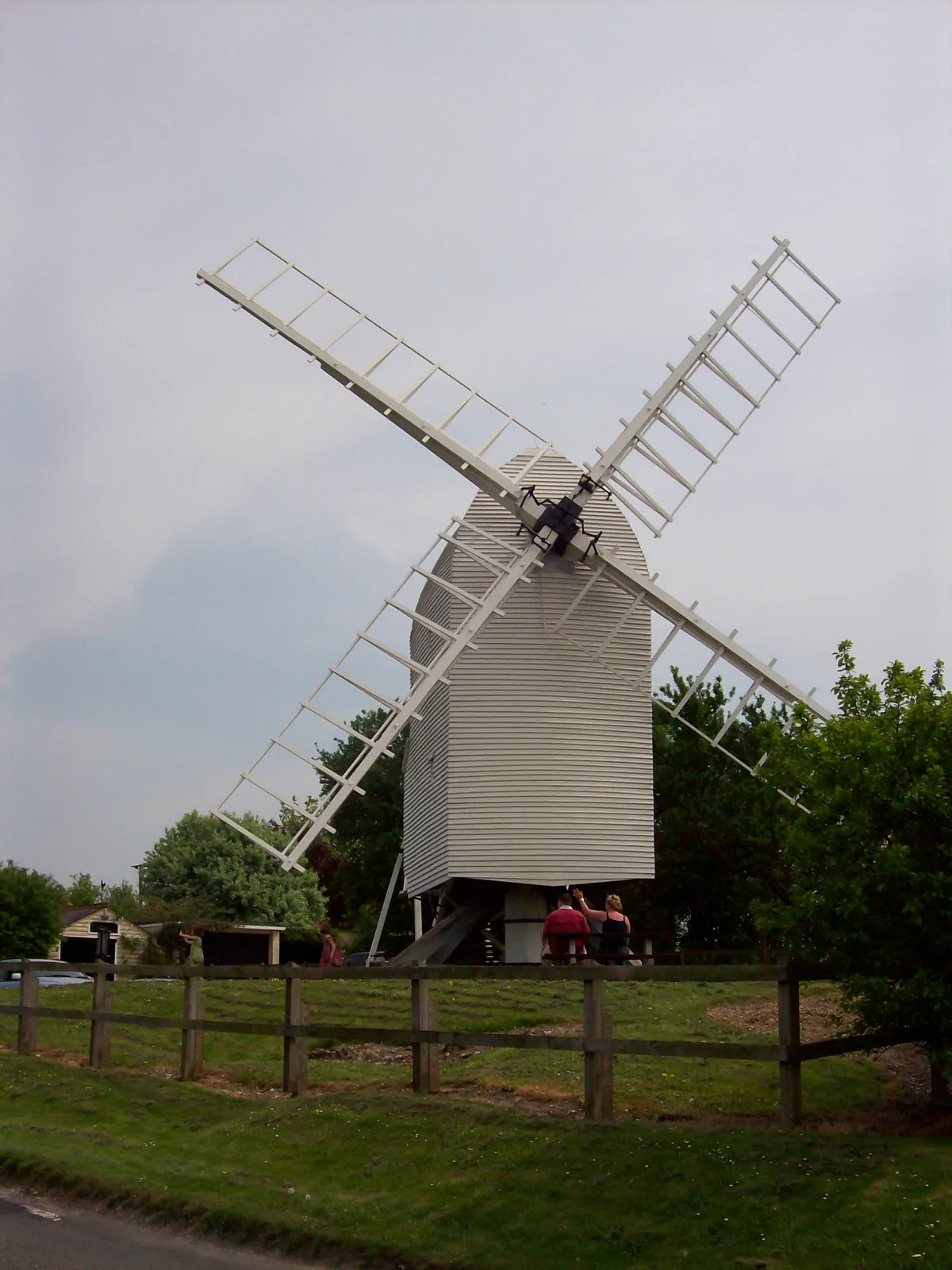
Cambridgeshire County Top
Mountains & hills · 2.3 km

Great Chishill
Villages · 2.5 km
Chrishall is a village in Essex, located in the London region, with a population of 507. Our guide lists nearby attractions within reach.
At a glance
- Population
- 507
- Administrative county
- Essex
- Constituency
- North West Essex
- Top categories near here
Things to see in Chrishall
12 attractions within 12 km. Full guide: things to do in Chrishall →
📷 5Forests & woodlands · East of England
Wood Green Animal Shelter (Heydon)
Wood Green Animal Shelter (Heydon) — a other in england-london, United Kingdom.
📷 5Historic churches · East of England
St Dunstan's Church
St Dunstan's Church — a church in england-london, United Kingdom.
📷 5Public art & sculpture · East of England
Chrishall Village Sign
Chrishall Village Sign — a public art in england-london, United Kingdom.
📷 5Memorials & monuments · East of England
Chrishall War Memorial
Chrishall War Memorial — a memorial in england-london, United Kingdom.
📷 5Literary houses · East of England
Chrishall Park Wood Castle
Chrishall Park Wood Castle — a literary house museum in england london.
📷 5Literary houses · East of England
Castle Grove
Castle Grove — a literary house museum in england london.
📷 5📷 5📷 5 📷 5
📷 5Mountains & hills · East of England
Pepperton Hill
Pepperton Hill — mountain in england london. Elevation: 101 m.
 📷 5
📷 5Historic pubs · East of England
Woodman Public House
Woodman Public House in England East, United Kingdom.
📷 5Nearby
📷 5Memorials & monuments · East of England
Chrishall War Memorial
Chrishall War Memorial — a memorial in england-london, United Kingdom.
📷 5Public art & sculpture · East of England
Chrishall Village Sign
Chrishall Village Sign — a public art in england-london, United Kingdom.
📷 5📷 5Literary houses · East of England
Chrishall Park Wood Castle
Chrishall Park Wood Castle — a literary house museum in england london.
📷 5📷 5Where to eat & stay near Chrishall
Places to stay
 📷 5
📷 5Caravan parks · East of England
Apple Acre Caravan Park
Apple Acre Caravan Park — a caravan park in england london.
 📷 7
📷 7Hotels · East of England
Crown House
Crown House — a hotel in england london.
 📷 5
📷 5 📷 7
📷 7 📷 5
📷 5Hotels · East of England
Banyers House
Banyers House — a hotel in england london.
 📷 5
📷 5Places to eat & drink
📷 5📷 5Historic pubs · East of England
Woodman Public House
Woodman Public House in England East, United Kingdom.
 📷 7
📷 7Historic pubs · East of England
The Fox And Hounds Public House With Inn Sign
The Fox And Hounds Public House With Inn Sign in England East, United Kingdom.
 📷 5
📷 5 📷 7
📷 7Historic pubs · East of England
Old Carpenters Arms
Old Carpenters Arms in England East, United Kingdom.
 📷 5
📷 5More towns in this region
 Flagship📷 10
 Flagship📷 10
Towns & cities · East of England
Cambridge
Cambridge — city in Cambridgeshire, England.
 Flagship📷 10
Towns & cities · East of England
Chelmsford
Chelmsford — city in Essex, United Kingdom.
 Flagship📷 10
Towns & cities · East of England
Colney Heath
Colney Heath — village and civil parish in St Albans, Hertfordshire, England, UK.
Frequently asked questions
- Where is Chrishall?
- Chrishall is in Essex, London, United Kingdom (postcode SG8), in the parish of Chrishall.
- What is Chrishall?
- Chrishall — village in Essex, England.
- How do I get to Chrishall?
- The nearest railway station is Great Chesterford, about 6.5 km away. Drivers can use postcode SG8.
- Is Chrishall free to visit?
- Yes, Chrishall is free to enter.
- How do I get to Chrishall?
- The nearest railway station is Great Chesterford, about 6.5 km away. Drivers can navigate to postcode SG8.