Museums · London
Chorleywood
In or near Maple Cross.
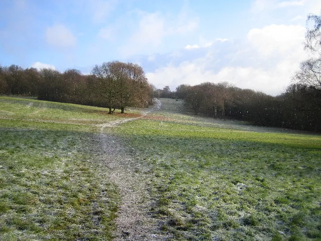
Chorleywood is a village and civil parish in the Three Rivers District, Hertfordshire, on the border with Buckinghamshire, approximately 20 miles (32 km) northwest of Charing Cross. The village is adj

Robin Webster — CC BY-SA 2.0 via Wikimedia Commons licence
Plan your visit
- Typical visit
- 1.5 h–3 h
- Best time of year
- Year-round
- Nearest railway station
- Chorleywood · 0.7 km
- Family-friendly
- Limited wheelchair access
Getting there & planning your visit
To visit Chorleywood museum, the nearest railway station is Chorleywood, located 0.7 km away. The postcode for the museum is WD3 5ET. Accessibility is limited for wheelchair users.
About
Chorleywood is a village and civil parish in the Three Rivers District, Hertfordshire, on the border with Buckinghamshire, approximately 20 miles (32 km) northwest of Charing Cross. The village is adjacent to the Chiltern Hills Area of Outstanding Natural Beauty and is part of the London commuter belt included in the government-defined Greater London Urban Area. Chorleywood was historically part of the parish of Rickmansworth, becoming a separate ecclesiastical parish in 1845 and a separate civil parish in 1898. The population of the parish was 11,286 at the 2011 census. In 2004, a study by The Social Disadvantage Research Centre at the University of Oxford named Chorleywood as the "happiest place" to live in the UK. Of the 32,482 communities surveyed, Chorleywood came out top. More recently, Chorleywood has been ranked as the "least deprived" area in the country by the Department of Communities and Local Government.
Photo gallery
Protected designations
- Area of Outstanding Natural Beauty: Chilterns
Designations sourced from Natural England open data under OGL v3.
From the Wikipedia article
Chorleywood is a village and civil parish in the Three Rivers District, Hertfordshire, on the border with Buckinghamshire, approximately 20 miles (32 km) northwest of Charing Cross. The village is adjacent to the Chiltern Hills Area of Outstanding Natural Beauty and is part of the London commuter belt included in the government-defined Greater London Urban Area. Chorleywood was historically part of the parish of Rickmansworth, becoming a separate ecclesiastical parish in 1845 and a separate civil parish in 1898. The population of the parish was 11,286 at the 2011 census. In 2004, a study by The Social Disadvantage Research Centre at the University of Oxford named Chorleywood as the "happiest place" to live in the UK. Of the 32,482 communities surveyed, Chorleywood came out top. More recently, Chorleywood has been ranked as the "least deprived" area in the country by the Department of Communities and Local Government.
Excerpt from Wikipedia under CC BY-SA 4.0. See the source article linked in Sources below.
Background
History
]] Settlement at Chorleywood dates to the Paleolithic era when the plentiful flint supply led to swift development of tools by man. The Romans built a village on the ancient site complete with a mill and brewery. Though variants have been proposed, the name has been derived from the Anglo-Saxon leah, meaning a clearing or a wood, of the ceorla or peasants. A line runs through Chorleywood that once divided the Kingdoms of Mercia and Wessex and now divides the counties of Hertfordshire and Buckinghamshire. Edward the Confessor gave Chorleywood to the Monastery of St Albans. In the 1973 BBC Television documentary, Metro-land, Sir John Betjeman described Chorleywood as "essential Metro-land".…
Sourced from Wikipedia under CC BY-SA 4.0.
- Coordinates
- 51.6500, -0.5100
- County
- Hertfordshire
- District
- Three Rivers
- Parish
- Chorleywood
- Postcode
- WD3 5ET
- Parliamentary constituency
- South West Hertfordshire
- Nearest railway station
- Chorleywood — 0.7 km
Sources
- wikipedia: Chorleywood (CC BY-SA 4.0)
Other places nearby

Honey Bee
Public art & sculpture · 0.5 km

Chorleywood Common
Forests & woodlands · 0.6 km

Village Art Phone Box
Public art & sculpture · 1.0 km

Chorleywood Lawn Cemetery
Cemeteries · 1.2 km
Chorleywood Common
Wildlife reserves · 1.6 km

Chorleywood House Estate
Wildlife reserves · 1.6 km

Chorleywood West
Villages · 1.6 km

North Hill Farm RV Park
Caravan parks · 1.6 km

North Hill Farm Campsite
Campsites · 1.6 km
Chorleywood House Estate
Forests & woodlands · 1.6 km
North Hill Farm Overflow Camp Site
Campsites · 1.7 km

Chorleywood Car Boot
Farmers’ markets · 2.1 km
Nearby
📷 5Public art & sculpture · London
Honey Bee
Honey Bee — a public art in england-west-midlands, United Kingdom.
📷 5Forests & woodlands · London
Chorleywood Common
Chorleywood Common is a forest or woodland in the United Kingdom.
📷 3Public art & sculpture · London
Village Art Phone Box
Village Art Phone Box — a public art in england-west-midlands, United Kingdom.
📷 3Cemeteries · London
Chorleywood Lawn Cemetery
Chorleywood Lawn Cemetery is a cemetery in the United Kingdom.
📷 5Wildlife reserves · London
Chorleywood Common
Chorleywood Common — nature reserve in Hertfordshire, England.
📷 3Wildlife reserves · London
Chorleywood House Estate
Chorleywood House Estate is a wildlife reserve in the United Kingdom.
Where to eat & stay near Chorleywood
Places to stay
📷 5Caravan parks · London
North Hill Farm RV Park
North Hill Farm RV Park — a caravan park in england west midlands.
📷 5Campsites · London
North Hill Farm Campsite
North Hill Farm Campsite — a campsite in england west midlands.
📷 5Campsites · London
North Hill Farm Overflow Camp Site
North Hill Farm Overflow Camp Site — a campsite in england west midlands.
 📷 5
📷 5Campsites · East of England
Diogenes Sun Club
Diogenes Sun Club — a campsite in england west midlands.
 📷 5
📷 5Campsites · London
Lees Wood Scout & Guide Activity Centre
Lees Wood Scout & Guide Activity Centre — a campsite in england london.
 📷 5
📷 5Campsites · East of England
Paccar Scout Camp
Paccar Scout Camp — a campsite in england west midlands.
Places to eat & drink
 📷 5
📷 5Historic pubs · London
The Whip And Collar Public House
The Whip And Collar Public House in England London, United Kingdom.
 📷 5
📷 5 📷 5
📷 5 📷 7
📷 7Historic pubs · East of England
Saddlers House The Feathers Public House
Saddlers House The Feathers Public House in England East, United Kingdom.
 📷 5
📷 5Historic pubs · East of England
The Green Dragon, Flaunden
The Green Dragon, Flaunden in England East, United Kingdom.
 📷 5
📷 5Historic pubs · London
Ye Old Greene Manne Public House
Ye Old Greene Manne Public House in England London, United Kingdom.
More museums in this region
 Flagship📷 10
Museums · London
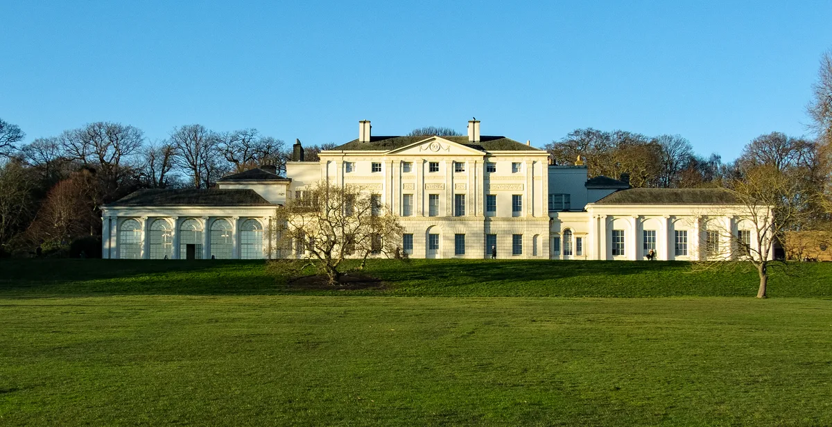
Kenwood House
Kenwood House — art museum and historic house in Hampstead, London.
 📷 5
📷 5Museums · London
Amora London
Amora London — European touring exhibition dedicated to love, relationships and sexual wellbeing.
 📷 5
📷 5Museums · London
Antique Breadboard Museum
Antique Breadboard Museum — small museum in Putney, London, England, UK.
 📷 5
📷 5Museums · London
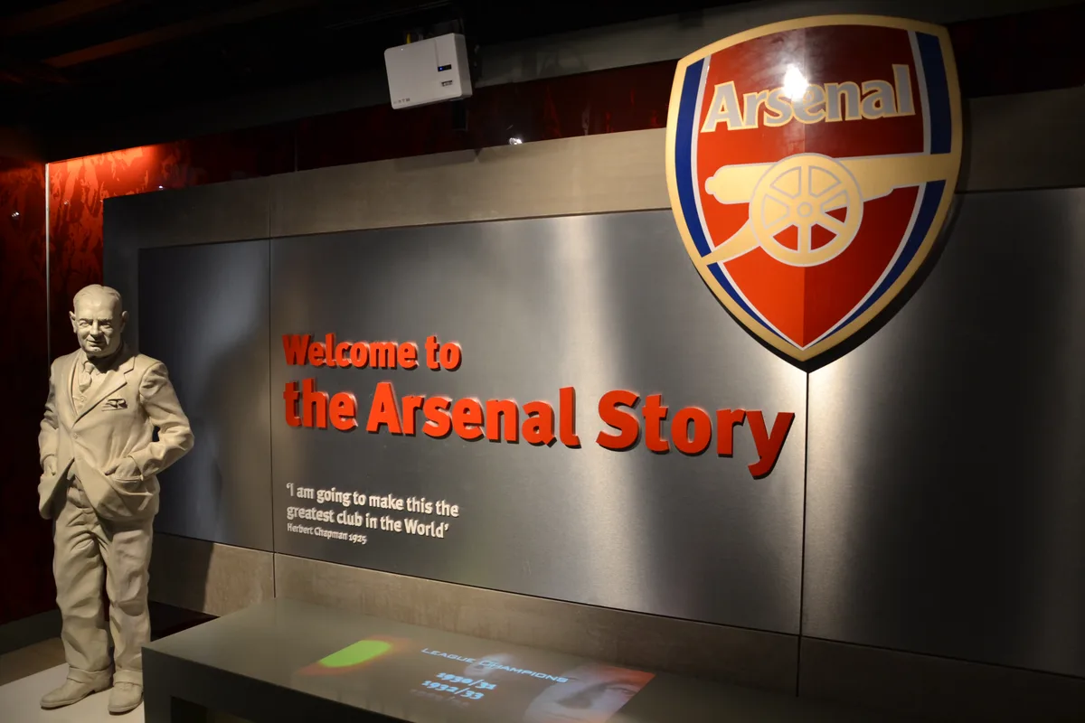
Arsenal Football Club Museum
Arsenal Football Club Museum — sports museum in London.
Frequently asked questions
- Where is Chorleywood?
- Chorleywood is in Hertfordshire, the West Midlands, United Kingdom (postcode WD3 5ET), in the parish of Chorleywood.
- What is Chorleywood?
- Chorleywood is a village and civil parish in the Three Rivers District, Hertfordshire, on the border with Buckinghamshire, approximately 20 miles (32 km) northwest of Charing Cross. The village is adj
- How do I get to Chorleywood?
- The nearest railway station is Chorleywood, about 0.7 km away. Drivers can use postcode WD3 5ET.
- Is Chorleywood a protected site?
- Yes — Chorleywood is part of the Chilterns National Landscape (AONB).
- How do I get to Chorleywood?
- The nearest railway station is Chorleywood, about 0.7 km away. Drivers can navigate to postcode WD3 5ET.