
Historic churches · South East England
Chatham, Kent
Also known as: Chatham, Caint, Chatham
In or near Wouldham.
Chatham ( CHAT-əm) is a town within the Medway unitary authority in the ceremonial county of Kent, England. The town forms a conurbation with neighbouring towns Gillingham, Rochester, Strood and Rainh

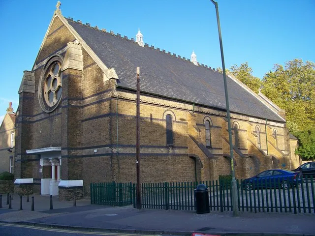
Danny Robinson — CC BY-SA 2.0 via Wikimedia Commons licence

Plan your visit
- Typical visit
- 30 min–1 h
- Nearest railway station
- Chatham · 1.1 km
- Free entry
Getting there & planning your visit
To visit Chatham, Kent, you can take the train to Chatham railway station, which is approximately 1.1 km away. The postcode for the location is ME4 6HA, and entry is free.
About
Chatham ( CHAT-əm) is a town within the Medway unitary authority in the ceremonial county of Kent, England. The town forms a conurbation with neighbouring towns Gillingham, Rochester, Strood and Rainham. In 2020 it had a population of 80,596. The town developed around Chatham Dockyard and several barracks for the British Army and the Royal Navy, together with 19th-century forts which provided a defensive shield for Chatham Dockyard. The Corps of Royal Engineers is still based in Chatham at Brompton Barracks. Chatham Dockyard closed on 31 March 1984, but the remaining naval buildings are an attraction for a flourishing tourist industry. Following closure, part of the site was developed as a commercial port, other parts were redeveloped for business and residential use, and part was used as the Chatham Historic Dockyard museum. Its attractions include the submarine HMS Ocelot. The town benefits from key transport connections, with Chatham Waterfront bus station and Chatham railway station serving as the main interchanges for the area. It is the administrative headquarters of Medway Council. which is a Unitary Authority, as well as its principal retail and shopping location.
Photo gallery
See it from the streetimagery from 2026
Imagery © Mapillary contributors, CC BY-SA 4.0
Protected designations
- Area of Outstanding Natural Beauty: Kent Downs
Designations sourced from Natural England open data under OGL v3.
From the Wikipedia article
Chatham ( CHAT-əm) is a town within the Medway unitary authority in the ceremonial county of Kent, England. The town forms a conurbation with neighbouring towns Gillingham, Rochester, Strood and Rainham. In 2020 it had a population of 80,596. The town developed around Chatham Dockyard and several barracks for the British Army and the Royal Navy, together with 19th-century forts which provided a defensive shield for Chatham Dockyard. The Corps of Royal Engineers is still based in Chatham at Brompton Barracks. Chatham Dockyard closed on 31 March 1984, but the remaining naval buildings are an attraction for a flourishing tourist industry. Following closure, part of the site was developed as a commercial port, other parts were redeveloped for business and residential use, and part was used as the Chatham Historic Dockyard museum. Its attractions include the submarine HMS Ocelot. The town benefits from key transport connections, with Chatham Waterfront bus station and Chatham railway station serving as the main interchanges for the area. It is the administrative headquarters of Medway Council. which is a Unitary Authority, as well as its principal retail and shopping location.
Excerpt from Wikipedia under CC BY-SA 4.0. See the source article linked in Sources below.
Background
History
The A2 road passes by Chatham along the line of the ancient Celtic route. It was paved by the Romans, and named Watling Street by the Anglo-Saxons. Among certain archaeological finds here have been the remains of a Roman-era cemetery. Chatham was a long, small village on the banks of the River Medway. By the 16th century, warships were being moored at Jillingham Water (Gillingham), because of its strategic sheltered location between London and the European continent. It was established as a Royal Dockyard by Queen Elizabeth I in 1568, and most of Chatham Dockyard lies within Gillingham. Initially a refitting base, it became a shipbuilding yard; from then until the late 19th century, further…
Sourced from Wikipedia under CC BY-SA 4.0.
- Coordinates
- 51.3700, 0.5200
- District
- Medway
- Parish
- Medway, unparished area
- Postcode
- ME4 6HA
- Parliamentary constituency
- Chatham and Aylesford
- Nearest railway station
- Chatham — 1.1 km
Sources
- wikipedia: Chatham, Kent (CC BY-SA 4.0)
Other places nearby

Chatham Cemetery
Cemeteries · 0.2 km

McCudden War Memorial and Grave
Memorials & monuments · 0.2 km

Fort Luton
Forts · 0.9 km
St Michael the Archangel Church, Chatham
Abbeys & priories · 1.1 km

University for the Creative Arts - Rochester
Natural landmarks · 1.2 km

Lord Duncan Public House
Historic pubs · 1.2 km

The Alexandra & Hotel
Historic pubs · 1.2 km
Thomas Waghorn
Memorials & monuments · 1.3 km

Nucleus Arts Centre & Cafe Nucleus
Galleries · 1.3 km

National Electric Theatre
Theatres · 1.3 km

Victoria Gardens War Memorial
Memorials & monuments · 1.3 km

Invicta Cinema
Theatres · 1.4 km
Nearby
📷 5Cemeteries · South East England
Chatham Cemetery
Chatham Cemetery is a cemetery in the United Kingdom.
📷 5Memorials & monuments · South East England
McCudden War Memorial and Grave
McCudden War Memorial and Grave — Grade II listed building-listed memorial in england-london, United Kingdom.
📷 5Flagship📷 5Abbeys & priories · South East England
St Michael the Archangel Church, Chatham
St Michael the Archangel Church, Chatham — catholic church in Kent, United Kingdom.
📷 5Natural landmarks · South East England
University for the Creative Arts - Rochester
University for the Creative Arts - Rochester — a university in england-london, United Kingdom.
📷 5Historic pubs · South East England
Lord Duncan Public House
Lord Duncan Public House in England South East, United Kingdom.
Where to eat & stay near Chatham, Kent
Places to stay
 📷 5
📷 5Hotels · South East England
Travelodge Rochester
Travelodge Rochester — a hotel in england london.
 📷 5
📷 5 📷 5
📷 5 📷 7
📷 7Hotels · South East England
The Royal Victoria and Bull Hotel
The Royal Victoria and Bull Hotel — a hotel in england london.
 📷 5
📷 5 📷 5
📷 5Campsites · South East England
Buckmore Park Scout Campsite
Buckmore Park Scout Campsite — a campsite in england london. Brand: The Scout Association.
Places to eat & drink
📷 5Historic pubs · South East England
Lord Duncan Public House
Lord Duncan Public House in England South East, United Kingdom.
📷 5Historic pubs · South East England
The Alexandra & Hotel
The Alexandra & Hotel — Historic pub — listed building or notable heritage status.
 📷 5
📷 5Historic pubs · South East England
White Lion Hotel
White Lion Hotel — Historic pub — listed building or notable heritage status.
 📷 6
📷 6Historic pubs · South East England
The Prince of Wales
The Prince of Wales — Historic pub — listed building or notable heritage status.
 📷 5
📷 5Historic pubs · South East England
The Nag's Head
The Nag's Head in England South East, United Kingdom.
 📷 5
📷 5Historic pubs · South East England
Command House And Attached Entrance Railings, Stable And Carriage House And Rear Wall
Command House And Attached Entrance Railings, Stable And Carriage House And Rear Wall in England South East, United Kingdom.
More places in this region
 📷 5
📷 5Historic churches · South East England
All Saints Church, Frindsbury
All Saints Church, Frindsbury — church in Medway, UK.
 📷 5
📷 5Historic churches · South East England
All Saints Church, Maidstone
All Saints Church, Maidstone — parish church associated with the Archbishop's Palace, Maidstone, Kent, England, UK.
 📷 5
📷 5Historic churches · South East England
All Saints Church, West Farleigh
All Saints Church, West Farleigh — Grade I listed church in West Farleigh, Maidstone, Kent, England, UK.
 📷 5
📷 5Historic churches · South East England
All Souls' Church, Sutton Green
All Souls' Church, Sutton Green — church in Guildford, England.
Frequently asked questions
- Where is Chatham, Kent?
- Chatham, Kent is in London, United Kingdom (postcode ME4 6HA), in the parish of Medway, unparished area.
- What is Chatham, Kent?
- Chatham ( CHAT-əm) is a town within the Medway unitary authority in the ceremonial county of Kent, England. The town forms a conurbation with neighbouring towns Gillingham, Rochester, Strood and Rainh
- How do I get to Chatham, Kent?
- The nearest railway station is Chatham, about 1.1 km away. Drivers can use postcode ME4 6HA.
- Is Chatham, Kent a protected site?
- Yes — Chatham, Kent is part of the Kent Downs National Landscape (AONB).
- Is Chatham, Kent free to visit?
- Yes, Chatham, Kent is free to enter.
- How do I get to Chatham, Kent?
- The nearest railway station is Chatham, about 1.1 km away. Drivers can navigate to postcode ME4 6HA.