Reservoirs & lochs · West Midlands
Chasewater
Chasewater — reservoir in Staffordshire, England, UK.

Wikimedia Commons contributors — see linked file page for photographer and licence licence
Plan your visit
- Typical visit
- 1 h–2.5 h
- Nearest railway station
- Brownhills West · 0.8 km
- Free entry
- Dog-friendly
About
Chasewater is a reservoir in the United Kingdom. Wikidata describes it as: "reservoir in Staffordshire, England, UK". Coordinates: 52.6641°, -1.9417°.
Photo gallery
Protected designations
- Site of Special Scientific Interest: Chasewater and The Southern Staffordshire Coalfield Heaths SSSI
Designations sourced from Natural England open data under OGL v3.
From the Wikipedia article
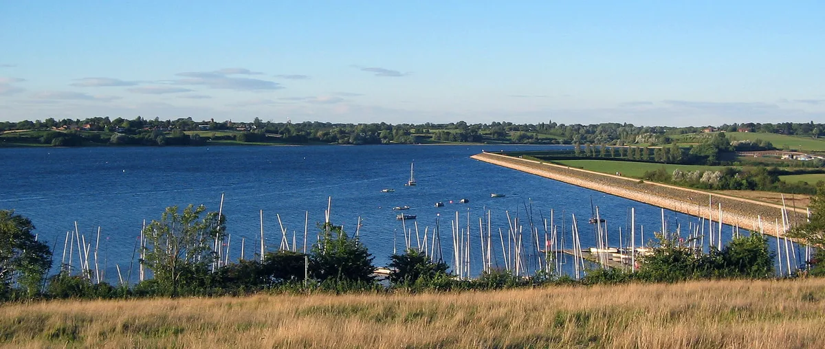
Chasewater is a reservoir located in the parish of Burntwood and the district of Lichfield in Staffordshire, England. Originally known as Norton Pool and Cannock Chase Reservoir, it was created as a canal feeder reservoir in 1797. The reservoir was created to directly supply the Wyrley and Essington Canal and maintain levels in the 160-mile (260 km) Birmingham Canal Network. During a period of great industrial growth in the Black Country region the maintenance of water levels in canal infrastructure was essential and Chasewater was in great demand. As canals became less essential for transport of goods during the mid-20th century, the reservoir diversified and became a popular public amenity with activities such as water-skiing, sailing, wakeboarding and cycling. Chasewater is the third largest reservoir by volume in the county of Staffordshire and the largest canal feeder reservoir in the West Midlands.
Excerpt from Wikipedia under CC BY-SA 4.0. See the source article linked in Sources below.
Background
History
An act of Parliament, the Wyrley and Essington Canal Act 1794 (34 Geo. 3. c. 25), received royal assent on 28 March 1794, entitled "An Act for extending the Wyrley and Essington Canal", this authorised a long extension, from Sneyd past Lichfield to Huddlesford Junction on the Coventry Canal, together with the raising of up to £115,000 to complete construction. As part of the act the Wyrley and Essington Canal Company were required to provide a water source to keep the new length of canal topped up. The flood wave caused significant damage with roads and bridges destroyed, fields flooded and livestock killed. The increased capacity of the reservoir created Jeffries Swag at the western end of…
Visiting
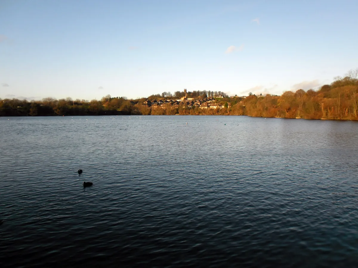
The surrounding area is designated as a country park. The reservoir hosts a variety of activities including water skiing, sailing, angling and bird watching. Running around Chasewater is the Chasewater Railway. The large house situated halfway along the dam wall was originally the weir master's cottage. The weir master would walk up to the hexagonal valve house, constructed to the same design as BCN tollhouses, and operate the gate valves to release water from Chasewater reservoir into the canal. The construction of the M6 Toll between the reservoir and the A5 required the construction of a new bridge over the motorway to access the southern side of the lake, where an Innovation Centre…
Sourced from Wikipedia under CC BY-SA 4.0.
- Coordinates
- 52.6641, -1.9417
- County
- Staffordshire
- District
- Lichfield
- Parish
- Burntwood
- Postcode
- WS8 7NL
- Parliamentary constituency
- Lichfield
- Nearest railway station
- Brownhills West — 0.8 km
- Official site
- www.staffordshire.gov.uk
Sources
- wikidata: Q5087255 (CC0)
- wikipedia: Chasewater (CC BY-SA 4.0)
- commons: Chasewater Pier 20120105.jpg (CC BY-SA 4.0)
Other places nearby
Loading nearby places…
Nearby
 📷 3
📷 3Natural landmarks · West Midlands
Chasewater Innovation Centre
Chasewater Innovation Centre — a other in england-west-midlands, United Kingdom.
 📷 5
📷 5Wild swimming spots · West Midlands
Chase Open Water Swimming
Chase Open Water Swimming — a wild swimming in england west midlands.
 📷 5
📷 5Lakes · West Midlands
Chasewater
Chasewater — a lake in england west midlands.
 📷 3
📷 3Museums · West Midlands
Chasewater Railway Museum
Chasewater Railway Museum — a museum in england-west-midlands, United Kingdom.
 📷 5
📷 5Natural landmarks · West Midlands
Brownhills School
Brownhills School — a school heritage in england-west-midlands, United Kingdom.
 📷 5
📷 5Villages · West Midlands
Chasetown
Chasetown — a village in england west midlands.
More places in this region
 Flagship📷 3
Reservoirs & lochs · West Midlands
Draycote Water
Draycote Water — reservoir in the United Kingdom.
 Flagship📷 3
Reservoirs & lochs · West Midlands
Netherton Reservoir
Netherton Reservoir — reservoir in West Midlands, England, UK.
 📷 3
📷 3Reservoirs & lochs · West Midlands
Abingdon Reservoir
Abingdon Reservoir — proposed reservoir in Oxfordshire, England, UK.
 📷 3
📷 3Reservoirs & lochs · West Midlands
Aston Reservoir
Aston Reservoir — reservoir in Birmingham, West Midlands, England, UK.
Frequently asked questions
- Where is Chasewater?
- Chasewater is in Staffordshire, the West Midlands, United Kingdom (postcode WS8 7NL), in the parish of Burntwood.
- What is Chasewater?
- Chasewater — reservoir in Staffordshire, England, UK.
- How do I get to Chasewater?
- The nearest railway station is Brownhills West, about 0.8 km away. Drivers can use postcode WS8 7NL.
- Is Chasewater a protected site?
- Yes — Chasewater is part of the Chasewater and The Southern Staffordshire Coalfield Heaths SSSI Site of Special Scientific Interest.
- Is Chasewater free to visit?
- Yes, Chasewater is free to enter.
- How do I get to Chasewater?
- The nearest railway station is Brownhills West, about 0.8 km away. Drivers can navigate to postcode WS8 7NL.