
Museums · South West England
Chard, Somerset
In or near Chaffcombe.
Chard is a town and a civil parish in the English county of Somerset. It lies on the A30 road near the Devon and Dorset borders, 15 miles (24 km) south west of Yeovil. The parish has a population of a

Ray Jennings — CC BY-SA 2.0 via Wikimedia Commons licence

Plan your visit
- Typical visit
- 1.5 h–3 h
- Best time of year
- Year-round
- Family-friendly
- Limited wheelchair access
About
Chard is a town and a civil parish in the English county of Somerset. It lies on the A30 road near the Devon and Dorset borders, 15 miles (24 km) south west of Yeovil. The parish has a population of approximately 14,000 and, at an elevation of 121 metres (397 ft), Chard is the southernmost and one of the highest towns in Somerset. The name of the town was Cerden in 1065 and Cerdre in the Domesday Book of 1086. After the Norman Conquest, Chard was held by the Bishop of Wells. The town's first charter was from King John in 1234. Most of the town was destroyed by fire in 1577, and it was further damaged during the English Civil War. A 1663 will by Richard Harvey of Exeter established Almshouses known as Harvey's Hospital. In 1685 during the Monmouth Rebellion, the pretender Duke of Monmouth was proclaimed King in the Town prior to his defeat on Sedgemoor. Chard subsequently witnessed the execution and traitor's death of 12 condemned rebels, who, tried by Judge Jeffreys, were hanged near the present Tesco roundabout. The Chard Canal was a tub boat canal built between 1835 and 1842. Chard Branch Line was created in 1860 to connect the two London and South Western Railway and Bristol and Exeter Railway main lines and ran through Chard until 1965. The town has a very unusual feature, a stream running along either side of Fore Street. One stream eventually flows into the Bristol Channel and the other reaches the English Channel. Chard Reservoir, approximately a mile north east of the
Photo gallery
Protected designations
- Area of Outstanding Natural Beauty: Dorset
Designations sourced from Natural England open data under OGL v3.
From the Wikipedia article
Chard is a town and a civil parish in the English county of Somerset. It lies on the A30 road near the Devon and Dorset borders, 15 miles (24 km) south west of Yeovil. The parish has a population of approximately 14,000 and, at an elevation of 121 metres (397 ft), Chard is the southernmost and one of the highest towns in Somerset. The name of the town was Cerden in 1065 and Cerdre in the Domesday Book of 1086. After the Norman Conquest, Chard was held by the Bishop of Wells. The town's first charter was from King John in 1234. Most of the town was destroyed by fire in 1577, and it was further damaged during the English Civil War. A 1663 will by Richard Harvey of Exeter established Almshouses known as Harvey's Hospital. In 1685 during the Monmouth Rebellion, the pretender Duke of Monmouth was proclaimed King in the Town prior to his defeat on Sedgemoor. Chard subsequently witnessed the execution and traitor's death of 12 condemned rebels, who, tried by Judge Jeffreys, were hanged near the present Tesco roundabout. The Chard Canal was a tub boat canal built between 1835 and 1842. Chard Branch Line was created in 1860 to connect the two London and South Western Railway and Bristol and Exeter Railway main lines and ran through Chard until 1965. The town has a very unusual feature, a stream running along either side of Fore Street. One stream eventually flows into the Bristol Channel and the other reaches the English Channel. Chard Reservoir, approximately a mile north east of the town, is a Local Nature Reserve, and Snowdon Hill Quarry a geological Site of Special Scientific Interest. Major employers in the town include Numatic International Limited. There are a range of sporting and cultural facilities, with secondary education being provided at Holyrood Academy; religious sites including the Church of St Mary the Virgin, which dates from the late 11th century.
Excerpt from Wikipedia under CC BY-SA 4.0. See the source article linked in Sources below.
Background
History
The earliest evidence of settlement near Chard is the Iron Age fort of Cotley Castle overlooking the Town near Bound's Lane. There was a small Saxon settlement centred round the Church and the area is still known as 'Old Town'. Chard's name was Cerden in 1065 and Cerdre in the Domesday Book of 1086 and it means "house on the chart or rough ground" (Old English: ćeart + renn). Before the Norman Conquest Chard was held by the Bishop of Wells. The town's first charter was from King John and another from the bishop in 1234, which delimited the town and laid out burgage holdings in 1 acre lots at a rent of twelve pence per year. The parish of Chard was part of the Kingsbury Hundred, Most of the…
Sourced from Wikipedia under CC BY-SA 4.0.
- Coordinates
- 50.8728, -2.9587
- District
- Somerset
- Parish
- Chard Town
- Postcode
- TA20 2AF
- Parliamentary constituency
- Yeovil
- Official site
- www.somersetintelligence.org.uk
Sources
- wikipedia: Chard, Somerset (CC BY-SA 4.0)
Other places nearby

The Happy Return Public House
Historic pubs · 0.1 km

John Stringfellow Monument
Memorials & monuments · 0.5 km

Chard War Memorial
Memorials & monuments · 0.5 km
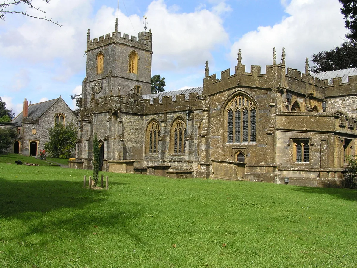
Church of St Mary the Virgin, Chard
Historic churches · 0.5 km

The Choughs Public House
Historic pubs · 0.6 km

Chard Museum
Museums · 0.7 km

Chard Reservoir
Reservoirs & lochs · 1.7 km

Bounds Lane
Vineyards · 1.9 km

Alpine Grove
Campsites · 2.2 km

Eleigh Bridge At Ngr 3329 1098
Historic bridges · 2.5 km

WW2 Anti Tank Blocks
Historic houses · 2.5 km
WW2 Pillbox (Intact)
Historic houses · 2.6 km
Nearby
📷 7Historic pubs · South West England
The Happy Return Public House
The Happy Return Public House in England South West, United Kingdom.
📷 3Memorials & monuments · South West England
John Stringfellow Monument
John Stringfellow Monument — a memorial in england-south-west, United Kingdom.
📷 3Memorials & monuments · South West England
Chard War Memorial
Chard War Memorial — Grade II listed building-listed memorial in england-south-west, United Kingdom.
📷 5Historic churches · South West England
Church of St Mary the Virgin, Chard
Church of St Mary the Virgin, Chard — church in Chard, Somerset, England, UK.
📷 5Historic pubs · South West England
The Choughs Public House
The Choughs Public House in England South West, United Kingdom.
📷 3Museums · South West England
Chard Museum
Chard Museum — a museum in england-south-west, United Kingdom.
Where to eat & stay near Chard, Somerset
Places to stay
📷 5 📷 5
📷 5Campsites · South West England
Higher Sea House CL
Higher Sea House CL — a campsite in england south west.
 📷 5
📷 5Caravan parks · South West England
Turnpike Caravan Park
Turnpike Caravan Park — a caravan park in england south west.
 📷 7
📷 7Hotels · South West England
Best Western The Shrubbery
Best Western The Shrubbery — a hotel in england south west. 3-star. Brand: Best Western.
 📷 5
📷 5Campsites · South West England
Wytch Wood Camping
Wytch Wood Camping — a campsite in england south west.
 📷 7
📷 7Places to eat & drink
📷 7Historic pubs · South West England
The Happy Return Public House
The Happy Return Public House in England South West, United Kingdom.
📷 5Historic pubs · South West England
The Choughs Public House
The Choughs Public House in England South West, United Kingdom.
 📷 5
📷 5Restaurants · South West England
La Campagna Restaurant & Bar
La Campagna Restaurant & Bar — a restaurant in england south west. Brand: La Campagna.
 📷 7
📷 7Historic pubs · South West England
Dolphin Public House
Dolphin Public House in England South West, United Kingdom.
 📷 7
📷 7 📷 5
📷 5Historic pubs · South West England
Former Old Inn Public House
Former Old Inn Public House in England South West, United Kingdom.
More museums in this region
 📷 5
📷 5Museums · South West England
Alexander Keiller Museum
Alexander Keiller Museum — museum in South West England, United Kingdom.
 📷 5
📷 5Museums · South West England
American Museum and Gardens
American Museum and Gardens — culture and arts museum near Bath, England, United Kingdom.
 📷 5
📷 5Museums · South West England
Atwell-Wilson Motor Museum
Atwell-Wilson Motor Museum — museum in Calne, England, UK.
 📷 5
📷 5Museums · South West England
Bath Abbey Heritage Vaults
Bath Abbey Heritage Vaults — museum in Bath Abbey, Bath, England, UK.
Frequently asked questions
- Where is Chard, Somerset?
- Chard, Somerset is in South-West England, United Kingdom (postcode TA20 2AF), in the parish of Chard Town.
- What is Chard, Somerset?
- Chard is a town and a civil parish in the English county of Somerset. It lies on the A30 road near the Devon and Dorset borders, 15 miles (24 km) south west of Yeovil. The parish has a population of a
- How do I get to Chard, Somerset?
- Drivers can use postcode TA20 2AF.
- Is Chard, Somerset a protected site?
- Yes — Chard, Somerset is part of the Dorset National Landscape (AONB).
- How do I get to Chard, Somerset?
- Drivers can navigate to postcode TA20 2AF. It sits within the Yeovil parliamentary constituency.